Arizona Backcountry Discovery Route

Map not loading? Visit our Main Interactive Map. For best performance and experience, use the latest web browser version of Microsoft Edge or Firefox. We are currently troubleshooting technical issues with Chrome.

Rocky, remote and hot are three words that come to mind for Arizona. Blessed with a surprising number of mountain ranges, the Arizona BDR is more green and mountainous than many people expect. Starting on the US/Mexico border, the 750- mile route stays east of Tucson and Phoenix and explores the historic Empire Ranch, Sierra Ancha Cliff Dwellings, Mogollon Rim, Saguaro Cactus Forests, Navajo Nation, wild horses, Vermillion Cliffs and options to see the Grand Canyon from vantage points most people never see.

Best time of year: April through June and Late September/October. July and August have very high temperatures and should be avoided. August is also monsoon season and is not a good time to ride the route.

Additional Route Information

IMPORTANT: . You MUST obtain an Arizona State Land Trust Recreational Permit. Visit AZ Recreation Permit.

Another permit is needed for riding through Navajo Nation (Section 6).  You MUST obtain a pass to ride and camp in Navajo Nation.

See the FAQ for more information on the two required permits, and Ride Responsibly.

Visit the Forest Service Website for current information on forest closures and fire restrictions in the Coconino National Forest.

AZBDR – SECTION DESCRIPTIONS

Section 1: USA-Mexico Border to Benson – 128 Miles

The official start to the AZBDR is a stones throw from the Mexico border in the Coronado National Monument. This is an interesting area both geographically and historically. It is the center of four major biogeographic provinces: Madrean, Sonoran, Chihuahuan and southern Rockies/Mogollon. It is also the site of the Francisco Vásquez de Coronado Expedition of 1540- 1542.
Information about both can be found at the interpretive overlook a few miles from the park entrance. From there, it’s a mellow ride along the border fence using wide graded dirt roads before heading north to the small town of Sonoita. Fuel up here for your journey through Empire Ranch, a historic working cattle ranch from the 1870s.

Section 2: Benson to Globe – 127 Miles

Heading north out of Benson will bring you through stunningly fertile farm lands along San Pedro River. The road is wide and hard packed with no major obstacles. It’s a straight shot up to the small town of Mammoth where you can fuel up. Shove a pack of homemade tortillas in your pannier, the tiny Mexican restaurant next to the gas station in Mammoth makes them hot and fresh and they are possibly the best we ever tasted.

From Mammoth you will parallel the highway on a narrow dirt road on your way to Winkelman. The ride from Winkelman to Globe can be on paved Hwy 77 or an ALT Harder section over Pioneer Pass (6,154’). Cactus filled desert disappears into high elevation pine forests if you ride the stunning ridges over the pass.

Section 3: Globe to Young – 85.7 Miles

This is a remote section as you transition from low desert to expansive pine forest. Once you get north of Roosevelt Lake, the road turns from pavement to a wide two lane gravel road with plenty of camping spots among the giant cacti. Ride a little further towards Coon Creek and Cherry Creek for even better campsites tucked under cottonwood trees along the water.
Once you turn on FR202, you’ll begin the climb from desert to pines, with rocky terrain and stunning vistas.

An optional Harder section includes primitive overgrown two-track, switchbacks, and stunning high-desert terrain all the way to Young. Highway 288 is an optional bypass with a mix of gravel and pavement that will bring you into Young from the south and is recommended during adverse weather.

Section 4: Young to Winona – 135 Miles

The saguaro cactus and dry deserts make way to ponderosa pine, towering cliffs and dramatic canyons in Section 4. You get a sense for this change almost immediately as the road climbs onto the Mogollon Rim, an escarpment that marks the edge of Colorado Plateau. You can expect a reasonable amount of weekend camping traffic early in this section but expect to see fewer people the further north you go. The route meanders north through one of the largest pine forests in the world, with ample camping opportunities.

Fuel and supplies are available in nearby Clints Well. The terrain near Long Lake and Kinnikinick Lake can be quite rocky, with one optional Harder section and incredible views of the San Francisco Peaks in the distance.

Section 5: Winona to Cameron – 125 Miles

Section 5 has much different terrain than southern Arizona. The first few miles intersect fast roads made mostly of hard packed volcanic sand with ancient volcanic cones scattering the landscape. The most impressive is Sunset Crater which you will ride right past. Explore this area, and take a detour to the impressive Wupatki National Monument
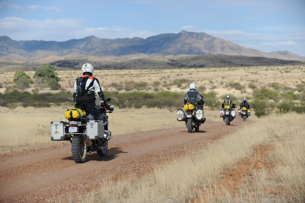
 ruins.

There are several options to get a peek into the Grand Canyon. You can take the optional track which will bring you to some of the more popular canyon overlooks inside the National Park, or you can visit one of the overlooks just outside of the park boundary along Highway 64 on the way to Cameron. Make sure and pick up your Navajo Nation permit once you arrive in Cameron as you’ll need it for the next section.

Section 6: Cameron to Utah Border – 153 Miles

You are about to enter the Navajo Nation, one the most iconic sections of the AZBDR. This is a wild and untouched part of our country and while visiting here is welcomed, it is a delicate matter, PLEASE respect the land and its people. Stay on posted roads and keep speeds down. The roads are wide and nicely graded with no major technical spots to speak of but keep your eyes open for wild horses and packs of dogs around the modest homes dotting the countryside. Once you leave the Navajo Nation you’ll have a short jaunt on pavement before finishing your expedition on 13 miles of fun, mellow dirt roads through Vermillion Cliffs National Monument.

AZBDR LODGING


The Jonquil is more than just a motel, it is your road trip oasis in the desert southwest. We have one of the largest outdoor event spaces in old Bisbee with several patios and seating areas suitable for groups. The backyard area features an outdoor stage, a wooden barrel sauna, and private dry-camping in a charming park-like setting with a seasonal creek.

Motorcyclists
The Jonquil Motel is owned by motorcycle filmmaker Sterling Noren and his partner Eva Rupert. The owners understand the needs of motorcyclists and are able to provide advice and information for both on and off-road riding in the area. The Jonquil is a short 45-minute ride from the start of the Arizona Backcountry Discovery Route. There is off-street parking for motorcycles in front of the motel and riders can also park in our courtyard next to their motel rooms.

317 Tombstone Canyon, Bisbee, AZ 85603
Ph. 520-432-7371

Read more>>

For anyone who thinks the idea of sipping local wines while taking in the breathtaking, wide open scenery sounds like a perfect day, Sonoita, Arizona is an ideal destination. Sonoita is a part of the state’s original wine country, and tasting rooms and vineyards continue to thrive around the small village.

Visit Website »

One of the best things about the town of Benson, Arizona is its weather. It is known for having some of the best weather in the country. Benson was founded back in the year 1880, at the heyday of the mining industry in Arizona. Visitors have the opportunity to take in the culture of the Old West and explore the area’s railroad heritage.

Visit Website »

47893 N Hwy 288, Young, AZ 85554
Ph. 928-462-4022

Located in the heart of the Tonto National Forest in historic Young. Offers unique Arizona lodging and a 1800’s western saloon.

Visit Website »

47661 N. Hwy 288 (Arizona 288 & Midway Ave), Young, AZ 85554
Ph. 928-462-3593

A small 10-unit motel right on Hwy 288 along your route in Young, Arizona. Rates vary from $75.00 single occupancy to $80.00 double occupancy. Rooms have in-room coffee, refrigerators, microwaves, cable t.v., internet and if you want, serve breakfast.

Facebook

Globe is centrally located in Southern Arizona. We are the perfect get away for a day trip or a weekend. We are located along the Historic Old West Highway, which takes you from Apache Junction, Arizona to Lordsburg, New Mexico.

Visit Website »

AZBDR FOOD

For anyone who thinks the idea of sipping local wines while taking in the breathtaking, wide open scenery sounds like a perfect day, Sonoita, Arizona is an ideal destination. Sonoita is a part of the state’s original wine country, and tasting rooms and vineyards continue to thrive around the small village.

Visit Website »

A great place for a quick bite and coffee or ice cream. Very friendly staff and there is awesome outdoor seating. The food selection and quality is excellent.

Address: 3166 AZ-83, Sonoita, AZ 85637

Phone: (520) 330-1308

Visit Website »

One of the best things about the town of Benson, Arizona is its weather. It is known for having some of the best weather in the country. Benson was founded back in the year 1880, at the heyday of the mining industry in Arizona. Visitors have the opportunity to take in the culture of the Old West and explore the area’s railroad heritage.

Visit Website »

Mammoth was founded in 1876 as a mining camp for the surrounding mines, located on the west banks of the San Pedro River and the base of the Galiuro Mountains which serve as a beautiful backdrop for the town. Mammoth became an incorporated town in 1958 and held it’s first Town Council on March 21, 1958.

Visit Website »

At the confluence of the San Pedro and Gila rivers, Winkelman holds just the right ingredients to become a desert oasis. The rivers’ waters feed the area’s beautiful, sprawling desert landscape – enhanced by a majestic mountain backdrop – while also hydrating a diverse collection of wild residents.

Visit Website »

Globe is centrally located in Southern Arizona. We are the perfect get away for a day trip or a weekend. We are located along the Historic Old West Highway, which takes you from Apache Junction, Arizona to Lordsburg, New Mexico.

Visit Website »

Young, Arizona is located in the heart of Pleasant Valley and Gila County, about 120 miles northeast of Phoenix. Arizona’s best kept secret. Untouched and unspoiled. The true wild, wild west.

Visit Website »

Surrounded by the Ponderosa Pines of the Coconino National Forest, Clint’s Well Resort offers cool, clear, mountain air.

Visit Website »

Finally, in the words of Bobby Troup, “don’t forget Winona.” Originally, the place was called Walnut, predating its occupation in 1912. The town got its beginning when a man named Billy Adams was making his way on a bicycle from Moody, Texas to Long Beach, California to visit his brother in the early 1900s.

Visit Website »

When lodging near the Grand Canyon and Lake Powell at the Cameron Trading Post hotel lodge, the cuisine offered within our dining room is not to be missed! In addition to the shopping, the fine hotel rooms, and the beautiful gardens, the food and atmosphere of the Cameron dining room is yet another wonderful highlight.

Visit Website »

Cathedral Wash Trail in Marble Canyon, Arizona. Beautiful view through the trail which leads to Colorado River.

Marble Canyon is a tiny populated place in Coconino County, Arizona, on US Route 89A, about 12 miles southwest of Page. It is a short distance from Lee’s Ferry, once one of the few places where travelers could cross the Colorado River and today a popular tourist spot. Marble Canyon got its name for its colorful purple rocks and cliffs.

Visit Website »

AZBDR FUEL

I-40 and BDR Route
Day – 928-527-1177  Eve. 928-853-3676
Services: Gas, Groceries, Liquor, Towing Service

Visit Website »

AZBDR MOTORCYCLE DEALERSHIPS

GOAZ MOTORCYCLES

Scottsdale, AZ

WEBSITE

One of the premiere motorcycle dealerships in the country offering an impressive line up of motorcycle brands, as well as first class training and service facility. GOAZ Motorcycles is THE destination dealership for the AZBDR.

AZBDR DISCOVERY POINTS

Utah Border (AZBDR)

Side trip.

Visit Website »

Side trip.

Visit Website »

Side trip

Side trip.

Visit Website »

Side trip.

Visit Website »

Side trip.

Visit Website »

Side trip

Visit Website »

Side trip

Visit Website »

Side trip

Visit Website »

Side trip

Visit Website »

Side trip

Visit Website »

Side trip.

Visit Website »

Start near Mexico Border (AZBDR)

AZBDR PACKING LIST

This packing list serves as an example and is not intended to be a complete list for your backcountry riding needs. Feel free to customize this list to work for you.

  • Helmet
  • Boots
  • Goggles
  • Gloves (2 sets)
  • Protective gear (pressure suit, Leatt brace, knee braces)
  • Jacket
  • Pants
  • Balaclava or neck gaitor
  • Water bladder or bottle
  • Hydration pack
  • Ear plugs

FREQUENTLY ASKED QUESTIONS

Below are answers to some Frequently Asked Questions about the Arizona Backcountry Discovery Route.

The Arizona Backcountry Discovery Route (AZBDR) is a 750-mile scenic ride across the state of Arizona, beginning at the Mexico border and finishing at the Utah border. This South to North route consists of a mostly remote dirt roads and winds through the remote high desert country, jagged canyons, wild lands, pristine mountain ranges, and a surprising number of water crossings.  It passes through iconic locations including the Mogollon Rim, Sunset Crater National Monument, Grand Canyon and the Navajo Nation.  The route includes dirt, gravel, and pavement surfaces and may include rocks, ruts, sand, mud and snow depending on time of year and conditions. The route can be completed in 4-6 days depending on pace, and is also accessible by four-wheel drive vehicles, as the entire route is at least double-track.

The longest gap between gas stations is approximately 136 miles from Young to Winona.  There is gas at Clints Well, which is 10 miles off the route.

There is a monsoon season that begins in August that may cause significant rain in many places that time of year, however, there can be periods without rain also.  For any backcountry ride, the weather should be surveyed and taken into consideration to determine how the trip and road conditions might be effected.  Extreme heat can also be an issue in the summer months. Most or all of the AZBDR can be ridden from April to November if weather allows. Spring and Fall can be the best times for weather. Early in the spring, some roads may be damaged from winter storms or may still be closed for winter by land managers.  Summer months can have challenges due to heat and rainy season.

No, you can complete the AZBDR using motels and restaurants, but they are fewer than other BDR’s. Motels are in most towns, though some are one motel towns. There are no motels in Young and Winona.

In most cases camp fires are allowed, but check with local Ranger Stations to determine if campfires are allowed before you build one. Forest fires are a threat during parts of the year and the rules that manage this risk must be followed. Be sure to fully extinguish fires so they are DEAD-OUT. Use water to ensure a fire is fully extinguished and the ground is left cool and wet.

There are many campgrounds and suitable dry camping locations along the route. The Butler Motorcycle Map for the AZBDR has a tent icon showing campgrounds on the route and many near the route.  The AZBDR Butler Map is available at www.touratech-usa.com or www.butlermaps.com.

Please note, on Navajo land (Section 8) you must camp in designated areas only.

Yes, you will need to obtain two permits.
The first one is the Arizona State Land Trust Recreation Permit from the AZ State Land Trust (AZSLT). You can now obtain it online at https://land.az.gov/applications-permits.  Please Ride Responsible and purchase the permit.
The second permit is needed when riding through Navajo Nation (Section 8) you MUST obtain a pass to ride and camp in Navajo Nation. Camping and riding permits are $15 each per person (cash only). They can be purchased at the small round building at the junction of Hwy 64 and 89 in Cameron. Don’t plan on entering these lands after dark after the permit office is closed. Cameron Visitor Center: P.O. Box 459, Cameron, AZ 86020 tel : 928.679.2303, fax: 928.679.2017, info@navajonationparks.org.
Please also note, no alcohol or firearms are allowed on Navajo land, and you must camp in designated areas only.

The tracks for the route can be downloaded free of charge online at https://ridebdr.com/download-tracks/ .

Always bring a complete set of maps for the area you plan to ride. They have good information about roads, water sources, and are an indispensable resource when the GPS doesn’t work, or is giving questionable advice. Unplanned events can occur and having paper/synthetic maps of the area can be a life saver. National Forest maps are available at http://www.fs.fed.us/recreation/map/state_list.shtml#U and local Ranger Stations. AZBDR Butler Motorcycle Maps are available at www.touratech-usa.com or www.butlermaps.com.

There are a few natural water sources along this route however, depending on the snow pack, some may not be running. You can find potable water in the towns along the way.  It is suggested that plenty of water is carried for personal and cooking use. Here is a video on water filtration filmed in the Oregon Backcountry: http://youtu.be/vqOFZAoZdTU

The AZBDR is best from May-June and Sept-Oct.  The route can be done in April or November but snowpack in the high mountains may keep you from doing the entire route as mapped. There have been some years where the snow has not cleared from the high country until the May. Because the route travels in the desert where the temperatures can reach above 100 and then move into the mountains where the temperatures can drop in the 30’s, you must plan accordingly for gear.

Any bike that has a license plate, can run knobby tires, is set-up to carry the gear you plan to bring, and has the fuel range to make the distance between gas stops. Most adventure or dual-sport motorcycles will be suitable for the trip.  Choose the bike that you are the most comfortable riding in desert and mountain terrain.

Any GPS unit capable of displaying 10 track logs with a minimum of 500 points each is suitable for use on the AZBDR. Garmin models that work best for this application are: Zumo 665/660, Montana, GPSMap 60, 62, 76, 78 and 276. Other GPS manufacturers may have units that will work. Check the technical specs to determine suitability.

The AZBDR route is designed to be ridden on adventure and dual-sport motorcycles, as well as driven in 4×4 vehicles. There are no single-track style trails on this route. Many of the roads are in remote areas where road maintenance is minimal or non-existent. You can expect to cover sections of road with deep ruts, loose rocks, sand and other challenges. There are also sections that have extend periods of deep sand. Road conditions change from week to week based on the recent weather.  When you see signs that read, “Roads maybe impassable when wet”, use caution, roads become very slick and can be impassable. You may also encounter sections that have trees or branches over the road. There are alternate “easier” routes around a few of the most challenging sections. Depending on time of year and weather, there may be a few deep water crossings. Flash floods are frequent during summer storms.  Don’t cross flooded washes. Wait until water subsides.

DOT approved knobby tires (such as Continental TKC 80, Motoz Tractionator, or Dunlop 606) are strongly recommended.

The temperatures in the southern part of the route can reach highs over 100 and then lows in the thirties in the high mountains.  The nights are normally cooler in the desert, so gear needs to be appropriate for such temperature changes.  Arizona has fast moving thunder storms during the summer months in the higher elevations.  These storms usually build in the mountains in the early afternoon and usually contain lightning, hail stones and heavy downpours.

The highest elevations are reached early on in Section 4, where elevation reaches over 8,000 ft.

Most people average 150 miles a day on a backcountry motorcycle trip. Plan on doing this route in 4-6 days depending on how fast you want to travel and how early you want to roll out of camp.

Yes, there are several gates on the route. Most remain open unless BLM or NFS has closed them due to snow closure.  Please leave gates as you have found them.  Many sections will have grazing cattle in the forest.

During seasonal closures due to snow, the AZBDR gates will be locked in the northern sections of the route. Do not ride around locked gates. Find an alternate route that is legal to ride. Riding around locked gates is illegal and jeopardizes our access to public lands. Please do your part to Ride Respectfully along the BDR routes by respecting locked gates.

Much of this route is remote and out of reach for cell phone towers. There will be long sections with no coverage. Your best bet is to talk or text in the towns. You will be surprised where you get coverage and where you don’t. A satellite communication device is a good idea in the backcountry.

We do our best to post the most up-to-date information on our Route Updates Page. We depend on the BDR community to inform us about route and road conditions, so if you encounter any road closures or severe conditions that are worth reporting, please contact us with the information.

There is also a dedicated AZBDR Facebook Group Page. We recommend that you join the group prior to your trip to read trip reports and comments from other riders about their experience on the route.

Don’t forget to use our Interactive Map to get route conditions in real time. Read this Article to a quick tutorial on how to use the Interactive Map.

This is a tough question to answer because conditions are constantly changing.  If the weather has been moist or temps have been cool, the sand will be firmer and significantly easier to ride.  If it has been hot for some time, the sand becomes very soft and deep.  So the bottom line is, learn to ride in deep sand before your trip which will make your ride more enjoyable.

Yes the route can be done North to South, but you will not be able to obtain a Navajo travel permit until you get to Cameron. You still need to stop and pick up your permit and please let them know you traveled prior to getting your permit and pay for the proper usage. You will also be traveling on Navajo lands after Cameron, so a permit is necessary.

There are several sections where the road is a clay surface north of Flagstaff all the way to the Utah border.  When wet, these sections become very slick and virtually impassable.  When you encounter wet clay roads, a higher gear selection is recommended to keep your rear wheel from sliding.  Slow and steady will get you through, but in some cases travel will come to a halt due to slick conditions.

We get this question all the time. Here are some key things to consider as you put together your plan.

All of the BDR routes include intermediate to advanced terrain. If a person is on a large bike twin-cylinder bike like an R1200GS Adventure or Yamaha Super Tenere, the routes can be very difficult. If a person’s skills are not advanced level, they may consider taking a smaller bike or choosing the easier options when possible. A BDR is something a person should build up to and it shouldn’t be their first overnight trip on their ADV bike.

Although, WA and CO are less difficult than UT and AZ,  they all contain difficult sections. We suggest looking at the Butler Map and take the optional easier routes to avoid the difficult sections. Even taking this approach there may be difficult stretches depending on changes in road conditions, weather, construction and the unknown. This is part of what makes it an adventure. Regardless of its description on the map or in the film, no section of a BDR should be underestimated.

Do some shorter overnight trips as practice and ride increasingly difficult terrain to build up your skills and confidence. Also remember that riding with a fully-loaded bike should be practiced prior to tackling a BDR. Lastly, always ride with a group so that you have a team to help overcome any obstacles whether it’s terrain, mechanicals, navigation, medical emergency, etc…

In summary, take baby steps and work up to doing a BDR. Don’t make it your first adventure motorcycle outing on a full-sized twin-cyclinder bike.

This advice comes from Rob Watt, BDR Board and Expeditions Member, and Wilderness EMT.

We carry items for wound management, breaks, basic meds and dental.  You can buy a good first aid kit at one of the outdoor stores online or Touratech-USA.  Get one that is an Extended Day Backpacker or 3-4 person kit.  These kits usually have the basics for a motorcycle trip.

They usually don’t have a SAM splint, so pick one of those up along with a couple ace bandages.  One other thing that we do for every multi-day trip, is to gather important information about each rider: allergies, medications, medical issues, emergency contacts, etc.

Then we put that on a master sheet for each person, so if something does happen we have that information handy incase that person can’t speak.  Another good practice is to do a little research of where medical facilities are along your planned route.  Is there a “flight for life” in the area? Where are the hospitals, Medical clinics, etc?

Here is a list of some items that you should have in your medical kit:

  • Bandages: Assorted sizes for small cuts, blisters, etc.
  • 4-inch closure strips or butterfly closures: For closing large wounds. 4-inch strips are more effective than butterfly.
  • 4 inch by 4 inch sterile dressing pads (5 to 10): To apply pressure to a wound and stop bleeding
  • Non-adherent sterile dressing (2 inch by 2 inch): Use these or Second Skin to cover blisters, burns or lacerations.
  • Gauze roll: Holds dressing in place.
  • Small roll of 1-inch adhesive tape: Holds dressings in place.
  • Multi-use tool or knife: Should include knife, scissors. A scalpel and blade are also useful for first aid.
  • Forceps or tweezers: For removing splinters, ticks, and removing debris from wounds.
  • Scissors: Trauma scissors, which have a blunt end to protect the patient, can be used for cutting away clothing from injury, cutting medical tape, etc.
  • Thermometer: Digital is generally more accurate, but batteries do wear out.
  • Malleable splint: Lightweight foam-covered aluminum, such as a SAM splint.
  • Irrigation syringe (35 cc): Used to flush and clean wounds.
  • Suction syringe (65 cc): Used to clear mouth of fluids when giving CPR.
  • Safety pins: Can help remove splinters, fasten arm sling, or make a whole in a plastic bag for improvised wound irrigation.
  • Cotton-tip swabs: For removing  foreign objects from eye, or applying antibiotic ointment.
  • Resealable plastic bags: Many uses, including icing a swollen joint or creating wound irrigation device.
  • ACE, Coban, or other rubberized bandage: Can be used as outer wrap on splints, wound dressings or support for joint injuries. Be careful not to wrap too tightly.
  • Antiseptic towlettes: For cleaning small wounds.
  • Cleansing pads with lidocaine: For cleaning. Includes a topical anesthetic for abrasions, stings, etc.
  • Topical antibiotic ointment: For application to wounds. Simple Vaseline can also be used in dressing a wound.
  • Moleskin: Prevents blisters. Cut and apply a section to your foot as soon as you discover a “hot spot.” Duct tape also works for this purpose.
  • Povidone Iodine USP 10 percent, 1 oz.: For preventing infection. Bottled PVD iodine 10 percent solution should be diluted to a ratio of 1 percent or less for flushing wounds.
  • Aloe vera gel: Found in packets or small bottles for relief of minor burns.
  • Pain relievers, including aspirin and Ibuprofen: Provides relief for minor aches and pains, reduces fever, helps reduce inflammation of sprains and other injuries.
  • Antihistamines: For relief of pollen allergies, or to reduce reaction to bites and stings.
  • Immodium 2 mg capsules or tablets: For relief of diarrhea from intestinal infections.
  • Pepto Bismol or antiacid tablets: For relief from general diarrhea, abdominal upset.
  • After Bite or hydrocortisone cream USP 1 percent: Relieves skin irritation from bites, poison oak, stings, or allergic reactions.
  • Latex or nitrile gloves: Protects against blood-borne diseases and infection.
  • CPR microshield mask: A compact flexible barrier with a one-way valve for rescue breathing, which protects user from blood, vomit or saliva.
  • Oral rehydration salts: Packet of electrolyte salts and glucose for treatment of dehydration, heat exhaustion, or loss of fluids from vomiting or diarrhea.
  • Space bag/blanket: Lightweight emergency shelter. For treating hypothermia victims.
  • Paper and pencil: For recording medical data such as body temperature, pulse, time and date of symptoms, injuries, medicines administered, etc. Most repackaged kits include accident report forms.
  • Wilderness First Aid booklet: Many prepackaged first aid kits contain one. An excellent pocket guide is the Wilderness Medical Handbook

Rating the Routes by Difficulty

We often get requests to provide the difficulty ratings of the BDR. We do not officially rate roads or routes because the difficulty can change from day to day depending on weather, changes in road conditions, and road damage caused by a variety of forces including wind, storms, flooding, snow, logging, forest fires and more.

The difficulty experienced by an individual also depends on their off-road skills, level of fitness, stamina, bike size and amount of weight carried on the bike. For these reasons we can’t provide a rating system like a ski resort or OHV park.

We can help you a bit by ranking the existing Backcountry Discovery Routes from most difficult to least difficult. Here is the list: CABDR-South, NEBDR, AZBDR, ORBDR, WYBDR, UTBDR, COBDR, NVBDR, WABDR, NMBDR, IDBDR, MABDR.

So CABDR-South is the most difficult especially if you ride the expert sections and MABDR is the easiest in general terms. Although MABDR is the easiest there are still a few challenging rocky sections and the several water crossings that can get very difficult if the water is high.

Be sure to also review the FAQ’s for each route and our General FAQs prior to embarking on your trip.

Backcountry Discovery Routes is a 501c(3) non-profit corporation. © 2022 - 2024 Backcountry Discovery Routes, Inc. All rights reserved. Terms of Use.