Red Desert Wyoming BDR-X

Map not loading? Visit our Main Interactive Map. For best performance and experience, use the latest web browser version of Microsoft Edge or Firefox. We are currently troubleshooting technical issues with Chrome.

Whether you’re riding the entire WYBDR and looking for just a little more, or in the southern Wyoming area on the hunt for an epic – but shorter ride, the Red Desert BDR-X will not disappoint.

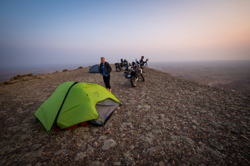
This BDR-X shares the same starting point as the WYBDR and offers a sampling of Wyoming’s diverse terrain from the vast region known as the Red Desert. The loop is 149 miles long when starting and ending in the town of Baggs – so be sure to fuel up and grab supplies there BEFORE you set off. The route can be completed in one long day or broken-up into two. Dispersed camping is available mid-way through the route.

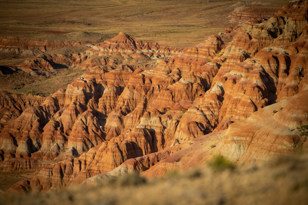
The Red Desert has remained lesser-known as a travel destination, but offers “National Park” quality scenery and fun riding. It is one of the last high-desert ecosystems in North America, and the home to Killpecker Sand Dunes, the largest living dune system in the United States. It is also home to the world’s largest herd of desert elk, and hosts the largest migratory herd of pronghorn in the lower 48 states.

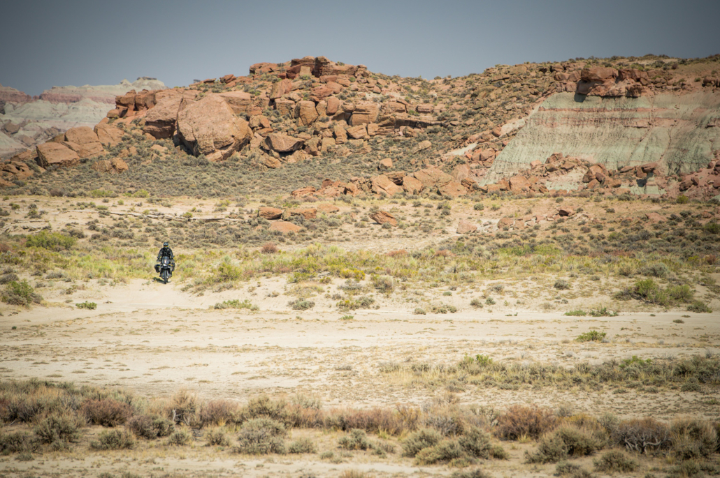
Riders will enjoy varied landscape of buttes, dunes, sagebrush steppe, mountains, and rocky pinnacles. If you think about it, these are the same views and trails that hundreds of thousands of pioneers on the Oregon Trail experienced as they made their way toward Oregon, California, and Washington.

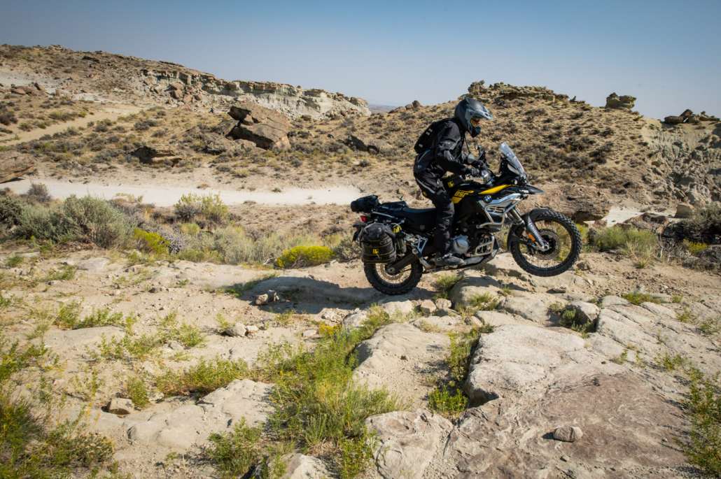
Depending on your skill level and current conditions, the Red Desert BDR-X will contain modest to difficult terrain. So, we recommend riding the loop in a clockwise direction putting the most challenging sections early on in the ride – allowing you the option to turn around if the sand or technical areas become overwhelming. This way you’ll have a shorter distance to backtrack and a lower risk of running out of fuel.

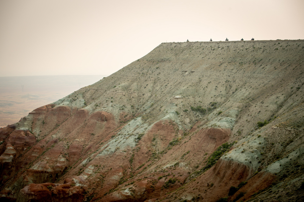
After riding tarmac north from Baggs for 22 miles on Hwy 789 the route turns west onto dirt roads that give a little insight into Wyoming’s vast mining and extraction industries. Continue on these roads with their intermittent deep sand, ruts and rock ledges for another 30 miles and the reward will be an area known as Adobe Town. This geological region is filled with sandstone towers, valleys, hoodoos, and more. It’s a perfect spot to stretch your legs, get your cameras out and explore this gorgeous Wyoming treasure. It’s also a good opportunity to hydrate and take a lunch break. Always remember to ride respectfully and leave no trace.

Leaving Adobe Town, the route enters wide-open desert and offers a short side-trip up a rugged road that leads to the ruins of Fort LaClede, a former stage coach stop and defensive fort established in 1863.

Continuing on, double-track roads lead up onto Delaney Rim another highlight of the route. The highest point, Delany Point, at over 7400 feet juts out to the north and surrounds you with outstanding views.

The descent off of the rim is on hard pack roads that pass through another mining and extraction area. From there the route follows dirt county roads to connect back to Highway 789 where a right turn will lead you back to Baggs.

If you are doing this loop and run low on fuel or need food and lodging, the town of Wamsutter on I-80 will be your savior. It’s accessible to the north after you descend from the Delaney Rim.

Remember always Ride Right, Ride Respectfully and Yield to Animals.

WYBDR LODGING

The Boyer YL Ranch is located close to the start of the WYBDR in Savery, WY, and is the perfect lodging destination to kick off your WYBDR trip.  The ranch is owned by Jonathan “Jock” Boyer and his wife Kimberly Coats.  The property includes a variety of accommodations, from an historic barn loft and cozy wood cabins, to a 1972 John Wayne Bluebird bus.  Meals are available upon request.  Call for rate, or book directly through AirBNB.

Address:  34 County Road 754, Savery, Wyoming  82332

Phone: 307 383 7778

Visit Website »

Address: 110 North St, Baggs, WY 82321
Phone: (307) 383-7059

Visit Website »

Address: 210 Penland St #490, Baggs, WY 82321
Phone: (307) 383-2200

Visit Website »

Address: 175 Mccormick St, Wamsutter, WY 82336
Phone: 307-324-4075

Visit Website »

WYBDR FOOD

Address: 1460 Penland St, Baggs, WY 82321

Phone: (307) 383-6369

Address: 399 McCormick St, Wamsutter, WY 82336

Phone: 307-324-2040

WYBDR FUEL

Address: 1455 Penland St, Baggs, WY 82321

Phone: (307) 383-7700

Address: 303 S 1st St, Baggs, WY 82321

Phone: (307) 326-5638

Address: 350 Mc Cormick Rd, Wamsutter, WY 82336

Phone: 307-324-7807

WYBDR PACKING LIST

This packing list serves as an example and is not intended to be a complete list for your backcountry riding needs. Feel free to customize this list to work for you.

  • Helmet
  • Boots
  • Goggles
  • Gloves (2 sets)
  • Protective gear (pressure suit, Leatt brace, knee braces)
  • Jacket
  • Pants
  • Balaclava or neck gaitor
  • Water bladder or bottle
  • Hydration pack
  • Ear plugs

FREQUENTLY ASKED QUESTIONS

Below are answers to some of the Frequently Asked Questions about the Wyoming Backcountry Discovery Route.

The Red Desert BDR-X is a backcountry loop route in Wyoming for dual-sport and adventure motorcycle travel. Riders will test their endurance and skills on this epic 150-mile backcountry tour. The tracks wind through Wyoming’s vast Red Desert region and lead to Adobe Town (a geologic area with sandstone features), the ruins of Fort LaClede, and Delaney Rim. This route will throw many challenges at you like loose sand and rock ledges so don’t try this route if you are new to adventure motorcycling.

This X route can be done in two short days or one long one.

The best time to ride the Red Desert is July 1st to mid-September. Note that roads in this region become unridable when wet so avoid them during and right after rains. 

The Red Desert uses BLM and county roads to traverse the backcountry and these typically open sometime in June or July depending on the size of the lingering snowpack.

BDRs are generally designed for the average adventure rider on a fully-loaded adventure or dual-sport motorcycle. The BDR-X Red Desert is suitable for riders with intermediate plus and above skill level. You can expect to cover sections with ruts, loose sand, rock ledges and other challenges. Road conditions change from day to day in the Rocky Mountains, and Wyoming is no exception. If there has been an afternoon rainstorm, the roads in high desert regions will be impassible. The clay roads become slippery and the clay clings to tires creating dangerous conditions. Don’t “press on” if it starts raining. Turn back to better roads or stay put until the roads dry out. Always carry gear to wait out inclement weather should you be riding when the storms hit.  There also may be some deep puddles and especially early in the season.

The Rocky Mountains are notorious for severe thunderstorms that seem to appear out of nowhere. Watch weather forecasts and even monitor weather radar maps, when possible, to see where rain might occur. If the high desert roads get wet, the clay surfaces will become unrideable. They become very slippery and will gum up your tires so bad that they will not roll. Do not attempt wet roads as your chances of getting stranded are high. Always carry a satellite tracking & communication device as cell phone reception is poor throughout the Wyoming backcountry. Be sure to check the interactive map at the top of this page for current conditions and use a reliable weather app on your phone during your ride. 

Yes. The Red Desert BDR-X was designed for riding clockwise and we recommend doing it that way, but it can be done counter-clockwise. Signage on this route is. confusing when going counter-clockwise but if you are following the tracks on a GPS unit you should not miss any turns.

Please be prepared for two-way traffic everywhere on this route and always remember to Ride Right to avoid head-on collisions around blind corners.

The average distance for a backcountry adventure motorcycle trip is about 150 miles a day. Since this route is that length it can be done in a day but riders might want to camp along the way to make it a two day trip. 

Services including lodging are available in Wamsutter should you need to rest or get gas or provisions.

There are no special permits or passes needed for normal groups of riders. On BLM lands like the Red Desert, permits are required for commercial activities like paid guided tours and for organized groups larger than 25 people. Contact BLM if your group fits either of those descriptions.

Dispersed camping is available along the route but be aware that private lands are adjacent to the route so only camp near the track and don’t venture off onto private lands.

If you are dispersed camping, we don’t suggest building fires. Instead, bring a camp stove for cooking and boiling water to avoid the risk of fires in Wyoming’s arid landscapes. Be sure to fully extinguish fires so they are DEAD-OUT. Use water to ensure a fire is fully extinguished and the ground is left cool and wet.

On Wyoming state trust lands (see the brown areas on our map above) there is no camping, no open fires, and no vehicular travel off-established routes and roads. Note that the state can issue fines of up to $750 for travelers who break these rules. A good example of state trust lands would be some of the areas surrounding and in the vicinity of Renner WMA. In general, it’s safest for dispersed camping inside National Forests (consult their websites for limitations). Wyoming has so many state land properties along the WYBDR and it’s difficult to know when you are on them, on BLM land, or on private land. So outside of national forests we suggest only camping in designated campgrounds to avoid accidentally camping on state land. This page on the Wyoming state website has the rules & regulations, recreational use restrictions, and even a map viewer to find the state properties you’ll be passing through.

There is no fuel along the BDR-X Red Desert.  We recommend filling up in Baggs, WY before starting your ride.

This route cannot be ridden without the use of GPS tracks.  Be prepared and bring the downloadable BDR-X Red Desert Map AND your navigation device with the latest GPS tracks loaded. Free GPS tracks are available for download on this site. The route can also be navigated using a smartphone GPS navigational app like Gaia, Rever and others. The BDR-X Red Desert documentary film is a great source of information about the route. 

Any GPS unit capable of handling 15 track logs with a minimum of 1500 points each is suitable for use on the WYBDR. Garmin models that work best for this application are: Zumo 590/595/395/396, Montana, and 276Cx. Many other GPS units are compatible with the GPX file format, check the owner’s manual of your device for more information.  You can also import the tracks into a GPS navigational app, like Gaia GPS, but make sure you have the premium version of the app, so you can navigate via offline maps.

Cell phone service is very limited on this route so a satellite communication or tracking device is recommended for emergency situations. 

Any bike that has a license plate, can run knobby tires, has adequate suspension, can carry the gear you will need, and has enough fuel range. Most adventure or dual-sport motorcycles will be suitable for the trip.  However, if you are planning on doing the Expert sections, we recommend a mid-sized bike for this route unless you are very comfortable on a big bore bike in rough technical terrain.  Even very experienced riders on our team reported being challenged on larger bikes by some of the technical sections of the route during the filming expedition. Choose the bike that you are the most comfortable riding in challenging terrain and that you are not afraid to drop a few times.

DOT approved knobby tires are strongly recommended.  Riding this route without a least a 60/40 tire (60% dirt, 40% road) could be dangerous.

Segments of this route can be ridden two-up for those experienced in riding off-highway with a passenger and luggage. However, we strongly advise against riding the technical sections of this route two-up.

We don’t recommend leaving the route as there are private parcels adjacent to BLM lands.

Yes, there are a few gates on the BDR-X Red Desert. When you encounter gates, leave them as you found them. If they are open, leave them open and if they are closed, close them again after you pass through. If you pass by ranches, be courteous and ride respectfully. In spring and early summer there may be temporary closures when crews are repairing washout and other road hazards. If roads are closed due to wildfires, do not ride around the signs as that can put you or fire crews in danger and can get you a hefty fine. Check the BDR website for route updates before you go.

Please abide by posted road closure signs. Ignoring these signs is a sure-fire way of getting a road closed for good. That said, sometimes locals will post unofficial “road closed” signs on public roads for their own personal reasons. Additionally, land managers may not have removed a “closed” sign from a seasonal road – even though the sign right next to it clearly displays the open/closed dates. In these cases, use your best judgment – if in doubt navigate around the closed road and report it to BDR. And please remember never to engage in arguments with local land owners.

We do our best to post the most up-to-date information about the route on ridebdr.com/WYBDR.  We depend on the BDR community to inform us about route and road conditions, so if you encounter any road closures or sever conditions that are worth reporting, please contact us with the information.

There is also a dedicated WYBDR Facebook group page.  We recommend that you join the group prior to your trip to read trip reports and comments from other riders about their experience on the route. Search for: Wyoming Backcountry Discover Route (WYBDR).

Wyoming is a habitat for many animals like deer, antelope, moose and bear as well as smaller animals like coyote, porcupines, and snakes — all of which make their way to the road at some point. Be alert everywhere you go as animals can and will cross your path along the route – especially at dusk.

Antelope are known for wanting to race motorcycles, but don’t encourage them. Slow down as soon as you see animals as, for some reason, they like to cross in front of bikes instead of running away from them. Look out for wild horses when you are in open range land.  Appropriate food practices while camping is an absolute must for your safety and the animal’s safety. 

Yield to all animals whether wild, domestic, or livestock by slowing down or stopping. Many locals in rural areas keep their dogs off-leash on their property and dogs love to chase motorcycles – be cautious and considerate.

All of the roads used on the WYBDR are open to vehicles. If you do decide to drive this route you will want a 4×4 with high clearance as the route has deep puddles, large rocks, huge ruts and steep loose grades. Always stay to the right and go slow around blind corners to avoid head-on accidents with others using the roads. We recommend traveling south to north to minimize head-on traffic.

When we filmed the WYBDR documentary our support vehicle remained on major roads as much as possible. 

It is absolutely essential that you Ride Respectfully and follow the tips outlined in our Ride Respectfully campaign.  Remember, it’s up to all of you to preserve our access – we can easily lose access to many of these roads if we don’t practice proper etiquette. Always represent BDR and the ADV community in the best light.

Rating the Routes by Difficulty

We often get requests to provide the difficulty ratings of the BDR. We do not officially rate roads or routes because the difficulty can change from day to day depending on weather, changes in road conditions, and road damage caused by a variety of forces including wind, storms, flooding, snow, logging, forest fires and more.

The difficulty experienced by an individual also depends on their off-road skills, level of fitness, stamina, bike size and amount of weight carried on the bike. For these reasons we can’t provide a rating system like a ski resort or OHV park.

We can help you a bit by ranking the existing Backcountry Discovery Routes from most difficult to least difficult. Here is the list: CABDR-South, NEBDR, AZBDR, WYBDR, UTBDR, COBDR, NVBDR, WABDR, NMBDR, IDBDR, MABDR.

So CABDR-South is the most difficult especially if you ride the expert sections and MABDR is the easiest in general terms. Although MABDR is the easiest there are still a few challenging rocky sections and the several water crossings that can get very difficult if the water is high.

Be sure to also review the FAQ’s for each route and our General FAQs prior to embarking on your trip.

Backcountry Discovery Routes is a 501c(3) non-profit corporation. © 2022 - 2024 Backcountry Discovery Routes, Inc. All rights reserved. Terms of Use.