FOUNDING SPONSOR

Backcountry Discovery Routes
  • ROUTES
    • BDR ROUTES:
      • BDR Routes Overview
      • Arizona BDR
      • California North BDR
      • California South BDR
      • Colorado BDR
      • Idaho BDR
    •  
      • Montana BDR (In Development)
      • Mid Atlantic BDR
      • Nevada BDR
      • New Mexico BDR
      • North East BDR
      • Oregon BDR
    •  
      • South East BDR
      • Utah BDR
      • Washington BDR
      • Wyoming BDR
      • BDR Connector Routes
    • BDR-X ROUTES:
      • BDR-X Routes Overview
      • Big Bend Texas
      • Black Hills South Dakota
      • Chattahoochee Georgia
      • Lost Coast (In Development)
      • PA Wilds Pennsylvania
      • Red Desert Wyoming
      • Steens/Alvord Oregon
      • Texas Hill Country
      • IN DEVELOPMENT
      • CANADIAN DISCOVERY ROUTES™
      • BITE-SIZE BDR MAP COLLECTION
  • NEWS & EVENTS
    • Events
    • Latest News
    • Articles
  • RIDER RESOURCES
    • Routes Overview
    • Touring
    • Training
    • Bike Rentals
    • Gear
    • Bike Shipping & Storage
    • Motorcycle Dealers
  • STORE
  • PARTNERS
    • Industry Sponsors
    • Supporting Partners
    • Advocacy Partners
  • ABOUT
    • About BDR
    • Our Mission
    • Awareness Programs
    • Veterans Initiative
    • Economic Impact
    • Film Festival
    • Frequently Asked Questions
    • Staff
    • Board of Directors & Officers
    • Contact Us
  • SUPPORT BDR
    • Make a Donation
    • Become an Annual Supporter
    • Our Supporters & Donors
    • BDR Ambassadors
  • GPS TRACKS
  • ROUTE UPDATES
  • Menu Menu
  • ROUTES
    • BDR ROUTES:
      • BDR Routes Overview
      • Arizona BDR
      • California North BDR
      • California South BDR
      • Colorado BDR
      • Idaho BDR
      • Montana BDR (In Development)
      • Mid Atlantic BDR
      • North East BDR
      • New Mexico BDR
      • Nevada BDR
      • Oregon BDR
      • South East BDR
      • Utah BDR
      • Washington BDR
      • Wyoming BDR
    • BDR-X ROUTES:
      • BDR-X Routes Overview
      • Big Bend Texas BDR-X
      • Black Hills South Dakota BDR-X
      • Chattahoochee Georgia BDR-X
      • Lost Coast BDR-X (In Development)
      • PA Wilds Pennsylvania BDR-X
      • Red Desert Wyoming BDR-X
      • Steens/Alvord Oregon BDR-X
      • Texas Hill Country BDR-X
    • BDR CONNECTOR ROUTES
    • IN DEVELOPMENT
    • CANADIAN DISCOVERY ROUTES™
    • BITE-SIZE BDR MAP COLLECTION
  • NEWS & EVENTS
    • Events
    • Route Updates
    • Latest News
    • Articles
  • RIDER RESOURCES
    • Routes Overview
    • Touring
    • Training
    • Bike Rentals
    • Gear
    • Bike Shipping & Storage
    • Motorcycle Dealers
  • STORE
  • PARTNER
    • Industry Sponsors
    • Supporting Partners
    • Advocacy Partners
    • Film Festival
  • ABOUT
    • About BDR
    • Our Mission
    • Awareness Programs
    • Veterans Initiative
    • Economic Impact
    • Film Festival
    • Frequently Asked Questions
    • Staff
    • Board of Directors & Officers
    • Contact Us
  • SUPPORT BDR
    • Make A Donation
    • Become an Annual Supporter
    • Our Supporters & Donors
    • BDR Ambassadors
  • GPS TRACKS
  • ROUTE UPDATES
  • FOUNDING SPONSOR
DONATE NOW

Washington Backcountry Discovery Route

DOWNLOAD
GPS TRACK
SECTION
BY-SECTION
FREQUENTLY
ASKED QUESTIONS
PURCHASE
ROUTE MAP
PLAN YOUR
ADVENTURE
JOIN THE WABDR
FACEBOOK GROUP
ROUTE
UPDATES

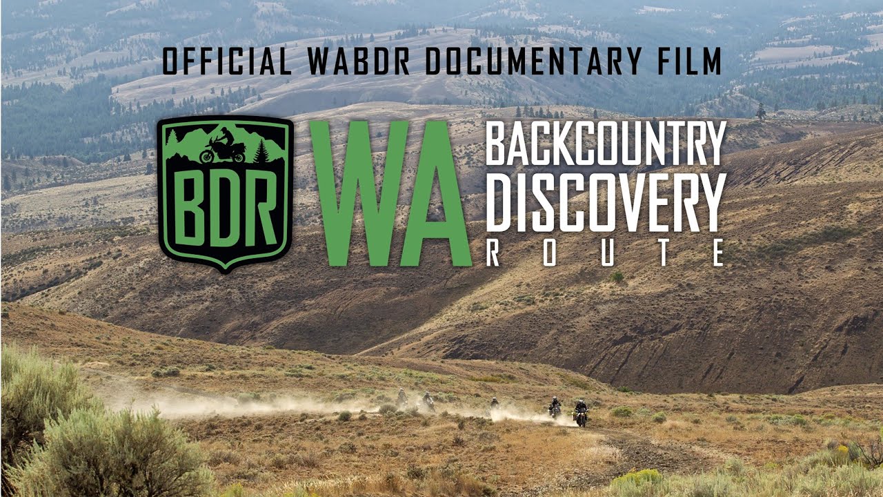
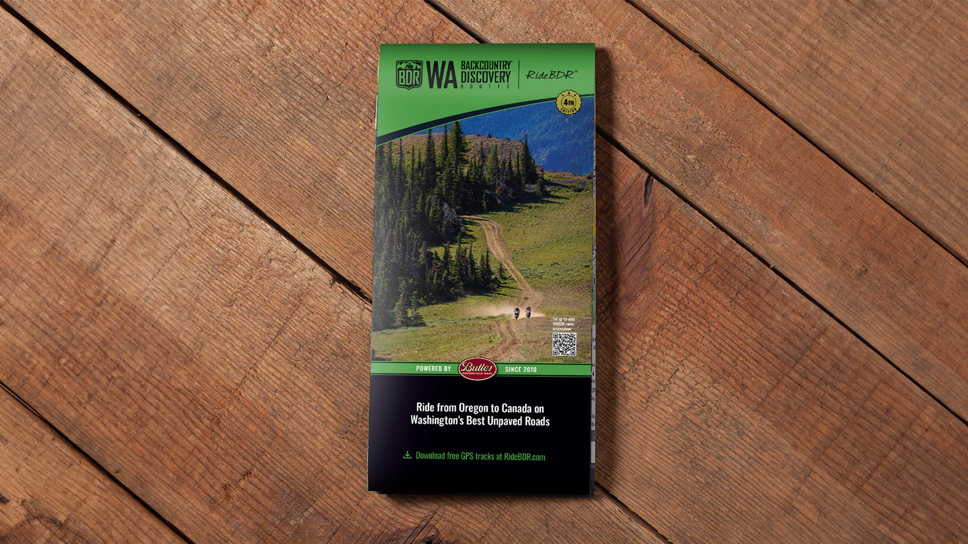
It’s been 15 years since we launched the Washington BDR, our first route. Since then, we’ve been saving up route changes, big and small, for a future update. That time is now! Because of the route changes, we are releasing new GPX tracks, a new printed map (coming in January 2026), and a new short film of the founders riding the WABDR in its new configuration.

The Washington Backcountry Discovery Route is a multi-day off-pavement ride designed for dual-sport and adventure motorcycles. This route begins at the border with Oregon on the Columbia River and quickly ascends into Washington’s densely forested South Cascade Range, passing by 12,276’ Mt. Adams on the way northward. The central portion of the route explores the more arid eastern foothills of the Cascades and crosses multiple sub-ranges with optional, more difficult rocky and rutted roads. After crossing the Entiat and Chelan Mountains, the route descends and wraps around Lake Chelan to enter the North Cascades.

This remote northern region offers wonderful scenery and undulating backroads before ending at a remote US-Canada border crossing near the ghost town of Nighthawk. It takes around 4-6 days on average to ride this 688-mile route with countless photo opportunities along the way to slow you down. The best time of year to ride it is July-Sept when it’s typically snow free at the highest elevations. Despite being one of the shorter BDRs, the WABDR packs in a lot of stunning viewpoints, quaint small towns, and epic riding that you won’t forget.

SAVE THE DATE and join us Friday, November 14, for the release of the updated WABDR (Washington Backcountry Discovery Route).

Fifteen years ago, a small crew of riders set out to map one unforgettable route through Washington’s backcountry. They had no idea it would spark a nationwide ADV movement and inspire riders everywhere to get out and explore.

Now, 22 BDR routes later, the original team got back together to ride the new and improved WABDR 2.0, and we can’t wait to share it with you.

We’ll be showing a 40-minute documentary film, chatting with the founders, and hearing their thoughts on what’s changed over the last 15 years and where BDR is headed next.

If BDR has been part of your riding journey, grab a few friends and join us to hear from the folks who started it all.

WATCH THE FILM

WATCH THE TRAILER WATCH THE FILM

PURCHASE THE MAP

BDR Online Store

The latest version of the WABDR map is dated: Fourth Edition 2024

SECTION-BY-SECTION

OR BORDER
TO PACKWOOD
PACKWOOD
TO ELLENSBURG
ELLENSBURG
TO CASHMERE
CASHMERE
TO CHELAN
CHELAN
TO CONCONULLY
CONCONULLY
TO CANADA
Previous Previous Previous Next Next Next

OR BORDER TO PACKWOOD – 119 miles

The beginning of the WABDR involves crossing the Bridge of the Gods from Oregon into Washington, just west of Stevenson, WA, where you should top off your fuel tank. The route then heads northeast over Triangle Pass and Trail Peak on gravel and dirt roads in Gifford Pinchot National Forest. On a clear day, riders will be treated to views of three volcanoes: Mt. Hood, Mt. Adams, and Mt. St. Helens, which lost 1,300 feet of elevation in a massive eruption on May 18th, 1980. A short detour from the route to visit the Guler Ice Caves is worth the time. Created by a lava flow over 20,000 years ago, this lava tube preserves ice formations year round. From there, you’ll ride north at the base of Mt. Adams and around Takhlakh Lake before beginning a long descent to the town of Packwood, where you’ll find full services.

LODGING

Stevenson
Stevenson is the southernmost town on the WABDR and a great place to get fueled up for the long trip to Packwood. You’ll find several restaurants and lodging options in town.

  • Visit Website

Columbia Gorge Getaways
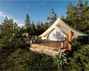
Glamping Resort nestled into the forest approximately 1 mile down Bear Creek Rd. Sitting on a lush 400-acre reclaimed timber stand, it boasts a wide variety of accommodations.

  • Address: 1101 Bear Creek Rd. Carson, WA 98610
  • Phone: (360) 903-1418
  • Visit Website

Carson, Washington
Carson is a scenic gateway deep in the Columbia Gorge and a smart stop for your ride—a perfect place to fuel up, grab a meal, or rest before you push on


Takhlakh Lake & Campground
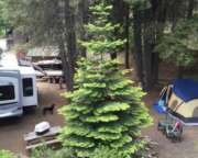
For rustic camping on the shore of Horseshoe Lake, take a few minutes to detour off the main route and head to the lake’s campground.

  • Address: Takhkakh Loop Rd, Randle, WA 98377
  • Phone: (360) 497-1100
  • Visit Website

Packwood
With options in food, gas, and lodging, a stop in Packwood is always a good choice along the WABDR. After or before the long section between Packwood and Stevenson, you’ll need to fuel up your steed at one of the gas stations.

FOOD

Stevenson
Stevenson is the southernmost town on the WABDR and a great place to get fueled up for the long trip to Packwood. You’ll find several restaurant and lodging options in town.

  • Visit Website

Walking Man Brewing
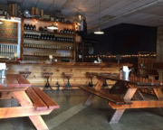
Sample award-winning brew during an overnight stop in Stevenson at Walking Man Brewing. As one of just a dozen breweries in the two-state Columbia River Gorge region, enjoy its outdoor beer garden in the warmer months, or step inside the popular brewpub and warm up with a pint.

  • Address: 240 1st St, Stevenson, WA 98648
  • Phone: (509) 427-5520
  • Visit Website

Backwoods Brewing Company
An ideal location to celebrate either the beginning or the end of the WABDR. The pub is open 7 days a week, and will soon be open 11:30 AM – 9 PM every day. They have outdoor and indoor seating, are family friendly, dogs welcome, and they serve delicious pizza, salads, sandwiches and, of course, beer!

  • Address: 1162 B Wind River Hwy, Carson, WA 98610
  • Phone: (509) 427-3412
  • Visit Website

Packwood
With options in food, gas, and lodging, a stop in Packwood is always a good choice along the WABDR. After or before the long section between Packwood and Stevenson, you’ll need to fuel up your steed at one of the gas stations.


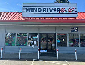
Wind River Market
This is your last chance to fuel up and grab a hot bite to eat before leaving civilization on your north bound journey through Washington state. Carson Washington is the gate way to the Gifford Pinchot National Forest.

  • Address: 11 Carson Frontage Rd, Carson, WA, 98610

FUEL

Stevenson
Stevenson is the southernmost town on the WABDR and a great place to get fueled up for the long trip to Packwood. You’ll find several restaurant and lodging options in town.

  • Visit Website

Packwood
With options in food, gas and lodging, a stop in Packwood is always a good choice along the WABDR. After or before the long section between Packwood and Stevenson, you’ll need to fuel up your steed at one of the gas stations.

  • Visit Website

DISCOVERY POINTS

Oregon Border – Bridge of the Gods
Take in mountain and river views from every angle as the Bridge of the Gods transports riders on a 1/3-mile-long scenic tour originating in Cascade Locks, Oregon and ending in Washington State. Riders join hikers of the Pacific Crest Trail, taking the bridge together as it crosses over the famed Columbia River. As the official southern marker for the WABDR, the old steel truss bridge replaced a legendary stone bridge thought to have been formed by the gods themselves. Considered one of the river’s oldest bridges, the $1 toll is well worth the money. Drive slowly for the best experience and the best views of this southern border crossing.

  • Visit Website

Walking Man Brewing
Sample award-winning brew during an overnight stop in Stevenson at Walking Man Brewing. As one of just a dozen breweries in the two-state Columbia River Gorge region, enjoy its outdoor beer garden in the warmer months, or step inside the popular brewpub and warm up with a pint. With locally and sustainably sourced goods on the menu, grab a basket of pub fries, wings, burgers or pizza, then wash it all down with some award-winning craft beer. For a real treat, choose a sampler of beer as you kick back and meet new friends on this easy stopover of the WABDR.

  • Visit Website

Trail Peak Viewpoint
Take in majestic scenery at every curve in the road of this winding adventure up Trail Peak. Surrounded by tall trees and natural terrain, make time to take in some fantastic views of the gorge and Mount Hood to the south with a short stopover at this unmarked viewpoint. One of the route’s best kept secrets, look over the treetops of Gifford Pinchot National Forest to experience the vast beauty of the region. Void of any development, the peaceful location marks a good spot to absorb the untapped, natural beauty of the route in the ride up through Washington state.

  • Visit Website

Guler Ice Cave Picnic Area
A short side trip off the WABDR, take in one of the coolest stops in the region. The Guler Ice Cave is the place to cool off with underground ice formations all year long. Formed by lava thousands of years ago, the ice cave stretches hundreds of feet so wear a headlamp or bring a flashlight to venture deeper in the cave. It’s $5 per vehicle to enjoy this public facility or park for free with a Northwest Forest Pass, with easy parking near the cave entrance. Grab a spot at one of the nearby picnic tables for a quick bite to eat before heading back on the road.

  • Visit Website

Babyshoe Ridge Viewpoint
Take a slight detour from the main route with a short ride up a side road leading to Babyshoe Ridge. Not far from Babyshoe Pass, this open area is a great place to take in some views of the rolling terrain and Mount Adams in the distance. It’s also a good spot to park for a few minutes and take some pictures with a small break from the mostly towering trees found throughout much of the rest of the surrounding forest. While it only takes a few minutes extra to reach, the views are well worth the time on the road to Packwood.


Takhlakh Lake & Campground
Takhlakh Lake may be small in size but it’s large in terms of its views and adventure. With easy access from the main route riders should take a moment to check it out. Due to its high elevation and sheltered location the WABDR section that passes by the lake is one of the last to be free of snow after spring. Still, it can be muddy once the snow clears, so come prepared.  A day pass is required to park here or use a Northwest Forest Pass to enter. It’s extra to camp for the night, but that’s a popular choice. From the campground take in views of Mount Adams. If time allows, be sure to check out one of the trails leading around the lake or another that leads to great views from the top of an old lava flow.

  • Visit Website

Horseshoe Lake & Campground
For rustic camping on the shore of Horseshoe Lake, take a few minutes to detour off the main route and head to the lake’s campground. Situated on the northeast edge of the water, this small side trip allows riders to get some rest while taking in views of the nearby lake and wilderness. While the campground may not be large, it is close to a number of trails and to Mt. Adams Wilderness. It also offers picnic tables and limited facilities. It’s inexpensive to rent a single camping site for the night, and those camp sites are first come/first served.

  • Visit Website

Walupt Lake & Campground
Just a few short miles off the WABDR and surrounded by the Goat Rocks Wilderness, head to the popular campground of Walupt Lake. This high elevation campground sits right on the lakeshore with some incredible views. The lake’s a great place to cool off during warmer weather or choose from one of the easy or steep trails for a nature hike overlooking the wilderness. The site charges a fee for day use or show a Northwest Forest Pass to enjoy Walupt Lake. Camping is extra of course, but like most national forest camps in the area the cost is nominal. There’s also room to break for lunch at the picnic site or use the campground’s limited facilities.

  • Visit Website

PACKWOOD TO ELLENSBURG – 128 MILES

This section begins with an unavoidable, yet scenic, long paved ride on Highway 12 over White Pass. After descending from the pass, the route turns right and meanders south of Rimrock Lake on mostly dirt roads before returning to Highway 12 and crossing over it. The climb up from the highway involves gravel, washboards, and switchbacks before reaching Bethel Ridge. The main route takes you to the town of Nile in the Naches River valley on easy gravel and paved roads. The optional harder section follows rutted and rocky roads near the crest of Bethel Ridge before getting to Nile. Look for views of Mt. Rainier and Mt. Adams from Bethel Ridge. From Nile, the route climbs up to the summit of Cleman Mountain. The optional route to the summit involves a steep road with loose rocks that can be quite challenging. Dropping off Cleman, you’ll be in Evans Canyon, which eventually leads to the Wenas Valley. The last stretch to Ellensburg has two options with an easy trip over Ellensburg Pass or a long, tough trip along the crest of Umtanum Ridge. The latter option has another steep loose rock climb that has been nicknamed Baby Head Hill. When you get to Ellensburg, you’ll find full services in the medium-sized college town.

LODGING

Silver Beach Resort
Rimrock Lake has several campgrounds and cabins for rent on the north shore just off Highway 12. This resort is open year-round and has a restaurant and a small grocery store with camping items.

  • Visit Website

Rimrock Lake
Rimrock Lake has several campgrounds and cabins for rent on the north shore just off Highway 12. This resort is open year-round and has a restaurant and a small grocery store with camping items.

  • Visit Website

White Pass Village Inn
White Pass has a campground and a resort on Leech Lake just north of Highway 12 at the crest of the pass. The inn is open year-round and they have a gas station with coffee, groceries, and deli food.

  • Visit Website

Squaw Rock Resort & Mountain Momma’s Restaurant
Lodging (campsites and rooms for rent), Gas Station/Convenience Store, and Mountain Momma’s Home Cooking Restaurant on the same grounds.

  • Address: 1162 B Wind River Hwy, Carson, WA 98610
  • Phone: 509-658-2800
  • Visit Website

Ellensburg
The WABDR crosses Interstate 90 at Exit 106 on the outskirts of Ellensburg. At this truck stop, riders can get gas, shop for provisions, get a coffee and a meal, and stay in a hotel if necessary.

  • Visit Website

FOOD

Rimrock Lake
Rimrock Lake has several campgrounds and cabins for rent on the north shore just off Highway 12. This resort is open year-round and has a restaurant and a small grocery store with camping items.

  • Visit Website

White Pass Village Inn
White Pass has a campground and a resort on Leech Lake just north of Highway 12 at the crest of the pass. The inn is open year-round and they have a gas station with coffee, groceries, and deli food.

  • Visit Website

Squaw Rock Resort & Mountain Momma’s Restaurant
Lodging (campsites and rooms for rent), Gas Station/Convenience Store, and Mountain Momma’s Home Cooking Restaurant on the same grounds.

  • Address: 1162 B Wind River Hwy, Carson, WA 98610
  • Phone: 509-658-2800
  • Visit Website

Ellensburg
The WABDR crosses Interstate 90 at Exit 106 on the outskirts of Ellensburg. At this truck stop, riders can get gas, shop for provisions, get a coffee and a meal, and stay in a hotel if necessary.

  • Visit Website

The Woodshed Bar & Grill
Classic comfort dining with a full bar, laid-back vibe, and hearty American fare—ideal for stopping in after a day on the trail in the Nile Valley.

  • Address: 8590 State Route 410, Naches, WA 98937
  • Phone: (509) 658-2100
  • Visit Website

FUEL

Rimrock Lake
Rimrock Lake has several campgrounds and cabins for rent on the north shore just off Highway 12. This resort is open year-round and has a restaurant and a small grocery store with camping items.

  • Visit Website

White Pass Village Inn
White Pass has a campground and a resort on Leech Lake just north of Highway 12 at the crest of the pass. The inn is open year-round and they have a gas station with coffee, groceries, and deli food.

  • Visit Website

Squaw Rock Resort & Mountain Momma’s Restaurant
Lodging (campsites and rooms for rent), Gas Station/Convenience Store, and Mountain Momma’s Home Cooking Restaurant on the same grounds.

  • Address: 1162 B Wind River Hwy, Carson, WA 98610
  • Phone: 509-658-2800
  • Visit Website

Ellensburg
The WABDR crosses Interstate 90 at Exit 106 on the outskirts of Ellensburg. At this truck stop, riders can get gas, shop for provisions, get a coffee and a meal, and stay in a hotel if necessary.

  • Visit Website

DISCOVERY POINTS

White Pass – Food, Gas, Lodging, Camping
In the middle of a long paved section on Highway 12 at the crest of White Pass, you’ll find more services. The place for food, gas, lodging and camping, the site is also a good spot for skiing in the winter or taking in some outdoor adventures in the summer. The campground and resort area offers up added recreation including hiking, rafting or fishing on Leech Lake, plus the location’s simply a great choice for fueling up motorcycles and appetites before reaching the next destination along the WABDR. Experience this town for its scenery, its recreation and its convenience along the Washington route.

  • Visit Website

Silver Beach Resort
Found right on the shores of Rimrock Lake, Silver Beach Resort serves up the convenience of tent camp spots, cabins, motel rooms and trailer rentals. The site is a good place for swimming and outdoor recreation, plus there’s an on-site restaurant for extra convenience. Stay for the night or enjoy time exploring the lake and the mountain views with easy access right along the WABDR. The resort’s also a good spot to see Bald Eagles flying over the lake. Grab some snacks to go or fill up on a famous Rimrock Burger and milkshake before getting back on the road.

  • Visit Website

Rimrock Lake Resort
Open all year round, Rimrock Lake Resort is the place to stop for camping, picking up some food, or taking in some outdoor fun along the route. Just off Highway 12, the resort boasts more than two dozen campsites and furnished cabins for rent on the north shore. The site also offers nearby hiking trails, kayaks and fishing boats for rent, plus it’s simply a great spot to stop for a burger or some breakfast before getting back on the WABDR. Check out the nearby river rafting, grab some food and supplies for the road or just relax for a while with a stop at Rimrock Lake.

  • Visit Website

Cash Prairie Camp
For a fun side trip just off the WABDR, take a short two mile ride out to the group camp spot at the end of Cash Prairie Road (NF 199). The Cash Prairie Camp isn’t large and doesn’t have facilities, but it does have room for camping and picnics. Busiest during the summer and fall seasons, there’s no fee to enter but riders do need to pick up a free wilderness permit at one of the trailheads. A short walk out on the ridge gives you peekaboo views and the chance to spot some wildlife. Be sure to keep an eye out for some scenic viewpoints on the south side of the road as you ride out to the camp.

  • Visit Website

Bethel Ridge Hidden Viewpoint
Just off the main route, make time to try to find the Bethel Ridge Hidden Viewpoint. It takes a short side trip to reach this viewpoint, as it’s virtually unmarked and it’s fairly remote. The double track site does offer the ability to see up close Mt. Rainier and Mt. Adams (and other distant volcanoes on a clear day) and looks out over Rimrock Lake. If the views aren’t enough in the daylight, the site also provides a more secluded and private spot for camping than some of the more well-known and established campgrounds along the WABDR.


Bethel Ridge Rocky Point
An easy spot for riders to reach that’s right on the route, Bethel Ridge Rocky Point is a great place to check out views from high above the Bethel Ridge cliffs. Featured in the WABDR documentary, a quick ride out to this barren spot, gives visitors the chance to see even more viewpoints along the cliffs. Take it slow and take some extra time to enjoy the expansive scenery from every angle along the drive. Check out the dramatic scenery and hilly terrain of this remote mountain site before heading to the next destination on the WABDR.

  • Visit Website

Nile – Food & Gas
For a gas station and mini-mart stocked with provisions in one stop, make time to take a pit stop in Nile. The Wood Shed Restaurant in Nile serves up easy favorites like burgers and barbeque, plus it’s just as simple to head next door for some quick snacks and fuel before getting back on the road (temporarily closed but hopefully will re-open soon). For those needing to stay for the night, there’s the option of camping or renting out one of the rustic cabins in Nile (one sleeps 2 on twin beds and one sleeps 4 on bunk beds). Whether just a short stop or the chance to rest for a while, the town’s a convenient choice for riders along the route.

  • Visit Website

Cleman Mountain Summit
This part of the route passes over the top of Cleman Mountain, rewarding riders along the way with some fantastic surrounding views of the mountainous terrain. Once visitors reach the top, the mountain viewpoint serves up 360-degrees views of the range, looking out over such majestic scenery as Mt. Rainier, Mt. Adams and Goat Rocks. The rocky area is a good place to spot wildlife but be prepared for the possibility of lingering snow during cooler seasons of the year and hot, sunny weather in the summer months. Watch out for loose rocks and some steep slopes along the ride up and down this rugged mountain.

  • Visit Website

Baby Head Hill
One of the more difficult sections of the route, Baby Head Hill proves to be one of the more challenging locations for some riders to reach traveling on the WABDR. The remote location truly lives up to its namesake with round rocks virtually the size of baby heads. The small loose rocks line the route to this hilly spot, often making for a more interesting ride along the way. Plan to make a short stop just above the hill to take in the distant views, tall trees and the incredible scenery of the surrounding area before continuing on the road again.


Umtanum Ridge Durr Road Crossing
Even more fantastic views await riders approaching the Umtanum Ridge Durr Road crossing. The top of historic Old Durr Road is a great place to take in some sweeping views high above the canyon as riders make the descent into the approaching Ellensburg area. This intersection has another road meandering to the east known as the North Yakima Skyline Trail. If time and fuel allows riders can explore the ridge to look for more views that could include the dramatic Yakima River canyon. It’s often cool and windy on Umtanum Ridge so come prepared for the elements but spending a few extra minutes at the road crossing means the chance to take in some incredible views of rolling terrain, plus maybe Mt. Adams and Mt Rainier in the distance. Be sure to get a good look at what’s to come, as the route leads north to Ellensburg and beyond to Table Mountain.


Ellensburg – Gas, Food, Lodging
From food and fuel to lodging, use this next stop to fill up on everything needed to continue the journey. As riders approach Ellensburg a paved section of roadway leads into the full-service town. The WABDR actually crosses Interstate 90 at Exit 106 on the outskirts of Ellensburg. At this truck stop riders can easily get gas, shop for necessary items, or just grab a cup of coffee and a meal at one of the local restaurants. For a longer stop take in one of the museums, tour a winery, meet up with locals at one of the breweries, or even book a stay for the night.

  • Visit Website

ELLENSBURG TO CASHMERE – 79 MILES

Paved roads head north from Ellensburg toward Table Mountain and Lion Rock Lookout in Wenatchee National Forest. High elevation and twisty dirt roads with views of the Central Cascades make this a very enjoyable section. From Lion Rock to Beehive Reservoir, the route is stunning and rugged and reaches elevations of 6,000 feet along the north edge of Table Mountain. Look for spectacular views to the north toward Devil’s Gulch and the Columbia River. The final descent into Wenatchee is on paved roads, but soon you’ll be rewarded with an entertaining dirt road full of large water bars in Number 2 Canyon. A gradually descending road on dirt and then pavement in Mission Creek valley leads to the town of Cashmere, which has gas, groceries, restaurants, and lodging.

LODGING

Ken Wilcox Campground
This campground / horse camp offers 19 trailer / tent sites. Stock water only.

  • Visit Website

Wenatchee
Restaurants, wineries, breweries, motel/hotels made by passionate businesses.

  • Visit Website

Cashmere
Stock up on food, gas and everything else needed for the long road ahead in the town of Cashmere. The charming small town has all the necessary services on hand before heading up Nahahum Canyon toward the Entiat Mountains.

  • Visit Website

FOOD

Wenatchee
Restaurants, wineries, breweries, motel/hotels made by passionate businesses. Make a pit stop to fuel up and wind down before your next stretch.

  • Visit Website

Cashmere
Stock up on food, gas and everything else needed for the long road ahead in the town of Cashmere. The charming small town has all the necessary services on hand before heading up Nahahum Canyon toward the Entiat Mountains.

  • Visit Website

FUEL

Wenatchee
Restaurants, wineries, breweries, motel/hotels made by passionate businesses. Make a pit stop to fuel up and wind down before your next stretch.

  • Visit Website

Cashmere
Stock up on food, gas and everything else needed for the long road ahead in the town of Cashmere. The charming small town has all the necessary services on hand before heading up Nahahum Canyon toward the Entiat Mountains.

  • Visit Website

DISCOVERY POINTS

Reecer Creek Twisties
Paved roads can be a riding highlight as they are in this 6 mile long section of the WABDR. Numerous tight corners allow riders to ascend from Reecer Creek gulch up to the top of Table Mountain. All of the twists and turns lead through the trees and open areas, continuing on to the top of a flat-topped mountain. If you can take a break from the exhilarating twisties, stop long enough to take in views of the Yakima River valley below and Umtanum Ridge to the south.

  • Visit Website

Lion Rock Viewpoint
Making time for a short side trip out to Lion Rock during this part of the journey is a definite must. Once there, riders are treated to 180-degree views overlooking the Swauk Creek Valley and Central Cascades including Mt. Rainier. Be prepared for windy and cooler weather at this point, as the viewpoint extends out from a long steep cliff overlooking Central Washington. For a more remote camping spot without any amenities, this secluded viewpoint is the perfect location, surrounding visitors with local wildlife and the added scenery of blooming wildflowers. There’s no fee to visit the viewpoint, but also little in the way of facilities. Be sure to visit the actual rock west of the turnaround loop where most people stop.

  • Visit Website

Beehive Reservoir
Right on the route, the Beehive Reservoir is a great spot to get in a little rest before making the descent into Wenatchee. The popular fishing lake has limited facilities, but it’s a relaxing location to make a short stop before continuing. At 12-acres in size, the reservoir is often busy during the main season for trout fishing, later transcending into catch-and-release. There’s no camping right at the site, but it often makes a tranquil spot to spend a few minutes, or even a few hours taking in the peacefulness of the region before continuing on the journey.

  • Visit Website

Cashmere – Food, Gas, Lodging
Stock up on food, gas and everything else needed for the long road ahead in the town of Cashmere. The charming small town has all the necessary services on hand before heading up Nahahum Canyon toward the Entiat Mountains. Framed by mountain and river adventures at every turn, stay long enough to grab a bite to eat in one of the local restaurants (Rusty’s Drive In is a hit) or simply fuel up with gas and snacks for the journey ahead. Take some extra time to explore the surrounding area or book a stay to rest up for the night at one of the town’s cozy inns.

  • Visit Website

CASHMERE TO CHELAN – 119 MILES

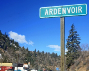
Heading north up Nahahum Canyon from Cashmere brings riders to a 360-degree view atop Chumstick Peak at 5,810 feet. The route then winds up and over Roaring Ridge in the Entiat Mountains before descending steep switchbacks to the one-store town of Ardenvoir, which has a small cafe, gas, and basic rations (closed on Wednesdays). After heading down canyon on paved Entiat River Roa,d the track then turns north, follows a meandering sandy 2-track road, and then rises to Steliko Lookout Tower before returning to the Ardenvoir area. The next 30 miles have a gain of over 4,000 feet as riders climb McKenzie Ridge and the Chelan Mountains. Views of Lake Chelan appear as travelers traverse Slide Ridge before the descent to 25 Mile Creek State Park on the lakeshore. An optional advanced section before Lake Chelan is available and has been aptly named “The Jungle” due to its remote and overgrown nature. The final part of Section 4 follows the southern Lake Chelan shoreline east to the full-service town of Chelan. 

LODGING

Twenty-Five Mile Creek State Park & Campground
For fun and adventure on Lake Chelan, head to Twenty-Five Mile Creek State Park & Campground. This stop is a great place to take a dip or pitch a tent for the night in the campground.

  • Visit Website

Chelan
Right on a lake of the same name, Chelan is the place to go for food, gas and lodging in Northern Chelan County.

  • Visit Website

White Aspen Camping
Luxury tents and rustic camp sites.

  • Address: PO Box 2802 Leavenworth, WA 98826 US
  • Phone: (509)679-0689
  • Visit Website

FOOD

Ardenvoir
Right on a lake of the same name, Chelan is the place to go for food, gas and lodging in Northern Chelan County.

  • Visit Website

Chelan
Right on a lake of the same name, Chelan is the place to go for food, gas and lodging in Northern Chelan County.

  • Visit Website

FUEL

Ardenvoir
Right on a lake of the same name, Chelan is the place to go for food, gas and lodging in Northern Chelan County.

  • Visit Website

Chelan
Right on a lake of the same name, Chelan is the place to go for food, gas and lodging in Northern Chelan County.

  • Visit Website

DISCOVERY POINTS

Chumstick Mountain Summit
A few extra minutes off the main route delivers riders to one of the best locations on the WABDR. After making the ascent from Cashmere, turn off the Entiat Ridge Road (NF-5200) and go up a short side road to reach one of the journey’s top summits. The 360-degree views possible from Chumstick Mountain summit are hard to beat. This mountain viewpoint is a popular spot for adventure riders and Jeeps to make a short stop, especially when low clouds aren’t blocking the views. Be sure to spend at least a few extra moments taking in the rolling mountainous terrain before getting back on the route and continuing with the backcountry expedition through Washington state.

  • Visit Website

Sugarloaf Lookout Tower
Take a step back in time as the journey climbs up to one of the longer side trip options on the route. Follow the gravel road to the top, then park and make the short walk to the rugged summit of Sugarloaf Lookout Tower. If time allows, the lookout is worth the extra ride. Visitors are treated to some incredible views from this rustic high point. Originally established as a lookout for forest fires in the early 1900s, it now sits on the National Historic Lookout Register. A popular location for visitors, the old tower is still staffed during the summer months.

  • Visit Website

Ardenvoir – Food & Gas
It may not be nearly as large as some of the other stops along the way, but tiny Ardenvoir serves just as important of a role for riders traveling the WABDR. The small town’s single storefront is a gas station, café and general store all wrapped into one. The stop marks an essential one for visitors passing northward through the region. Be sure to stop long enough to grab a quick lunch, plus some snacks and supplies for the long road ahead. When it’s time to head out take the time to top off your gas tank on the way out of town. Please say hi to the nice folks there who appreciate our outdoor pursuits.

  • Visit Website

Steliko Lookout Tower
Take a few extra minutes for a short side trip just beyond Ardenvoir. Steliko Lookout Tower is a worthy location for a lookout tower sitting directly above the small town. Although some choose to hike up to the lookout, there’s also a steep rugged road leading directly to the top of the summit. Keep in mind road conditions can vary. The small mountain is more popular for its history and its viewing platform than its height. For those lucky enough to make it to the top, check out some of the best views to the north, including Forest Mountain, Baldy Mountain and Tyee Mountain.

  • Visit Website

Slide Ridge Views
Take in views of Lake Chelan and beyond as you traverse Slide Ridge on the Washington BDR. Make the quick stop to admire the scenery hen traveling this part of the route. At over 6000 feet in places you’ll be passing right by the summits of Stormy Mountain and Baldy Mountain while visiting the ridge. You’ll probably see cars at the Windy Saddle Trailhead where hikers set out for the short hike to the top of Stormy. Keep in mind, though, Slide Ridge sometimes lives up to its namesake with occasional mudslides that make getting here just part of the adventure.

  • Visit Website

The Jungle (Forest Road 233)
One of the most difficult sections of the route, The Jungle is easily the road less traveled. A turn off the beaten trail, Forest Road 233 is quite literally an old abandoned road that’s barely open. It may take some work to travel through this area, including perhaps a saw to chop down branches before even heading down the old road. If big adventure is a part of the plan, though, be sure to at least try to give it a go. If the road’s too overgrown, there’s always the option of the newer main road as a worthy alternative.


Twenty-Five Mile Creek State Park & Campground
For fun and adventure on Lake Chelan, head to Twenty-Five Mile Creek State Park & Campground. This stop’s a great place to take a dip or pitch a tent for the night in the campground. Share the space with boaters at the marina or stock up on necessities at the small park store. The location’s also popular for fishing, bird watching, mountain biking and even scuba diving. It’s additionally a jumping off point for hikes into the North Cascades. A Discover Pass is the ticket into the park, but keep in mind the campground closes during cooler months of the year.

  • Visit Website

Lake Chelan State Park
Extremely popular during the summer months, Lake Chelan State Park is easily one of the most visited parks along the route. Join boaters, windsurfers and anglers at the lake, hang out on the long sandy beach or grab a raft and float in the calm lagoon. The park is also the place to rent stand-up paddleboards, do some wildlife viewing or get in a game of volleyball on the side. For a longer stay the park offers plenty of campsites. Be sure to stock up on food, snacks and more before leaving the park and heading to the next stop on the WABDR.

  • Visit Website

Lake Chelan Lakeside Park
No doubt by this part of the trip it’s time to wind down and relax. Lake Chelan Lakeside Park is the perfect day trip for taking a slow dip in the cool lake water or even taking a plunge from one of the docks. The year-round park has shade trees for dozing off, plenty of fun in the sun, and boat rentals to get out on the water. The site also features sand volleyball, pick-up basketball, a putting course and more. For a quick stop the park delivers the ease of picnic shelters, a seasonal snack bar and a welcoming setting.

  • Visit Website

Chelan – Food, Gas, Lodging
Right on a lake of the same name, Chelan is the place to go for food, gas and lodging in Northern Chelan County. This full-service town is extremely popular in the summer with visitors, so take some time to check out its parks, fresh farmer’s market, live music and more. With plenty of local restaurants to choose from, grab a spot beside the water, a spot to camp for the night, or book an overnight stay in one of the town’s many inns or resorts. Before leaving town take a stroll through Downtown Chelan to enjoy its charming small-town vibe.

  • Visit Website

CHELAN TO CONCONULLY – 163 MILES

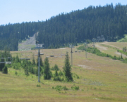
The route ascends north from Lake Chelan past the Echo Valley Ski Area toward Cooper Mountain, a 5,867-foot summit with stunning views. The route then ridgecrest of the Methow Mountains before descending toward Lake Chelan again. This stretch is filled with epic views of the lake and eventually reaches the remote South Navarre Campground. After cresting the same mountain range again, the route gradually descends into the Methow River valley. Just before reaching the river and Highway 153, the route turns west on more dirt roads and finally descends Poorman Creek Road into the town of Twisp on Highway 20. The next stretch has a wide variety of roads, from wide dirt and narrow pavement to unmaintained 2-track and deep silt roads. Eventually, you reach Highway 20 and meander into the scenic Loup Loup area. Look for the massive China Wall, which is in the forest just east of the road. The final descent is a steep, loose one on Ruby Grade, and a bit more pavement leads you to the small town of Conconully. Be sure to fuel up your motorcycle in Twisp, as the fuel pumps in Conconully are not working currently.

LODGING

Echo Valley Resort & Cabins
Just outside of town, on your ride you will pass right by the Eco Valley Ski Area and summer time resort. A popular spot during the winter months where locals hit the slopes for some fun in the snow (skiing and snow tubing), it’s much quieter in the summer months.

  • Address: 1800 Cooper Gulch Rd, Manson, WA 98831
  • Phone: (509) 687-8467
  • Visit Website

Carlton
Just outside of town, on your ride you will pass right by the Eco Valley Ski Area and summer time resort. A popular spot during the winter months where locals hit the slopes for some fun in the snow (skiing and snow tubing), it’s much quieter in the summer months.

  • Visit Website

Twisp
From food and shopping to arts and adventure, riders can make time for a side trip to the town of Twisp. This full-service town offers everything riders need on the WABDR.

  • Visit Website

Winthrop
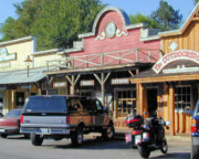
Step back in time to the Wild West with a side trip to Winthrop. The small town is a favorite of tourists thanks to its old west inspired buildings and easy outdoor recreation. Grab a bite to eat or play some pool at Washington’s oldest legal saloon or check out any one of the other food and lodging options in town.

  • Visit Website

Conconully
Load up on food, fuel and supplies at the General Store or grab a full meal at one of the local restaurants. The town also has several places to get some rest for the night or set up a campsite right on the shores of Conconully Reservoir.

  • Visit Website

FOOD

Carlton
Just outside of town, on your ride you will pass right by the Eco Valley Ski Area and summer time resort. A popular spot during the winter months where locals hit the slopes for some fun in the snow (skiing and snow tubing), it’s much quieter in the summer months.

  • Visit Website

Twisp
From food and shopping to arts and adventure, riders can make time for a side trip to the town of Twisp. This full-service town offers everything riders need on the WABDR.

  • Visit Website

Winthrop
Step back in time to the Wild West with a side trip to Winthrop. The small town is a favorite of tourists thanks to its old west inspired buildings and easy outdoor recreation. Grab a bite to eat or play some pool at Washington’s oldest legal saloon or check out any one of the other food and lodging options in town.

  • Visit Website

Conconully
Load up on food, fuel and supplies at the General Store or grab a full meal at one of the local restaurants. The town also has several places to get some rest for the night or set up a campsite right on the shores of Conconully Reservoir.

  • Visit Website

FUEL

Carlton
Just outside of town, on your ride you will pass right by the Eco Valley Ski Area and summer time resort. A popular spot during the winter months where locals hit the slopes for some fun in the snow (skiing and snow tubing), it’s much quieter in the summer months.

  • Visit Website

Twisp
From food and shopping to arts and adventure, riders can make time for a side trip to the town of Twisp. This full-service town offers everything riders need on the WABDR.

  • Visit Website

Winthrop
Step back in time to the Wild West with a side trip to Winthrop. The small town is a favorite of tourists thanks to its old west inspired buildings and easy outdoor recreation. Grab a bite to eat or play some pool at Washington’s oldest legal saloon or check out any one of the other food and lodging options in town.

  • Visit Website

Conconully
Load up on food, fuel and supplies at the General Store or grab a full meal at one of the local restaurants. The town also has several places to get some rest for the night or set up a campsite right on the shores of Conconully Reservoir.

  • Visit Website

DISCOVERY POINTS

Cooper Mountain Summit
For some of the most stunning views overlooking the North Cascades, Cooper Mountain Summit is easily one of the most important stops along the route. Take some extra time for a short ride out to the summit to enjoy the scenery from this mountain viewpoint. The highest point of a long ridge north of Lake Chelan, a clear day offers up panoramic mountain views from the top of the summit. It’s also a good spot to see native wildlife, take some pictures or simply rest high above it all. For a stop that’s hard to forget, pull off the main track to this scenic mountainous stop on the WABDR.

  • Visit Website

Carlton – Food, Gas, Camping
Tiny Carlton marks one of the last locations for riders to make a brief stop on this part of the route. This small community has long served riders with a one-stop shop for non-ethanol fuel and a general store to stock up on any last-minute needs and supplies on the road. As the Carlton General Store is currently closed and up for sale, for now riders can simply continue the ten short miles up Highway 153 to the full-service town of Twisp. Here visitors are sure to find a longer stop in store, plus everything else needed to continue on the remainder of the WABDR.

  • Visit Website

Twisp – Food, Gas, Lodging
From food and shopping to arts and adventure, riders can make time for a side trip to the town of Twisp. This full-service town offers everything riders need on the WABDR. If you visit, stroll through the charming downtown and sample some of the bakeries, cafes and brewpubs of this area. It’s also the place to stock up on groceries and supplies, fuel up, relax in the park or browse through local art galleries. Book a stay in one of the town’s motels or B&Bs, or head to a nearby campground to get some needed rest on this part of the journey.

  • Visit Website

Winthrop – Food, Gas, Lodging
Step back in time to the Wild West with a side trip to Winthrop. The small town is a favorite of tourists thanks to its old west inspired buildings and easy outdoor recreation. Bordered by North Cascades National Park to the west, the town is a popular spot for cross-country skiing, river rafting and more. Grab a bite to eat or play some pool at Washington’s oldest legal saloon or check out any one of the other food and lodging options in town. From authentic Cowboy Dinners to an Old West museum, there’s plenty to see and explore in this tiny town.

  • Visit Website

Leader Lake
A short side trip off the main route, make time to head to Leader Lake and Campground. This popular fishing hole is also a good spot to cool off in the water after a long ride during the warm summer days. The year-round spot has room to camp on both sides of the lake but be sure to take along a Discover Pass to stay for the night. It’s best known, though, for its fishing, especially for rainbow trout in the summer and winter. It’s not uncommon, however, to spot people fishing and visiting during all months of the year.

  • Visit Website

China Wall of Loup Loup
It may take some time to find, but a trip to the China Wall of Loup Loup is a must for its history and its uniqueness. These tall granite stone walls were actually part of Loup Loup, a thriving mining town in the late 1800s. Now deserted, the old town once served as a bustling area with hotels, saloons and more. The old wall, though, is more of a mystery. Found along the side of Ruby Hill, the ten walls measure up to 80 feet long and 27-feet tall. While much of the town’s history is no longer around, the old wall still stands as a puzzling reminder of its past.

  • Visit Website

Arlington Mine Site
Just a short trip for riders off the WABDR, the old Arlington Mine site takes visitors on another trip through history. Originally dating back to the late 1800s, thousands of tons of ore have been mined from the site. It’s a bit overgrown now so keep an eye out for evidence of old mining operations on the hill above Loup Loup Canyon. Although it hasn’t been in operation for decades, it’s still a cool spot for visitors to take some pictures, or just walk around and do some exploring. It’s all simply a short side trip off the main route.

  • Visit Website

CONCONULLY TO CANADA – 80 MILES

Head west out of town on Mineral Hill Road, which leads to seldom traveled silty roads. After getting back onto the main gravel road, you’ll climb up to Baldy Pass with distant views before and after it. The route then drops and climbs a couple more times as it wraps around the west side of Tiffany Mountain. After a short distance, the route enters Loomis State Forest and heads up the ominously named Skull and Crossbones Road, where an old homestead cabin and corral can be seen before heading down to North Fork Toats Coulee Creek. An optional extension leads to a high point called Cold Springs Camp in the forest not far from the Canadian Border. The route then winds down into a spectacular valley just south of Palmer Lake in the Sinlahekin Valley. With the dirt and gravel behind you, pavement leads you north past Palmer Lake through the former town of Nighthawk along the Similkameen River to the Nighthawk border crossing from the US into Canada.

LODGING

Salmon Meadows Camp
Nine miles north from the town of Conconully, join fellow campers who are venturing deeper into the North Cascades at Salmon Meadows Camp. This small campground sits on the east side of Thirtymile Ridge, with plenty of room for tent camping with a view.

  • Visit Website

North Fork Ninemile Campground
Located near a scenic forest stream, North Fork Nine Mile Campground is a secluded campground up Toats Coulee Road.

  • Visit Website

Cold Springs Camp and Viewpoint
Turn just a few miles off the main route to reach Cold Springs Camp and viewpoint. A fun place for visitors to ride to, it’s possible to take in some views from this hilltop clearing of Chopaka Mountain and the Pasayten Wilderness.

  • Visit Website

Chopaka Lake Campground
Less than a mile off the route, make the short side trip to camping, fishing and more at Chopaka Lake Camp. This popular lakeside campground is a favorite for fly fishing.

  • Visit Website

FOOD

Loomis
If needed, Loomis one of the last towns near the northern end of the WABDR to make a stop to stock up on food, supplies and fuel to complete the journey. A slight side trip to this tiny town provides riders with access to the town’s local store, Loomis Kwik Stop.

  • Visit Website

FUEL

Loomis
If needed, Loomis one of the last towns near the northern end of the WABDR to make a stop to stock up on food, supplies and fuel to complete the journey. A slight side trip to this tiny town provides riders with access to the town’s local store, Loomis Kwik Stop.

  • Visit Website

DISCOVERY POINTS

Funk Mountain Lookout
A small side trip off the WABDR, it’s possible to ride almost right up to Funk Mountain Lookout. It only takes minutes to reach the old lookout tower from the access gate but it’s a steep climb to the top! Take in panoramic views of the treetops, nearby peaks and the rolling terrain. The old fire lookout tower is also a great place to see the original “crow’s nest” platform high up in a nearby tree. Bring a Northwest Forest Pass to park. There’s also the option of backcountry camping or camping at one of the official campgrounds not far from the site.

  • Visit Website

Salmon Meadows Camp
Nine miles north from the town of Conconully, join fellow campers who are venturing deeper into the North Cascades at Salmon Meadows Camp. This small campground sits on the east side of Thirtymile Ridge, with plenty of room for tent camping with a view. The $8 camping fee includes a picnic table and fire ring plus limited camp facilities. Spend the daylight hours hiking or riding through the forest near the camp, or just lounge in the meadows soaking up the sun. The campground is also a great place for wildlife watching and for some nearby snow sports during the cooler months of the year.

  • Visit Website

Lone Frank Pass 6712′
As the route gets closer and closer to the Canadian border, climb up and over the highest point on the WABDR. Lone Frank Pass crests a ridge at about 6,700 feet, so take it slow enough to soak in the surrounding views before they’re gone. Pull off for a few minutes for pictures or just to admire the peaceful serenity of this spot high above the rest. Years ago, a deadly forest fire ravaged Thirtymile Ridge and the pine trees haven’t returned creating distant views from many spots near the pass. When it’s time to go, hit the road again for a ride through Loomis State Forest and on to the next adventure as the road trip continues along the most northern part of the WABDR.

  • Visit Website

Skull & Crossbones Corral and Cabin
One of the most unique, and ominously named places to make a stop along the route sits in a remote section of Loomis State Forest. At the top of Skull and Crossbones Ridge riders are treated to the unusual site of the remnants of an old log cabin. Ride right up to the Skull & Crossbones corral and the old cabin to get a closer look at the primitive site. It’s likely not a long stop but it is a fun spot to get a closer look and perhaps snap a few pictures before continuing on with the route to the Canadian border.

  • Visit Website

Cold Springs Camp and Viewpoint
Turn just a few miles off the main route to reach Cold Springs Camp and viewpoint. A fun place for visitors to ride to, it’s possible to take in some views from this hilltop clearing of Chopaka Mountain and the Pasayten Wilderness. It also happens to be where the original WABDR geocache was stashed (it no longer remains). Surrounded by more than 50 miles of hiking trails, the campground is a great place to do some exploring during a slightly longer stop, or to just stop, relax and eat some lunch at one of the picnic tables surrounded by the natural beauty of preserved land.

  • Visit Website

Chopaka Lake Campground
Less than a mile off the route, make the short side trip to camping, fishing and more at Chopaka Lake Camp. This popular lakeside campground is a favorite for fly fishing. It’s also a good spot to cool off during the warmer months of the year, but don’t expect much in the way of facilities. Take a Discover Pass to park and camp for the night at one of the primitive camping sites, then enjoy this setting in a deep valley surrounded by steep mountains. Be sure to keep an eye out for wildlife in this area, including mountain goats, bighorn sheep, deer, and possibly even bears.

  • Visit Website

Loomis – Food & Gas
If needed, Loomis one of the last towns near the northern end of the WABDR to make a stop to stock up on food, supplies and fuel to complete the journey. A slight side trip to this tiny town provides riders with access to the town’s local store, Loomis Kwik Stop. Here riders can fuel up their bikes and grab other items to help make the final part of the journey. If the town does not have what’s needed, try the towns of Tonasket or Oroville.

  • Visit Website

Nighthawk Ghost Town
Next up on the route is the tiny ghost town of Nighthawk. Once a booming mining town the old town is now little more than a few residents and some old deserted buildings. This privately-owned former town sits on the Similkameen River, and visitors drive right by it on Loomis-Oroville Road. Although it’s worth a second glance riders are advised not to disturb the current residents. Now a shell of its former self, the last mine in the area closed more than a half century ago. There aren’t any services for visitors these days, but it’s still an interesting place to ride by on the way to the border.

  • Visit Website

Canada-Washington Border
The official northern end of the WABDR delivers riders right to the Chopaka US-Canadian Border crossing. This crossing connects up Loomis, Washington with the sister towns of Cawston and Keremeos, British Columbia on the other side. Don’t expect to see many other vehicles in this area, as it’s the least used Canadian border crossing in the State of Washington. That’s likely because it’s also near one of the most remote locations. Be sure to take in the surroundings but don’t try taking any photographs as photos are prohibited near the border crossing.

  • Visit Website

PLAN YOUR ADVENTURE

WABDR PACKING LIST

This packing list serves as an example and is not intended to be a complete list for your backcountry riding needs. Feel free to customize this list to work for you.

Gadgets
  • Map holder / map case
  • GPS unit
  • GPS mount
  • Compass
  • Cell phone
  • Phone charger
  • Plug adapter: auto to BMW plug
  • Camera
  • Spot II
  • Notebook
  • Pencil/pen
Clothing
  • Rain shell
  • Riding socks (2)
  • Zip pants/shorts
  • Short sleeve (base layer shirt)
  • Swim suit
  • Flip flops/sandals
  • Riding jersey / long-sleeve (base layer shirt)
  • Fleece jacket
  • Underwear
  • Wool beanie
  • Ball cap
  • Socks
Motorcycle
  • Engine oil
  • Clip-style master link
  • Fuses
  • Chain lube
  • Spare inner-tubes
Riding
  • Helmet
  • Boots
  • Goggles
  • Gloves (2 sets)
  • Protective gear (pressure suit, Leatt brace, knee braces)
  • Jacket
  • Pants
  • Balaclava or neck gaitor
  • Water bladder or bottle
  • Hydration pack
  • Ear plugs
Personal
  • Toiletries
  • Soap
  • Toothpaste
  • Toothbrush & Floss
  • Towel (MSR Pack Towel)
  • Razor
  • Toilet paper
  • Sunscreen
  • Bug spray
  • Pain reliever
  • Allergy meds
  • Wet Wipes
  • Sun Glasses
  • Passport if going into Canada
  • Money (credit cards & cash)
Camping Gear
  • Sleeping bag
  • Pillow
  • Roll pad
  • Tent
  • Dry bags (2) for tent, sleeping pad & sleeping bag
  • Water storage (Dromedary Bag)
  • Folding hand saw
  • Water filter
  • Eating utensils
  • Lighter / waterproof matches
  • Can opener
  • Pots & pans
  • Coffee brewing device
  • Coffee cup
  • Headlamp (2)
  • Kitchen set & spices
  • Stove
  • Stove fuel bottle
  • Folding camp chair
Books & Maps
  • Forest & National Parks maps
  • WABDR Butler Map
Tools & Misc
  • Tool roll / tool set
  • Tire levers
  • Tire patch kit
  • Air pump
  • Tire gauge
  • Quicksteel
  • Leatherman tool
  • Swiss Army knife
  • Large inflation CO2 (for tubeless tires)
  • First Aid kit
  • Zip ties
  • Duct tape
  • Wire
  • LocTite
  • WD-40
  • Tow strap
Food
  • Energy bars
  • Coffee
  • Oatmeal
  • Other ingredients based on meal plan

WABDR MOTORCYCLE DEALERSHIPS

January 21, 2022

Cascade Moto

Tigard, OR 97223

WEBSITE

Cascade Moto is Portland, Oregon's ADV headquarters. Both our Triumph and BMW showrooms stock new and used adventure bikes, parts and apparel, ADV accessories, and more. Both of our locations are near the start of the WABDR and ready to help you make your next ride the best yet. Come stop by our shop and tell us about your next adventure!

https://ridebdr.com/wp-content/uploads/2022/02/Cascade-Moto-logo-1500x906-1.png 175 300 BDR https://ridebdr.com/wp-content/uploads/2022/11/BDR-RIDEBDR_Logo.png BDR2022-01-21 09:34:362025-03-11 09:19:52Cascade Moto

FREQUENTLY ASKED QUESTIONS

Below are answers to some Frequently Asked Questions about the Washington Backcountry Discovery Route.

What is the WABDR?

The Washington Backcountry Discovery Route (WABDR) is a mostly off-road route from Oregon, USA to British Columbia, Canada. The South to North route winds through the Cascade Mountains and some arid landscapes in the foothills of Eastern Washington. The roads include dirt, gravel, and pavement surfaces and may include rocks, ruts, sand, mud and snow depending on time of year and conditions. The route can be completed in 4-6 days depending on pace, and is also accessible by four-wheel drive vehicles, as the entire route is at least double-track.

What time of year can I do the WABDR?

The WABDR is best from July-October depending on snowpack and weather.

How long does it take to run the WABDR?

Most people average 150 miles a day on a backcountry motorcycle trip. Plan on doing this route in 4-6 days depending on how fast you want to travel and how early you want to roll out of camp.

How do I get information on current road conditions?

We do our best to post the most up-to-date information on our Route Updates Page. We depend on the BDR community to inform us about route and road conditions, so if you encounter any road closures or severe conditions that are worth reporting, please contact us with the information.

There is also a dedicated WABDR Facebook Group Page. We recommend that you join the group prior to your trip to read trip reports and comments from other riders about their experience on the route.

Don’t forget to use our Interactive Map to get route conditions in real time. Read this Article to a quick tutorial on how to use the Interactive Map.

Where can I find the GPS tracks for the WABDR?

The tracks for the route can be downloaded free of charge online at https://ridebdr.com/download-tracks/ .

Why do I need paper maps when I have GPS tracks?

Always bring a complete set of maps for the area you plan to ride. They have good information about roads, water sources, and are an indispensible resource when the GPS doesn’t work, or is giving questionable advice. Unplanned events can occur and having paper/synthetic maps of the area can be a life saver. National Forest maps are available at www.naturenw.org and local Ranger Stations. WABDR Butler Motorcycle Maps are available at Touratech-USA and Butler Maps.

How far between gas stops?

The longest gap between gas stations is approximately 122 miles from Packwood to Ellensburg, unless you stop for gas in Nile Valley on Hwy 410. The next longest section is 120 miles between Stevenson and Packwood. Premium fuel is available in Stevenson, Packwood, Ellensburg, Cashmere, Leavenworth, Chelan, Twisp, Omak and Oroville. Low octane gas is available in Carlton, Nile, Ardenvoir and Conconully. The elevation chart on the WABDR Butler Map includes all the mileage details and fuel locations.

Can I have a camp fire?

Check with local Ranger Stations to determine if campfires are allowed before you build one. Forest fires are a threat during parts of the year and the rules that manage this risk must be followed. Be sure to fully extinguish fires so they are DEAD-OUT. Use water to ensure a fire is fully extinguished and the ground is left cool and wet.

Where do I camp?

There are many campgrounds and suitable dry camping locations along the route. The Butler Motorcycle Map for the WABDR has a tent icon showing campgrounds on the route and many near the route. The WABDR Butler Map is available through Touratech-USA and Butler Maps. In addition, the Wenatchee, Okanogan, and Gifford Pinchot National forest maps show a tent icon for all campgrounds. These maps are available at www.naturenw.org and local Ranger Stations. Make sure to leave all camp locations clean and safe for the next user.

Do I have to camp?

No, you can complete the WABDR using hotels and restaurants fairly easily. Hotels, restaurants and grocery stores are available in Stevenson, Packwood, Ellensburg, Cashmere, Leavenworth, Chelan, Twisp, Omak and Oroville. Limited accommodations are also available in Conconully.

Is there water on the route?

You can find potable water in the towns along the way, or use a filtration system and source the water from creeks and springs along the route. The National Forest maps are a good resource for finding suitable creeks and springs. Choosing a camp location close to a water source is a good idea. It is strongly recommended to have a water filtration solution with you at all times in the backcountry. A filtration solution will allow you to carry less weight on the bike since you don’t have to haul your water. It’s also more flexible if you run into delays or have a mechanical issue along the way. Here is a video on water filtration filmed in the Oregon Backcountry: http://youtu.be/vqOFZAoZdTU

What GPS should I use?

Any GPS unit capable of displaying 10 track logs with a minimum of 500 points each is suitable for use on the WABDR. Garmin models that work best for this application are: Zumo 665/660, GPSMap 60, 62, 76, 78 and 276. Other GPS manufacturers may have units that will work. Check the technical specs to determine suitability.

Do I need a Discovery Pass?

A discover pass is required on street legal vehicles when using state recreation lands. For more information visit www.discoverpass.wa.gov/faq

What is the ideal bike to use?

Any bike that has a license plate, can run knobby tires and is set-up to carry the gear you plan to bring, and has the fuel range to make the distance between gas stops. Most adventure or dual sport motorcycles will be suitable for the trip.

How difficult is the route?

The WABDR route is designed to be ridden on adventure and dual-sport motorcycles, as well as driven in 4×4 vehicles. There are no single-track style trails on this route. Many of the roads are in remote areas and reach high elevation areas where road maintenance is minimal or non-existent. You can expect to cover sections of road with deep ruts, loose rocks, sand and other challenges. There are also sections that have steep grades combined with rough surfaces. You may also encounter sections that have trees or branches over the road. Some of the roads are overgrown with foliage, but are passable by both motorcycle and 4×4 vehicles. There are alternate “easier” routes around a few of the most challenging sections. Depending on time of year and weather, there may be a few small shallow water crossings, but none worth worrying about. Certainly nothing like the Malheur River on the OBDR (Oregon Backcountry Discovery Route)

Are there any gates on the route?

Yes, there are several gates on the route. Please make sure to close all gates that you pass through.

What tires should I use for the WABDR?

DOT approved knobby tires are strongly recommended. Our team members used either Continental TKC 80 or Dunlop 606 tires when we rode the route.

What is the highest elevation on the WABDR?

The highest elevations are reached in section 6 where Lone Frank Pass reaches nearly 7,000 feet. The route starts at nearly sea level and brings riders up to 5,000 to 6,000 multiple times on each section.

Is there cell phone coverage on the route?

Much of this route is remote and out of reach for cell phone towers. There will be long sections with no coverage. Your best bet to talk or text is in the towns or on top of mountains. You will be surprised where you get coverage and where you don’t. A satellite communication device is a good idea in the backcountry.

When is the border crossing at Nighthawk open?

The Nighthawk border crossing is typically open 9am – 5pm seven days a week. The nearby border crossing at Osoyoos just north of Oroville is open 24 hours a day. The US Border Office phone number is (509) 476-2125. Remember to bring your passport if you plan to cross into Canada.

Can I ship my bike up to the NW?

South Sound BMW provides a safe and convenient location to have your bike shipped to the Seattle/Tacoma area. They will allow you to use their shipping dock and warehouse to facilitate the shipping of your motorcycle. In most cases there is no charge for the receiving service. Email [email protected] or call (800) 303-1838 for more information.  Additionally, Motorcycle Shippers provides shipping services within the US.

What medical supplies should I carry on a BDR trip?

This advice comes from Rob Watt, BDR Board and Expeditions Member, and Wilderness EMT.

We carry items for wound management, breaks, basic meds and dental.  You can buy a good first aid kit at one of the outdoor stores online or Touratech-USA.  Get one that is an Extended Day Backpacker or 3-4 person kit.  These kits usually have the basics for a motorcycle trip.

They usually don’t have a SAM splint, so pick one of those up along with a couple ace bandages.  One other thing that we do for every multi-day trip, is to gather important information about each rider: allergies, medications, medical issues, emergency contacts, etc.

Then we put that on a master sheet for each person, so if something does happen we have that information handy incase that person can’t speak.  Another good practice is to do a little research of where medical facilities are along your planned route.  Is there a “flight for life” in the area? Where are the hospitals, Medical clinics, etc?

Here is a list of some items that you should have in your medical kit:

  • Bandages: Assorted sizes for small cuts, blisters, etc.
  • 4-inch closure strips or butterfly closures: For closing large wounds. 4-inch strips are more effective than butterfly.
  • 4 inch by 4 inch sterile dressing pads (5 to 10): To apply pressure to a wound and stop bleeding
  • Non-adherent sterile dressing (2 inch by 2 inch): Use these or Second Skin to cover blisters, burns or lacerations.
  • Gauze roll: Holds dressing in place.
  • Small roll of 1-inch adhesive tape: Holds dressings in place.
  • Multi-use tool or knife: Should include knife, scissors. A scalpel and blade are also useful for first aid.
  • Forceps or tweezers: For removing splinters, ticks, and removing debris from wounds.
  • Scissors: Trauma scissors, which have a blunt end to protect the patient, can be used for cutting away clothing from injury, cutting medical tape, etc.
  • Thermometer: Digital is generally more accurate, but batteries do wear out.
  • Malleable splint: Lightweight foam-covered aluminum, such as a SAM splint.
  • Irrigation syringe (35 cc): Used to flush and clean wounds.
  • Suction syringe (65 cc): Used to clear mouth of fluids when giving CPR.
  • Safety pins: Can help remove splinters, fasten arm sling, or make a whole in a plastic bag for improvised wound irrigation.
  • Cotton-tip swabs: For removing  foreign objects from eye, or applying antibiotic ointment.
  • Resealable plastic bags: Many uses, including icing a swollen joint or creating wound irrigation device.
  • ACE, Coban, or other rubberized bandage: Can be used as outer wrap on splints, wound dressings or support for joint injuries. Be careful not to wrap too tightly.
  • Antiseptic towlettes: For cleaning small wounds.
  • Cleansing pads with lidocaine: For cleaning. Includes a topical anesthetic for abrasions, stings, etc.
  • Topical antibiotic ointment: For application to wounds. Simple Vaseline can also be used in dressing a wound.
  • Moleskin: Prevents blisters. Cut and apply a section to your foot as soon as you discover a “hot spot.” Duct tape also works for this purpose.
  • Povidone Iodine USP 10 percent, 1 oz.: For preventing infection. Bottled PVD iodine 10 percent solution should be diluted to a ratio of 1 percent or less for flushing wounds.
  • Aloe vera gel: Found in packets or small bottles for relief of minor burns.
  • Pain relievers, including aspirin and Ibuprofen: Provides relief for minor aches and pains, reduces fever, helps reduce inflammation of sprains and other injuries.
  • Antihistamines: For relief of pollen allergies, or to reduce reaction to bites and stings.
  • Immodium 2 mg capsules or tablets: For relief of diarrhea from intestinal infections.
  • Pepto Bismol or antiacid tablets: For relief from general diarrhea, abdominal upset.
  • After Bite or hydrocortisone cream USP 1 percent: Relieves skin irritation from bites, poison oak, stings, or allergic reactions.
  • Latex or nitrile gloves: Protects against blood-borne diseases and infection.
  • CPR microshield mask: A compact flexible barrier with a one-way valve for rescue breathing, which protects user from blood, vomit or saliva.
  • Oral rehydration salts: Packet of electrolyte salts and glucose for treatment of dehydration, heat exhaustion, or loss of fluids from vomiting or diarrhea.
  • Space bag/blanket: Lightweight emergency shelter. For treating hypothermia victims.
  • Paper and pencil: For recording medical data such as body temperature, pulse, time and date of symptoms, injuries, medicines administered, etc. Most repackaged kits include accident report forms.
  • Wilderness First Aid booklet: Many prepackaged first aid kits contain one. An excellent pocket guide is the Wilderness Medical Handbook

Which BDR is the easiest? Which one would you recommend for a rider that hasn’t done a long trip on dirt before. I have just taken an intro level training course and I ride a 1200GSA?

We get this question all the time. Here are some key things to consider as you put together your plan.

All of the BDR routes include intermediate to advanced terrain. If a person is on a large bike twin-cylinder bike like an R1200GS Adventure or Yamaha Super Tenere, the routes can be very difficult. If a person’s skills are not advanced level, they may consider taking a smaller bike or choosing the easier options when possible. A BDR is something a person should build up to and it shouldn’t be their first overnight trip on their ADV bike.

Although, WA and CO are less difficult than UT and AZ,  they all contain difficult sections. We suggest looking at the Butler Map and take the optional easier routes to avoid the difficult sections. Even taking this approach there may be difficult stretches depending on changes in road conditions, weather, construction and the unknown. This is part of what makes it an adventure. Regardless of its description on the map or in the film, no section of a BDR should be underestimated.

Do some shorter overnight trips as practice and ride increasingly difficult terrain to build up your skills and confidence. Also remember that riding with a fully-loaded bike should be practiced prior to tackling a BDR. Lastly, always ride with a group so that you have a team to help overcome any obstacles whether it’s terrain, mechanicals, navigation, medical emergency, etc…

In summary, take baby steps and work up to doing a BDR. Don’t make it your first adventure motorcycle outing on a full-sized twin-cyclinder bike.

Rating the Routes by Difficulty

We are often asked if we rate BDRs by difficulty. We don’t officially rate the difficulty level of our routes as it varies daily due to current weather, road conditions, and other unpredictable factors. Difficulty also depends on individual skill and fitness level, bike and tire selection and load carried.

Some riders find sand to be most challenging, some find mountain passes difficult. Each rider’s perception is unique.

While we can’t provide a standardized rating like ski resorts, we can provide some basic guidance of difficulty level from most to least. This order does not include optional harder sections and implies favorable road and weather conditions:

BDR Routes: CABDR-South, ORBDR, AZBDR, WYBDR, UTBDR, COBDR, NVBDR, NEBDR, WABDR, NMBDR, CABDR-North, IDBDR, SEBDR, MABDR.

BDR-X Routes: Big Bend, TX; Red Desert, WY; Steens/Alvord, OR; Chattahoochee, GA; Black Hills, SD; PA Wilds, PA; Texas Hill Country.

Review the FAQs for each route before your trip.

Subscribe to our mailing list:

  • This field is for validation purposes and should be left unchanged.

General Questions:

Phone: (206) 383-6233
Send a Message

Route Questions:

Email: [email protected]

FREQUENTLY ASKED QUESTIONS

FOLLOW US!

Instagram TikTok
facebook YouTube
Backcountry Discovery Routes is a 501c(3) non-profit corporation. © 2025 Backcountry Discovery Routes, Inc. All rights reserved. Terms of Use.
Scroll to top Scroll to top Scroll to top

This site uses cookies. By continuing to browse the site, you are agreeing to our use of cookies.

Accept settingsSettings

Cookie and Privacy Settings


How we use cookies

We may request cookies to be set on your device. We use cookies to let us know when you visit our websites, how you interact with us, to enrich your user experience, and to customize your relationship with our website.

Click on the different category headings to find out more. You can also change some of your preferences. Note that blocking some types of cookies may impact your experience on our websites and the services we are able to offer.

Essential Website Cookies

These cookies are strictly necessary to provide you with services available through our website and to use some of its features.

Because these cookies are strictly necessary to deliver the website, refusing them will have impact how our site functions. You always can block or delete cookies by changing your browser settings and force blocking all cookies on this website. But this will always prompt you to accept/refuse cookies when revisiting our site.

We fully respect if you want to refuse cookies but to avoid asking you again and again kindly allow us to store a cookie for that. You are free to opt out any time or opt in for other cookies to get a better experience. If you refuse cookies we will remove all set cookies in our domain.

We provide you with a list of stored cookies on your computer in our domain so you can check what we stored. Due to security reasons we are not able to show or modify cookies from other domains. You can check these in your browser security settings.

Google Analytics Cookies

These cookies collect information that is used either in aggregate form to help us understand how our website is being used or how effective our marketing campaigns are, or to help us customize our website and application for you in order to enhance your experience.

If you do not want that we track your visit to our site you can disable tracking in your browser here:

Other external services

We also use different external services like Google Webfonts, Google Maps, and external Video providers. Since these providers may collect personal data like your IP address we allow you to block them here. Please be aware that this might heavily reduce the functionality and appearance of our site. Changes will take effect once you reload the page.

Google Webfont Settings:

Google Map Settings:

Google reCaptcha Settings:

Vimeo and Youtube video embeds:

Other cookies

The following cookies are also needed - You can choose if you want to allow them:

Accept settingsHide notification only