Wyoming Backcountry Discovery Route
The long awaited Wyoming BDR (WYBDR) is our eleventh route developed for dual-sport and adventure motorcycle travel.
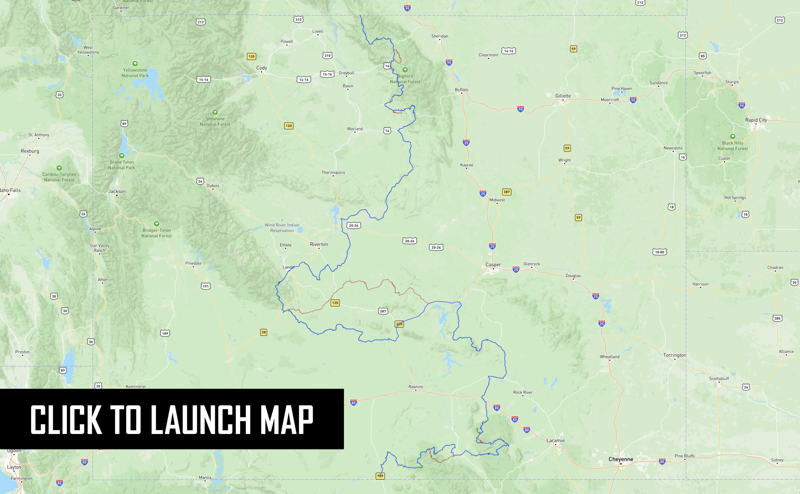
The Wyoming Backcountry Discovery Route is a multi-day off-pavement ride for dual-sport and adventure motorcycles through the most dramatic and rugged landscapes in Wyoming. Beginning in Baggs, WY, the route traces the mountain ranges to the east through the Sierra Madre and Medicine Bow Ranges, crosses west to the Wind River Range, then goes back east and north through the Bighorn Mountains, eventually ending at a remote Wyoming-Montana border. Almost every section includes some moderately technical riding, as the remote two-track flows through regions of vast high-desert, short-grass prairies, and alpine climates. You will experience expansive views from the summit of two different 11,000-foot mountains, cross two major rim escarpments and pass through many other seldom visited areas and historic mining towns. This is the most remote BDR, so plan ahead and be prepared to have a true backcountry adventure.
NOTE: Riders should not attempt the entire WYBDR before July 1st due to sensitive land areas and lingering snow and mud.
Click HERE for more information.
Download the latest track file with important changes labeled WYBDR-June2024 HERE
WYBDR – SECTION DESCRIPTIONS
Section 1: Baggs to Centennial - 161 Miles
Section 1: Baggs to Centennial – 161 Miles
The WYBDR begins in Baggs, Wyoming just 2.6 miles north of the Colorado border. This is a great place to get provisions for the trip as they have a grocery store. Lodging is available and convenient as you’ll probably be getting here from out of town (reserve rooms ahead if possible).
The route officially begins with a short paved segment on Highway 789. Pay attention for a turn that comes up quickly on the right which leads you into the vast treeless region known as Wild Horse Basin. Enjoy the views and the firm dirt track which makes a nice introduction to Wyoming’s backcountry. This section ends when it descends into the Savery Creek Valley and passes by Boyer YL Ranch, another lodging option for the start of the WYBDR. A side trip to the historic town of Savery (pop. 25) is worthwhile.
Riders will then ascend out of the valley onto a blissful track with sagebrush and aspen trees called Savery Stock Drive which is impassible when wet as the mud will be too slippery and sticky to ride. This mud warning applies to all of the non-forested sections of the WYBDR. One more bit of pavement leads past the Battle Mountain Viewpoint before a northward turn begins a long segment through the Sierra Madre Range. Immediately riders will go through the unmistakable “Aspen Alley” where photographs are in order. Then riders will pass through burned forests before stopping to make a decision. The first harder option on the WYBDR goes over the Continental Divide Trail and Bridger Peak (elev. 11,004 ft). This option is not doable early in the season and after the first snowfall in autumn. If you’re here in July and August and you are an advanced rider who enjoys steep rocky 4×4 trails, this is for you. Otherwise enjoy the scenic and bucolic option that bypasses this massive mountain. Both options end in the town of Encampment/Riverside (pop. 460 combined) where you should re-fuel.
The next section uses pavement and wide dirt roads heading eastward towards the next mountain range. The road ascends from the North Platte River Valley and passesthrough another burned forest before getting to Rob Roy Reservoir in the heart ofMedicine Bow-Routt National Forest. Camping is available at Holmes Campground and v Rob Roy Campground at the north end of the lake. For those staying at Rob Roy consider the side trip up to Spruce Mountain Lookout for superb views of the area. The BDR leavesRob Roy going northward and the track gets a bit rougher. Watch for puddles and sharp rocks as the track continues and turns NE before leaving the Medicine Bow Mountains And descending to the historic town of Centennial (pop. 308).
Section 2: Centennial to Elk Mtn - 68 Miles
Section 2: Centennial to Elk Mtn – 68 Miles
After leaving Centennial, riders will begin ascending into the Snowy Mountains area of Medicine Bow – Routt National Forest. The first part follows paved twisties on Barber Lake Road through Libby Creek Recreation Area before returning to the highway.
After a couple miles of pavement on Highway 130, watch for a right turn which soon becomes Towner Lake Road, a rugged scenic track below the Snowy Mountains. Look for moose which frequent the small lakes along this road. You’ll find campgrounds galore in this area north of the highway. The brief dirt thoroughfare connects back to pavement and heads westward on Highway 130. Stop at one of the two signed viewpoints along this section to photograph the mountains.
As Highway 130 descends you’ll have to decide again whether to take a harder section. This one involves a deep water crossing and rugged forested roads for eight miles. Early in the riding season this creek crossing might be too deep and fast flowing to attempt. If so, just take the main route.
A 6.5 mile long side trip leads up to the summit of Kennaday Peak (elev. 10,810 ft). Early in the year snow will linger and after the first snows of fall appear this summit might not be attainable. At other times, it’s worth the extra time as the riding is top notch and the views at the summit are rewarding.
The rest of this section heads north through typical forest roads before the skies open again to treeless farmlands and wide fast roads leading to the town of Elk Mountain (pop. 194). We recommend filling up at the gas station where the track crosses Interstate 80 as it has high octane fuel and the one in Medicine Bow does not.
Section 3: Elk Mtn to Alcova - 122 Miles
Section 3: Elk Mtn to Alcova – 122 Miles
After crossing the interstate, look for a road on the right and follow the track as it heads north on seldom traveled County Rd 115. This bit of two-track heaven meanders through sage hills and shallow valleys as it connects I-80 to Highway 30. Along the way you’ll need to open and close a few gates in barbed wire fences. Near the north end look for old rock walls that still stand from the abandoned mining town of Carbon (circa 1881). The town’s substantial cemetery can be found on the west side of the road too. After the dirt ends you have roughly nine miles of tarmac before reaching the town of Medicine Bow (pop. 284).
The WYBDR turns north onto a long paved segment on Highways 487 and 77 and passes the countless wind turbines of Dunlap Wind Farm. The track then ascends into the Shirleys on moderate-level roads with loose rocks, occasional ruts and sandy patches. You’ll soon descend more fun roads and the trees will open up to sage covered high desert again. The roads north of the Shirley Mountains are wide and fast. They seem to go on forever, but eventually they pass by Alcova Reservoir, descend a red rock canyon and end at the town of Alcova (pop. 86)
Section 4: Alcova to Atlantic City - 145 Miles
Section 4: Alcova to Atlantic City – 145 Miles
Top off your fuel tank in Alcova and stock up on food and drinks as the next stretch is 145 miles long. Leaving Alcova, enjoy 50 miles of pavement cruising before hitting the dirt in the small town of Bairoil.
The road out of town is an industrial road and can be slick when wet. When the track leaves the main road, it is a moderately-sandy two track that follows a powerline. Be prepared for a wire ranch gate to cross, and leave it how you found it. The two track splits from the powerline headed west and intersects Crooks Gap road to Three Forks Road. This is a very fun section, nice road and a blissful ride through open high-desert terrain.
At Bison Basin you’ll join another industrial road so be aware of big trucks and equipment. The route will pass through an oil field through Riverview Cutoff Road with great scenery all the way to historic Atlantic City (pop. 39). Stop into Miner’s Grubstake for a meal and drinks and stay at Miner’s Delight BnB. The owner, Bill, sells fuel here as well. Fuel is also available in nearby Lander.
Optional ALT Harder Track:
The optional ALT Harder track follows along the Beaver Rim and starts with easy riding on Dry Creek Road before turning into many miles of doubletrack that can be loose sand, round rocks, deep ruts, slippery puddles and everything in between. It’s a scenic and spectacularly fun riding challenge you’ll never forget. It is important to pay close attention to the track on this section as there are many private landowner parcels that the route skirts–stay on public land, and remember this road must not be traveled on priority to July 1st each year.
If the daylight dwindles or your internal reserves run low there are a couple roads to bail on that will get you south to Highway 287. The main optional bail point is Ore Road which is near the center of Beaver Rim and takes you to Jeffrey City and a gas station which is occasionally open, but don’t count on it.
After Ore Road you are pretty committed to completing this entire section. The going finally gets easier as you start heading southwest on wider roads before reaching Atlantic City.
Section 5: Atlantic City to Shoshoni - 130 Miles
Section 5: Atlantic City to Shoshoni – 130 Miles
Soon after leaving Atlantic City you’ll pass by the remains of Carissa Mine (circa 1867). The gold found in this mine led to a surging population in the area and the founding of South Pass City (pop. 57). This restored historic town is worth a stop as the buildings are often open for viewing and there’s a museum and gift shop as well.
The route becomes an undulating doubletrack after crossing Highway 28. It’s short but sweet riding and soon connects to a wide road crossing the south end of the Wind River Range. This section on Forest Road 300 is one of the highest trafficked sections of the WYBDR so go slow and watch for vehicles on every corner, and Ride Right. You’ll pass by several lakes including Louis Lake, Fiddlers Lake and Frye Lake along this section and several campgrounds run by Shoshone National Forest.Eventually, the dirt ends and the pavement begins, but don’t fret, this is a wonderful bit of tarmac.
Eight sweeping switchbacks take you down from the Wind Rivers to the Middle Popo Agie River Valley below. After the switch backs end, look for signs for Sinks Canyon StatePark. This park has two parking lots, one for where the river disappears underground and another 1 1/2 miles down the road where it “rises” in a calm pool full of hungry trout (you can feed them for a quarter).
In a few miles you’ll reach Lander, the largest city on this BDR and home to NOLS. Lander has all the services you’ll need so fuel up the body and the bike. A few miles of pavement riding gets you to the town of Hudson and the start of a long section of dirt roads through wide open spaces dotted with mining and extraction sites. It’s not the most exciting section of the WYBDR but it goes around the Wind River Indian Reservation. You will pass by unique and colorful sandstone formations on this section and go right through a gas plant on a public road. There are Poison Gas Warning signs in the area and it feels strange but ride on through (if the lights aren’t flashing). This section ends at Shoshoni (pop. 515) where you must fuel up again.
Section 6: Shoshoni to Ten Sleep - 104 Miles
Section 6: Shoshoni to Ten Sleep – 104 Miles
Leaving Shoshoni and continuing northward the WYBDR follows the wide dirt Badwater Road past more mining and extraction areas. It’s fast fun riding and after passing a couple small mining support towns (Lysite and Lost Cabin) the route ascends towards Cottonwood Pass (elev. 6,727). This barely noticeable pass marks the beginning of a memorable section that descends the Nowood Road towards Ten Sleep.This farm-filled valley is surrounded by rock walls to create a high contrast of greens and reds. It’s picturesque to say the least. Riders will pass through a narrow gap where Nowood River has carved its way through a ridge on Mahogany Butte.
After a few more miles on Upper Nowood Road through bucolic settings, theroute branches off onto County Road 58 where the track gets a little rougher and definitely integrates more red hues into its surface. Eventually CR 58 connects back to the main road which leads to a thriving town of Ten Sleep (pop. 214) where you can find food, gas, lodging, camping and beer at Ten Sleep Brewing Co.
Section 7: Ten Sleep to Burgess Junction - 116 Miles
Section 7: Ten Sleep to Burgess Junction – 116 Miles
Fuel up for a long section, then ride east into Ten Sleep Canyon as it ascends into the Bighorn Mountains. The route leaves the pavement near the pass and enters Bighorn National Forest. These roads are rugged and will throw all sorts of obstacles at you. Pay attention to the tracks as they turn off Hyattville Road into Renner Wildlife Habitat Management Area (no fires, no camping). This route through state land can have deep sand and deep ruts, so take your time. You’ll also have to watch the GPX tracks as it’s easy to miss turns before getting back to Hyattville Rd.
After passing through Hyattville (pop. 97 and no services), we recommend doing the side trip to Medicine Lodge Archaeological Site to see the petroglyphs. Then begins another long ascent into the Bighorns. This twisty forest road leads to Medicine Lodge Lakes where you’ll find a couple campgrounds and Paintrock Lodge. The road quality improves after the lakes and you’ll ride roads that alternate between groves and prairies then open up to high elevation alpine hillsides.
After crossing Shell Creek you’ll come to another optional advanced section. This one is 22 miles long and follows tough roads over remote Woodchuck Pass (elev. 9,636 ft). The first part of this harder segment tests riders skills immediately. If the roads in this area are wet, they’ll be slippery and could be impassible. The alternative option is mostly paved en route to Highway 14. Section 7 ends at Bear Lodge Resort near Burgess Junction where you can get food, fuel and a room for the night.
Section 8: Burgess Junction to MT Border - 43.2 Miles
Section 8: Burgess Junction to MT Border – 43.2 Miles
Get fuel at Bear Lodge and begin the last section which uses wide dirt roads north of Highway 14A. The first 15 miles follows Freeze Out Road (NF-15) as it meanders in and out of trees in Bighorn National Forest. Then you turn onto road 143 and begin five miles of doubletrack bliss that descends back to the highway.
After a few miles of pavement the track turns due north on an out-and-back adventure to a remote fence at the Wyoming-Montana border marking the end of the WYBDR. This high elevation 17-mile long road passes by Sheep and Duncum Mountains (both approx 9800 ft) and has grand views most of the way.
Celebrate your accomplishment then ride back to Highway 14A the same way you rode in. Head back east for fuel in Burgess Junction, or west down the mountain to Lovell.

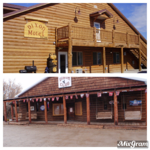 The Dixon Motel and Club is located 7 miles east of Baggs, WY on HWY 70. Our motel has single, double, triple, and quadruple rooms. Each room has a private bathroom, microwave, mini fridge, coffee pot, TV and free WIFI. Coin operated washers/dryers on site as well as 2 independent “trucker showers” for those that need to refresh. Dinners prepared with previous reservation at the Dixon Club, located across the street from the motel. You can enjoy an adult beverage while your food is prepared. Additionally, there is trailer parking for guests during your adventure.
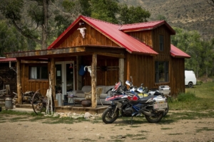 The Boyer YL Ranch is located close to the start of the WYBDR in Savery, WY, and is the perfect lodging destination to kick off your WYBDR trip. The ranch is owned by Jonathan “Jock” Boyer and his wife Kimberly Coats. The property includes a variety of accommodations, from an historic barn loft and cozy wood cabins, to a 1972 John Wayne Bluebird bus. Meals are available upon request. Call for rate, or book directly.
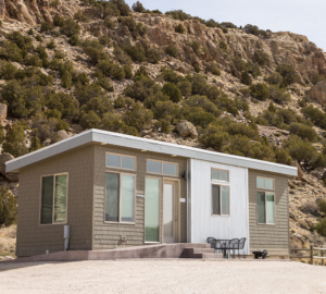 Our four on-site vacation rentals, The Reef Cottages, feature big windows and big views overlooking Grey Reef. Each of our cottages have a single bedroom that houses two plush queen beds with an extra long twin bunk over one of the queen beds. A fourth guest sleeps on the futon in the living space. A tiled shower, full kitchen, a large patio with a grill and outside dining furniture as well as a flat screen TV culminate in a great vacation rental at the best possible location. Cottage guests are not required to fish at all, but we’d highly recommend it! If you prefer to grill your own steak and arrange your own logistics it doesn’t get any better than the cottages.
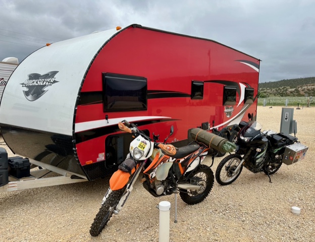 Windy Waters RV Parks, located in Alcova, WY across the street from Sloane’s General Store, is the perfect mid-point of the WYBDR. Whether you chose to make them home base between the North and South routes, or just a stopover along the way, they have a spot for you. No camper? No problem they have (2) RV rentals set-up ready and waiting for you.
 The Hyde Out is a small guest cabin located just off of Main Street in Atlantic City, Wyoming.
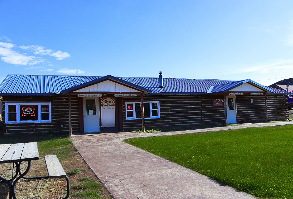 A friendly stop with hearty meals inspired by the spirit of the Gold Rush. Enjoy breakfast, lunch, and dinner at the restaurant and bar, stock up at the general store, or stay the night in the rental cabin (call to book). Located near the Continental Divide with plenty of free parking.
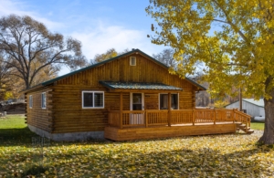 The “Base Camp Cabin on Main” offers a great location to access the western slope of the Bighorn Mountains. At the junction of all three BLM and Forest Service access roads (Alkali Road, Cold Springs Road & the Hyattville Logging Road) leading into the Bighorn Mountains the cabin offers a superb central point to begin or end miles and miles of “two-track” mountain roads. Approximately 17 miles north of Tensleep Wyoming on a gravel road you will find our cabin. Situated on main street, it is a short walk to the local watering hole to quinch a dusty thirst after a day on the trail. Please take a look at our listing, Base Camp Cabin on Main, Hyattville, WY on Airbnb or VRBO. We look forward to seeing you in Hyattville, the quiet gem of the Big Horn Basin.
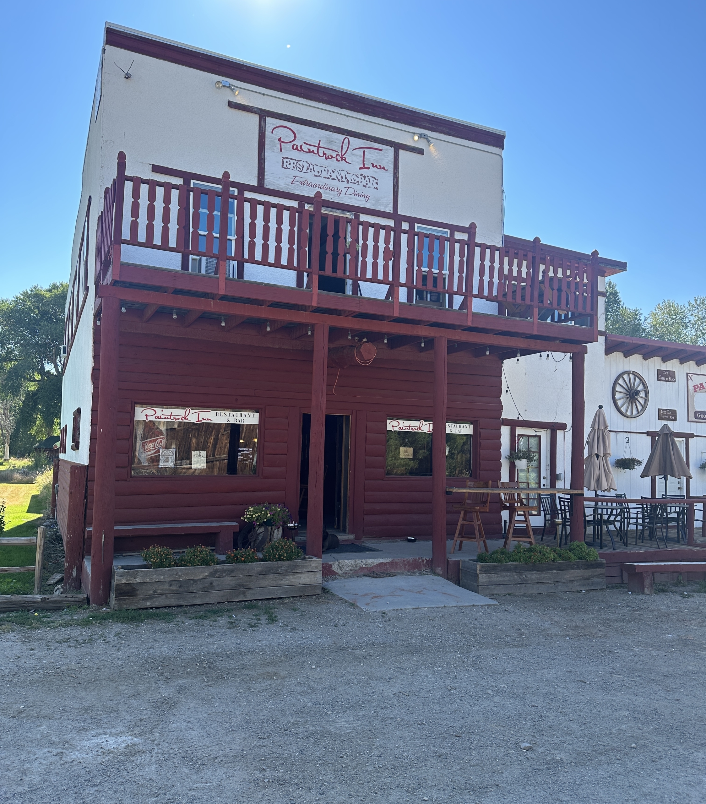
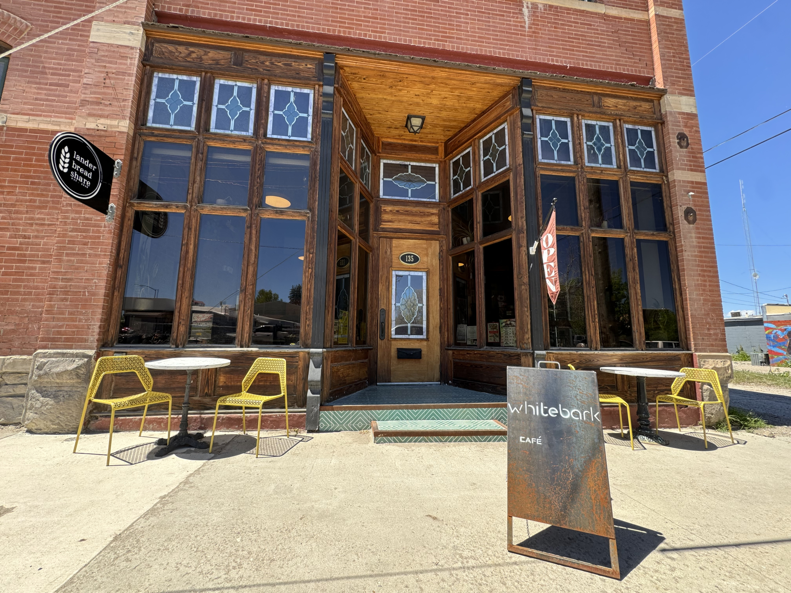
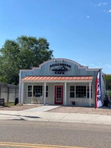 A breakfast Cafe with some lunch specials, serving breakfast from 6am-2pm, everyday. Suppers available on Tuesday and Friday nights from 5pm -8pm.

