Northern California Backcountry Discovery Route

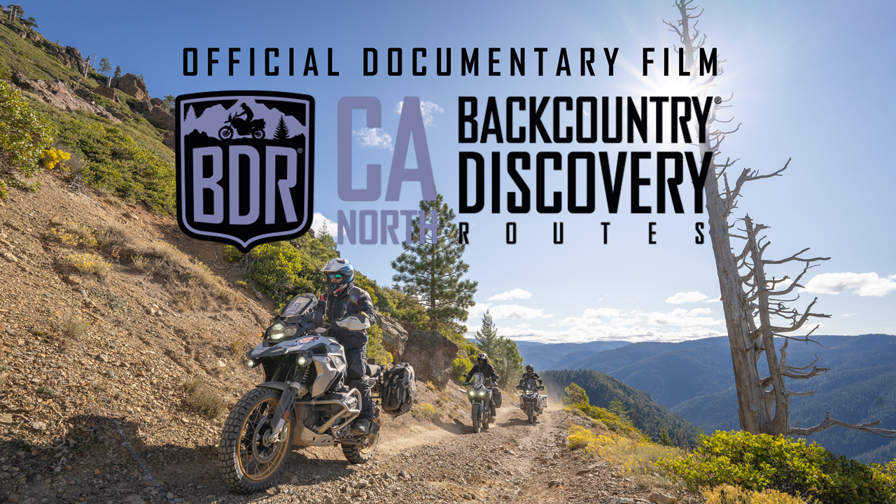
The Northern California Backcountry Discovery Route (CABDR-North) is the 13th route developed by the BDR organization for dual-sport and adventure motorcycle travel.

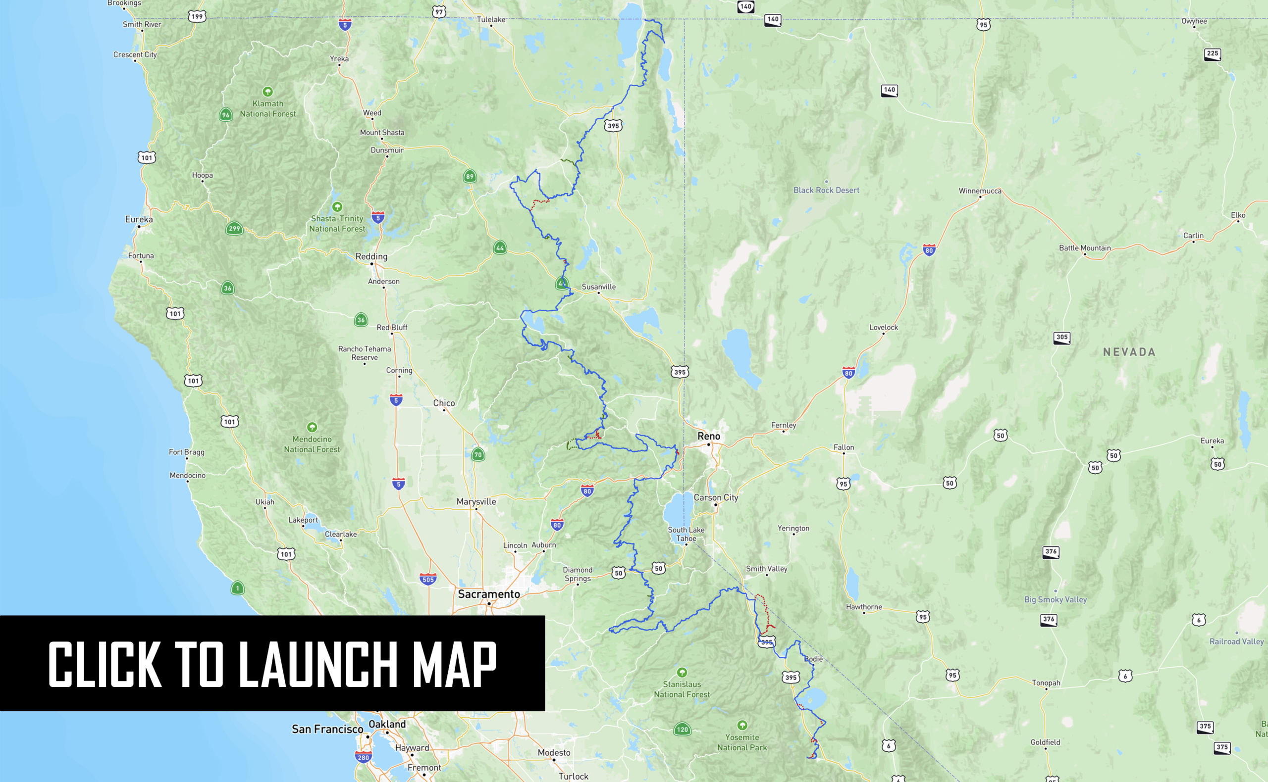
The Northern-California Backcountry Discovery Route (CABDR-North) is a 940-mile, off-pavement route designed for adventure motorcycles. Starting in Mammoth Lakes, CA atop Minaret Vista, you’ll traverse the Great Sierra Nevada Range’s conifer forests, mountain meadows, and gentle slopes, concluding in the high desert of the Modoc Plateau just north of Alturas, CA at the Oregon border.  Ride blissful forested two-tracks, tackle rugged canyon and mountain roads, and ascend peaks to fire lookouts with unparalleled views. Explore quaint towns nestled in the High Sierra’s folds, with historic inns dating back to the 1880s. Beyond the thrill of the twisty roads and scenic vistas, you can delve into California history, discover relics of mining towns, and witness geological wonders. The route caters to riders of varying skill levels and offers optional challenging sections plus three expert segments. Immerse yourself in Northern California’s appealing blend of adventure, history, and epic scenery.

Read more about the route in the Film Trailer Press Release article.

*  *  *

ROUTE SPONSORS
BDR partnerships with major industry brands made this project possible.

BMW Motorrad USA is presenting their third BDR route, with the Lead Motorcycle Instructor from the BMW U.S. Rider Academy (in Greer, South Carolina) joining the CABDR-North filming expedition.

Zero Motorcycles underscored their commitment to advancing the possibilities of electric adventure riding in the backcountry by providing two DSR/X motorcycles, their pioneering electric ADV model, to be tested on the route.

Edelweiss Bike Travel, Austria-based premier world-wide motorcycle tour company, has been a BDR industry supporter for many years.

Outback Motortek, producer of quality protection and multifunctional luggage systems (used by BDR recently in their Ducati DesertX build) with deep roots in metal fabrication going as far back as the early 80’s.

Special thanks to BDR community members and BDR industry partners including: 

Touratech- USA, KLIM Technical Riding Gear, Mosko Moto, Motoz Tires, SENA, Alpinestars, Colorado Motorcycle Adventures, Rev’It!, Austin Moto Adventures, Cyclops Adventure Sports, Moto Camp Nerd, West 38 Moto, Rever, Wolfman Luggage/Threadworks, Black Dog Cycle Works, Doubletake Mirror, ADVMoto Magazine, Upshift Online, and BMW MOA.

WATCH THE TRAILER

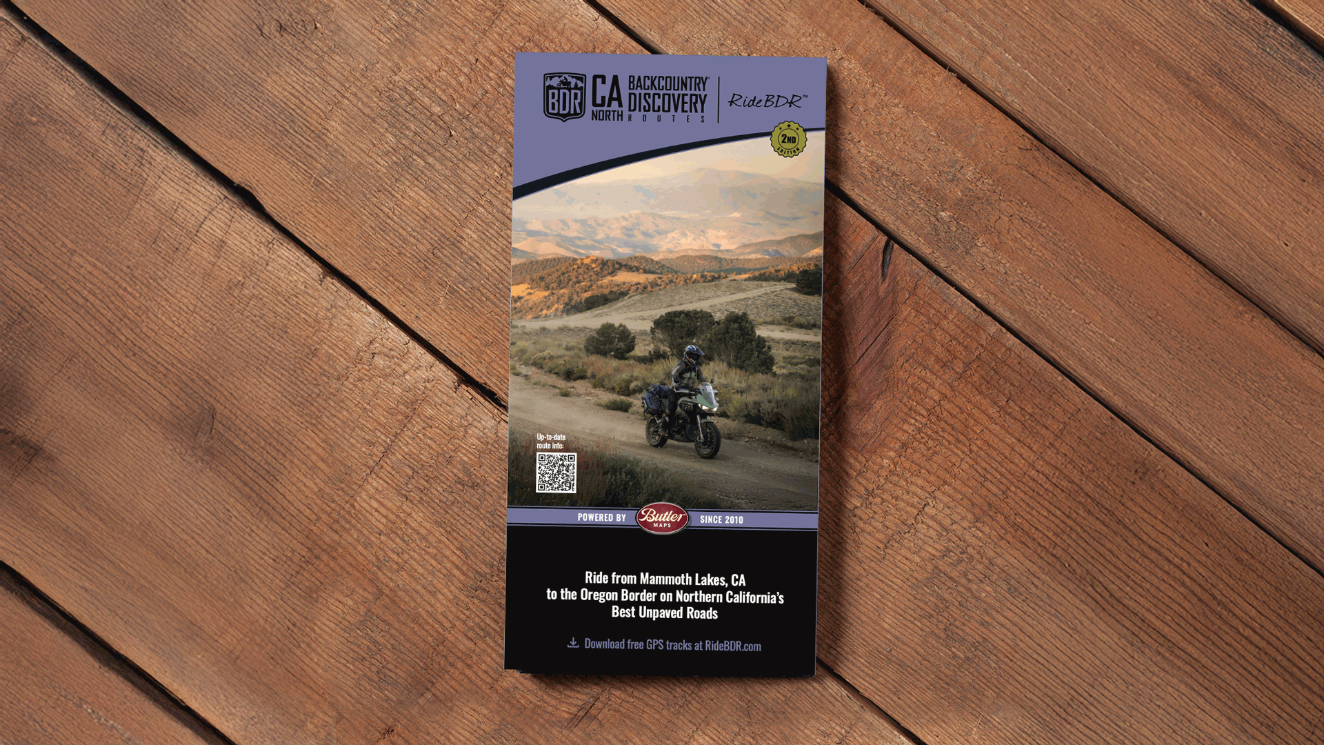
PURCHASE THE MAP

The latest version of the CABDR-North map is dated: First Edition 2024

SECTION-BY-SECTION

MAMMOTH TO BRIDGEPORT – 94.8 MILES

The official start of your journey begins just a few miles from the resort town of Mammoth Lakes atop Minaret Vista (9,265’). Take in the incredible views and crisp mountain air, then choose your own adventure as the route splits. The first optional advanced section follows OHV trails through the largest Jeffrey Pine Forest in the world, which can be sandy with hidden roots underneath. Later in this section, the second advanced option loops around Obsidian Dome, with tight forested turns and primitive sandy terrain (be mindful of OHV traffic on the advanced sections).

Admire the scenic wonders of Mono Lake with its unique Tufa Spires, then adhere to the main route if you’re not up for a technical water crossing with large, slick boulders, which can get quite deep depending on the season. The northern portion meanders through the hills above Bodie, and if you like old mining towns, Bodie State Historic Park is worth exploring (fee required). Continuing toward the town of Bridgeport, the section ends with an epic two-track with views of Nevada and the Sweetwater Range.

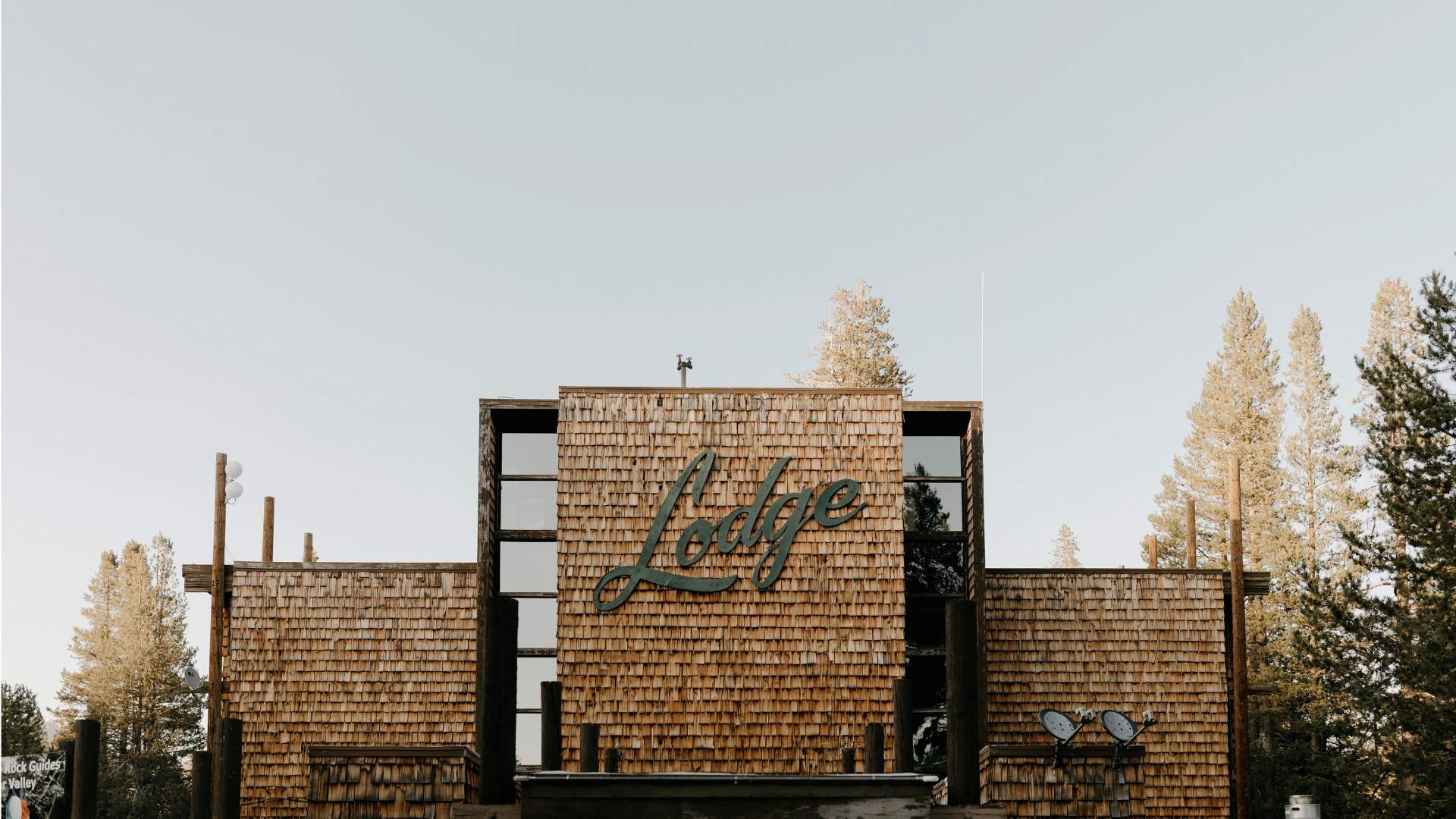
Tamarack Lodge & Resort
Nestled in the Mammoth Lakes Basin where paved roads give way to pure wilderness, Tamarack Lodge offers private cabins, access to world-class activities, and one of the finest restaurants in Mammoth to make your mountain getaway both comfortable and rejuvenating.

  • Address:163 Twin Lakes Rd, Mammoth Lakes, CA 93546
  • Phone:(760) 934-2442
  • Visit Website

Mammoth Mountain Inn
Mammoth Mountain Inn offers a full host of modern amenities with an old-school California soul. With its full-service restaurant, bar, and coffee shop – and just steps away from Main Lodge, ski school, and the Panorama Gondola.

  • Address: 10400 Minaret Rd, Mammoth Lakes, CA 93546
  • Phone: (760) 934-2581
  • Visit Website

The Village Lodge Mammoth
The Village Lodge is the perfect combination of luxury and convenience. Offering studios, one, two, and three-bedroom condos, multiple hot tubs, a heated pool, direct gondola access to the slopes in the winter, and direct access to hiking trails and the Mammoth Bike Park in the summer.

  • Address:1111 Forest Trail, Mammoth Lakes, CA 93546
  • Phone: (760) 934-1982
  • Visit Website

Edelweiss Lodge
Experience the charm of a 1950s knotty pine lodge while still enjoying the modern conveniences of today. Fully equipped kitchens, wood-burning fireplaces, cable TV, and free WIFI give you the comforts of home with the charm of a time gone by. Located in a quiet area of town known as “Old Mammoth”.

  • Address:1872 Old Mammoth Rd, Mammoth Lakes, CA 93546
  • Phone: (760) 934-2445
  • Visit Website

El Mono Motel & Latte Da Coffee Cafe
A small family-run motel and coffee house. El Mono Motel offers eleven guest rooms that are uniquely decorated and furnished. All Guest Rooms come equipped with WIFI.

  • Address: 51395 HWY 395 Lee Vining, California 93541
  • Phone: 760-647-6310
  • Visit Website

Paradise Shores Camp
Rental trailers and tent camping just East of Bridgeport on the shores of the reservoir. High speed fiber optic internet, communal bathhouse, kitchen area and fire pits.

  • Address: 2399 CA HWY 182, Bridgeport, CA
  • Phone: (760)-932-7735
  • Visit Website

Mono Inn
Located at the back gate of Yosemite National Park and easily accessible from the Bay Area and Southern California, the new Mono Inn offers one of the most extraordinary dining experiences in all of California.

  • Address: 55620 US-395, Lee Vining, CA 93541
  • Phone: (760) 647-6581
  • Visit Website

Bodie Mike’s Barbeque

Relaxed restaurant serving breakfast, sandwiches & traditional dishes.

  • Address: Highway 120, Lee Vining, CA 94341
  • Phone: 760-647-6432
  • Visit Website

Tioga Gas Mart & Whoa Nellie Deli
Gas Station, Restaurant, Gift store, everything you need! Located at the entrance to Yosemite National Park.

  • Address:343 Old Mammoth Rd, Mammoth Lakes, CA 93546
  • Phone: 760-647-1088
  • Visit Website

Shell, Mammoth Lakes, CA

  • 3275 Main St, Mammoth Lakes, CA 93546
  • (760) 934-2283

Chevron, Mammoth Lakes, CA

  • 3236 Main St, Mammoth Lakes, CA 93546
  • (760) 934-8111

Shell, Lee Vining, CA

  • 51424 Main St Hwy 395, Lee Vining, CA 93541
  • (760) 647-6303

Chevron, Lee Vining, CA

  • 51557 US-395, Lee Vining, CA 93541
  • (760) 647-6330

Mammoth Lakes
The official starting town for the route, with ample recreation, lodging, and camping opportunities.


Lakes Basin

Just above the town of Mammoth lies a series of beautiful lakes with great fishing, camping, and boating.


Earthquake Fault Trail

Unique views of a crack in ground!


Inyo Craters

Amazing volcanic features just 1/2 mile walk from the parking area.


Bald Mountain Lookout Tower

One of many optional fire lookouts adjacent to the CABDR-N. 360 degree Views, small log cabin used in winter for snowmobiles.


Mono Mills

Remnants of the old mill used to supply wood to build the nearby town of Bodie.


Mono Basin Scenic Area Visitors Center

Expansive views of Mono Lake and interpretive history center.


Dechambeau Ranch

1800’s ranch that supplied food for Bodie.


Bodie State Historic Park

One of the best preserved Ghost Towns in the US. Fee required.


Chemung Mine

Impressive ghost town with views of the town of Bridgeport below.

BRIDGEPORT TO BEAR VALLEY – 89.5 MILES

After a ride up Hwy 395, turn onto Burcham Flat Road to hit the dirt. If you dare, take the optional Expert tracks, but make sure you allow several hours. Expect steep, rocky, loose terrain with sheer drop offs as you summit Mount Patterson (11,673’), and rocks and potentially deep sand on the remote Sweetwater Loop north of Lobdell Lake. If you summit Patterson and have had enough, simply backtrack the way you came and rejoin the main route. These challenging sections should not be attempted late in the day or alone as they are remote with no bailouts and don’t reconnect with the main route for nearly 40 miles.

Continuing northward, follow the smooth turns of Hwy 89 as it climbs over Monitor Pass (8,314’). The paved fun intensifies on Hwy 4 as the road narrows to one lane over Ebbetts Pass (9,186’), marking the official transition from the steep escarpment of Eastern Sierras to the more gentle slopes of the western flanks of the Great Sierra Nevada Range.

Bridgeport Inn
Bridgeport Inn Historic Hotel Rooms come with antique furnishings with either one double or two twin beds. The Motel Rooms, located at ground level all have two queens or three double beds.


Virginia Creek Settlement
The Virginia Creek Settlement is nestled in the natural beauty of the eastern slopes of the High Sierra within easy driving distance to Bodie State Park, Mono Lake, Tioga Pass, Yosemite National Park, June Lake, and Mammoth Lakes.

  • Address: 70847 US-395, Bridgeport, CA 93517
  • Phone: (760) 932-7780
  • Visit Website

The Silver Maple Inn
Built in the 1930’s in the middle of the Motor Lodge Era, the Silver Maple Inn was originally a motor lodge. In the middle of Historic Bridgeport, CA on Main Street, USA our accommodations meet every traveler’s needs. Close to fishing lakes, streams, hiking trails, restaurants, shopping, and beautiful scenery.

  • Address: 310 Main St, Bridgeport, CA 93517
  • Phone: (760) 932-7383
  • Visit Website

Walker River Lodge
Newly-renovated rooms range from 2 queens to 2-room suites with kitchens. All new linens and upgraded bathrooms offer luxury along with many conveniences such as large flat-screen TVs, eco-friendly ceramic mugs, and glasses.

  • Address: 100 Main St, Bridgeport, CA 93517
  • Phone: (760) 932-7021
  • Visit Website

Bear Valley Lodge
Relax in their grand, wood-paneled lounge, the heart of the lodge, where modern lighting meets the warmth of a rustic open fire surrounded by a stunning boulder feature. Enjoy the convenience of on-site restaurants, a cozy coffee shop, and a general store, all designed to enhance your stay.

  • Address: 265 Bear Valley Rd. Bear Valley, CA 95223
  • Phone: 1-209-753-2327
  • Visit Website

High Sierra Bakery
High Sierra Bakery is located in beautiful Bridgeport CA. They offer an amazing assortment of breads and pastries daily. 

  • Address: 172 Main St, Bridgeport, CA 93517-8070
  • Phone: (760) 914-4002
  • Email: [email protected]

Jolly Kone
Jolly Kone is a place that resonates with mouthwatering memories, offering comfort food like burgers and malts. 

  • Address: 178 Main St, Bridgeport, CA 93517
  • Phone: (760) 932-7555
  • Visit Website

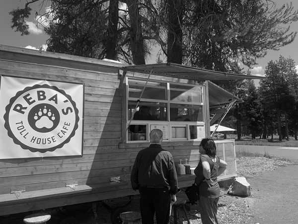
Reba’s Toll House Cafe

Take a break from the trail and enjoy a cooked meal from our small but mighty food trailer. Our chefs cook to order with fresh and seasonal ingredients. Open daily 11am-3pm Memorial Day Weekend through mid-October.

  • Address:1 Bear Valley Road, Bear Valley, CA 95223
  • Phone:(209) 753-2834
  • Visit Website

Shell, Bridgeport, CA (Section 2)

  • 76773 Main St, Bridgeport, CA 93517
  • (760) 932-7266

Valero, Bridgeport, CA (Section 2)

  • 397 Main St, Bridgeport, CA 93517

Walker Country Store, Coleville, CA (Section 2 off route)

  • 107700 US-395, Coleville, CA 96107
  • (530) 495-2945

Chevron, Topaz Lake, NV (Section 2 off route)

  • 1979 US-395 S, Gardnerville, NV 89410
  • (775)-266-3338

Bear Valley Adventure Company

Gas and supplies at the entrance to Bear Valley. 

  • Visit Website
  • 1 Bear Valley Rd, Bear Valley, CA 95223
  • (209)-753-2834

Mono County Museum

History of Bodie and Bridgeport on display.


Travertine Hot Springs

Natural Hot springs and soaking pools just a short distance from the town of Bridgeport.


Mount Patterson

Highest point on the route via an optional Expert section to the summit.


BEAR VALLEY TO KYBURZ – 85.9 MILES

Blissful forested two-track awaits just outside of Bear Valley, as you meander through the deep pines before reaching the backwoods pavement of Winton Road. Heads up, Winton Road closes on Nov 1st or after the first significant snowfall. The steep descent to the Mokelumne River via Forest Route 7N08 is a highlight of this section, but be mindful this dirt road can be challenging if wet. Several picturesque riverside campgrounds can be found along Mokelumne River.

Once you cross the river bridge, narrow and steep dilapidated pavement switchbacks take you up the other side of the canyon, topping out with an epic traverse of the Bear River Reservoir dam. Soon, the route follows Hwy 88 then continues northward on forested tracks with an optional quick out-and-back to the Leek Springs Hill Lookout Tower (7,621’). A short ride on the historic Mormon Emigrant Trail leads to even more forested dirt and the end of Section 3 on Hwy 50 in the tiny town of Kyburz.

Sierra Inn
Sierra Inn on the River, located in Kyburz, CA, lives up to the name with the South Fork of the American in our backyard. Perfect for exploring the incredible lakes, trails, and mountains of the El Dorado Forest and Sierra Lake Tahoe Basin.

  • Address: 13660 El Dorado Fwy, Kyburz, CA 95720
  • Phone: (866) 743-7729
  • Visit Website

Bear Valley Lodge
Relax in their grand, wood-paneled lounge, the heart of the lodge, where modern lighting meets the warmth of a rustic open fire surrounded by a stunning boulder feature. Enjoy the convenience of on-site restaurants, a cozy coffee shop, and a general store, all designed to enhance your stay.

  • Address: 265 Bear Valley Rd. Bear Valley, CA 95223
  • Phone: 1-209-753-2327
  • Visit Website

The Grizzly Bar & Grill
A quaint and charming spot that offers breakfast, lunch, and more.

  • Address:13672 El Dorado Fwy, Kyburz, CA 95720
  • Phone: (530) 583-8963
  • Visit Website

Sky High Pizza & Pub
 Enjoy fresh, seasonal ingredients on house-made dough are the inspiration for signature pizzas. Appetizers, sandwiches, salads, and a full bar round out the menu.

  • Address: 265 Bear Valley Rd. Bear Valley, CA 95223
  • Phone: 209-753-2327
  • Visit Website

Bear Valley Lodge
Relax in their grand, wood-paneled lounge, the heart of the lodge, where modern lighting meets the warmth of a rustic open fire surrounded by a stunning boulder feature. Enjoy the convenience of on-site restaurants, a cozy coffee shop, and a general store, all designed to enhance your stay.

  • Address: 265 Bear Valley Rd. Bear Valley, CA 95223
  • Phone: 1-209-753-2327
  • Visit Website

Bear Valley Adventure Company

Gas and supplies at the entrance to Bear Valley. 

  • Visit Website
  • 1 Bear Valley Rd, Bear Valley, CA 95223
  • (209)-753-2834

76, Kyburz, CA (Section 4)

  • 13200 US-50, Kyburz, CA 95720
  • (530) 293-3172

Bear River Reservoir

Unique Lake that becomes a river in the fall or low rain years.


Leek Springs fire lookout

Built in 1961, impressive views with picnic table and outhouse for visitors.


Alder Ridge fire lookout

Impressive lookout just off the route.

KYBURZ TO TRUCKEE – 111 MILES

Take a journey back in time as you ride part of the original Pony Express Trail just outside of Kyburz. Ice House Road comes next, with paved banked turns as the route travels around the Desolation Wilderness west of Lake Tahoe. The original road to the Sacramento Valley leads past Uncle Tom’s Cabin, a homestead from the 1840’s that once welcomed pioneers, and is now a watering hole and campground.

Broken pavement and dirt roads with a few challenging rocky sections lead down to French Meadow Reservoir. From there, you’ll ride incredible two-track as it climbs up and over the mountains towards Truckee, and a stunning paved section over Donner Pass. Walk through the tunnels hand-carved through Sierra Granite by Chinese immigrants to complete the Transcontinental Railroad, and stop at Donner Memorial State Park. The infamous Donner Party was stranded here in the winter of 1846 after encountering deep snow and resorted to cannibalism to survive. Hopefully you’ve packed enough snacks and won’t have to do the same.

Uncle Tom’s Cabin Camping
Uncle Tom’s Cabin is a bar any family, miner, 4-wheelers, motorcyclist, hunter, or explorer would feel at home in. It has been referred to as “It’s as rustic as it gets,”  “Norman Rockwell flashback,” “The jewel of the Sierra,” “An anomaly on its own,” “Best Mountain Bar Ever!” Play a round of horseshoes or bring a tent and stay the evening.

  • Address: 15630 Wentworth Springs Rd, Pollock Pines, CA 95726
  • Phone: (530) 402-7204
  • Visit Website

Robbs Hut
Robbs Hut offers a peaceful, rustic getaway with phenomenal views of the Sierra Nevada. The cozy, yet minimalistic cabin is open year-round and can be accessed by car in warmer months. Reservations only, access by permit.

  • Address: Placerville Ranger Station 4260 Eight Mile Rd., Camino Ca. 95709.
  • Phone: (866) 743-7729
  • Visit Website

Two Feathers Cafe
A quaint and charming spot that offers breakfast, lunch, and more.

  • Address:13672 El Dorado Fwy, Kyburz, CA 95720
  • Phone: (530) 583-8963
  • Visit Website

Moon’s Korean Kitchen
Moon’s Korean Kitchen is a family-owned restaurant offering authentic Korean food. Who doesn’t want a warm bowl of noodles after a long ride?

  • Address: 13220 US-50, Kyburz, CA 95720
  • Phone: (530) 293-3511
  • Visit Website

76, Kyburz, CA (Section 4)

  • 13200 US-50, Kyburz, CA 95720
  • (530) 293-3172

Pony Express Trail

Ride a few miles of the original Pony Express Trail just outside of Kyburz.


Uncle Tom’s Cabin

Rustic bar with cabins and camping at an 1800’s 40 Acre Homestead.


Chinese Tunnels at Donner Summit

Walk through history as you explore the tunnels dug by hand to complete the Transcontinental Railroad.


Donner Memorial State Park

State Park and museum dedicated to the infamous Donner Party and other pioneers that emigrated to California in the 1800’s.

TRUCKEE TO GRAEAGLE – 138 MILES

Leaving Truckee, the route passes by Boca Reservoir and turns to flowy dirt roads with an optional rocky climb up Verdi Peak (8,444’). Fill up in Sierraville, then travel the historic Henness Pass Road and Webber Lake, with pristine camping available at water’s edge.

WARNING: The very steep descent on dirt to Downieville via Galloway Road is a highlight, but not advised when wet, so an optional bypass track is available.

The main route follows a pleasant gravel road up Forest Road 93 just a few miles east of Downieville. An optional harder track offers a rocky, narrow climb, where you can continue north to the main route, or take the optional Expert section for a steep, challenging climb to a trailhead parking area just 3/4 mile from Sierra Buttes Lookout (8,587’). Although the road continues, the GPS track ends in a parking area on the left, where we suggest you park your bike and hike the rest of the way to the summit. WARNING: The road from the parking area to the summit is extremely dangerous, with steep, rocky, tight switchbacks and exposed cliff edges.
Single-lane pavement brings you to Gold Lake Hwy before exiting onto dirt and yet another spectacular lookout in this section, Mills Peak (7,324’), before reaching the quaint town of Graeagle.

Downieville River Inn & Resort
A unique home-away-from-home, surrounded by the Tahoe National Forest, nestled in the quiet and historic gold rush town of Downieville.

  • Address: 121 River Street, P.O. Box 412, Downieville, CA 95936
  • Phone: (530) 289-3308
  • Visit Website

Sierra Hot Springs
This rustic hot-springs resort in an 1870s lodge is set on a 700-acre site on the edge of Tahoe National Forest and is 25 miles from the I-80.

  • Address: 521 Campbell Hot Springs Rd, Sierraville, CA 96126
  • Phone:  (530) 9943773
  • Visit Website

Gravity Haus
Enjoy the custom comforts of a boutique hotel centrally located between the world-class slopes of Palisades Tahoe (formerly Squaw Valley and Alpine Meadows), Northstar California, and the shores of beautiful Lake Tahoe.

  • Address: 10918 Brockway Rd, Truckee, CA 96161
  • Phone: (530) 582-5655
  • Visit Website

La Cocina De Oro Taqueria
Located near the Downie River, La Cocina offers scrumptious Mexican food with fresh ingredients and generous portions.

  • Address:322 Main St, Downieville, CA 95936
  • Phone: (530) 289-3584
  • Visit Website

Smithneck Farms Cafe
Charming and small coffee shop with a country store feel. Ideal stop for a coffee and sandwich.

  • Address: 107 E Main St, Sierraville, CA 96126
  • Phone:(530) 414-5773
  • Visit Website

Old Town Tap
Warm, rustic-industrial joint serving Italian fare plus pies, cocktails, craft brews & on-tap wine

  • Address: 10164 Donner Pass Rd #1, Truckee, CA 96161
  • Phone: (530) 563-5233
  • Visit Website

Donner Lake Kitchen
Homey, rustic venue since the 1970s serving pancakes & omelets, plus lunch fare, wine & beer.

  • Address: 2600 Alpine Meadows Rd, Alpine Meadows, CA 96146
  • Phone:(530) 5838963
  • Visit Website

Shell, Truckee, CA (Section 5)

  • 10278 CA-89, Truckee, CA 96161
  • (530) 587-3853

Valero, Truckee, CA (Section 5)

  • 10009 CA-267, Truckee, CA 96161
  • (530) 582-5529

Sierraville Country Store, Sierraville, CA (Section 5)
May close at 6pm each day

  • 126 S Lincoln St, Sierraville, CA 96126

Bassett’s Station, Sierra City, CA (Section 5 off route)

  • 100 Gold Lake Hwy, Sierra City, CA 96125
  • (530) 862-1297

Lake Tahoe

World renowned for its beauty, this deep water lake is a must visit. Ample recreational, camping, and lodging opportunities.


Verdi Peak fire lookout

Impressive fire lookout accessible via an optional advanced route.


Sierra Hot Springs

Clothing optional hot springs (fee required). Features a historic hotel, camping and cafe.


Henness Pass

Historic pass with incredible views of Sierra Buttes in the distance.


Sierra Buttes Lookout

The most spectacular fire lookout on the route, accessible via an Expert-only track. Note, the gps track ends at a parking area where you can hike 3/4mi to the tower. Only highly experienced riders should attempt riding to the summit.


Mills Peak lookout

Easily accessible lookout tower with incredible views of the surrounding area.

GRAEAGLE TO CHESTER – 117 MILES

Bring your A-game leaving Graeagle, as this section includes rocky and faint two-track and steep climbs through burned out forest. Use extra care reading the primitive grass-covered roads and watch for fallen trees and hanging branches.

Relax with a quick spin up to Argentine Rock Lookout (7,209’) with views of Sierra Buttes, Lassen Peak and the town of Quincy. Another short trek leads to Mt. Hough Lookout (7,232’), followed by a winding descent to the hamlet of Taylorsville, which lacks fuel but features a wonderful general store with great burgers, shakes, sundries, and espresso, and has been serving the community for over 100 years.

After passing Round Valley Reservoir, the landscape turns ominous and enters the aftermath of the 2021 Dixie Fire that consumed almost one million acres of Northern California forests.

Dirt roads through a deep canyon take you past the ghost town of Seneca, site of one of the largest gold nuggets found in California. Fun flowing two-track roads through burned forests (be mindful of tree branches sticking out on the trail!), bring a smooth finish to the town of Chester on the banks of Lake Almanor.

Quincy Feather Bed Inn
Quincy Feather Bed Inn is a beautiful, historic, family-owned Inn, located in the heart of Quincy, a small western town. It’s nestled among the northern Sierra Nevada mountain range.

  • Address: 542 Jackson St, Quincy, CA 95971
  • Phone: (530) 283-3000
  • Visit Website

Feather River Park Resort (Cabins)
The real old-fashioned resort is nestled into 160 acres of the breathtaking Mohawk Valley, Plumas County, California. Crowded living isn’t part of your stay at the Feather River Park Resort.

  • Address: 8339 CA-89, Blairsden, CA 96103
  • Phone: (530) 836-2328
  • Visit Website

Gold Pan Lodge
Located in the heart of Plumas County, Quincy California. Easy to find right off the highway with beautiful mountain views. Open 24/7!

  • Address: 200 Crescent St, Quincy, CA 95971
  • Phone: (530) 283-3686
  • Visit Website

Beckwourth Peak High Camp 
Modern bunkhouses and yurt offering scenic views and cozy spaces, ensuring a memorable stay, whether you explore the nearby trails or simply soak in the mountain vistas. The 60-acre property is in the middle of the Plumas National Forest, 13 minutes from Graeagle – but it’s less than a 10-minute drive to the stores and restaurants in Portola, California.

  • Address: QGWX+9J, 518 23N03, Portola, CA 96122
  • Phone: 530-322-0322
  • Visit Website

Camp Almanor
Rustic cabin rentals on the East Shore of Lake Almanor. Enjoy wifi, gas BBQs and a relaxed quiet atmosphere.

  • Address: 2655 Big Springs Road, Lake Almanor, CA
  • Phone: (530) 448-8028
  • Visit Website

Taylorsville Campground
Owned by Plumas County is a 60 site campground in the trees with flush toilets and showers in Taylorsville right next to Indian Creek. $20 a night, ice available for $5 of which supports the Junior Rodeo. See website for details

  • Address: The intersection of North Valley Road, Genessee Road, and Arlington Road
    Taylorsville, CA 95983
  • Phone: (530) 283-6299
  • Visit Website

Graeagle Outpost
Coffee shop with all sorts of sweet treats & the most delicious hot dogs. When visiting this place, it’s a must to try great mochaccinoespresso, or tea.

  • Address: 7358 CA-89, Graeagle, CA 96103
  • Phone: (530) 836-5820
  • Visit Website

The Brewing Lair
The Brewing Lair is located on 15 acres of forested land in the Northern Sierra Nevada. Hang out at the brewery for an afternoon to sip on craft beers and enjoy the beautiful outdoors.

  • Address: 67007 CA-70, Blairsden, CA 96103
  • Phone: (530) 394-0940
  • Visit Website

Chevron, Graeagle, CA (Section 6)

  • 7408 CA-89, Graeagle, CA 96103
  • (530) 836-2309

Quincy Market and Gas, Quincy, CA (Section 6 off route)

  • 98 E Main St, Quincy, CA 95971
  • (530) 283-1175

Nellz Town Pump, Greenville, CA (Section 6 off route)

  • 114 Crescent St, Greenville, CA 95947
  • (530) 284-6655

Plumas-Eureka State Park

Mining history walking tour and museum. Just up the road is the site of the first ski races held in the US.


Argentine Rock lookout

This lookout is being rebuilt as a lodging option on the route! Consider donating as this non-profit needs your help to finish.


Mt Hough lookout

Impressive lookout just a short distance off the route near Taylorsville.


Henness Pass

Historic pass with incredible views of Sierra Buttes in the distance.

CHESTER TO BIEBER – 125 MILES

Treat yourself with views of Lake Almanor before tackling primitive overgrown forest roads that lead to yet another lookout, but this one is unique. Antelope Mountain Lookout (7,684’) is one of the first fire lookouts in the country to be solar powered (through a joint venture between NASA and the US Forest Service). A short optional advanced section descends the backside of the summit, and more delectable two-track leads to Harvey Mountain Lookout (7,354’).

The main route soon turns to asphalt all the way to Bieber. For the daring, an optional advanced track intersects the start of Section 8 through Little Valley and entails overgrown grassy terrain with a steep, technical rocky climb that transitions to blissful, faint forested two-track. Don’t forget to leave the gates as you found them!

NOTE: If you take the ALT Harder track, this will be the longest stretch between fuel. You’ll have to either take a side trip to Adin (15.3 mi round trip) or continue to Alturas if you have the range (over 180 miles from Chester to Alturas if taking the ALT Harder track).

Best Western Rose Quartz Inn, Chester, CA 
Nestled among the Sierra Nevada Mountain range in Northern California, guests can easily enjoy biking, star gazing, snowshoeing, golfing, hiking, snowmobiling, hunting, and skiing.

  • Address: 306 Main St, Chester, CA 96020
  • Phone: (530) 258-2002
  • Visit Website

Timber House Brewery and Lodge, Chester, CA
Timber House Lodge offers nine themed rooms that are sure to surprise you as you walk in. Brand new top-of-the-line mattresses with 800 thread-count sheets and a 50-inch TV are just a few reasons you will want to come back and stay again.

  • Address: 501 Main St, Chester, CA 96020
  • Phone:(530) 816-1426
  • Visit Website

Lake Almanor Lodge, Chester, CA
Experience all of the rugged beauty and wild adventures of the Lake Almanor area while enjoying the comfort of our lodge accommodations.

  • Address: 545 Martin Way, Chester, CA 96020
  • Phone: 530-815-8159
  • Visit Website

St. Bernard Lodge, Mill Creek, CA
Located on ten gorgeous acres just outside the small town of Chester. The lodge is near Lassen Volcanic National Park, Lassen National Forest, Lake Almanor, the Pacific Crest Trail, and countless other outdoor treasures.

  • Address: 44801 Hwy 36 E, Mill Creek, CA 96061
  • Phone: 530-258-3382
  • Visit Website

Timber House Brewery and Lodge, Chester, CA
In addition to lodging, Timber House opens its doors as a restaurant, distillery, and brewery. Offering a selection of craft beer and scrumptious meals, this is an all-in-one stop.

  • Address: 501 Main St, Chester, CA 96020
  • Phone:(530) 816-1426
  • Visit Website

Ranch House Pub & Grub, Chester, CA
The Ranch House Pub & Grub is a full-service restaurant and bar with friendly staff and a beautiful back patio. They are currently remodeling and are under new ownership!

  • Address: 501 Main St, Chester, CA 96020
  • Phone:(530) 816-1426
  • Visit Website

Cravings, Chester, CA
Mom & Pop shop specializing in traditional breakfast & lunch favorites from scratch with/ tasty twists!

  • Address: 5278 Main St, Chester, CA 96020
  • Phone:(530) 258-2229
  • Visit Website

Chevron, Chester, CA (section 7)

  • 225 Main St, Chester, CA 96020
  • (855) 285-9595

Valero, Chester, CA (Section 7)

  • 314 Main St, Chester, CA 96020
  • (210) 345-2000

Valero Westwood, Westwood, CA (Section 7)

  • CA-36, Westwood, CA 96137
  • (530) 256-3668

Antelope Mountain fire lookout

One of the first solar powered lookouts in the US with a grant from NASA. Open to visitors when staffed and an optional advanced route on the backside.


Champs Flat Ranch

Old scenic ranch just a short detour off the route.


Harvey Mountain lookout

Built in 1919, this may be the oldest fire lookout still operational in California.

BIEBER TO ALTURAS – 91.2 MILES

Just a few miles from Bieber, take a quick spin up Snag Hill Lookout (6,073’) as you meander through more evidence of past forest fires via beautiful gravel roads and brilliant red chipseal. This section is filled with stunning wide-open vistas as you blaze through undulating gravel and two-track roads through the high desert landscape. Over the river and through the woods to Alturas you go!

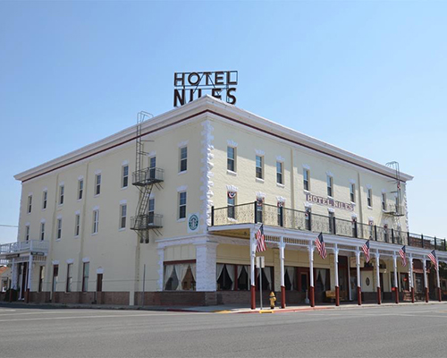
Cross the beautiful little Ash Creek with plenty of great camping options and check out Manzanita Mountain (7,036’) before making your way to this historic town. If you prefer supernatural company over your riding friends, plan a stay at the Niles Hotel, rumored to have a ghost who resides in a room on the second floor.

Fall River Hotel, Bieber, CA 
Fall River Hotel is a unique and one-of-a-kind Northern California destination and is so much more than just a hotel. With the personal touch of our restaurant and bar, and the privacy of romantic, cozy rooms, Fall River Hotel is the perfect base for your adventures.

  • Address: 24860 Main St, Fall River Mills, CA 96028
  • Phone: (530) 336-5550
  • Visit Website

Bieber Motel
The Bieber Motel offers the personal conveniences of home with a charming, nostalgic atmosphere! If you are visiting for business or leisure, our clean and comfortable accommodation at reasonable room rates will leave you feeling refreshed.

  • Address: 100 CA-299 E, Bieber, CA 96009
  • Phone: (530) 294-5454
  • Visit Website

The Old Mill Grill
A diner located in the charming town of Bieber that has quickly become a favorite of both locals and visitors alike. Serving up classic American cuisine with a smile, this diner is a must-visit for anyone looking for a delicious and satisfying meal.

  • Address: Market St & CA Hwy 299, Bieber, CA, United States, California
  • Phone: (530) 294-5144
  • Visit Website

Big Valley Market
Locally owned and family oriented, Big Valley Market definitely lives up to its motto “the little market in the Big Valley.” They serve ice cream, deli sandwich’s, pizzas and offer daily lunch and dinner specials, not to mention our famous Friday Night BBQ.

  • Address:201 Bridge St, Bieber, CA 96009
  • Phone: (530) 294-5754
  • Visit Website

Red Barn, Bieber, Ca (Section 8)

  • 656-980 CA-299, Bieber, CA 96009
  • (530) 294-5565

Juniper Junction, Adin, CA (Section 8 off route)

  • 711 S, 711 Main St, Adin, CA 96006
  • (530) 299-3187

Snag Hill lookout

Relatively new fire lookout just a quick jaunt off the route.


Manzanita Mountain fire lookout

Scenic fire lookout tower just off the route north of Adin.

ALTURAS TO THE OREGON BORDER – 87.3 MILES

After leaving Alturas on a short stretch of tar and more heavenly forest roads, summit your final fire lookout atop Sugar Hill (7,267’). Cross CR-9 for a blissful spin up fresh pavement and well-packed dirt to a moderately challenging section descending an off-camber forested road that sees very little usage. Splish splash through a few creek crossings and into historic Fort Bidwell, with a restaurant and inn occupying the same building that beckons any weary rider.

The final miles of this route are as impressive as the first as you meander through dense pine forest with abundant camping opportunities before descending to Highway 395 and up to the Oregon border. There is no fuel here, so take Hwy 395 for 39 miles back to Alturas or 13 miles north to Lakeview, OR.

Congratulations on completing an epic adventure!

Niles Hotel, Alturas, CA (Section 9)

The Niles Hotel is a historic hotel located in the heart of Modoc County, built in 1908. The hotel has unique rooms available as well as a Starbucks Coffee Shop serving breakfast and lunch, Roadhouse Dining Room, Full Service Bar and Event Room.

  • Address: 304 S Main St, Alturas, CA 96101
  • Phone: (530) 233-3773
  • Visit Website

Fort Bidwell Hotel
The Fort Bidwell Hotel is a historic country inn in a small old-west town where California meets Oregon and Nevada. Serene, clean, and comfortable, the Fort Bidwell Hotel is a haven for fishermen, hunters, artists, and seekers of peace and quiet.

  • Address: 55015 Main St, Fort Bidwell, CA 96112
  • Phone: (530) 708-1070
  • Visit Website

Rim Rock Motel
The Rim Rock is a beautiful facility located just on the outage of Alturas with beautiful surroundings and mountains. Picnic areas, horseshoes, and more are available on the ground. Friendly staff and very clean rooms.

  • Address: 22760 HWY 395, 22760 US-395, Alturas, CA 96101
  • Phone: (530) 233-5455
  • Visit Website

Fort Bidwell Hotel & Restaurant
Experience small-town dining. Fort Bidwell Hotel & Restaurant offers giant delicious burgers made with locally raised beef in addition to breakfast, steaks and so much more.

  • Address: 55015 Main St, Fort Bidwell, CA 96112
  • Phone: (530) 708-1070
  • Visit Website

Niles Road House
Enjoy classics with a Niles signature twist, from distinctive appetizers to mouth-watering steaks, juicy ribs, “Big Mouth” burgers, and healthy salads.

  • Address:304 South Main Street, Alturas, California 96101, United States
  • Phone:(530) 233-3773
  • Visit Website

Antonio’s Cucina Italiana
Antonio’s Cucina Italiana has been serving great pizza and pasta since All Fool’s Day 1989. Originally named Pizza & Pasta Place the restaurant was immediately a hit with locals and visitors alike.

  • Address:220 S Main St, Alturas, CA 96101
  • Phone: (760) 932-7555
  • Visit Website

Chevron, Alturas, CA (Section 9)

  • 1080 N Main St, Alturas, CA 96101
  • (530) 233-5114

76, Alturas, CA (Section 9)

  • 402 N Main St, Alturas, CA 96101
  • (503) 233-4109

Chimney Rock Travel Center, Alturas, CA (Section 9)

  • 27002 US-395, Alturas, CA 96101
  • (530) 233-2470

Chevron, Lakeview, OR (Section 9 off route)

  • 715 N 4th St, Lakeview, OR 97630
  • (541) 947-3456

Sugar Hill lookout

Commissioned in the 1930’s, this lookout tower features incredible views with a great ride to the summit.

CABDR-NORTH PACKING LIST

This packing list serves as an example and is not intended to be a complete list for your backcountry riding needs. Feel free to customize this list to work for you.

  • Helmet
  • Boots
  • Goggles
  • Gloves (2 sets)
  • Protective gear (pressure suit, Leatt brace, knee braces)
  • Jacket
  • Pants
  • Balaclava or neck gaitor
  • Water bladder or bottle
  • Hydration pack
  • Ear plugs

CABDR-NORTH MOTORCYCLE DEALERSHIPS

BMW MOTORCYCLES OF RIVERSIDE

Riverside, CA

WEBSITE

BMW Motorcycles of Riverside is your local BMW Motorcycle dealer in Riverside, CA. As a full-service dealership, we provide excellent financing, in-house service and repair, and the complete line of BMW Motorcycles for sale in Riverside, CA. Our hard-working sales team is standing by Tuesday through Saturday to give you a great deal on the BMW Motorcycle of your choosing. Stop by today and test ride a high-end BMW Motorcycle near Los Angeles, CA. Your open-air riding journey begins right here at BMW Motorcycles of Riverside.

FREQUENTLY ASKED QUESTIONS

Below are answers to some Frequently Asked Questions about the California North Backcountry Discovery Route.

The Northern-California Backcountry Discovery Route (CABDR-North) is a 940-mile, off-pavement route designed for adventure motorcycles. Starting in Mammoth Lakes, CA atop Minaret Vista, you’ll traverse the Great Sierra Nevada Range’s conifer forests, mountain meadows, and gentle slopes, concluding in the high desert of the Modoc Plateau just north of Alturas, CA at the Oregon border.  Ride blissful forested two-tracks, tackle rugged canyon and mountain roads, and ascend peaks to fire lookouts with unparalleled views. Explore quaint towns nestled in the High Sierra’s folds, with historic inns dating back to the 1880s. Beyond the thrill of the twisty roads and scenic vistas, you can delve into California history, discover relics of mining towns, and witness geological wonders. The route caters to riders of varying skill levels and offers optional challenging sections plus three expert segments. Immerse yourself in Northern California’s appealing blend of adventure, history, and epic scenery.

The route can be ridden starting in May but depending on winter snowfall, late June is the safer bet. Much of the route can be ridden until the first significant snowfall, normally in late October.  There may be a gate closure on the route on November 1st after Bear Valley on Winton Road, which would require a lengthy paved bypass if riding that late in the season.

The Northern California BDR route is positioned in the middle of all BDR’s in terms of difficulty, but the ALT Harder sections and three optional ALT Expert sections are some of the most difficult and should not be attempted by inexperienced riders or when riding solo. Much of the route is mellow, remote forested roads, but there are many sections of primitive two track with rocks, loose dirt, and elevation changes. The southern part of the route is more high-desert landscape, transitioning to sub alpine terrain as you travel north. Be mindful of deep ruts that may develop after a heavy snow year as spring runoff can turn an easy  road into a difficult track.

May and June, expect cool spring mountain temperatures.  July and August can get well into the 100’s at lower elevations. July can be a monsoonal month with moisture from Mexico and drop prodigious amounts of rainfall in a short period.  By late September and October a brief snowfall can be expected, but the weather generally returns to beautiful fall temperatures quickly once these fast moving storms roll out.

Yes. As with all the BDR routes, the NorCal BDR was designed for riding South to North, but it can be done from North to South. Please be prepared for two-way traffic everywhere on this route and always remember to Ride Right to avoid head-on collisions around blind corners.

The time it takes to ride a BDR can vary based on many factors including your fuel range, preparedness, riding skill, stamina, breakdowns, weather, and many other factors. There are 9 sections with services (gas, food, lodging) at the beginning and end of each section. It is suggested to ride roughly one section per day but many riders will adjust depending on their preference.  Most riders should plan 6-10 days to ride this route.

Street legal motorcycles with a license plate can ride the CABDR-N.

In addition to numerous ALT Harder sections, there are three ALT Expert track sections on this route.  Mount Patterson Summit and the Sweetwater Loop will challenge even the best of riders, and requires a long duration of 3-5 hours to complete both, and are very remote with no bailouts.


The ALT Expert section to the parking area prior to Sierra Buttes lookout tower is challenging and the track ends there, with an option for a ¾ mi hike to the summit.  Riding from this parking area to the summit is rocky, steep, tight switchbacks, and exposed cliff edges and should only be attempted by riders with advanced skill.

Designated public campgrounds can be found in the national forests and other places along this route. A few of the public campgrounds are identified on the CABDR-N map as a small tent icon and are listed on the CABDR-N webpage. Dispersed camping is also available throughout the route but be aware that each forest and land manager has their own guidelines so it’s advisable to check their websites.

In the national forest campgrounds campfires are allowed, but check with local Ranger Stations to determine if campfires are allowed before you build one. In most cases, campfires are only allowed in fire rings. If you are dispersed camping, we don’t suggest building fires. Instead, bring a camp stove for cooking and boiling water to avoid the risk of fires in Northern California’s arid landscapes. Be sure to fully extinguish fires so they are DEAD-OUT. Use water to ensure a fire is fully extinguished and the ground is left cool and wet.

The longest main section between fuel is from Chester to Bieber at 125mi. However, If you take the ALT Harder track (Little Valley), this will be the longest stretch between fuel.  You’ll have to either take a side trip to Adin (15.3 mi round trip) or continue to Alturas if you have the range (it is approx 180 miles from Chester to Alturas if taking the ALT Harder track).

This route can be done by taking advantage of the numerous lodgings the length of the route, many with Historic origins from the 1800s.  After Labor Day, in general, reservations are not necessary, but always advised. However, there is limited availability along Hwy 4 and Bear Valley, as well as the end of Section 3 near Kyburz.  Riders can divert 30 minutes off route to South Lake Tahoe for additional lodging at the end of Section 3.  Advanced reservations are always recommended for these sections and you may have to divert from the route to find a room.

This route cannot be ridden without the use of GPS tracks.  Be prepared and bring the official BDR Map AND your navigation device with the latest CABDR-N GPS tracks loaded. Free GPS tracks are available for download on this site. The route can also be navigated using a smartphone GPS navigation app like Gaia, Rever, and others. The CABDR-N expedition documentary film is a great source of information about the route and is available for free on YouTube.com/ridebdr.

Any modern GPS unit capable of handling multiple tracks with a minimum of 1500 points each is suitable for use on the CABDR-N. Garmin models that work best for this application are: Zumo XT, XT2, Zumo 590/595/395/396, Montana, and 276Cx. Many other GPS units are compatible with the GPX file format, check the owner’s manual of your device for more information.  You can also import the tracks into a GPS navigation app, like Gaia GPS, but make sure you have the premium version of the app, so you can navigate via offline maps.

Cell phone service is very limited on this route so a satellite communication or tracking device is recommended for emergency situations.  

Any bike that has a license plate, can run knobby DOT tires, has adequate suspension, can carry the gear you will need, and has enough fuel range. Most adventure or dual-sport motorcycles will be suitable for the trip.  However, if you are planning on doing the Expert sections, we recommend a mid-sized bike for this route unless you are very comfortable on a big bore bike in rough technical terrain.  Even very experienced riders on our team reported being challenged on larger bikes by some of the technical sections of the route during the filming expedition. Choose the bike that you are the most comfortable riding in challenging terrain and that you are not afraid to drop a few times.

DOT approved knobby tires are strongly recommended.  Riding this route without at least a 60/40 tire (60% dirt, 40% road) could be dangerous.

Segments of this route can be ridden two-up for those experienced in riding off-highway with a passenger and luggage. However, we strongly advise against riding the technical sections of this route two-up.

Please don’t go off the route anywhere where it’s gated or signed for seasonal or permanent closures, don’t venture onto private property.

The CABDR-N route includes a few instances where the track follows an easement road through private land. In many, but not all cases, the land owners have installed “private land” signs and it is important that riders acknowledge these signs and stay on the designated track. If you are unsure of the land ownership adjacent to the roads, such as outside of national forest lands, it’s best to stay on the track to avoid trespassing. In all cases riders should not ride off the roads which creates new trails and damages vegetation. Please remember that riding off the designated roads can jeopardize our right to use these roads for recreation.

Yes. There may be gates and/or barricades along the route. When you encounter cattle gates, leave them as you found them. If they were open, leave them open and if they were closed, close them again after you pass through. If you pass by ranches and homes, be courteous and ride respectfully. In spring and early summer, there may be temporary closures when crews are repairing washouts, downed trees, and other road hazards. If roads are closed due to wildfires, do not ride around the signs as that can put you or fire crews in danger and can get you a hefty fine. Check the BDR website for route updates before you go.

On most BDR riders will encounter gates across roads and the CABDR-North is no exception. These gates are important and are used by ranchers to control and separate herds. The rule of thumb is to leave the gate as you’ve found it. This means that if it was closed when you found it, close it after passing through. If it was open, leave it open. It is important for riders to follow this rule to prevent animal herds intermixing, and respect the rights and needs of private landowners and permittees.

Please abide by posted road closure signs. Ignoring these signs is a sure-fire way of getting a road closed for good. That said, sometimes locals will post unofficial “road closed” signs on public roads for their own personal reasons. Additionally, land managers may not have removed a “closed” sign from a seasonal road – even though the sign right next to it clearly displays the open/closed dates. In these cases, use your best judgment – if in doubt navigate around the closed road and report it to BDR. And please remember never to engage in arguments with local land owners.

Each state has its own recreational fishing requirements and restrictions. To learn about the required licenses and stamps for fishing (and hunting) in California, visit: https://wildlife.ca.gov/Licensing/Online-Sales

We do our best to post the most up-to-date information about the route on the website.  We depend on the BDR community to inform us about route and road conditions, so if you encounter any road closures or severe conditions that are worth reporting, please contact us with the information.

https://roads.dot.ca.gov/roadscell.php   You can also call 1-800-427-7623 for current highway conditions

There is also a dedicated CABDR-N Facebook group page.  We recommend that you join the group prior to your trip to read trip reports and comments from other riders about their experience on the route. Search for: Northern California Backcountry Discovery Route.

California is a habitat for many animals like deer, coyotes, and bears as well as smaller animals like squirrels and snakes — all of which make their way to the road at some point. Be alert everywhere you go as animals can and will cross your path along the route – especially at dusk.

Deer are known for wanting to race motorcycles but don’t encourage them. Slow down as soon as you see animals as, for some reason, they like to cross in front of bikes instead of running away from them. Look out for wild horses when you are in open-range land.  Appropriate food practices while camping are an absolute must for your safety and the animal’s safety. 

Yield to all animals whether wild, domestic, or livestock by slowing down or stopping. Many locals in rural areas keep their dogs off-leash on their property and dogs love to chase motorcycles – be cautious and considerate.

All of the roads used on the CABDR-N are open to vehicles. If you do decide to drive this route you will need a reliable 4×4 with high clearance as the route has deep puddles, large rocks, huge ruts and steep loose grades. Always stay to the right and go slow around blind corners to avoid head-on accidents with others using the roads. We recommend traveling south to north to minimize head-on traffic.

It is absolutely essential that you Ride Respectfully and follow the tips outlined in our Ride Respectfully campaign.  Remember, it’s up to all of you to preserve our access – we can easily lose access to many of these roads if we don’t practice proper etiquette. Always represent BDR and the ADV community in the best light.

Rating the Routes by Difficulty

We are often asked if we rate BDRs by difficulty. We don’t officially rate the difficulty level of our routes as it varies daily due to current weather, road conditions, and other unpredictable factors. Difficulty also depends on individual skill and fitness level, bike and tire selection and load carried.

Some riders find sand to be most challenging, some find mountain passes difficult. Each rider’s perception is unique.

While we can’t provide a standardized rating like ski resorts, we can provide some basic guidance of difficulty level from most to least. This order does not include optional harder sections and implies favorable road and weather conditions:

BDR Routes: CABDR-South, ORBDR, AZBDR, WYBDR, UTBDR, COBDR, NVBDR, NEBDR, WABDR, NMBDR, CABDR-North, IDBDR, MABDR.

BDR-X Routes: Red Desert, WY; Steens/Alvord, OR; Chattahoochee, GA; Black Hills, SD; PA Wilds, PA.

Review the FAQs for each route before your trip.

Backcountry Discovery Routes is a 501c(3) non-profit corporation. © 2024 Backcountry Discovery Routes, Inc. All rights reserved. Terms of Use.