Colorado Backcountry Discovery Route

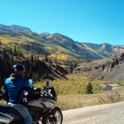
If getting high is your thing, Colorado offers some of the tallest mountains passable by motorcycle in the US. With several passes over 12,000 feet, there is no shortage of views on this route, just shortness of breath while taking in the sights in the thin air of Ophir, Corkscrew, Hurricane, California, Cinnamon, Cumberland, Cottonwood, Weston and Hagerman passes.

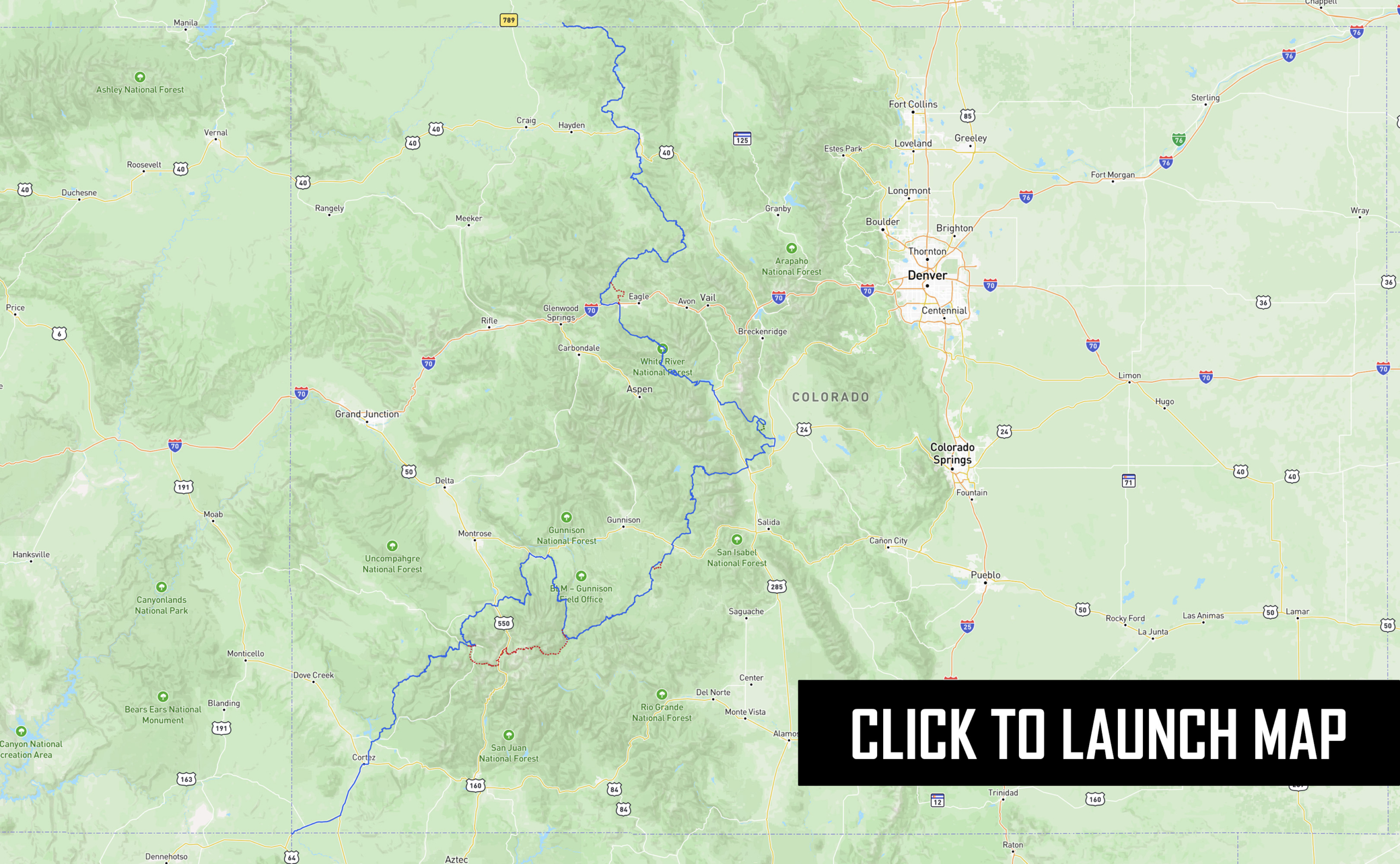
Beginning in the four corners location where, CO, AZ, NM and UT intersect, this 691-mile route winds its way north through the Rocky Mountains to the Wyoming border. The terrain includes dirt roads with rocks, sand and even a few water crossings to keep it exciting.

Best time of year: July through September. Most of the route can be done in late June. Depending on snowpack you might not make it through some high passes until sometime in July.

PURCHASE THE MAP

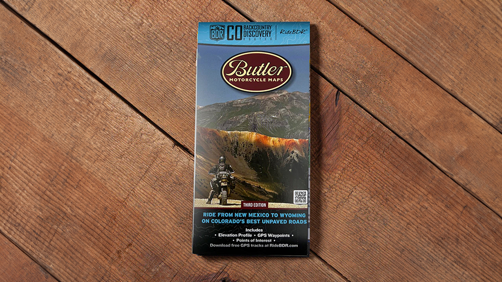
The latest version of the COBDR map is the Third Edition, dated: 2023

SECTION-BY-SECTION

Four Corners to Telluride – 131 Miles

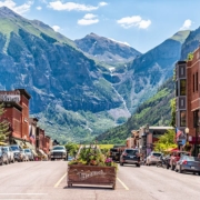
The COBDR begins at the Four Corners National Monument where the borders of New Mexico, Arizona, Utah and Colorado converge. The official BDR track follows paved roads to the small town of Dolores prior to heading onto the dirt. Riders can fill up with fuel there before heading north on a mix of narrow two-track and wide-graded roads on the way toward Groundhog Reservoir. There is a small convenience store at the reservoir for drinks and snacks. While the official route follows a dirt road just before the town of Telluride, consider riding through the historic downtown and up to Bridal Veil Falls for some amazing views down into the valley floor a thousand feet below.

Dolores, CO
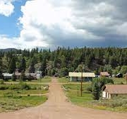
Dolores was a major railroad town along the Rio Grande Southern route between Durango and Ridgway. Today, visitors can tour an exact replica of the original train depot on Railroad Avenue, now the Rio Grande Southern Railroad Museum. Visit the restored Galloping Goose narrow-gauge railcar, in operation until 1952. A sprinkling of bed and breakfasts, campgrounds, and inns complete this Colorado destination.


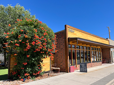
Dolores Bike Hostel
The Dolores Bike Hostel is newly renovated and offers two 6-person bunk rooms, three private rooms with a queen bed and shared bathrooms, and a large private room sleeping five with an en suite bathroom. Amenities include several communal lounge areas, a large kitchen, turf patio, grill, sauna, and cold plunge. The hostel is a few minutes’ walk from restaurants, cafes, a grocery store, gas station, and brewery. Car and truck storage is available upon request; call to secure your long-term parking space.

  • Address: 507 Central Ave, Dolores, CO 81323
  • Phone: (970) 676-0036
  • Visit Website

Dolores, CO
Dolores was a major railroad town along the Rio Grande Southern route between Durango and Ridgway. Today, visitors can tour an exact replica of the original train depot on Railroad Avenue, now the Rio Grande Southern Railroad Museum. Visit the restored Galloping Goose narrow-gauge railcar, in operation until 1952. A sprinkling of bed and breakfasts, campgrounds, and inns complete this Colorado destination.

Four Corners Monument
The only point in the U.S. where four states—Colorado, New Mexico, Arizona, and Utah—meet.


Ute Mountain Ute Tribal Park Visitor Center
Guided tours through Ancestral Puebloan cliff dwellings and rock art, located on Ute Mountain Ute tribal land.


Mesa Verde National Monument – 8.7 miles side trip
Famous for its well-preserved Ancestral Puebloan cliff dwellings, including the iconic Cliff Palace.


Cortez – Food, Gas, Lodging
Gateway town to Mesa Verde and Canyons of the Ancients, offering full services for travelers.


Canyons Of The Ancients Visitor Center & Museum – 1.3 miles side trip
The interpretive hub for the surrounding Canyons of the Ancients National Monument, featuring exhibits and hiking trails.


Dolores – Food, Gas, Lodging
Charming small town along the Dolores River, offering amenities and outdoor recreation access.


Groundhog Reservoir – Food & Lodging
A quiet fishing and camping spot tucked in the San Juan Mountains, ideal for a peaceful stopover.


Woods Lake Recreation Area & Campground – 1.5 miles side trip
Popular campground near Telluride offering scenic lake views, fishing, and access to hiking trails.

Telluride to Lake City – 69.5 Miles

Section 2 brings riders through the heart of Southern Colorado’s San Juan Mountains. Dramatic passes, ghost towns and one of a kind vistas make this section a highlight of the trip. The first riding challenge comes on Ophir Pass, just outside Telluride. This is a rocky road with tight switchbacks that requires a slow and methodical pace.

At Highway 550, riders will have several miles of pavement before heading east on rugged backroads toward Lake City over several high altitude passes. The charming town of Ouray is several miles off route, but is worth the detour, especially if you’re looking for a real bed and a warm meal. The ride from Ouray to Lake City covers incredible terrain over Corkscrew Pass, California Pass and Cinnamon Pass. Expect to take the better part of a day to explore this area. There will be more than enough excuses to stop for a photo and wander around many of the historic mining towns. There is primitive camping at the base of Corkscrew Pass just off Hwy 550 as well as near Lake City. There is also a state campground with services along Lake San Cristobal.

For riders opting for an easier option with no lack of scenery, take Last Dollar Road, one of Colorado’s most scenic backcountry drives, right outside of Telluride. Here you can connect with Owl Creek Pass and rejoin the route in Lake City.

Telluride, CO
Telluride offers an endless array of outdoor adventures and cultural activities. We invite you to discover the wonders in this amazing destination on your own. Whether it’s your first time to the greater Telluride region or you’re a seasoned guest, Telluride and Mountain Village never cease to amaze.

Tomboy Mining Ghost Town – 8 miles side trip
One of Colorado’s most famous ghost towns, perched high above Telluride with remnants of mining buildings and stunning views.


Bridal Veil Falls – 7 miles side trip
Colorado’s tallest free-falling waterfall, cascading 365 feet at the end of Telluride’s box canyon.


Ophir Pass
A high mountain pass offering a scenic, rocky route between Silverton and Telluride with incredible alpine views.


Idarado Mine Ruins
Historic remnants of one of the largest mining operations in the San Juan Mountains, visible along the Million Dollar Highway.


Million Dollar Highway
Famous for its steep cliffs, tight turns, and jaw-dropping views, this stretch of US 550 connects Ouray and Silverton.


Ouray – Food, Gas, Lodging
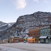
Known as the “Switzerland of America,” Ouray is a charming mountain town offering full services and access to off-road adventures.


Corkscrew Pass
Named for its winding switchbacks, this pass connects to several classic Colorado 4×4 routes and features colorful red rock formations.


Hurricane Pass
A high mountain pass offering panoramic views of the surrounding San Juan peaks and connecting with other iconic passes.


Lake Como – 0.3 mile side trip
A small alpine lake located near Hurricane Pass, perfect for a quick scenic stop.


California Pass
This scenic, rugged high pass connects Animas Forks to Lake Como and offers sweeping views of the San Juans.


Animas Forks Mine & Ghost Town
A well-preserved ghost town featuring historic mining-era structures and cabins at over 11,000 feet elevation.


Cinnamon Pass
A high mountain pass that’s part of the famous Alpine Loop, offering rugged terrain and alpine scenery.


Lake San Cristobal
Colorado’s second-largest natural lake, located near Lake City, offering camping, fishing, and paddling opportunities.

Lake City to Buena Vista – 146 Miles

Section 3 provides a much different riding experience than the first two sections. The roads are wider and faster, allowing for quick miles between fuel stops in both Lake City and Taylor Park. For those looking to camp, primitive but beautiful spots can be found near Los Pinos Pass. The small mining towns of Tincup and Pitkin are worth a stop and offer a few choices for food and supplies. If fuel range is an issue, fill up in Taylor Park.

A few small water crossings make the route interesting before hitting the well-traveled and freshly paved surface of Cottonwood Pass. Buena Vista is one of the larger towns along the COBDR with plenty of places to eat and sleep.

Ouray, CO
The “Outdoor Recreation Capital of Colorado.” Centrally located in Southwest Colorado, Ouray is the perfect basecamp for your explorations, offering a treasure trove of unique experiences all year long.


Lake City, CO
Jagged peaks pierce deep blue skies while wildlife teems in rocky canyons and on high valley floors. Crystalline rivers flow from altitude while unique geology promises adventure and spurs endless exploration. And continuously, within this wondrous dreamscape, whispers from the past mingle with voices of the present in the cool, rarefied air of remote Hinsdale County and its historic town of Lake City.


Lake City Cabin, Cimarron, CO
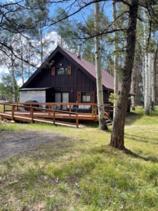
Great spot to explore COBDR Colorado section 3 from and relax after a great ride in the surrounding outdoors. Room to sleep 8 (2 bedrooms and 1 loft). The comfortable cabin is located between Gunnison, Montrose and Lake City at approximately 9500 feet near the San Juan Mountains and Gunnison Basin, next to Uncompahgre National Forest in the Arrowhead mountain community. Comes with firewood, wood stove, full kitchen and wifi.


Pitkin, CO
Colorado mountains and aspen groves become a gorgeous backdrop for a wide range of activities!

American Elk Grill and Inn
It is the staff’s goal to offer you exceptional food, service, and rentals to ensure that your stay with them will make for remarkable memories. You can find them on-site every day as they run the restaurant and inn, so come visit anytime!


Taylor Park Trading Post, Almont, CO
Taylor Park Trading Post was established in 1940. Our cabins, RV park, and restaurant overlook Taylor Reservoir, a 2040-acre mountain lake that is deep, clear, and full of fish! Breathtaking views you will find nowhere else!


Ouray, CO
The “Outdoor Recreation Capital of Colorado.” Centrally located in Southwest Colorado, Ouray is the perfect basecamp for your explorations, offering a treasure trove of unique experiences all year long.


Lake City, CO
Jagged peaks pierce deep blue skies while wildlife teems in rocky canyons and on high valley floors. Crystalline rivers flow from altitude while unique geology promises adventure and spurs endless exploration. And continuously, within this wondrous dreamscape, whispers from the past mingle with voices of the present in the cool, rarefied air of remote Hinsdale County and its historic town of Lake City.


Pitkin, CO
Colorado mountains and aspen groves become a gorgeous backdrop for a wide range of activities!

Slumgullion Earthflow Overlook
One of the best examples of an active earthflow in the world, visible from multiple viewpoints near Lake City.


Hot Springs Reservoir & Tomichi Dome
Tomichi Dome is a prominent volcanic feature near Gunnison, Colorado, composed of rhyolite lava flows.


Pitkin – Food, Gas, Lodging
A historic mining town offering basic services and access to several scenic off-road routes.


Cumberland Pass
A high mountain pass at 12,015 feet, offering expansive views and connecting Pitkin to Tincup.


Tincup Town
A small, historic mountain town known for its mining roots, rustic charm, and nearby trails.


Taylor Park Trading Post – Food & Gas
A hub for off-roaders and adventurers offering fuel, supplies, cabin rentals, and a general store.


Cottonwood Pass
One of the highest paved mountain passes in Colorado, crossing the Continental Divide at 12,126 feet.


Cottonwood Lake & Campground – 3 miles side trip
A scenic lake and campground offering fishing, paddling, and hiking opportunities west of Buena Vista.


Cottonwood Hot Springs
Natural, geothermal hot springs with rustic soaking pools and lodging, located near Buena Vista.

Buena Vista to Gypsum – 143 Miles

Be prepared for varying terrain in Section 4. Just outside Buena Vista, the route follows sandy two-track through an OHV area. Heading north, riders will traverse three major alpine passes on their way to the high desert landscape of Gypsum. Weston Pass is the first and has no major obstacles. Food, lodging and fuel are available in Leadville, a historic mining town and one-time front runner for Colorado’s state capitol.

Hagerman Pass is typical of Colorado’s backcountry, offering stunning views of the rugged alpine tundra. After descending into the Fryingpan River Valley for a short stint on blacktop, the route heads north again up and over Crooked Creek Pass. Lime Creek Park has a few primitive camp sites at the base of a steep limestone canyon. Alternatively, ride to the other side of the pass and pay for a spot at Sylvan Lake State Park. Narrow logging and hunting roads will bring you from Sylvan Lake to Gypsum through dense pine and aspen forest groves. There is great camping near Gypsum as well as hotels here and nearby Eagle.

Buena Vista, CO
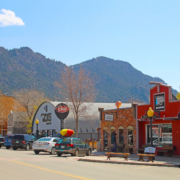
It all came about at a meeting in 1879, when residents and property owners in the area at the convergence of Cottonwood Creek and the Arkansas River held a meeting to create a formal community. They had been told that would help attract a railroad line (eventually it attracted three). Two names were proposed by attendees: Collegiate Peaks, after the mountains in the area, and Buena Vista, which means “beautiful view” in Spanish, certainly an appropriate description.


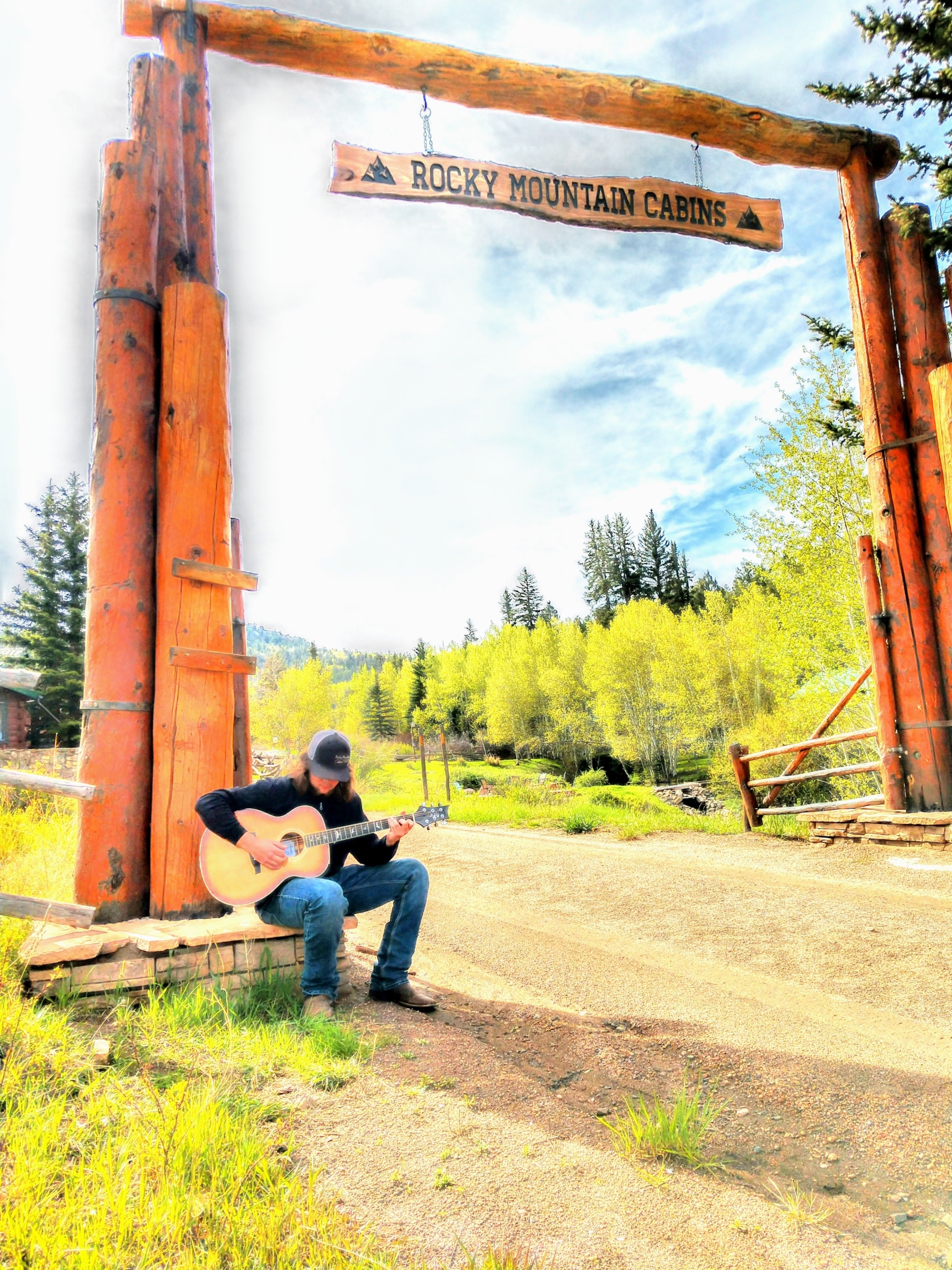
Rocky Mountain Cabins of Buena Vista, Colorado
Tucked away within the San Isabel National Forest, Rocky Mountain Cabins is a 10-cabin mountain lodging resort. They’re off-the-grid and proudly generate their own energy, plus receive water supply from a natural mountain spring. There are many amenities on property to enjoy such as fishing ponds, rec room, fireside group gathering lodge, fire-pits and miles of hiking, biking, and motor vehicle trails to explore. Their cabins are equipped with convenient kitchenettes and outside grills for meal preparations. However, half the fun is getting here. Once you leave the highway you’ll wind your way down 10 miles of dirt country roads taking in a variety of changing landscapes and wildlife sightings. Rocky Mountain Cabins is a true Colorado mountain experience.

  • Address: 13000 County Rd 185B, Buena Vista, CO 81211
  • Phone: 719-678-7237
  • Visit Website

Leadville, CO
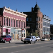
In the heart of Colorado, tucked in a high mountain valley and surrounded by snow-capped mountains, is Leadville, a city rich in history, abundant in outdoor recreation, and home to down-to-earth residents ready to welcome you with a smile.

High Mountain Pies
The High Mountain Pies Culinary Team are dedicated in their quest to broadcast fresh and delicious pizza to the hungry world via their mountaintop pizza shop. Enjoy pizza on their beautiful patio or call ahead and take it to go. They also deliver!


Meredith General Store
The Meredith General Store is located in Meredith, Colorado, just east of Ruedi Reservoir.


Buena Vista, CO
It all came about at a meeting in 1879, when residents and property owners in the area at the convergence of Cottonwood Creek and the Arkansas River held a meeting to create a formal community. They had been told that would help attract a railroad line (eventually it attracted three). Two names were proposed by attendees: Collegiate Peaks, after the mountains in the area, and Buena Vista, which means “beautiful view” in Spanish, certainly an appropriate description.


Leadville, CO
In the heart of Colorado, tucked in a high mountain valley and surrounded by snow-capped mountains, is Leadville, a city rich in history, abundant in outdoor recreation, and home to down-to-earth residents ready to welcome you with a smile.

Weston Pass
A scenic high mountain pass at 11,921 feet, connecting South Park and Leadville, offering mild off-road terrain.


Leadville – Food, Gas, Lodging
America’s highest incorporated city at 10,152 feet, rich with mining history and full traveler services.


Turquoise Lake & Campgrounds
A popular alpine lake near Leadville offering fishing, boating, and multiple well-maintained campgrounds.


Hagerman Pass
A rugged, scenic mountain pass at 11,925 feet, featuring historic railroad remnants and connecting Leadville to Basalt.


Meredith General Store – 2.6 miles side trip
A charming local store offering supplies, snacks, and a community feel near Ruedi Reservoir.


Ruedi Reservoir & Campgrounds – 5.5 miles side trip
A scenic reservoir ideal for boating, fishing, and camping, located outside of Basalt.


Crooked Creek Pass & Reservoir
A quiet mountain pass and reservoir area offering camping and fishing, surrounded by forested terrain.


Sylvan Lake State Park
A scenic state park featuring a mountain lake, camping, hiking, and wildlife viewing opportunities.

Gypsum to Steamboat Springs – 120 Miles

Section 5 begins on a mellow dirt road that runs past the town’s namesake Gypsum Mine north of town. Trail Gulch can be challenging at times with ruts and soft silt beds. An optional easier bypass is available. Low sage and black dirt offer a unique contrast to the alpine settings experienced in previous sections. Wilderness and private land limit off-road options through this part of the state, so a small section of paved riding is necessary to link the best dirt sections together.

Keep an eye out for State Bridge along the Colorado River and Highway 131. This funky venue offers camping in teepees and yurts and periodically hosts live music events. North of State Bridge you’ll encounter mellow dirt roads with a few shallow water crossings.

Camping is very limited once you cross Highway 134 near Gore Pass, so riders looking to pitch a tent should keep their eyes peeled between State Bridge and the historic stagecoach stop just south of the highway. The small section of road below the dam at Stagecoach Reservoir is particularly stunning in the early morning or late evening when the sun bounces off the river winding next to the road.

Gypsum, CO
Rugged ranching town of Gypsum lies west of world-class ski areas Vail and Beaver Creek.


Rancho Del Rio, Bond, CO
Located along the Colorado River Scenic Byway aka The Trough Road aka CO RT 1 & CO RT 11! In addition to fuel, they offer ice, firewood, lodging, a general store, liquor store and boat rentals too!
They have 12 cabins for rent. They are all set up similar to an efficiency hotel room with bedding, towels, soaps, coffee, pots & pans, kitchenette & more!
They have 30 simple campsites as well. 5 of them have shade shelters which would provide shelter for your bikes.

Gypsum, CO
Rugged ranching town of Gypsum lies west of world-class ski areas Vail and Beaver Creek.

State Bridge
A historic river crossing turned riverside resort, offering live music, cabins, camping, and access to outdoor recreation.


Radium Colorado River Access
A popular boat launch and river access point for rafting and fishing along the Upper Colorado River.


Radium Hot Springs
A natural, primitive riverside hot spring located along the Colorado River near Radium, accessible by a short hike.


Stagecoach Reservoir
A scenic state park offering boating, camping, hiking, and fishing in a high-mountain setting near Steamboat Springs.

Steamboat Springs to WY Border – 81.2 Miles

The final section of the route is a mellow one. Just northwest of Steamboat Springs, the route connects gently winding roads through acres of lush farmland. These are well used roads, so be wary of farm trucks and other traffic. As you pass Steamboat Lake, the road narrows and ascends into a serene pine forest, but remains relatively easy. The small towns of Clark and Columbine offer a few amenities and make a great lunch stop. Camping can be found at Steamboat Lake and further north near the Wyoming border.

Steamboat Springs, CO
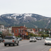
Steamboat Springs is nestled in the Rocky Mountains of Colorado, off the beaten path but still within reach. Our Colorado vacation destination is easy to get to by air or by car, year-round. If you’re looking for an authentic mountain town, steeped in adventure, history and culture yet full of modern amenities, we invite you to browse our vacation ideas that are as big as the Rockies themselves. However you like to spend your down time, you’ll find the perfect mountain vacation here in Steamboat.


The Cabins at Historic Columbine, CO
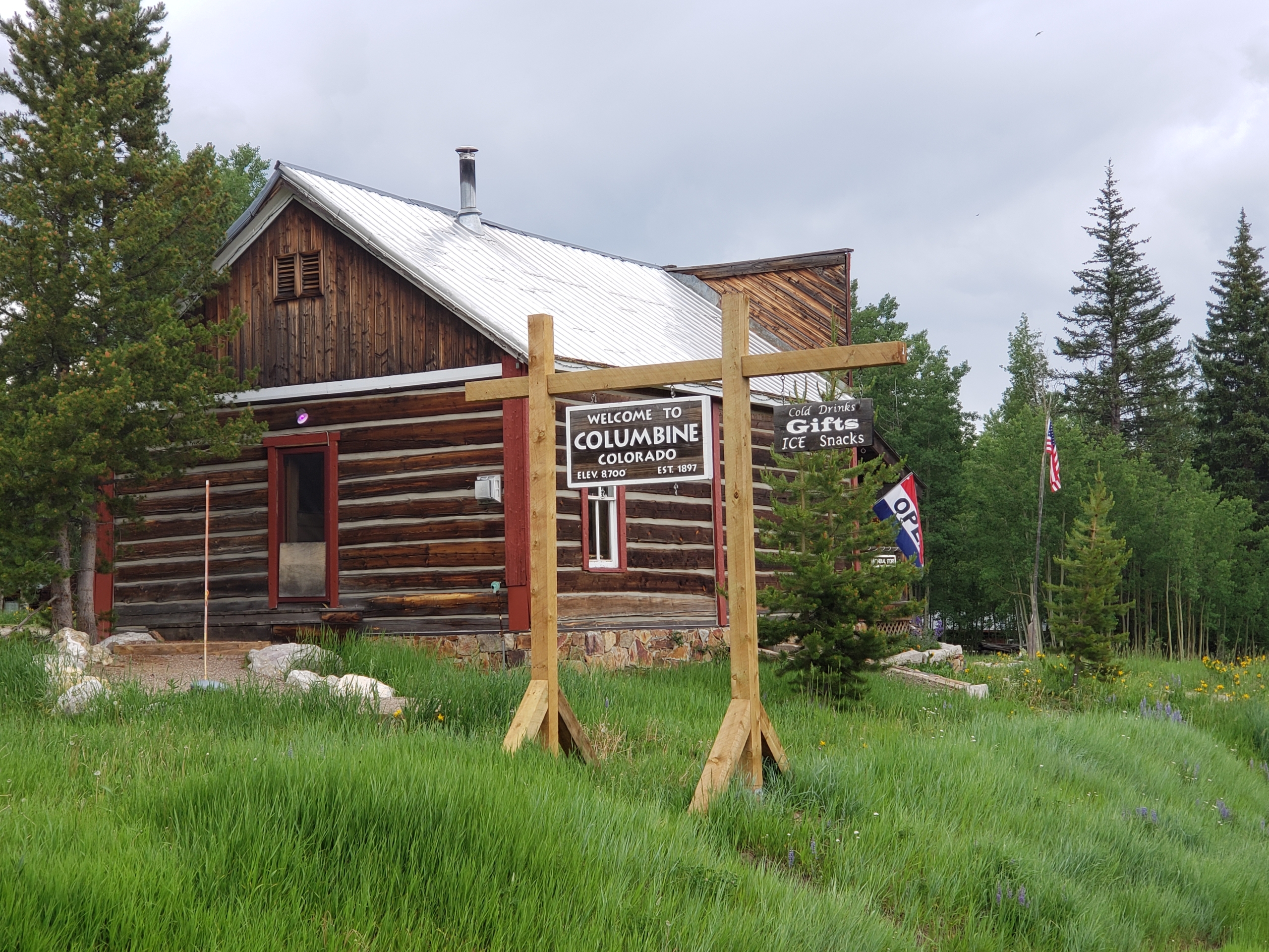
Located on County Road 129 about 15 miles south of the Wyoming border and 29 miles north of Steamboat Springs. There are 14 rustic, yet well-equipped, log cabins in the historic mining town of Columbine, Colorado. The town, on the National Register of Historic Places, features a modern shower house (for their non-bathroom cabins) and an authentic General Store which has ice, snacks, drinks, and they scoop ice cream made on site! Cabins have full kitchens, made beds, and towels.

  • Address: 64505 Co Rd 129, Clark, CO 80428
  • Phone: 970-879-5522
  • Visit Website

The Dixon Motel & Club
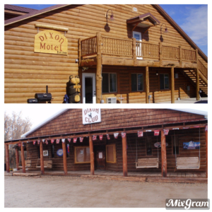
The Dixon Motel and Club is located 7 miles east of Baggs, WY on HWY 70. Our motel has single, double, triple, and quadruple rooms. Each room has a private bathroom, microwave, mini fridge, coffee pot, TV and free WIFI. Coin operated washers/dryers on site as well as 2 independent “trucker showers” for those that need to refresh. Dinners prepared with previous reservation at the Dixon Club, located across the street from the motel. You can enjoy an adult beverage while your food is prepared. Additionally, there is trailer parking for guests during your adventure.

  • Address: 216 Cottonwood Street, Dixon, WY 82323
  • Phone: 307-383-2300
  • Visit Website

Boyer Ranch
The Boyer YL Ranch is located close to the start of the WYBDR in Savery, WY, and is the perfect lodging destination to kick off your WYBDR trip. The ranch is owned by Jonathan “Jock” Boyer and his wife Kimberly Coats. The property includes a variety of accommodations, from a historic barn loft and cozy wood cabins to a 1972 John Wayne Bluebird bus. Meals are available upon request. Call for rate, or book directly.

  • Address: 34 County Road 754, Savery, WY 82332
  • Phone: 307-383-7778
  • Visit Website

Steamboat Springs, CO
Steamboat Springs is nestled in the Rocky Mountains of Colorado, off the beaten path but still within reach. Our Colorado vacation destination is easy to get to by air or by car, year-round. If you’re looking for an authentic mountain town, steeped in adventure, history and culture yet full of modern amenities, we invite you to browse our vacation ideas that are as big as the Rockies themselves. However you like to spend your down time, you’ll find the perfect mountain vacation here in Steamboat.


The Dixon Motel & Club
The Dixon Motel and Club is located 7 miles east of Baggs, WY on HWY 70. Our motel has single, double, triple, and quadruple rooms. Each room has a private bathroom, microwave, mini fridge, coffee pot, TV and free WIFI. Coin operated washers/dryers on site as well as 2 independent “trucker showers” for those that need to refresh. Dinners prepared with previous reservation at the Dixon Club, located across the street from the motel. You can enjoy an adult beverage while your food is prepared. Additionally, there is trailer parking for guests during your adventure.

  • Address: 216 Cottonwood Street, Dixon, WY 82323
  • Phone: 307-383-2300
  • Visit Website

Steamboat Springs, CO
Steamboat Springs is nestled in the Rocky Mountains of Colorado, off the beaten path but still within reach. Our Colorado vacation destination is easy to get to by air or by car, year-round. If you’re looking for an authentic mountain town, steeped in adventure, history and culture yet full of modern amenities, we invite you to browse our vacation ideas that are as big as the Rockies themselves. However you like to spend your down time, you’ll find the perfect mountain vacation here in Steamboat.

Strawberry Hot Springs – 6.7 miles side trip
Natural, mineral-rich hot springs surrounded by forest, featuring rustic stone pools and relaxing mountain scenery.


Clark Store
A community hub offering a general store, deli, fuel, and supplies just north of Steamboat Springs.


Steamboat Lake State Park
A popular destination for boating, fishing, and camping with panoramic views of Hahn’s Peak.


Columbine General Store
Located in the historic town of Columbine, this store offers supplies, snacks, and access to cabin rentals.


Wyoming Border Intersection
The northern end of the route, marking the intersection into Wyoming.

COBDR PACKING LIST

This packing list serves as an example and is not intended to be a complete list for your backcountry riding needs. Feel free to customize this list to work for you.

  • Helmet
  • Boots
  • Goggles
  • Gloves (2 sets)
  • Protective gear (pressure suit, Leatt brace, knee braces)
  • Jacket
  • Pants
  • Balaclava or neck gaitor
  • Water bladder or bottle
  • Hydration pack
  • Ear plugs

COBDR MOTORCYCLE DEALERSHIPS

Accelerate Motorworks

Buena Vista, CO, 81211, US

WEBSITE

Our Buena Vista, CO shop is located in the heart of the Colorado BDR. Accelerate Motor Works can service your motorcycle as you are passing through and get you back on the trail. Our lead mechanic is BMW certified with 20+ years of experience, and services all makes and models of motorcycles. Our showroom stocks many of the necessities you may find yourself in need of, from gloves & levers, to tires & filters. We are also an authorized Garmin, Giant Loop, and Touratech dealer. Stop by to see us, pick up some maps, and share your stories! We also offer secure motorcycle storage if you decide to spend some time exploring the area and the many activities our Rocky Mountains have to offer.

Interstate Honda

Fort Collins, CO 80524

WEBSITE

Every adventure starts somewhere. Interstate Honda has a passion for adventure and Northern Colorado is our backyard. With over 30 years of experience we can get the job done and have extensive knowledge of the local trails. We understand that when traveling problems can arise. Rest easy with our First Come First Serviced Saturdays with no appointment necessary to get your machine repaired and back on the road. Along with Free Pick Up and the understanding that your time is precious, we will make time to get you back on the road so can you enjoy what's around the next corner. We look forward to visiting with you and hearing about your adventures.

Northern Colorado Powersports

Fort Collins, CO 80524

WEBSITE

NoCo Powersports is the largest BMW, Triumph, and CanAm Dealership in Northern Colorado. Serving Northern Colorado and Wyoming, we can get you back on the BDR whether you need parts, tires, or service to continue your adventure. If you need assistance planning or continuing your ride we can help. Located in beautiful Fort Collins, CO and open Tuesday-Saturday. Stop by for a cup of coffee and chat, we love talking about the BDR and other great rides in our area.

FREQUENTLY ASKED QUESTIONS

Below are answers to some Frequently Asked Questions about the Colorado Backcountry Discovery Route.

The Colorado Backcountry Discovery Route (COBDR) is a mostly off-road motorcycle route across Colorado from New Mexico to Wyoming. The South to North route winds through the high elevations such as the San Juan mountains and relaxing segments such as the Colorado River Rd. The route includes dirt, gravel, and pavement surfaces and may include rocks, ruts, sand, mud and snow depending on time of year and conditions. The route can be completed in 4-6 days depending on pace, and is also accessible by four-wheel drive vehicles, as the entire route is at least double-track.

The longest gap between gas stations is approximately 121 miles from Gypsum to Steamboat Springs. There is gas at Rancho Del Rio, but it’s not guaranteed and they only carry low octane gas.

No, you can complete the COBDR using motels and restaurants fairly easily.

In most cases camp fires are allowed, but check with local Ranger Stations to determine if campfires are allowed before you build one. Forest fires are a threat during parts of the year and the rules that manage this risk must be followed. Be sure to fully extinguish fires so they are DEAD-OUT. Use water to ensure a fire is fully extinguished and the ground is left cool and wet.

There are many campgrounds and suitable dry camping locations along the route. The Butler Motorcycle Map for the COBDR has a tent icon showing campgrounds on the route and many near the route. The COBDR Butler Map is available at www.touratech-usa.com or www.butlermaps.com.

There are a few natural water sources along this route however, depending on the snow pack, some may not running. You can find potable water in the towns along the way. It is suggested that plenty of water is carried for personal and cooking use. Here is a video on water filtration filmed in the Oregon Backcountry: http://youtu.be/vqOFZAoZdTU

The tracks for the route can be downloaded free of charge online at https://ridebdr.com/download-tracks/ .

Always bring a complete set of maps for the area you plan to ride. They have good information about roads, water sources, and are an indispensable resource when the GPS doesn’t work, or is giving questionable advice. Unplanned events can occur and having paper/synthetic maps of the area can be a life saver. National Forest maps are available at http://www.fs.fed.us/recreation/map/state_list.shtml#U and local Ranger Stations. COBDR Butler Motorcycle Maps are available at www.touratech-usa.com or www.butlermaps.com.

Any bike that has a license plate, can run knobby tires, is set-up to carry the gear you plan to bring, and has the fuel range to make the distance between gas stops. Most adventure or dual-sport motorcycles will be suitable for the trip. Choose the bike that you are the most comfortable riding in desert and mountain terrain.

Any GPS unit capable of displaying 10 track logs with a minimum of 500 points each is suitable for use on the COBDR. Garmin models that work best for this application are: Zumo 665/660, Montana, GPSMap 60, 62, 76, 78 and 276. Other GPS manufacturers may have units that will work. Check the technical specs to determine suitability.

The COBDR route is designed to be ridden on adventure and dual-sport motorcycles, as well as driven in 4×4 vehicles. There are no single-track style trails on this route. Many of the roads are in remote areas and reach high elevation areas where road maintenance is minimal or non-existent. You can expect to cover sections of road with deep ruts, loose rocks, sand and other challenges. There are also sections that have deep sand. Road conditions change from week to week based on the recent weather. When you see signs that read, “Roads maybe impassable when wet”, use caution, roads become very slick and can be impassable. You may also encounter sections that have trees or branches over the road. There are alternate “easier” routes around a few of the most challenging sections. Depending on time of year and weather, there may be a few small deep water crossings. Flash floods are frequent during summer storms. Don’t cross flooded washes. Wait until water subsides.

The COBDR is best from July-September and sometimes October if no early snow storms have occurred. The route can be done in June, but snowpack in the high mtns may keep you from doing the entire route as mapped. There have been some years where the snow has not cleared from the high country until the last week of July.

Yes, there are several gates on the route. Most remain open unless BLM or NFS has closed them due to snow closure.

DOT approved knobby tires (such as Continental TKC 80 or Dunlop 606) are strongly recommended.

Colorado has fast moving thunder storms during the summer months. These storms usually build in the mountains in the early afternoon and usually contain lightning, hail stones and heavy downpours. It’s recommended you go over the high passes early in the day.

The highest elevations are reached in section where California Pass reaches nearly 13,000 feet. The route travels at high elevations for long distances and is above 8,000 feet the majority of the time.

Most people average 150 miles a day on a backcountry motorcycle trip. Plan on doing this route in 4-6 days depending on how fast you want to travel and how early you want to roll out of camp.

Much of this route is remote and out of reach for cell phone towers. There will be long sections with no coverage. Your best bet is to talk or text in the towns or on top of mountains. You will be surprised where you get coverage and where you don’t. A satellite communication device is a good idea in the backcou

We do our best to post the most up-to-date information on our Route Updates Page. We depend on the BDR community to inform us about route and road conditions, so if you encounter any road closures or severe conditions that are worth reporting, please contact us with the information.

There is also a dedicated COBDR Facebook Group Page. We recommend that you join the group prior to your trip to read trip reports and comments from other riders about their experience on the route.

Don’t forget to use our Interactive Map to get route conditions in real time. Read this Article to a quick tutorial on how to use the Interactive Map.

Yes the route can be done North to South.

This is a tough question to answer because conditions are constantly changing. If the weather has been moist or temps have been cool, the sand will be firmer and significantly easier to ride. If it hasn’t been hot for some time, the sand becomes very soft and deep. So the bottom line is, learn to ride in deep sand before your trip which will make your ride more enjoyable.

There are several sections where the road is a clay surface north of Haggerman Pass. When wet, these sections become very slick and virtually impassable. When you encounter wet clay roads, a higher gear selection is recommended to keep your rear wheel from sliding. Slow and steady will get you through, but in some cases travel will come to a halt due to slick conditions.

Altitude sickness is certainly possible on this ride. The COBDR reaches elevations of over 10,000 feet many times so plan your ride responsibly. The higher and faster you go up, the greater risk you are for symptoms. Consider spending a night or two at moderate elevation if you are prone to altitude sickness. It’s always best to ride up high, sleep down low. Altitude sickness, also referred to as Acute Mountain Sickness, is the illness causing effect of high altitude on the human body. The exact mechanism by which it occurs is unknown, but the severity of symptoms can vary from mild to life threatening.

Common symptoms of High Altitude Sickness / Acute Mountain Sickness include: fatigue, headaches, nausea, vomiting, dizziness, muscle cramping, insomnia, elevated blood pressure, shortness of breath, water retention and dehydration. Recognizing the symptoms of High Altitude Sickness, getting to a lower elevation, using supplemental oxygen, staying hydrated with water and Acli-Mate® Mountain Sport Drink may help to prevent or reduce the severity of altitude sickness. (Immediate medical attention is advised for moderate to severe AMS!)

We get this question all the time. Here are some key things to consider as you put together your plan.

All of the BDR routes include intermediate to advanced terrain. If a person is on a large bike twin-cylinder bike like an R1200GS Adventure or Yamaha Super Tenere, the routes can be very difficult. If a person’s skills are not advanced level, they may consider taking a smaller bike or choosing the easier options when possible. A BDR is something a person should build up to and it shouldn’t be their first overnight trip on their ADV bike.

Although, WA and CO are less difficult than UT and AZ,  they all contain difficult sections. We suggest looking at the Butler Map and take the optional easier routes to avoid the difficult sections. Even taking this approach there may be difficult stretches depending on changes in road conditions, weather, construction and the unknown. This is part of what makes it an adventure. Regardless of its description on the map or in the film, no section of a BDR should be underestimated.

Do some shorter overnight trips as practice and ride increasingly difficult terrain to build up your skills and confidence. Also remember that riding with a fully-loaded bike should be practiced prior to tackling a BDR. Lastly, always ride with a group so that you have a team to help overcome any obstacles whether it’s terrain, mechanicals, navigation, medical emergency, etc…

In summary, take baby steps and work up to doing a BDR. Don’t make it your first adventure motorcycle outing on a full-sized twin-cyclinder bike.

This advice comes from Rob Watt, BDR Board and Expeditions Member, and Wilderness EMT.

We carry items for wound management, breaks, basic meds and dental.  You can buy a good first aid kit at one of the outdoor stores online or Touratech-USA.  Get one that is an Extended Day Backpacker or 3-4 person kit.  These kits usually have the basics for a motorcycle trip.

They usually don’t have a SAM splint, so pick one of those up along with a couple ace bandages.  One other thing that we do for every multi-day trip, is to gather important information about each rider: allergies, medications, medical issues, emergency contacts, etc.

Then we put that on a master sheet for each person, so if something does happen we have that information handy incase that person can’t speak.  Another good practice is to do a little research of where medical facilities are along your planned route.  Is there a “flight for life” in the area? Where are the hospitals, Medical clinics, etc?

Here is a list of some items that you should have in your medical kit:

  • Bandages: Assorted sizes for small cuts, blisters, etc.
  • 4-inch closure strips or butterfly closures: For closing large wounds. 4-inch strips are more effective than butterfly.
  • 4 inch by 4 inch sterile dressing pads (5 to 10): To apply pressure to a wound and stop bleeding
  • Non-adherent sterile dressing (2 inch by 2 inch): Use these or Second Skin to cover blisters, burns or lacerations.
  • Gauze roll: Holds dressing in place.
  • Small roll of 1-inch adhesive tape: Holds dressings in place.
  • Multi-use tool or knife: Should include knife, scissors. A scalpel and blade are also useful for first aid.
  • Forceps or tweezers: For removing splinters, ticks, and removing debris from wounds.
  • Scissors: Trauma scissors, which have a blunt end to protect the patient, can be used for cutting away clothing from injury, cutting medical tape, etc.
  • Thermometer: Digital is generally more accurate, but batteries do wear out.
  • Malleable splint: Lightweight foam-covered aluminum, such as a SAM splint.
  • Irrigation syringe (35 cc): Used to flush and clean wounds.
  • Suction syringe (65 cc): Used to clear mouth of fluids when giving CPR.
  • Safety pins: Can help remove splinters, fasten arm sling, or make a whole in a plastic bag for improvised wound irrigation.
  • Cotton-tip swabs: For removing  foreign objects from eye, or applying antibiotic ointment.
  • Resealable plastic bags: Many uses, including icing a swollen joint or creating wound irrigation device.
  • ACE, Coban, or other rubberized bandage: Can be used as outer wrap on splints, wound dressings or support for joint injuries. Be careful not to wrap too tightly.
  • Antiseptic towlettes: For cleaning small wounds.
  • Cleansing pads with lidocaine: For cleaning. Includes a topical anesthetic for abrasions, stings, etc.
  • Topical antibiotic ointment: For application to wounds. Simple Vaseline can also be used in dressing a wound.
  • Moleskin: Prevents blisters. Cut and apply a section to your foot as soon as you discover a “hot spot.” Duct tape also works for this purpose.
  • Povidone Iodine USP 10 percent, 1 oz.: For preventing infection. Bottled PVD iodine 10 percent solution should be diluted to a ratio of 1 percent or less for flushing wounds.
  • Aloe vera gel: Found in packets or small bottles for relief of minor burns.
  • Pain relievers, including aspirin and Ibuprofen: Provides relief for minor aches and pains, reduces fever, helps reduce inflammation of sprains and other injuries.
  • Antihistamines: For relief of pollen allergies, or to reduce reaction to bites and stings.
  • Immodium 2 mg capsules or tablets: For relief of diarrhea from intestinal infections.
  • Pepto Bismol or antiacid tablets: For relief from general diarrhea, abdominal upset.
  • After Bite or hydrocortisone cream USP 1 percent: Relieves skin irritation from bites, poison oak, stings, or allergic reactions.
  • Latex or nitrile gloves: Protects against blood-borne diseases and infection.
  • CPR microshield mask: A compact flexible barrier with a one-way valve for rescue breathing, which protects user from blood, vomit or saliva.
  • Oral rehydration salts: Packet of electrolyte salts and glucose for treatment of dehydration, heat exhaustion, or loss of fluids from vomiting or diarrhea.
  • Space bag/blanket: Lightweight emergency shelter. For treating hypothermia victims.
  • Paper and pencil: For recording medical data such as body temperature, pulse, time and date of symptoms, injuries, medicines administered, etc. Most repackaged kits include accident report forms.
  • Wilderness First Aid booklet: Many prepackaged first aid kits contain one. An excellent pocket guide is the Wilderness Medical Handbook

Rating the Routes by Difficulty

We are often asked if we rate BDRs by difficulty. We don’t officially rate the difficulty level of our routes as it varies daily due to current weather, road conditions, and other unpredictable factors. Difficulty also depends on individual skill and fitness level, bike and tire selection and load carried.

Some riders find sand to be most challenging, some find mountain passes difficult. Each rider’s perception is unique.

While we can’t provide a standardized rating like ski resorts, we can provide some basic guidance of difficulty level from most to least. This order does not include optional harder sections and implies favorable road and weather conditions:

BDR Routes: CABDR-South, ORBDR, AZBDR, WYBDR, UTBDR, COBDR, NVBDR, NEBDR, WABDR, NMBDR, CABDR-North, IDBDR, SEBDR, MABDR.

BDR-X Routes: Big Bend, TX; Red Desert, WY; Steens/Alvord, OR; Chattahoochee, GA; Black Hills, SD; PA Wilds, PA.

Review the FAQs for each route before your trip.

Backcountry Discovery Routes is a 501c(3) non-profit corporation. © 2025 Backcountry Discovery Routes, Inc. All rights reserved. Terms of Use.