Nevada Backcountry Discovery Route

BDR announces its seventh route, the NVBDR, produced in partnership with the American Honda Motor Co. IncTravelNevada and RideNow Vegas.

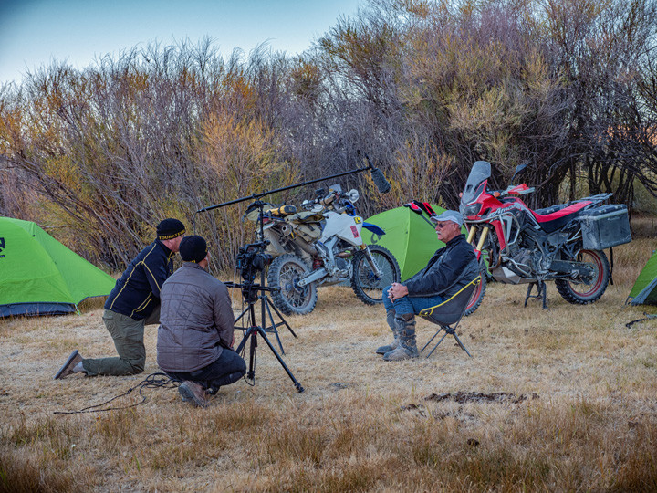
The NVBDR release includes free GPS tracks and route travel information on the BDR website, a waterproof map from Butler Motorcycle Maps, and expedition documentary DVD produced by ColorBlind, and BDR Documentary Films.

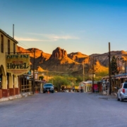
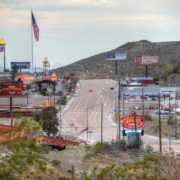
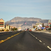
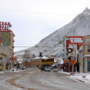
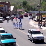
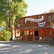
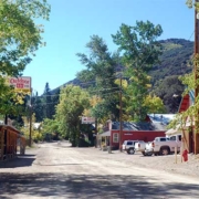
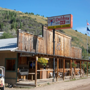
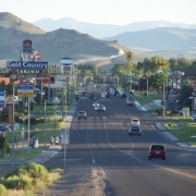
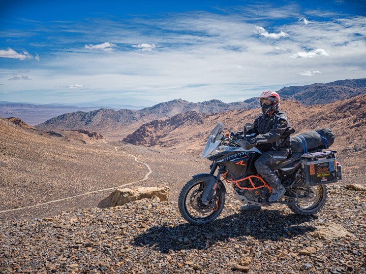
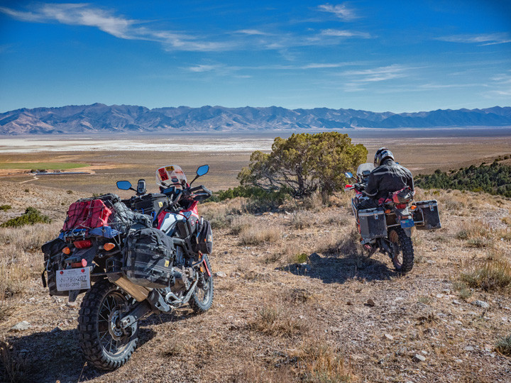
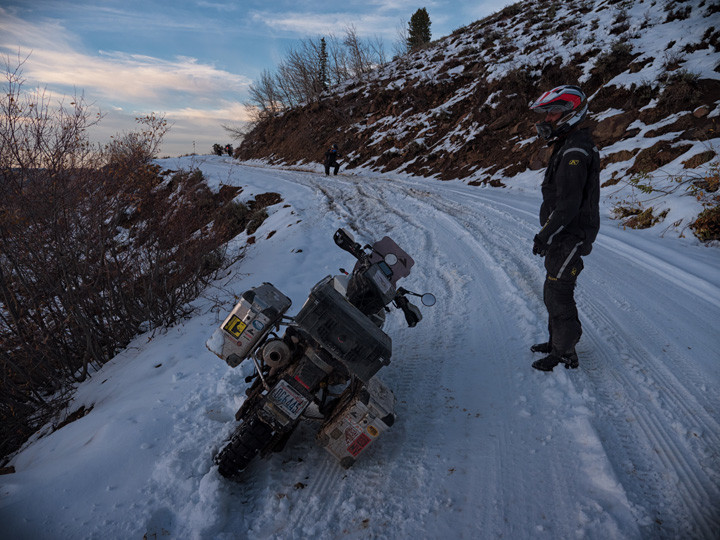
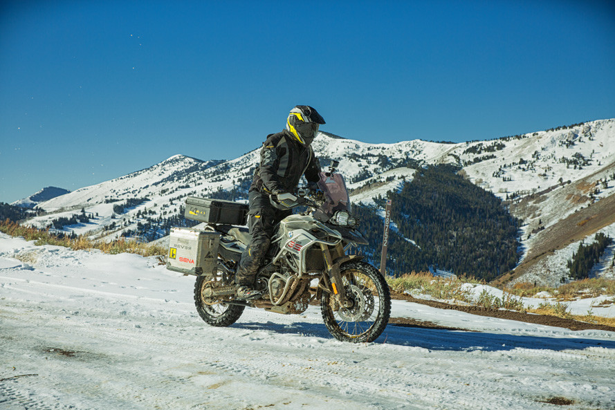
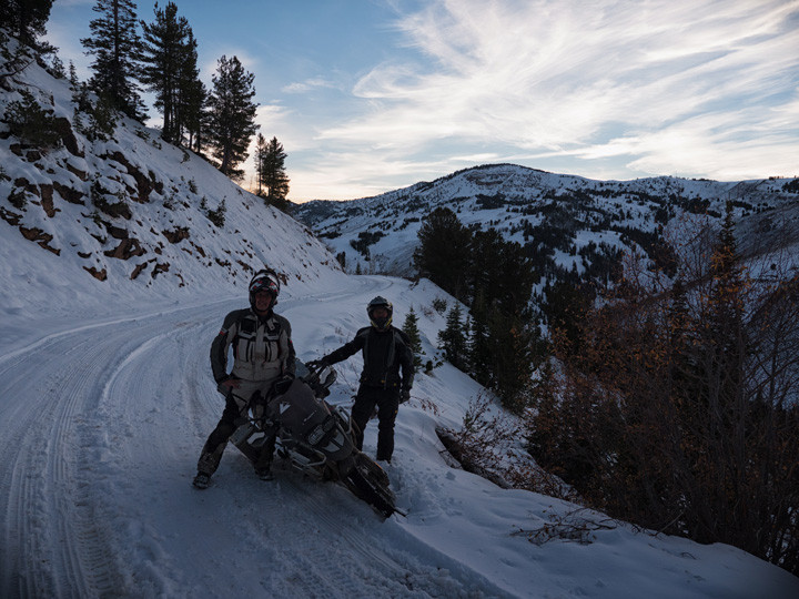
The NVBDR is a scenic ride across Nevada, beginning in Oatman, AZ, and finishing in Jarbidge, NV.  Created for dual-sport and adventure motorcyclists, this 900-mile south-to-north route primarily uses dirt roads to lead riders through Nevada’s expansive deserts, open sagebrush valleys, and seemingly endless mountain ranges.

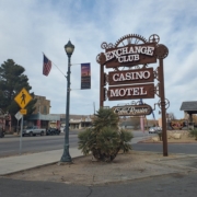
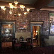
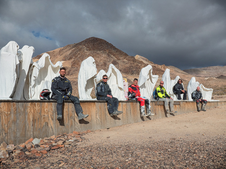
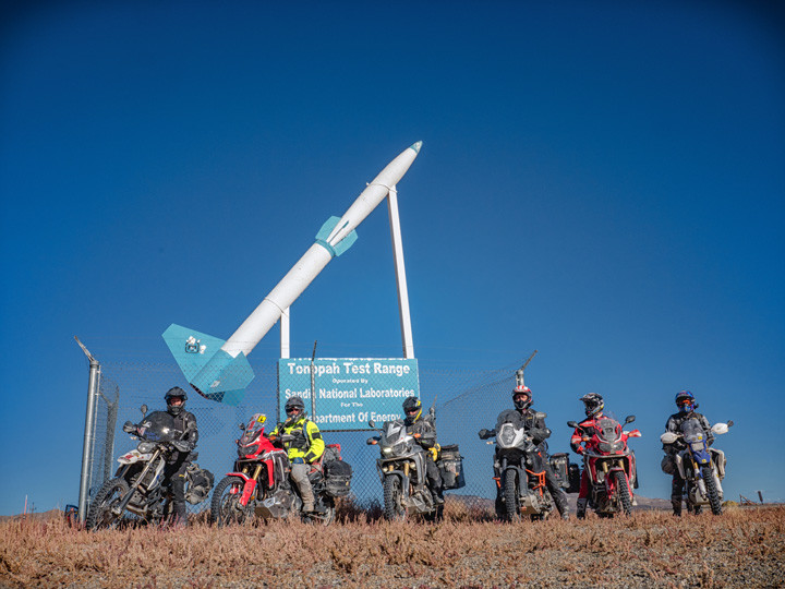
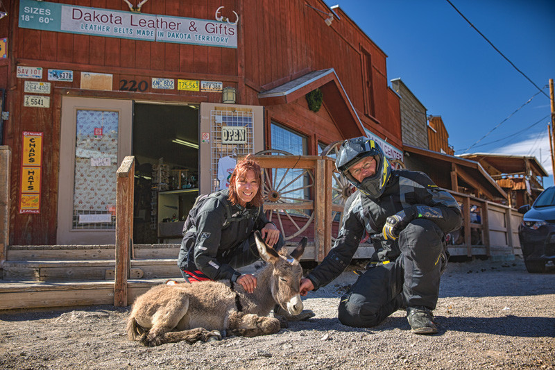
In rural Nevada, you’ll experience historic saloons and relics from it’s rich mining history. The state’s maverick spirit remains, and you’ll see ghost towns, artifacts, desert sculptures, murals, the world’s largest car forest, jackrabbits, antelope and even wild mustangs.

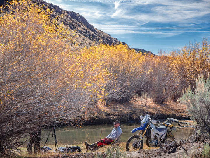
Most importantly, the film reveals miles of meandering two-track roads that are just perfect for spending time on an adventure motorcycle.

PURCHASE THE MAP

The latest version of the NVBDR map is the Third Edition, dated: October 2024

SECTION-BY-SECTION

OATMAN, AZ TO PAHRUMP – 166 miles

The official start of the NVBDR is in Oatman, Arizona, a popular stop along Route 66. Expect an interesting mix of tourists, eclectic locals and donkeys, as Oatman is known for the wild burros that wander main street.

After about 17 miles you’ll cross the mighty Colorado River and enter the state of Nevada at Laughlin. The route follows Highway 163 and then ascends Christmas Tree Pass, before leading you on a narrow two-track road south of Searchlight. This section can be very sandy so stand on the pegs, throttle up and focus. This is also a Desert Tortoise sanctuary, so be alert. West of Nipton, the route meanders through the desert in the shadows of the Ivanpah Solar Electric Generating System before reaching Primm.

The ride from Primm to Pahrump is mostly high-speed gravel roads, but take the time to stop at the Pioneer Saloon in Goodsprings, the oldest bar in Nevada, before reaching the end of Section 1 in Pahrump. Be cautious of the unexpected silt beds in Pahrump Valley if the conditions are dry.

Oatman, AZ
At first glance, the wild burros of Oatman, Arizona, seem to steal the whole show, what with their adorable faces, pushy ways, and high-pitched whinnies. But in this fascinating little almost-ghost town, they’re actually just the opening act.


Laughlin, NV
Nine different resorts, with nearly 10,000 rooms, all close together on an exciting strip. There’s a world of choices in dining, entertainment, recreation and gaming, right along the beautiful Colorado River.


Searchlight, NV
About an hour south of Las Vegas is the old mining camp and revived the town of Searchlight, Nevada. It all began when G.F. Colton discovered gold in 1897 and soon started the Duplex Mine. The next year, the Searchlight Mining District was founded and a post office was established at the camp.


Nipton, NV
Nipton is an unincorporated community with a population of about 15 – 20, in San Bernardino County, California, on the northeastern border of Mojave National Preserve, approximately 12 miles southeast of Primm, Nevada and the Ivanpah Solar Power Facility. It is accessible via Nevada State Route 164.


Primm, NV
Located 25 minutes south of Las Vegas on Interstate 15, Primm is a popular destination with Las Vegans and Californians alike thanks to its convenient location on the Southern Nevada/California state line. Offering an array of affordable activities, Las Vegans frequent Primm to shop while Californians like to visit for its Vegas vibe.

Oatman, AZ
At first glance, the wild burros of Oatman, Arizona, seem to steal the whole show, what with their adorable faces, pushy ways, and high-pitched whinnies. But in this fascinating little almost-ghost town, they’re actually just the opening act.


Laughlin, NV
Nine different resorts, with nearly 10,000 rooms, all close together on an exciting strip. There’s a world of choices in dining, entertainment, recreation and gaming, right along the beautiful Colorado River.


Searchlight, NV
About an hour south of Las Vegas is the old mining camp and revived the town of Searchlight, Nevada. It all began when G.F. Colton discovered gold in 1897 and soon started the Duplex Mine. The next year, the Searchlight Mining District was founded and a post office was established at the camp.


Primm, NV
Located 25 minutes south of Las Vegas on Interstate 15, Primm is a popular destination with Las Vegans and Californians alike thanks to its convenient location on the Southern Nevada/California state line. Offering an array of affordable activities, Las Vegans frequent Primm to shop while Californians like to visit for its Vegas vibe.

Davis Dam & Lake Mohave

Davis Dam and Powerplant facility was constructed by the Bureau of Reclamation in Pyramid Canyon, 67 miles downstream from Hoover Dam. The site is about 10 miles north of the point where Arizona, Nevada, and California meet and approximately 2 miles upstream from the Laughlin, Nevada, and Bullhead City, Arizona, communities.


Christmas Tree Pass

A 12-mile scenic gravel road through Nevada’s Newberry Mountains, Christmas Tree Pass offers desert vistas and access to petroglyphs in Grapevine Canyon. Suitable for high-clearance vehicles.


The Solar Array Power Solar Farm

Large-scale solar farms consist of ground-mounted photovoltaic panels that convert sunlight into electricity, supplying power to the grid and supporting renewable energy initiatives.

PAHRUMP TO BEATTY – 90.6 miles

Section 2 runs between the Nevada Test Site and California, through classic Nevada desert sprinkled with quirky Nevada culture. You’ll be cruising on mostly smooth gravel roads with the occasional sandy two-track and a few mellow rocky sections. If you’ve ever dreamed of riding giant sand dunes you can take a side trip to Big Dune, north of Pahrump. You’ll also cross a dry lake bed that looks like the moon, pass a pond full of endangered Pup Fish and stop at a crystal clear bubbling oasis. Take a spin up to Secret Pass lookout before the final stretch into Beatty.

Beatty offers easy access to Death Valley National Park, including the unforgettable Titus Canyon. If time allows, take a detour into the park before continuing north.

Pahrump, NV
Pahrump, Nevada is easy to reach and hard to forget. It’s an hour west of Las Vegas, a city so famous it needs no introduction, and an hour east of Death Valley National Park, a place known for extremes. Pahrump truly is the heart of the desert and the perfect place to enjoy the best of southern Nevada. Pahrump is home to big attractions and events. There’s more to do here than you may think.


Beatty, NV
Located on the crossroads of Hwy. 95 and State Route 374, Beatty offers easy access to Death Valley National Park, off roading, bird watching, hiking, ghost town exploration, camping, photography, filming, star gazing, geocaching, and the list goes on.


Spicer Ranch, Beatty, NV
Spicer Ranch boasts sprawling green pastures with lush green grass and several freshwater pools, which provide habitat for a handful of endemic creatures found here, and only here, like the Amargosa Toad. In addition to the hiking and mountain biking trails system found throughout the property Spicer Ranch invites anyone visiting to spend the night at the on-site, donation-based campground, complete with shady campsites, picnic tables, hot showers, and restrooms.

Pahrump, NV
Pahrump, Nevada is easy to reach and hard to forget. It’s an hour west of Las Vegas, a city so famous it needs no introduction, and an hour east of Death Valley National Park, a place known for extremes. Pahrump truly is the heart of the desert and the perfect place to enjoy the best of southern Nevada. Pahrump is home to big attractions and events. There’s more to do here than you may think.


Beatty, NV
Located on the crossroads of Hwy. 95 and State Route 374, Beatty offers easy access to Death Valley National Park, off roading, bird watching, hiking, ghost town exploration, camping, photography, filming, star gazing, geocaching, and the list goes on.

Ash Meadows National Wildlife Refuge

This desert oasis, a very rare and unique ecosystem, is recovering and playing an important role in global conservation efforts. The refuge strives to promote conservation management and awareness through environmental education, outreach programs, voluntarism, and visitor services programs. We promote the ‘no trace left behind’ philosophy and ask our visitors to leave nothing behind and take only memories.


Devils Hole Trailhead

A detached unit of Death Valley National Park is habitat for the only naturally occurring population of the endangered Devils Hole Pupfish (Cyprinodon diabolis). The 40-acre (16 ha) unit is a part of the Ash Meadows complex, an area of desert uplands and spring-fed oases designated a national wildlife refuge in 1984.


Big Dune Recreation Area

Situated in Amargosa Valley, Big Dune encompasses approximately five square miles of sand dunes, rising up to 500 feet. It’s a popular spot for off-highway vehicle enthusiasts and offers opportunities for dispersed camping.


Secret Pass Tower

Secret Pass is a high mountain pass at an elevation of 4,944 feet in Nye County. The area features a radio tower and offers scenic views of the surrounding landscape, accessible via a rugged road suitable for high-clearance vehicles.


Fluorine Post Office Historical Site

Located in Nye County, the Fluorine Post Office was established in 1908 to serve the local mining community. While the post office is no longer operational, the site remains a point of historical interest in the region.

BEATTY TO TONOPAH – 142 miles

There are very few places in America that have the character of the old mining town of Gold Point. Belly up for a sarsaparilla and wander around the relics that scatter the old town. There is primitive camping available in the desert and a few small cabins available for rent in Gold Point.

Section 3 has lots of big-open desert riding with the exception of an exhausting but fun section of sand whoops north of Gold Point. You’ll earn your rest at fantastic stops along the way, including the bizarre car art near Goldfield—it’s truly a must see. Tonopah offers plenty of lodging opportunities and is the halfway point of the NVBDR.

Tonopah, NV
Because it’s so far from the bright lights of any major city, Tonopah’s night skies are considered among the best in the country for stargazing. Tour our Historic Mining Park & visit the Central Nevada Museum. Go off-roading or visit nearby ghost towns. Shop in unique stores, discover local artists & even pan for gold during the annual Jim Butler Days celebration!


The Mizpah Hotel, Tonopah, NV
Experience historic elegance and comfort in Nevada’s breathtaking high desert! A treasured destination since 1907, The Mizpah Hotel in Tonopah is better known as the “Jewel of the Desert”. Beautifully renovated by Nancy and Fred Cline in 2011, The Mizpah Hotel takes you back in time, but also offers modern amenities for a comfortable stay.

Dinky Diner
Homemade food. Great dining experience, in a small historical town. Their business hours are 7am-4pm, everyday day except Sundays we close at 2pm.

  • Address: 323 Crook Ave, Goldfield, NV 89013
  • Phone:  (775) 277-9290
  • Visit Website

Tonopah, NV
Because it’s so far from the bright lights of any major city, Tonopah’s night skies are considered among the best in the country for stargazing. Tour our Historic Mining Park & visit the Central Nevada Museum. Go off-roading or visit nearby ghost towns. Shop in unique stores, discover local artists & even pan for gold during the annual Jim Butler Days celebration!

International Car Forest of the Last Church

An open-air art installation in Goldfield featuring over 40 vehicles—cars, trucks, and buses—planted vertically or stacked, all adorned with graffiti and murals. Created by artists Mark Rippie and Chad Sorg, it’s considered one of the largest car art installations in the U.S. Open 24/7 and free to visit.


Florence Mine

A historic gold mine near Goldfield, once producing ore with exceptionally high gold content. Now privately owned, tours are available by appointment, offering insights into early 20th-century mining operations.


Central Nevada Museum

Located in Tonopah, this museum showcases the region’s rich mining history, Native American artifacts, and military exhibits. Features both indoor and outdoor displays, including a recreated Old West town.


Old Tonopah Cemetery

Established in 1901, this cemetery is the final resting place for many of Tonopah’s early residents, including victims of mining accidents and the 1911 Belmont Mine Fire. Adjacent to the Clown Motel, it’s reputed to be haunted.

TONOPAH TO AUSTIN – 178 miles

From Tonopah to the north, the scenery begins to evolve from dry desert to mountains as you move away from the western border of the state. This section is not particularly challenging as it consists of mostly wide graded roads, but offers incredible vistas as you climb up and over several mountain ranges. Take a rest in the historic town of Belmont and grab a drink or bite to eat at Dirty Dick’s Saloon.

Kingston Canyon Road just before Austin is spectacular as it climbs over aggressive alpine terrain that feels more like Colorado than something you’d expect in Nevada.

BE ADVISED: This section does not have any fuel stops between Tonopah and Austin, so be conservative on the throttle and carry extra fuel.

Manhattan Historic Town


A historic ghost town in Nevada, offering a glimpse into the state’s mining past with well-preserved buildings and landmarks. Once a booming gold mining town, it now stands as a quiet reminder of the Old West. Open for exploration and outdoor activities.


Belmont Historic Town


A historic ghost town in Nevada, known for its well-preserved mining buildings and scenic views. It provides a fascinating look into the state’s mining history, with remnants of old mines and structures. Open year-round for visitors.


Northumberland Pass 8730′

A scenic mountain pass in Nevada offering stunning views of the surrounding landscape. Popular with outdoor enthusiasts, it’s a great spot for hiking, off-roading, and taking in the natural beauty of the area. Open year-round, though conditions may vary depending on weather.


Spencer Hot Springs

A natural hot spring located in the heart of Nevada, offering a relaxing soak in the wilderness. Known for its scenic surroundings and rustic setting, it’s a popular spot for travelers looking to unwind. Open year-round for those seeking a natural spa experience.


Stokes Castle

A historic stone tower built in 1897, once part of a mining venture. The castle offers panoramic views of the surrounding valley and is a popular stop for history buffs and photographers. Open for exploration, with great photo opportunities.

AUSTIN TO ELKO – 220 miles

Settle in for a long day in the saddle. Section 5 crosses big chunks of Nevada with very few services. It is over 200 miles between fuel in Austin and your next opportunity to gas up in Elko, so be prepared. There is, however, a detour halfway through this section to nearby Eureka for fuel by taking highway 278 south for about 24 miles.

You’ll make good time in the first part of this section as you ride wide open gravel roads across enormous valleys. The climb over Telegraph Peak is an optional advanced section for riders looking for an added challenge. As you get closer to Elko, ride a portion of the original Pony Express Trail and get a good mix of tighter 4×4 roads through unique geography that is much different than you’ve seen so far in Nevada. Elko is a bustling town with plenty of options for lodging, food and fuel.

Austin, NV
Highway 50 is known for its stark, open landscapes, but there’s not much on the road besides wide-open country. Fortunately, about halfway through the state, there’s a charming mountain town with a wide range of activities and amenities for travelers. The Greater Austin Area Chamber of Commerce is proud to welcome you to Austin, NV.


Lamoille, NV
As quite the snug and picturesque little village tucked away in the foothills of the Ruby Mountains, Lamoille is not too far from Elko in the northeastern corner of Nevada. What it lacks in size, it more than makes up for in charm and amenities.

Austin, NV
Highway 50 is known for its stark, open landscapes, but there’s not much on the road besides wide-open country. Fortunately, about halfway through the state, there’s a charming mountain town with a wide range of activities and amenities for travelers. The Greater Austin Area Chamber of Commerce is proud to welcome you to Austin, NV.

Pony Express Trail

A historic route that spanned over 1,800 miles, used by riders to deliver mail across the United States in just 10 days during 1860–1861. Today, the trail offers historical sites, markers, and events commemorating this rapid mail service.


Bailey Pass (Elevation: 6,812′)

A mountain pass in Nevada, offering scenic views and access to outdoor activities. While specific visitor information is limited, the pass is noted on USGS topographic maps.


Overland Pass (Elevation: 7,500′)

A mountain pass in Nevada, located approximately 90 km south of Elko. The Overland Pass Project is a gold exploration project situated at the southern end of the Carlin Trend.

ELKO TO JARBIDGE – 103 miles

After riding the highway for about 54 miles from Elko, the route turns east onto County Road 746. An optional advanced section over Wild Horse Mountain features elevation changes amidst primitive two-track before rejoining the main route.

At Charleston-Jarbidge Road, you’ll turn north and continue for another 28 miles to the end of the NVBDR and one of the most remote towns in the US, Jarbidge, Nevada. This final section crosses over a couple of passes that are around 8,500 feet in elevation, so you’ll have to wait for the snow to melt as this road often does not open until July 4th.

Jarbidge is also the official start of the IDBDR and has fuel and a small restaurant, two campgrounds, and a few rooms for rent. Make sure to book ahead if you get there during the busy season.

Jarbidge, NV
The tiny town of Jarbidge may be the most isolated of Nevada’s well-known mining towns of yesteryear, but it’s also arguably in the most stunning setting. The Jarbidge Wilderness Area, a sprawling 65,000-acre region that extends into Idaho, surrounds this historic community and is perfect for backcountry adventure. In winter months, access to this ruggedly remote town is usually limited to the drive in from Idaho, due to deep snowdrifts blocking off the Nevada entrance.


Outdoor Inn
Food/Camping/Hotel/Showers/Laundry.

  • Address: 630 Main St, Jarbidge, NV 89826
  • Phone: (775) 488-2311
  • Visit Website

Elko, NV
Elko is a vibrant community offering great food from a variety of cuisines and cultures; a wide selection of meeting, conference and lodging accommodation options; wonderful events throughout the year; art galleries, museums and historical attractions and an abundance of outdoor recreation opportunities.

Jarbidge, NV
The tiny town of Jarbidge may be the most isolated of Nevada’s well-known mining towns of yesteryear, but it’s also arguably in the most stunning setting. The Jarbidge Wilderness Area, a sprawling 65,000-acre region that extends into Idaho, surrounds this historic community and is perfect for backcountry adventure. In winter months, access to this ruggedly remote town is usually limited to the drive in from Idaho, due to deep snowdrifts blocking off the Nevada entrance.


Elko, NV
Elko is a vibrant community offering great food from a variety of cuisines and cultures; a wide selection of meeting, conference and lodging accommodation options; wonderful events throughout the year; art galleries, museums and historical attractions and an abundance of outdoor recreation opportunities.

Wild Horse Reservoir & Campground

A scenic recreation area in Elko County, Nevada, offering fishing, boating, camping, and hiking opportunities. The campground features 34 sites with amenities such as shade, tables, fire pits, and restrooms.


Charleston Schoolhouse

A historic ghost town in Elko County, Nevada, established in 1876 during a gold rush. The site includes remnants of the original settlement, such as the Charleston Schoolhouse, which operated from 1922 to 1967.


Bear Creek Summit (Elevation: 8500′)

A mountain pass located at an elevation of 8,500 feet in the Jarbidge Wilderness, Nevada. The summit offers stunning views and access to hiking trails in a remote and rugged area.

NVBDR PACKING LIST

This packing list serves as an example and is not intended to be a complete list for your backcountry riding needs. Feel free to customize this list to work for you.

  • Map holder / map case
  • GPS unit
  • GPS mount
  • Compass
  • Cell phone
  • Phone charger
  • Plug adapter: auto to BMW plug
  • Camera
  • Spot II
  • Notebook
  • Pencil/pen

NVBDR MOTORCYCLE DEALERSHIPS

FREQUENTLY ASKED QUESTIONS

Below are answers to some Frequently Asked Questions about the Nevada Backcountry Discovery Route.

The NVBDR is the seven route developed by the Backcountry Discovery Routes organization for dual-sport and adventure motorcycle travel.  The NVBDR is a south-to-north route across the state of Nevada covering over 900 miles of mostly non-paved track.  The route begins in the old mining town of Oatman, AZ and finishes in Jarbidge, Nevada. You will experience challenging riding on remote backcountry roads through this beautiful state.  Discover Nevada’s scenic terrain including iconic deserts, rocky valleys, high-elevation forests, sage high desert, and beautiful canyons. You will experience the unique sights only found here, in Nevada. Enjoy Nevada’s rural towns, mining districts, historic locations, wild west saloons & colorful people.

This is probably one of the harder BDR’s to plan the entire trip due to temperature changes from start to finish.  Temperatures in Sections 1 and 2 can be as high as 110 in the summer months.  But can be 60-80s in April, May, Oct, and Nov.  You can in most cases ride these sections throughout the winter as well.  Once you head north from Gold Point to Jarbridge the temperatures become cooler. You can expect to ride these sections from June to October.  However, you may run into snow in the very northern part into late June, depending on snowpack.  Snow does begin to fall in early October in northern Nevada and can make travel impassable.   We suggest you ride from the North to the South in the summer until you can’t stand the heat and ride from the South to the North until you can’t take the cold.

Most people average 150 miles a day on a backcountry motorcycle trip. Plan on doing this route in 7-9 days depending on how fast you want to travel and how early you want to roll out of camp. There is a lot of history to see and Saloons to visit on the NVBDR so planning a little extra time is suggested.

The NVBDR route is designed to be ridden on adventure and dual-sport motorcycles, as well as driven in 4×4 vehicles. There are no single-track style trails on this route. Many of the roads are in remote areas and reach high elevation areas where road maintenance is minimal or non-existent. You can expect to cover sections of road with deep ruts, loose rocks, deep sand and other challenges.  Road conditions change from week to week based on the recent weather.  When you see signs that read, “Roads maybe impassable when wet”, use caution, roads become very slick and can be impassable. Depending on time of year and weather, there may be a few small deep water crossings. Flash floods are frequent during summer storms.  Don’t cross flooded washes. Wait until water subsides.

Nevada has fast moving thunder storms during the summer months.  These storms usually build in the mountains in the early afternoon and usually contain lightning, hail stones and heavy downpours. These storms can contain heavy winds with blinding dust storms.

Yes the route can be done North to South.

Always bring a complete set of maps for the area you plan to ride. They have good information about roads, water sources, and are an indispensable resource when the GPS doesn’t work, or is giving questionable advice. Unplanned events can occur and having paper/synthetic maps of the area can be a life saver. National Forest maps are available at http://www.fs.fed.us/recreation/map/state_list.shtml#U and local Ranger Stations. NVBDR Butler Motorcycle Maps are available at www.touratech-usa.com or www.butlermaps.com.

Any GPS unit capable of displaying 15 track logs with a minimum of 500 points each is suitable for use on the NVBDR. Garmin models that work best for this application are: Zumo 665/660, Montana, GPSMap 60, 62, 76, 78 and 276. Other GPS manufacturers may have units that will work. Check the technical specs to determine suitability.

Any bike that has a license plate, can run knobby tires, is set-up to carry the gear you plan to bring, and has the fuel range to make the distance between gas stops. Most adventure or dual-sport motorcycles will be suitable for the trip.  Choose the bike that you are the most comfortable riding in desert and mountain terrain.

The tracks for the route can be downloaded free of charge online at https://ridebdr.com/download-tracks/ .

DOT approved knobby tires (such as Continental TKC 80, Mefo Super Explorer, or Dunlop 606) are strongly recommended.

Section 5: Austin to Elko the distance is over 200 miles.  Carrying extra gas is strongly suggested. Section 4 also is a little long and has 178 miles between gas stops.  Never pass up the opportunity to get gas.

There are few campgrounds and suitable dry camping locations along the route. The Butler Motorcycle Map for the NVBDR has a tent icon showing campgrounds on the route and many near the route. The NVBDR Butler Map is available at www.touratech-usa.com,  www.butlermaps.com and other fine retailers and dealerships. You will also find dispersed camping along the way when on BLM lands.  Please make sure you camp near the road and respect the property owners private lands along the route.

In most cases camp fires are allowed, but check with local BLM/Ranger Stations to determine if campfires are allowed before you build one. Forest fires are a threat during parts of the year and the rules that manage this risk must be followed. Be sure to fully extinguish fires so they are DEAD-OUT. Use water to ensure a fire is fully extinguished and the ground is left cool and wet.

The NVBDR has fewer hotel opportunities than other Backcountry Discovery Routes. Camping on the other hand, is plentiful. Official campgrounds are shown on the front of this map with a small tent icon and many more primitive backcountry camps can be found along the way. Because of the limited beds available in the small towns along the NVBDR, it is recommended that riders make reservations ahead of their arrival. Rooms can be found in Laughlin, Searchlight, Primm, Pahrump, Beatty, Gold Point, Tonopah, Austin, Elko and Jarbidge.

There are a few natural water sources along this route however, depending on the snow pack, some may not be running. You can find potable water in the towns along the way.  It is suggested that plenty of water is carried for personal and cooking use. Here is a video on water filtration filmed in the Oregon Backcountry: http://youtu.be/vqOFZAoZdTU

Yes, there are several gates on the route. The route travels through several ranches where you will find gates open and closed.  Please leave the gates as you find them.

The highest elevations are reached in sections 4 & 6, where elevations climb to 8800ft. The NVBDR starts out in sections 1 & 2 with average elevations of 2500ft to 3000ft. The rest of the route averages between 5000ft to 6500ft with several higher elevations when climbing over mountain ranges.

We do our best to post the most up-to-date information on our Route Updates Page. We depend on the BDR community to inform us about route and road conditions, so if you encounter any road closures or severe conditions that are worth reporting, please contact us with the information.

There is also a dedicated NVBDR Facebook Group Page. We recommend that you join the group prior to your trip to read trip reports and comments from other riders about their experience on the route.

Don’t forget to use our Interactive Map to get route conditions in real time. Read this Article to a quick tutorial on how to use the Interactive Map.

Much of this route is remote and out of reach for cell phone towers. There will be long sections with no coverage. Your best bet is to talk or text in the towns or on top of mountains. You will be surprised where you get coverage and where you don’t. A satellite communication device is a good idea in the backcountry. Phones with Verizon service have more coverage on this route vs AT&T.

Nevada is a habitat to many large animals like the Black Bear, Elk, Deer and Antelope. Safe food practices while camping are an absolute for your safety and the animals safety.  Here is a link to find out more.  Rattlesnakes are also found throughout the state.

We get this question all the time. Here are some key things to consider as you put together your plan.

All of the BDR routes include intermediate to advanced terrain. If a person is on a large bike twin-cylinder bike like an R1200GS Adventure or Yamaha Super Tenere, the routes can be very difficult. If a person’s skills are not advanced level, they may consider taking a smaller bike or choosing the easier options when possible. A BDR is something a person should build up to and it shouldn’t be their first overnight trip on their ADV bike.

Although, ID, WA and CO are less difficult than UT and AZ, they all contain difficult sections. Lockhart Basin in UT is the hardest section of all the BDR’s. We suggest looking at the Butler Map and take the optional easier routes to avoid the difficult sections.

Even taking this approach there may be difficult stretches depending on changes in road conditions, weather, construction and the unknown. This is part of what makes it an adventure.

Regardless of its description on the map or in the film, no section of a BDR should be underestimated.

Do some shorter overnight trips as practice and ride increasingly difficult terrain to build up your skills and confidence. Also remember that riding with a fully-loaded bike should be practiced prior to tackling a BDR. Lastly, always ride with a group so that you have a team to help overcome any obstacles whether it’s terrain, mechanicals, navigation, medical emergency, etc…

In summary, take baby steps and work up to doing a BDR. Don’t make it your first adventure motorcycle outing on a full-sized twin-cyclinder bike.

This advice comes from Rob Watt, BDR Director of Developemnt, and Wilderness EMT.

We carry items for wound management, breaks, basic meds and dental.  You can buy a good first aid kit at one of the outdoor stores online or Touratech-USA.  Get one that is an Extended Day Backpacker or 3-4 person kit.  These kits usually have the basics for a motorcycle trip.

They usually don’t have a SAM splint, so pick one of those up along with a couple ace bandages.  One other thing that we do for every multi-day trip, is to gather important information about each rider: allergies, medications, medical issues, emergency contacts, etc.

Then we put that on a master sheet for each person, so if something does happen we have that information handy incase that person can’t speak.  Another good practice is to do a little research of where medical facilities are along your planned route.  Is there a “flight for life” in the area? Where are the hospitals, Medical clinics, etc?

Here is a list of some items that you should have in your medical kit:

  • Bandages: Assorted sizes for small cuts, blisters, etc.
  • 4-inch closure strips or butterfly closures: For closing large wounds. 4-inch strips are more effective than butterfly.
  • 4 inch by 4 inch sterile dressing pads (5 to 10): To apply pressure to a wound and stop bleeding
  • Non-adherent sterile dressing (2 inch by 2 inch): Use these or Second Skin to cover blisters, burns or lacerations.
  • Gauze roll: Holds dressing in place.
  • Small roll of 1-inch adhesive tape: Holds dressings in place.
  • Multi-use tool or knife: Should include knife, scissors. A scalpel and blade are also useful for first aid.
  • Forceps or tweezers: For removing splinters, ticks, and removing debris from wounds.
  • Scissors: Trauma scissors, which have a blunt end to protect the patient, can be used for cutting away clothing from injury, cutting medical tape, etc.
  • Thermometer: Digital is generally more accurate, but batteries do wear out.
  • Malleable splint: Lightweight foam-covered aluminum, such as a SAM splint.
  • Irrigation syringe (35 cc): Used to flush and clean wounds.
  • Suction syringe (65 cc): Used to clear mouth of fluids when giving CPR.
  • Safety pins: Can help remove splinters, fasten arm sling, or make a whole in a plastic bag for improvised wound irrigation.
  • Cotton-tip swabs: For removing  foreign objects from eye, or applying antibiotic ointment.
  • Resealable plastic bags: Many uses, including icing a swollen joint or creating wound irrigation device.
  • ACE, Coban, or other rubberized bandage: Can be used as outer wrap on splints, wound dressings or support for joint injuries. Be careful not to wrap too tightly.
  • Antiseptic towlettes: For cleaning small wounds.
  • Cleansing pads with lidocaine: For cleaning. Includes a topical anesthetic for abrasions, stings, etc.
  • Topical antibiotic ointment: For application to wounds. Simple Vaseline can also be used in dressing a wound.
  • Moleskin: Prevents blisters. Cut and apply a section to your foot as soon as you discover a “hot spot.” Duct tape also works for this purpose.
  • Povidone Iodine USP 10 percent, 1 oz.: For preventing infection. Bottled PVD iodine 10 percent solution should be diluted to a ratio of 1 percent or less for flushing wounds.
  • Aloe vera gel: Found in packets or small bottles for relief of minor burns.
  • Pain relievers, including aspirin and Ibuprofen: Provides relief for minor aches and pains, reduces fever, helps reduce inflammation of sprains and other injuries.
  • Antihistamines: For relief of pollen allergies, or to reduce reaction to bites and stings.
  • Immodium 2 mg capsules or tablets: For relief of diarrhea from intestinal infections.
  • Pepto Bismol or antiacid tablets: For relief from general diarrhea, abdominal upset.
  • After Bite or hydrocortisone cream USP 1 percent: Relieves skin irritation from bites, poison oak, stings, or allergic reactions.
  • Latex or nitrile gloves: Protects against blood-borne diseases and infection.
  • CPR microshield mask: A compact flexible barrier with a one-way valve for rescue breathing, which protects user from blood, vomit or saliva.
  • Oral rehydration salts: Packet of electrolyte salts and glucose for treatment of dehydration, heat exhaustion, or loss of fluids from vomiting or diarrhea.
  • Space bag/blanket: Lightweight emergency shelter. For treating hypothermia victims.
  • Paper and pencil: For recording medical data such as body temperature, pulse, time and date of symptoms, injuries, medicines administered, etc. Most repackaged kits include accident report forms.
  • Wilderness First Aid booklet: Many prepackaged first aid kits contain one. An excellent pocket guide is the Wilderness Medical Handbook

Rating the Routes by Difficulty

We are often asked if we rate BDRs by difficulty. We don’t officially rate the difficulty level of our routes as it varies daily due to current weather, road conditions, and other unpredictable factors. Difficulty also depends on individual skill and fitness level, bike and tire selection and load carried.

Some riders find sand to be most challenging, some find mountain passes difficult. Each rider’s perception is unique.

While we can’t provide a standardized rating like ski resorts, we can provide some basic guidance of difficulty level from most to least. This order does not include optional harder sections and implies favorable road and weather conditions:

BDR Routes: CABDR-South, ORBDR, AZBDR, WYBDR, UTBDR, COBDR, NVBDR, NEBDR, WABDR, NMBDR, CABDR-North, IDBDR, SEBDR, MABDR.

BDR-X Routes: Big Bend, TX; Red Desert, WY; Steens/Alvord, OR; Chattahoochee, GA; Black Hills, SD; PA Wilds, PA.

Review the FAQs for each route before your trip.

Backcountry Discovery Routes is a 501c(3) non-profit corporation. © 2025 Backcountry Discovery Routes, Inc. All rights reserved. Terms of Use.