Join our Facebook Group for more route updates.

Visit the official NVBDR Facebook Group page for ride reports, photos, and discussions with other riders in your area HERE

Important: Wildfire Season is Here

The unfortunate reality of wildfire season is upon us and there are important reminders to keep in mind:

  • While we do our best to post Route Updates for significant fire bypasses or closures, the rapidly-changing conditions of wildfires make it nearly impossible to track.
  • Before and during your ride, there are important things you must do to ensure your safety and adherence to closures:
    • Always check for Route Updates and download the latest GPS track file just before you go. Note, recommended bypasses are not always included in the track file.
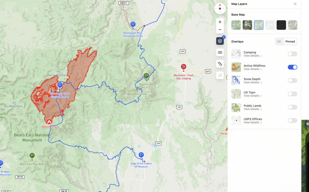
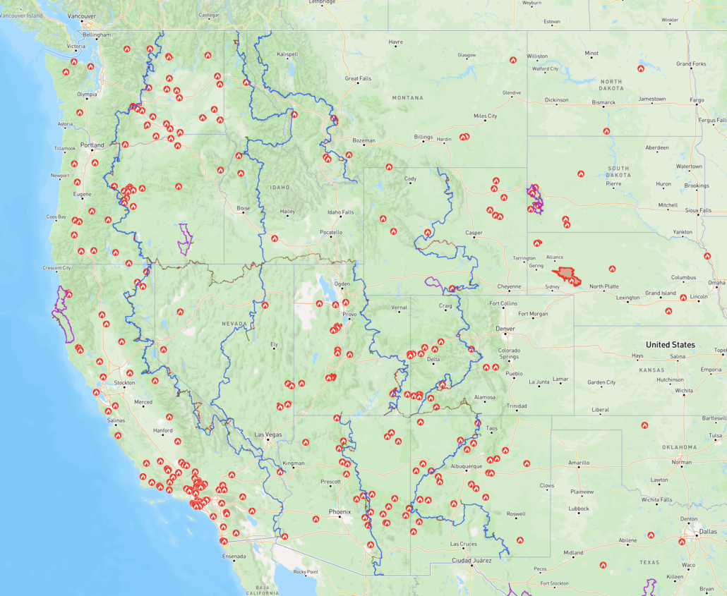
    • Reference the official BDR Interactive Map wildfire layers to see current activity HERE
    • Use other wildfire apps and websites to cross-reference data, such as WatchDuty HERE
    • Join the official Facebook Group Page for the route you intend to ride and monitor throughout your trip. This is a great way to get up to date reports and share intel.
    • Email us at [email protected] or report a route update on the mobile website to help us track any changes.
    • Check local jurisdictions for campfire regulations and bans. Please consider not having any campfires.
    • Always respect closures and adhere to detours. Wildfires are a tragic event for local residents. Be respectful of locals and allow the hard-working fire crews to do their job: stay out of their way.

See attached screenshots for reference.
April 28, 2026 (UPDATED June 26, 2026)

New Tracks Available for Download

A new version of the NVBDR has been posted labeled NVBDR-June2026

This update includes a few minor refinements and a few updates.:

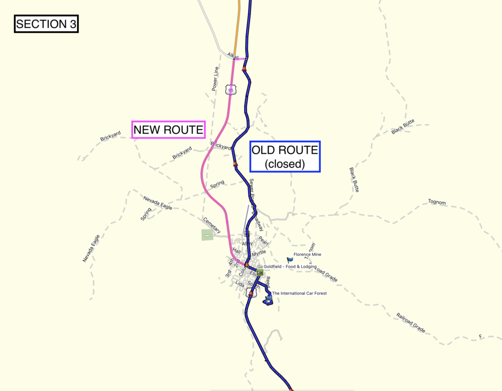
SECTION 3:

  • A minor track revision has been made north of Goldfield to bypass a newly privatized portion of the route for mining operations.

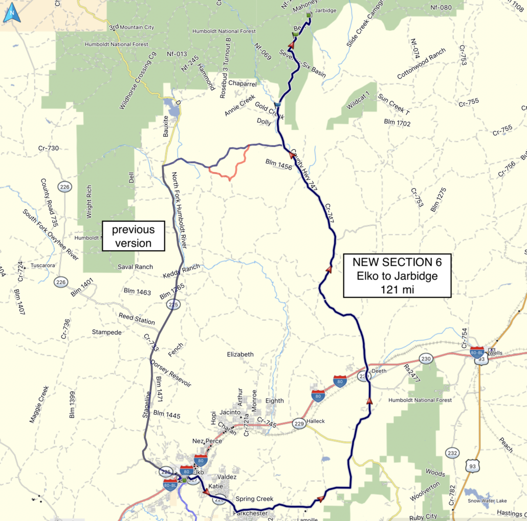
SECTION 6:

  • A brand new revision to Section 6 is now available! This revision eliminates a ton of highway and adds much more dirt.
  • The mileage is 121 mi from Elko to Jarbidge
  • A few highlight notes from our development team member Arnel:
  • This is a Keeper! Great trail! The portion south of the I-80 goes through the most beautiful desert farm country on good gravel and paved roads-a little populated, but no issues just Ride Right! As soon as you go north of the I-80 it is true NV desert, desolation with lots of nice canyon riding on good, graded dirt road all the way to where it intersects with the previous route version.

See attached screenshots for reference. These changes will be reflected on the printed map when the next reprint revision is due.
Purchase the official map for the NVBDR HERE

Always download the latest version of the GPS tracks just before you go HERE
May 8, 2021
SECTION 6: YEARLY CLOSURE

We have received reports that the route to Jarbidge in Section 6 does not open until July 4th. This is the case every year.

Backcountry Discovery Routes is a 501c(3) non-profit corporation. © 2026 Backcountry Discovery Routes, Inc. All rights reserved. Terms of Use.