
Hells Canyon Idaho/Oregon BDR-X

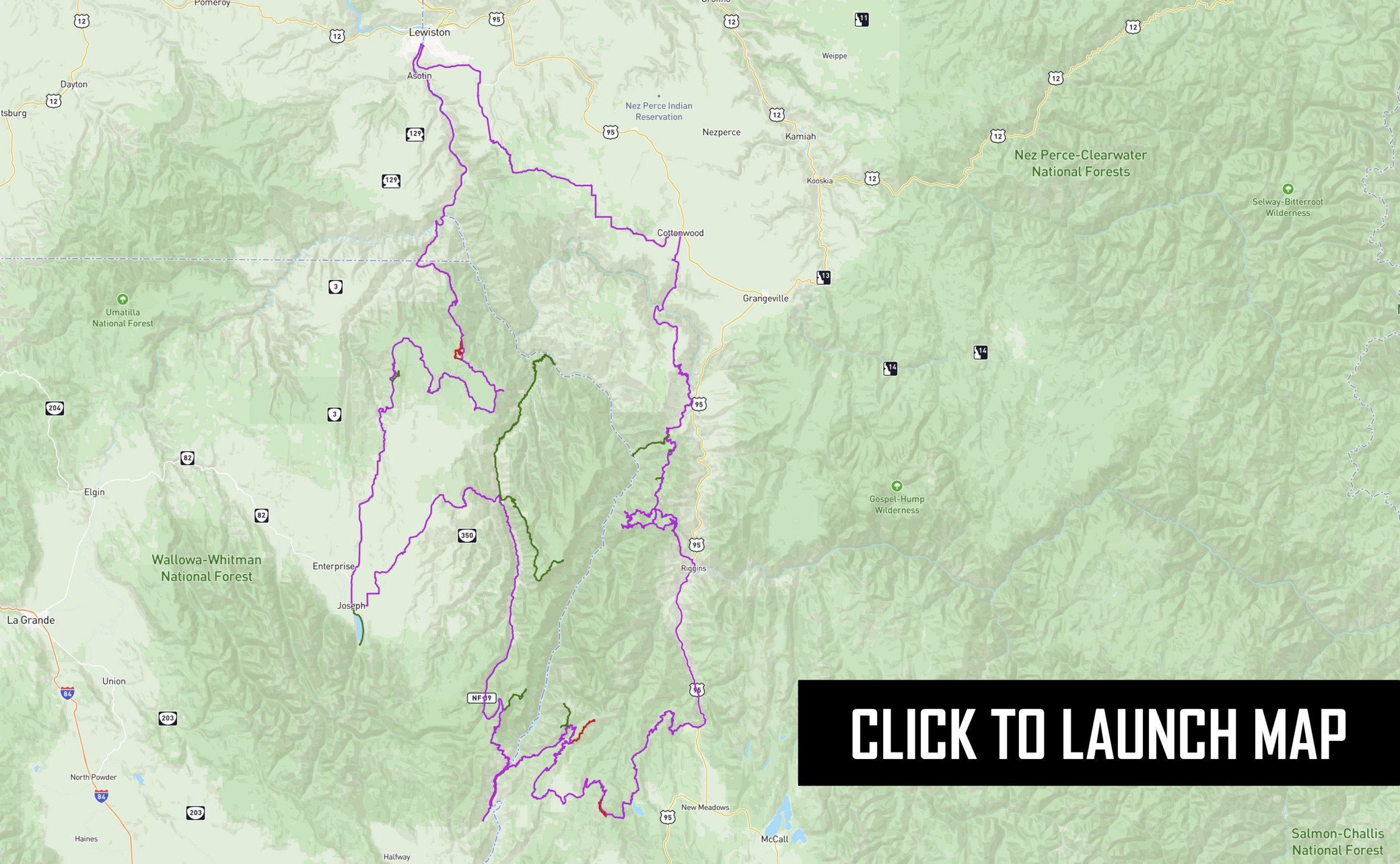
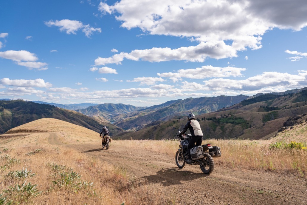
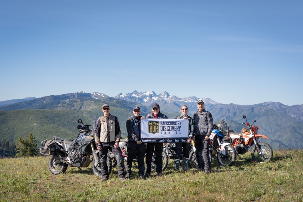
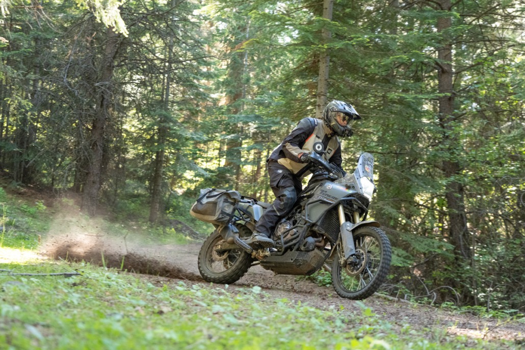
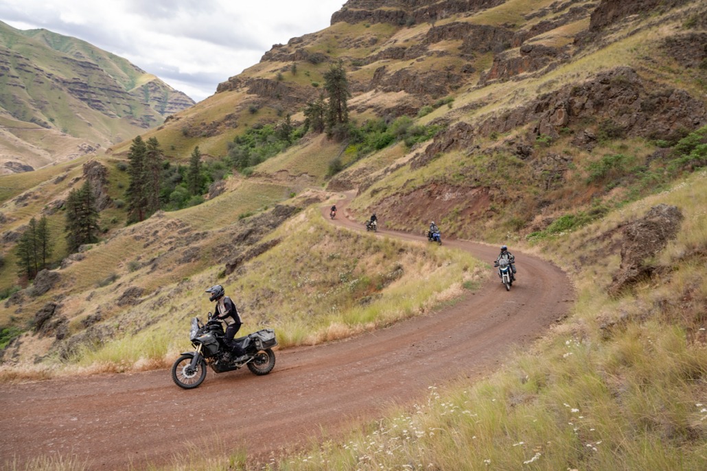
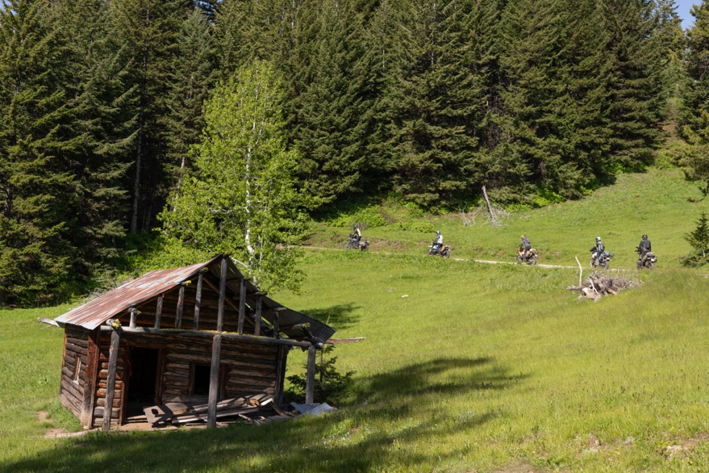
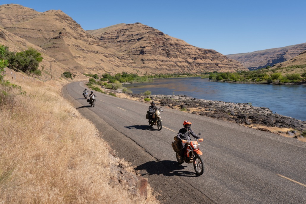
The Hells Canyon BDR-X is a 520-mile off-pavement motorcycle loop that circumnavigates Hells Canyon, the deepest river gorge in North America. Riders will explore both the Oregon and Idaho sides of the Snake River, discovering more than ten spectacular viewpoints and historic fire lookouts with breathtaking canyon vistas. The route traverses dramatic terrain, descending from high canyon rims to the river below and climbing back again, with elevation changes exceeding 5,000 feet. Along the way, riders will encounter diverse landscapes, changing climates, and significant temperature swings. The Hells Canyon BDR-X is a moderate route with a few optional challenging sections, delivering an unforgettable adventure through one of the most rugged, awe-inspiring, yet lesser-known landscapes in the American West.  Find your heaven in Hells Canyon.

The Hells Canyon BDR-X was developed with support from the Yamaha Outdoor Access InitiativeAllTerra by Alpinestars, and onX Offroad.

PURCHASE THE MAP

The latest version of the Hells Canyon Idaho/Oregon BDR-X map is the First Edition, dated: July 2026

SECTION-BY-SECTION

JOSEPH, OR TO OXBOW, OR – 98 miles

The Hells Canyon BDR-X begins in the charming town of Joseph, OR. Before departing, consider the short extension to Wallowa Lake for water access and a tramway ride to a mountaintop restaurant with spectacular views.

Leaving Joseph, the route meanders through farmlands before reaching the Zumwalt Prairie Preserve. It then descends a narrow creek canyon to the tiny town of Imnaha, where you’ll find the Imnaha Store & Tavern (est. 1904), but no fuel. Two worthwhile optional extensions depart from Imnaha. One visits Dug Bar on the Snake River (61 mi RT), considered one of the best roads in the area. The other leads to Hat Point Lookout Tower (46 mi RT).

Beyond Imnaha, the route climbs the Upper Imnaha River Canyon before reaching Hells Canyon Overlook. Hess Road then drops 3,800 feet in just seven miles. The lower section is exposed, often hot and dry, and offers dramatic views into Hells Canyon. Be mindful of loose rock and gravel, maintain sharp focus, and use engine braking to avoid overheating your brakes on the descent. Riders uncomfortable with steep grades, exposure, or heights can take NF-39 down to Oxbow.

The remainder of Section 1 follows a mix of dirt and pavement along the Snake River, ending at Scotty’s Outdoor Supply, where fuel and limited food options are available.

Indian Lodge Motel

  • Address: 201 S Main St, Joseph, OR 97846
  • Phone: (541) 432-2651
  • Visit Website »

Bronze Antler Bed and Breakfast

  • Address: 309 S Main St, Joseph, OR 97846
  • Phone: (541) 432-0230
  • Visit Website »

The Jennings Hotel

  • Address: 100 N Main St, Second Floor, Joseph, OR 97846
  • Phone: Not listed
  • Visit Website »

Kokanee Inn

  • Address: 700 S Main St, Joseph, OR 97846
  • Phone: (541) 432-9765
  • Visit Website »

Stubborn Mule Saloon & Steak

  • Address: 104 S Main St, Joseph, OR 97846
  • Phone: (541) 432-6853
  • Visit Website »

Embers Brewhouse

  • Address: 204 N Main St, Joseph, OR 97846
  • Phone: (541) 432-2739
  • Visit Website »

The Dog Spot

  • Address: 19 S Main St, Joseph, OR 97846
  • Phone: (208) 610-4932
  • Visit Website »

JD’s BBQ

  • Address: 202 S Main St, Joseph, OR 97846
  • Phone: (503) 577-9197
  • Visit Website »

Imnaha Store & Tavern

  • Address: 79015 Hat Point Rd, Imnaha, OR 97842
  • Phone: (541) 577-3111

Hells Canyon Inn

  • Address: 53945 OR-86, Halfway, OR 97834
  • Phone: (541) 785-3277

Joseph, OR

Scotty’s near Oxbow, OR

NOTE: No fuel in Imnaha

Wallowa Lake State Park & Campground (6 mi off route)

A scenic lakeside state park offering campsites, a marina, swimming beach, hiking access, and spectacular views of the Wallowa Mountains. It’s a popular basecamp for exploring the Eagle Cap Wilderness.


Wallowa Lake Tramway (6 mi off route)

Ride one of North America’s steepest gondolas to the summit of Mount Howard for panoramic views of Wallowa Lake, the Eagle Cap Wilderness, and Hells Canyon.


Zumwalt Prairie Preserve

One of North America’s largest remaining native bunchgrass prairies, this spectacular preserve is home to abundant wildlife, seasonal wildflowers, and sweeping views of the Wallowa Mountains and surrounding canyon country.


Dug Bar Landing (30 mi off route)

A remote boat launch on the Snake River and gateway to the depths of Hells Canyon, popular for rafting, fishing, camping, and exploring one of the most secluded areas in the region.


Granny View Overlook (17 mi off route)

A scenic overlook offering breathtaking views of Hells Canyon, the Snake River, and the rugged mountains that define northeastern Oregon.


Hat Point Lookout Tower (23 mi off route)

One of Oregon’s highest road-accessible viewpoints, featuring a historic fire lookout with incredible panoramic views deep into Hells Canyon.


McGraw Lookout Tower (4 mi off route)

A historic fire lookout perched atop McGraw Mountain, offering expansive views of the Wallowa Mountains, Hells Canyon, and the surrounding national forest.


Buck Point (5 mi off route)

A quiet scenic viewpoint overlooking the rugged ridges, forests, and canyons of the Hells Canyon region, making it a worthwhile stop for photography and sightseeing.


Hells Canyon Overlook

One of the best roadside viewpoints in northeastern Oregon, providing spectacular views into Hells Canyon and the Snake River nearly a mile below.

OXBOW, OR TO RIGGINS, ID – 126 MILES

Section 2 begins with a scenic paved ride along the Idaho side of the Snake River, followed by a long ascent on Kleinschmidt Grade with spectacular canyon views. After passing through the small community of Cuprum, an optional extension leads to two outstanding viewpoints: Horse Mountain Lookout Tower and Kinney Point. Another optional spur reaches Smith Mountain Lookout Tower, with a challenging final climb after leaving Black Lake Road.

The route then meanders through the hills south of the Seven Devils Mountains on a mix of gravel and dirt roads. An optional harder section above Grouse Creek is relentless, featuring loose rocks and requiring advanced riding skills. Eventually, the route descends to Highway 95 north of New Meadows, followed by a 23-mile ride along the Little Salmon River before reaching Riggins, Idaho, where lodging, restaurants, and fuel are available.

Salmon Rapids Lodge

  • Address: 1010 S Main St, Riggins, ID 83549
  • Phone: (208) 628-2743
  • Visit Website »

Salmon River Motel

  • Address: 1203 S Main St, Riggins, ID 83549
  • Phone: (208) 628-3025
  • Visit Website »

Riggins Motel

  • Address: 615 S Main St, Riggins, ID 83549
  • Phone: (208) 628-3001
  • Visit Website »

Big Iron Motel

  • Address: 515 N Main St, Riggins, ID 83549
  • Phone: (208) 628-3272
  • Visit Website »

Riverview Motel

  • Address: 704 N Main St, Riggins, ID 83549
  • Phone: (208) 628-3041
  • Visit Website »

Seven Devils

  • Address: 312 S Main St, Riggins, ID 83549
  • Phone: (208) 628-3558

Kate’s Cattlemen’s Restaurant

  • Address: 601 S Main St, Riggins, ID 83549
  • Phone: (208) 628-3195
  • Visit Website »

The Steakhouse & Diner

  • Address: 1149 S Main St, Riggins, ID 83549
  • Phone: (208) 834-0608

The Double L

  • Address: 1333 S Main St, Riggins, ID 83549
  • Phone: (208) 271-6280

Scotty’s near Oxbow, OR

Riggins, ID

Horse Mountain Lookout Tower (2 mi off route)

A historic fire lookout perched atop Horse Mountain, offering sweeping 360-degree views of the Payette National Forest and surrounding mountain ranges.


Kinney Point Overlook (4 mi off route)

A scenic overlook featuring interpretive displays and panoramic views of Hells Canyon, the Snake River, and the surrounding mountains, making it an excellent stop for photos and learning about the area’s geology and history.


Smith Mountain Lookout Tower (5.6 mi off route)

A restored historic fire lookout atop Smith Mountain with expansive views of the Seven Devils Mountains, Hells Canyon, and the surrounding forests.


Lost Valley Reservoir (2 mi off route)

A peaceful mountain reservoir popular for camping, fishing, kayaking, and picnicking, surrounded by forests and scenic views in the Payette National Forest.

RIGGINS, ID TO COTTONWOOD, ID – 97 MILES

Upon leaving Riggins, you’ll immediately begin climbing back into the mountains on Race Creek Road. If a gate is closed, a bypass is provided to continue on the route. Soon, the route passes by Cold Springs Mountain, where elevations approaching 7,000 feet offer incredible views of the Seven Devils Mountains.

The next segment is a highlight, featuring two out-and-back roads to Low Saddle and Saw Pit Saddle. These unique viewpoints provide a different perspective of Hells Canyon from within the canyon walls.

After visiting the saddles, the route heads north on a long ridgeline with several additional viewpoints and an optional extension to Pittsburg Saddle on the Snake River. This road is popular with vehicles towing boats and trailers to the campground and launch, so be prepared for traffic and dust.

The route then makes a long descent to the Salmon River and then a seemingly neverending scenic climb back up on Doumecq Road. Another long descent follows Center Canyon back to the Salmon River. The final miles follow paved Graves Creek Road into Cottonwood, Idaho, where full services are available.

Note: There is no lodging directly in Cottonwood. Nearby options:

White Bird Motel

  • Address: 115 Bridge St, White Bird, ID 83554
  • Phone: (208) 839-2646
  • Visit Website »

Elkhorn Lodge Motel

  • Address: 822 W South 1st St, Grangeville, ID 83530
  • Phone: (208) 983-1500
  • Visit Website »

Gateway Inn

  • Address: 700 W Main St, Grangeville, ID 83530
  • Phone: (208) 983-2500
  • Visit Website »

Rodonna’s Country Haus

  • Address: 407 Foster St, Cottonwood, ID 83522
  • Phone: (208) 962-3391

The Habit Coffee Shop

  • Address: 404 Main St, Cottonwood, ID 83522
  • Phone: (208) 507-2745

Backroads Coffee Co

  • Address: 1402 King St, Cottonwood, ID 83522
  • Phone: (208) 816-9850

Riggins, ID

Cottonwood, ID

Cold Springs Mountain

A high-elevation ridgeline along the route offering sweeping views of the Seven Devils Mountains, Hells Canyon, and the surrounding forests. It’s one of the most scenic stretches of the Hells Canyon BDR-X.


Low Saddle Viewpoint

A scenic mountain saddle with expansive views of Hells Canyon, the Seven Devils Mountains, and the rugged backcountry of western Idaho.


Saw Pit Saddle Viewpoint

A scenic saddle offering panoramic views across the surrounding mountains and deep canyons, making it a worthwhile stop for photos along the route.


Hidden Hells Canyon Viewpoint (0.9 mi off route)

A short detour leads to a spectacular overlook with dramatic views into Hells Canyon and the Snake River far below. It’s one of the area’s lesser-known viewpoints.


Grave Point Lookout Tower (1.2 mi off route)

A historic fire lookout perched atop Grave Point with outstanding panoramic views of Hells Canyon, the Seven Devils Mountains, and the surrounding wilderness.


Pittsburg Saddle Viewpoint (1 mi off route)

A scenic overlook along the Pittsburg Landing Road offering impressive views of Hells Canyon, rugged canyon walls, and the surrounding mountain landscape.


Pittsburg Landing (7 mi off route)

Located on the banks of the Snake River deep within Hells Canyon, Pittsburg Landing is a popular destination for boating, fishing, camping, and launching river trips.

COTTONWOOD, ID TO ASOTIN, WA – 63 MILES

This section follows rural roads through farmlands and lower-elevation forested areas north of the Salmon River. Along the way, you’ll find the small town of Keuterville, the Forest Saloon, a local watering hole (no food), and the Waha Grill restaurant. You’ll also ride past two lakes, Soldier Meadow Reservoir and Waha Lake.

Eventually, the route begins a long, gradual descent to the twin cities of Lewiston, Idaho, and Clarkston, Washington, named after explorers Lewis and Clark. Soon you’ll cross the Southway Bridge, the next crossing of the Snake River downstream from Oxbow. Together, these two bridges make the Hells Canyon BDR-X loop possible. Section 4 ends in Asotin, Washington, the last fuel stop before starting Section 5.

Hells Canyon Grand Hotel

  • Address: 621 21st St, Lewiston, ID 83501
  • Phone: (208) 799-1000
  • Visit Website »

River Tree Inn

  • Address: 1257 Bridge St, Clarkston, WA 99403
  • Phone: (509) 758-9551
  • Visit Website »

Many lodging options in Clarkston and Lewiston.

Waha Grill

  • Address: 40787 Waha Rd, Lewiston, ID 83501
  • Phone: (208) 746-7761
  • Visit Website »

Matt’s Grill & Lodge

  • Address: 90 2nd St, Asotin, WA 99402
  • Phone: (509) 243-6008

Kenzie’s Koffee

  • Address: 111 Filmore St, Asotin, WA 99402
  • Phone: (509) 243-3300
  • Visit Website »

Cottonwood, ID

Asotin, WA

St. Gertrude’s Monastery & Museum

A beautiful Benedictine monastery overlooking the Camas Prairie, featuring a historic chapel, museum, and exhibits showcasing the area’s religious, cultural, and pioneer history.


Forest Saloon

A longtime Grangeville favorite serving burgers, sandwiches, and drinks in a classic Idaho saloon atmosphere.


Soldier Meadow Reservoir

A quiet mountain reservoir surrounded by Payette National Forest, popular for camping, fishing, kayaking, wildlife viewing, and escaping into Idaho’s backcountry.


Hells Gate State Park & Campground

Situated along the Snake River near Lewiston, this state park offers riverside camping, boating, hiking, the Lewis & Clark Discovery Center, and serves as a gateway to Hells Canyon adventures.

ASOTIN, WA TO JOSEPH, OR – 133 MILES

Riding south from Asotin, you’ll meander along the western shore of the Snake River in Washington to Heller Bar, where Snake River jet boat tours begin. Along this stretch, look for the parking area for the Buffalo Eddy Petroglyphs, which are worth the short walk. From Heller Bar, the route briefly follows the Grande Ronde River before beginning a long climb back into the mountains on Joseph Creek Road and Horse Creek Road. This portion of the route can be challenging in places, with narrow, rutted roads and large rocks. Eventually, you’ll reach the ridgeline and travel along Cold Springs Road. Look for a series of viewpoints on the eastern side of the road that offer splendid views of Hells Canyon.

An optional harder track branches off Cold Springs Road onto a seldom-traveled two-track that may have downed trees and other obstacles. The entrance is not well marked, so follow the route carefully. Not far ahead is Buckhorn Overlook, one of the best viewpoints in Hells Canyon. The route then follows major gravel roads before turning north onto Hollow Log Road. This lesser-used road offers good opportunities to spot wildlife, including elk. Soon, the route passes a short spur to Red Hill Lookout Tower, which has panoramic views and a vault toilet. From Red Hill, it’s a long, gradual descent back to Joseph, where the adventure began.

See section 1 tab for listings in Joseph, OR

See section 1 tab for listings in Joseph, OR

Asotin, WA

Joseph, OR

Buffalo Eddy Petroglyphs

One of the Northwest’s largest collections of Native American rock art, featuring hundreds of petroglyphs carved into basalt cliffs overlooking the Snake River, with some dating back more than 4,500 years.


Heller Bar

A popular Snake River recreation area and boat launch offering access to boating, fishing, camping, and scenic views near the confluence of the Snake and Grande Ronde rivers.


Cold Springs Ridge Viewpoints

A series of scenic pullouts along Cold Springs Ridge offering expansive views of Hells Canyon, the Snake River, and the rugged mountains of northeastern Oregon and western Idaho.


Buckhorn Overlook

A spectacular roadside overlook offering panoramic views into Hells Canyon, the Wallowa Mountains, and the Seven Devils Range. A short walk leads to one of the region’s best viewpoints.


Red Hill Lookout Tower (1.6 mi off route)

A historic fire lookout perched atop Red Hill, offering panoramic views.

HELLS CANYON IDAHO/OREGON PACKING LIST

This packing list serves as an example and is not intended to be a complete list for your backcountry riding needs. Feel free to customize this list to work for you.

  • Helmet
  • Boots
  • Goggles
  • Gloves (2 sets)
  • Protective gear (pressure suit, Leatt brace, knee braces)
  • Jacket
  • Pants
  • Balaclava or neck gaitor
  • Water bladder or bottle
  • Hydration pack
  • Ear plugs

HELLS CANYON IDAHO/OREGON MOTORCYCLE DEALERSHIPS

FREQUENTLY ASKED QUESTIONS

Below are answers to some Frequently Asked Questions about the Hells Canyon Idaho/Oregon BDR-X.

The Hells Canyon BDR-X is a 520-mile off-pavement motorcycle loop that circumnavigates Hells Canyon, the deepest river gorge in North America. Riders will explore both the Oregon and Idaho sides of the Snake River, discovering more than ten spectacular viewpoints and historic fire lookouts with breathtaking canyon vistas.

The route traverses dramatic terrain, descending from high canyon rims to the river below and climbing back again, with elevation changes exceeding 5,000 feet. Along the way, riders will encounter diverse landscapes, changing climates, and significant temperature swings. 

The Hells Canyon BDR-X is a moderate route with a few optional challenging sections, delivering an unforgettable adventure through one of the most rugged, awe-inspiring, yet lesser-known landscapes in the American West. Find heaven in Hells Canyon.

The Hells Canyon BDR-X is best ridden between late-May and Mid-October, after the snow melts and before winter comes. Snow and cold come quickly, and riders can expect near freezing nighttime temperatures by early fall. Seasonal road closures may be in place, and gates could be closed early and late in the riding season. Always check weather forecasts and local conditions before heading out. Hells Canyon can be brutally hot during July and August, so prepare accordingly for heat exposure.

The main route is easy to moderate in difficulty when compared to other BDR routes, with three optional ALT Harder sections. The weather will have an impact on the difficulty of the route; rain and late snow will increase the possibility of mud, water, washouts, as well as tree and limb blowdowns. This route is approachable for most adventure riders, while still delivering on the full BDR experience.

The route features mountainous roads of varying condition, dense forest roads, minimally maintained seasonal roads, and a few primitive roads offering little to no maintenance.   

Unpaved roads are prone to ruts, washouts, rocks, mud, sand patches, large puddles, and overflowing lakes.  Paved roads may have cracks, potholes, tar patches, and frost heaves.

Afternoon thunderstorms can occur, so watch the weather forecasts and avoid riding, especially on ridgelines, while lightning is possible. Hells Canyon can be a very hot place in the summer months, so be prepared for heat exposure. Rain can make some of the roads on this route very slippery, so be cautious if it has rained or if there is rain in the forecast.

Yes. This route was designed to be ridden counter-clockwise, starting from Joseph, OR, but can be started from anywhere in either direction. Use caution in the many blind turns and Ride Right to avoid head-on collisions with other traffic if you ride in the opposite direction.

The time it takes to ride a BDR can vary based on many factors, including your fuel range, preparedness, riding skill, stamina, breakdowns, weather, and many other factors. This route is divided into six sections, which does not necessarily mean the number of days or how you should break up your trip. On average, this route will take riders 3-5 days to complete.

Street-legal motorcycles with a license plate can ride this route. No other permits or passes are required.

The Hells Canyon BDR-X currently features three optional advanced sections. The optional ALT Harders offer a greater challenge when compared to the rest of this route. These sections may feature large and loose rocks, steep hill climbs, and primitive road conditions. Cell service and EMS response are limited throughout this region, and an emergency satellite communication device is highly recommended.

There are many places to disperse camp for free along this route, and dozens of great established fee campgrounds are indicated on the official map, GPS tracks, and interactive map. Always practice Leave No Trace principles when camping, exercise extreme caution with campfires, and follow local regulations and restrictions.

Always check with local ranger stations to determine if campfires are allowed before you build one. In most cases, campfires are only allowed in established fire rings. If you are dispersed camping, we don’t suggest building fires. Instead, bring a camp stove for cooking and boiling water to avoid the risk of wildfires. Be sure to fully extinguish fires so they are DEAD-OUT. Use water to ensure a fire is fully extinguished, and the ground is left cool and wet.

The longest distance between available gas on the Hells Canyon BDR-X is approximately 135 miles, but this will be much more if you choose to take the optional Extension tracks. Even if your bike’s range is well beyond the gas stop distances, we recommend always topping off your gas and carrying extra fuel. Some gas stations do not have credit card readers at the pump and are closed in the evenings.

The Hells Canyon BDR-X passes through many small and medium-sized towns, most of which have multiple lodging opportunities. Some towns are quite small, and lodging may not be available, requiring riders to detour off-route to another nearby town. The end of Section 1 in Oxbow OR has camping but no lodging, but motels are available off-route in nearby Halfway.

Advanced reservations are highly recommended anywhere along the route.

The Hells Canyon BDR-X Facebook group page is a good place to find local info on parking. 

In addition, some towns may have local storage facilities that offer secure parking by the week or month.

This route cannot be ridden without the use of GPS tracks. Be prepared and bring the official BDR Map and your navigation device with the latest GPS tracks loaded. Free GPS tracks are available for download on this site. The route can also be navigated using a smartphone GPS navigation app, such as onX Offroad, Gaia GPS, Rever, and others. The Hells Canyon BDR-X expedition documentary film is a great source of information about the route and is available for free on YouTube.com/ridebdr.

Any modern GPS unit capable of handling multiple tracks with a minimum of 1500 points each is suitable. Garmin models that work best for this application are: Zumo XT, XT2, Zumo 590/595/395/396, Montana, and 276Cx. Many other GPS units are compatible with the GPX file format. Check the owner’s manual of your device for more information. You can also import the tracks into a GPS navigation app, like onX Offroad or Gaia GPS, but we recommend you upgrade to the premium version of the app so you can download and navigate via offline maps.

Cell phone service is very sparse on this route and non-existent in many areas. A satellite communicator, sat phone, or GPS tracking device is highly recommended for emergency situations, such as a Garmin InReach, so you can call for help or text without cell service (subscription required).

Any adventure or dual sport bike that has a license plate, can run knobby DOT tires, has adequate suspension, can carry the gear you will need, and has enough fuel range. Most adventure or dual-sport motorcycles will be suitable for the trip.

DOT approved knobby tires are strongly recommended. Riding this route without at least a 50/50 tire (50% dirt, 50% road) would not be advisable.

Segments of this route can be ridden two-up for those experienced in riding rugged, unpaved roads with a passenger and luggage.

Please don’t go off the route anywhere where it’s gated or signed for seasonal or permanent closures, and never venture onto private property.

This route may include a few instances where the track follows an easement road through private land. In many, but not all, cases, the land owners have installed “private land” signs, and it is important that riders acknowledge these signs and stay on the designated track. If you are unsure of the land ownership adjacent to the roads, it’s best to stay on the track to avoid trespassing. In all cases, riders should never ride off the road, which damages vegetation. Please remember that riding off the designated roads can jeopardize our right to use these roads for recreation.

This route may have seasonal gates in place at any time, but especially in the early riding season and late fall. There may be temporary closures when crews are repairing washouts, downed trees, and other road hazards. If roads are closed, please do not ride around the signs, as that can put you and work crews in danger and can get you a hefty fine. Check the BDR website for route updates before you go.

Please abide by posted road closure signs. Ignoring these signs is a sure way of getting a road closed for good. That said, sometimes locals will post unofficial “road closed” or “dead end” signs on public roads for their own personal reasons. Additionally, land managers may not have removed a “closed” sign from a seasonal road – even though the sign right next to it clearly displays the open/closed dates. In these cases, use your best judgment – if in doubt, navigate around the closed road and report it to BDR. And please remember never to engage in arguments with local landowners.

Each state has its own recreational fishing requirements and restrictions. Check local websites for each state for restrictions and permitting info if you intend to fish.

We do our best to post the most up-to-date information about the route on the website. We depend on the BDR community to inform us about route and road conditions, so if you encounter any road closures or severe conditions that are worth reporting, please contact us with the information.

There is also a dedicated Facebook group page. We recommend that you join the group prior to your trip to read trip reports and comments from other riders about their experience on the route. Search for: Hells Canyon BDR-X Backcountry Discovery Route.

This region of OR and ID is a habitat for many animals, like deer, as well as smaller critters — all of which make their way to the road at some point. Be alert everywhere you go, as animals can and will cross your path along the route – especially in the morning and at dusk. Deer are a major concern throughout this route, and you can expect to see many of them, so ride with extra caution.

Slow down as soon as you see animals, as they like to cross in front of bikes. Appropriate food practices while camping are an absolute must for your safety and the animal’s safety. 

Yield to all animals, whether wild, domestic, or livestock, by slowing down or stopping. Many locals in rural areas keep their dogs off-leash on their property, and dogs love to chase motorcycles – be cautious and considerate.

All of the roads used on the Hells Canyon BDR-X are public and open to licensed vehicles. If you do decide to drive this route, you will need a reliable 4×4 with high clearance, and full recovery gear is highly encouraged. Always stay to the right and go slowly around blind corners to avoid head-on accidents with others using the roads. We recommend traveling in the direction of the GPX tracks as this is intended to minimize head-on traffic.

It is absolutely essential that you Ride Respectfully and follow the tips outlined in our Ride Respectfully campaign.  Remember, it’s up to all of you to preserve our access – we can easily lose access to many of these roads if we don’t practice proper etiquette. Always represent BDR and the ADV community in the best light.

Rating the Routes by Difficulty

We are often asked if we rate BDRs by difficulty. We don’t officially rate the difficulty level of our routes as it varies daily due to current weather, road conditions, and other unpredictable factors. Difficulty also depends on individual skill and fitness level, bike and tire selection and load carried.

Some riders find sand to be most challenging, some find mountain passes difficult. Each rider’s perception is unique.

While we can’t provide a standardized rating like ski resorts, we can provide some basic guidance on difficulty level. These groupings do not include optional harder sections and imply favorable road and weather conditions:

BDR ROUTES:

Moderate: Idaho, Mid-Atlantic, Southeast

Challenging: California North, Colorado, Montana, Nevada, New Mexico, Northeast, Oregon, Wyoming

Difficult: Arizona, California South, Utah, Washington

BDR-X ROUTES:

Moderate: PA Wilds, Texas Hill Country, Adirondacks

Challenging: Black Hills, Chattahoochee, Hells Canyon, Lost Coast

Difficult: Big Bend, Ozarks, Red Desert, Steens-Alvord

Review the FAQs for each route before your trip.

Backcountry Discovery Routes is a 501c(3) non-profit corporation. © 2026 Backcountry Discovery Routes, Inc. All rights reserved. Terms of Use.