Ozarks Arkansas BDR-X

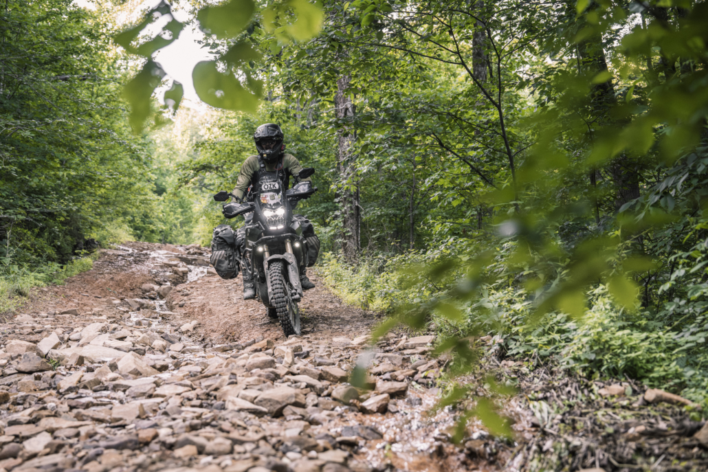
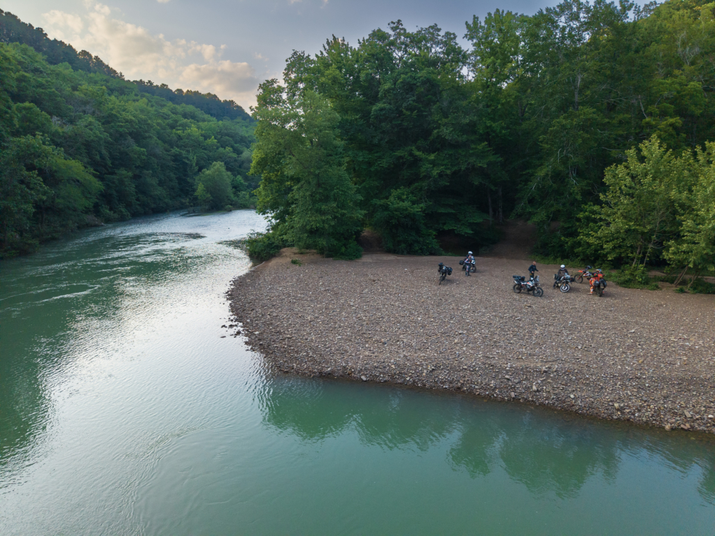
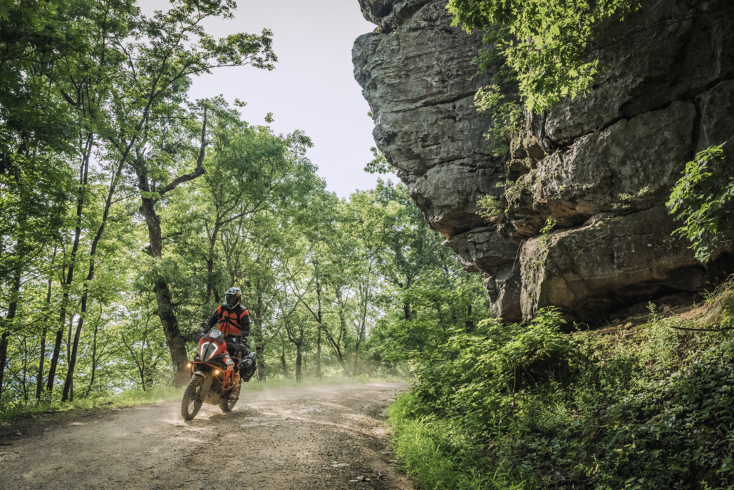
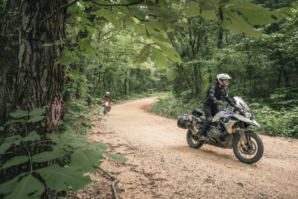
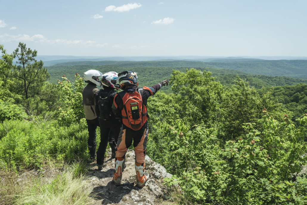
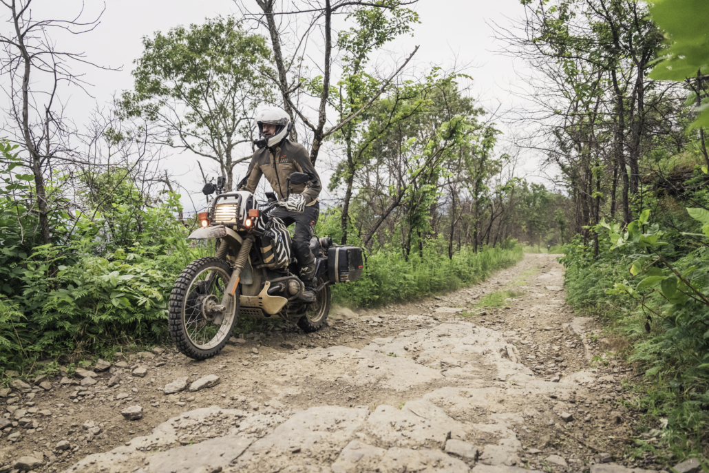
The Ozarks BDR-X is a 480-mile backcountry adventure route through the Ozark–St. Francis National Forest in northwest Arkansas. Riders will experience some of the very best riding in The Natural State, traveling through dense, lush forests, crossing pristine rivers, passing towering rock cliffs, and carving through scenic twisty pavement.

Carefully designed for adventure and dual-sport riders, this highly anticipated route features flowing dirt roads, primitive two-track, dozens of water crossings, and 8 optional advanced sections, the most of any BDR route to date.

Riders throughout Arkansas, Missouri, Oklahoma, and the greater Midwest now have a world-class adventure route right in their backyard.

Thank you to the Presenting Sponsors, All Terra by Alpinestars and Moto Camp Nerd.  Additional support was provided by Mach 1 dealership and So Live So Ride Moto Ranch.

ATTENTION: Since the map was printed, we have re-ridden the route and made several updates. Please visit the Route Updates page for detailed information before your trip. These changes are included in the current GPS tracks available for download, but are not reflected on the printed map, as they were made after it went to print.

PURCHASE THE MAP

Ozarks Arkansas BDR-X Map: First Edition, dated: February 2026

SECTION-BY-SECTION

JASPER TO DEER – 91 miles

Enjoy a cozy stay in the quaint town of Jasper, nestled along the Buffalo National River, America’s first designated free-flowing, undammed river, before embarking on this incredible adventure. The route hits fun primitive dirt roads dropping steadily to the valley below where if the water level allows, you can cross a concrete low bridge at the Buffalo River to access the historic Parker-Hickman farmstead.

Erbie Road twists and turns west, leading to a great stretch of pavement into the town of Ponca where you can refuel and resupply. The first optional ALT Harder track starts here as the main route diverts around, reconnecting with a nice stretch of flowy gravel roads. Two more ALT Harders are available, while the main route passes the iconic Hawksbill Crag hiking trail followed by a blissful stretch of primitive forest roads and a concrete low bridge crossing that can be impassable when high. Take a short hike to the scenic Alum Cove Natural Bridge before arriving in Deer. This small town has no lodging and fuel is unavailable Sundays, so riders may elect to ride 20 min back to Jasper for a second nights’ stay.

Buck & Bear Cabins

Cabins are available for $160 per night for two guests. Additional guests (up to six total) are $60 per person, per night, plus taxes and fees. There is no minimum stay, with a maximum of six nights. Rider-friendly amenities include a bike wash with a pressure washer, a small garage for light repairs, and parking for vehicles and trailers while guests ride. To receive 10% off, guests can visit the website, click Book, select their dates, then send an Airbnb inquiry and mention BDR-X.

  • Address: Located 1 mile North of Jasper off Hwy 7
  • Phone: (870) 414-3799
  • Visit Website »

Arkansas House Inn

  • Address: 215 E Court St, Jasper, AR 72641
  • Phone: (870) 446-5900
  • Visit Website »

Little Buffalo Terrace


Sommer House Inn


Little Switzerland Cabins

  • Address: Scenic Byway 7, Jasper, AR 72641
  • Phone: (870) 446-2693
  • Visit Website »

Buffalo Outdoor Center Cabins


Horseshoe Canyon Ranch


Wilderness Rider Buffalo Ranch and Adventure Park (Campground)


JB Trading Co (Campground)

  • Address: 12677 AR-43 S, Compton, AR 72624
  • Phone: (870) 420-3065
  • Visit Website »

Dogwood Springs Campground


Erbie Campground


Kyle’s Landing Campground


Steel Creek Campground

Ozark Cafe
Legendary diner open every day except Christmas for breakfast, lunch, and dinner.

  • Address: 107 E Court St, Jasper, AR 72641
  • Phone: (870) 446-2976
  • Visit Website »

Jasper Pizza Company

  • Address: 207 Stone St, Jasper, AR 72641
  • Phone: (870) 446-2505
  • Visit Website »

Low Gap Cafe
Fantastic restaurant with high-quality local cuisine just outside of town.

  • Address: 601 Court St, Jasper, AR 72641
  • Phone: (870) 861-5848
  • Visit Website »

Peggy Sue’s Coffee
Quaint coffee shop with great drinks and pastries.

  • Address: 203 Court St, Jasper, AR 72641
  • Phone: (870) 446-2312

JB Trading Co
Gas station with food, supplies, and camping.

  • Address: 12677 AR-43, Compton, AR 72624
  • Phone: (870) 420-3065
  • Visit Website »

Buffalo Outdoor Center
Sandwiches, drinks, camping supplies, and more.


Deer Country Store
Gas station with small restaurant offerings

  • Address: Hwy 16 On the Curve, Deer, AR 72628
  • Phone: (870) 428-5202
  • Visit Website »

Jasper

JB Trading Co

Buffalo Outdoor Center Ponca

Deer

Buffalo National River
America’s first designated National River, this 153-mile free-flowing river winds through the Ozarks with towering bluffs, clear water, and outstanding opportunities for paddling, hiking, camping, and wildlife viewing.


Parker Hickman Farmstead
A well-preserved 19th-century Ozark homestead featuring one of the oldest standing log structures in the Buffalo River area, offering a glimpse into early pioneer farming life.


Kapark Cemetery
A small, historic Ozark cemetery tucked into the hills, reflecting the region’s early settlers and offering a quiet, scenic glimpse into local history.


Hawksbill Crag Trailhead
Trailhead to Whitaker Point, one of Arkansas’s most iconic overlooks, features a dramatic rock ledge jutting out over the valley and a relatively easy hike with stunning views.


Historic Boxley Church
A picturesque historic church in Boxley Valley, surrounded by working farms and elk habitat, represents the area’s deep agricultural and cultural roots.


Alum Cove Natural Bridge
A unique 130-foot natural sandstone arch formed by erosion, accessible via a short scenic hike featuring caves, bluffs, and small waterfalls.

DEER TO MOUNTAINBURG – 130 MILES

Advanced riders can tackle the first ALT Harder, reconnecting with the main route along the majestic Big Piney Creek. This next stretch is a highlight and features ruts, rocks, creek crossings, and the potential for mud, along with great dispersed camping options.

Blissful gravel roads lead to County Road 26, a splendid primitive road with yet another crossing of the Big Piney Creek. Take a spin up to Devil’s Knob for incredible views before a short stretch of nice pavement.

Then, you can detour into Oark for gas and food if needed, and take the optional harder section if you’re up for a big challenge while the main route continues on forest roads past the Spoke Plant Hollow overlook.

Fly Gap Road meanders through the dense woods, giving way to open valley vistas as you make your way west, connecting to tighter forest roads, past Lake Fort Smith and into the town of Mountainburg.

This quaint town has food and gas, and lodging can be found off-route in nearby Alma.

Mill Creek Outfitters
The property offers camping cabins, RV and tent sites, 91 octane fuel, riding accessories, beer, ice, and a well-maintained bathhouse. It also provides convenient ride-in/ride-out access to the Ozark National Forest trails and the Ozarks BDR-X route.

  • Address: 145 Madison 5334,  Combs, AR 72721
  • Phone: (870) 692-3625
  • Visit Website »

Beard and Lady Inn

  • Address: 411 E Front Ave, Chester, AR 72934
  • Phone: (479) 997-5469
  • Visit Website »

Deer Hollow Cabins

  • Address: 13040 Schaberg Rd, Mountainburg, AR 72946
  • Phone: (479) 995-9242
  • Visit Website »

Quality Inn Alma


Serenity Campground

  • Address: 139 Madison 4372, Combs, AR 72721
  • Phone: (479) 209-2364
  • Visit Website »

Ray’s Grocery Store
Service station with fuel and food just west of Deer.

  • Address: AR-16, Deer, AR 72628
  • Phone: (870) 428-5947

MJ’s Tin Box Cafe

  • Address: 11652 N Hwy 348, Mountainburg, AR 72946
  • Phone: (479) 650-0293
  • Visit Website »

Pizza Den

  • Address: 1816 N Hwy 71, Mountainburg, AR 72946
  • Phone: (479) 369-0131

Neon Moon

  • Address: 326 Hwy 71 SE, Mountainburg, AR 72946
  • Phone: (479) 369-1705

Dairy Dream

  • Address: 1600 Hwy 71 NW, Mountainburg, AR 72946
  • Phone: (479) 406-8115

Ozark Mountain Grill

  • Address: 8265 AR-282, Alma,

Ray’s Grocery Store

Oark (off route)

Combs (off route)

St Paul (off route)

Mountainburg

Devil’s Knob Overlook
A scenic viewpoint offering sweeping vistas of the Ozark National Forest, with expansive views of forested ridges and valleys that are especially striking at sunrise and sunset.


Spoke Plant Hollow Overlook
A lesser-known overlook featuring quiet, panoramic views into a rugged hollow, showcasing the remote beauty and layered terrain of the Ozarks.


Hanging Rock
A dramatic rock outcrop perched above the surrounding forest, providing a striking vantage point and a popular stop for photos and short hikes.


Historic Mountain Crest Academy
A historic rural school building dating back to the early 20th century, reflecting the heritage of education and community life in the Ozark Mountains.


Lake Fort Smith State Park
A scenic state park at the western edge of the Ozarks offering lake access, hiking trails, camping, and access to the Ozark Highlands Trail, with excellent opportunities for outdoor recreation.

MOUNTAINBURG TO OARK – 103 MILES

Departing Mountainburg, the main route climbs via pristine twisty pavement, connecting to flowy dirt roads as you cruise along Hurricane Creek Rd. White Rock is a must see, featuring cabins, camping, and spectacular views with a nice general store (day use fee required).

Meander through the dense forest on amazing dirt roads and twisty pavement as you spin past Shores Lake with a great overlook. Apple Tree Rd is a great stretch of dirt passing by a picture-worthy rock arch before you cross the bridge over the Mulberry River into Turner Bend for fuel and supplies.

The final stretch of Section 3 features flowy gravel roads and nice pavement past Horsehead Lake, followed by a rocky climb heading north, with scenic Hwy 103 leading to the small town of Oark. This legendary general store features fuel, supplies, and the best home cooking around. Aside from a few cabin rentals, there is no lodging here, so riders may wish to plan for traditional lodging off-route in Ozark or Clarksville.

Crooked H Cabin on the Mulberry River
Just a short ride from the Ozark BDR-X, Crooked H Cabin is the perfect spot to rest, recharge, and enjoy the outdoors. Keep bikes safe under the covered carport, swim or fish in the river, and relax by the campfire. With plenty of parking and peaceful scenery, it’s ideal for pausing mid-ride or launching your Ozark BDR-X adventure.

  • Address: 17207 Clyde Brown Road, Ozark, AR 72949
  • Phone: (479) 970-5361
  • Visit Website »

White Rock Lodge Cabins
Incredible cabins perched high above the valley below, with a nice general store. Cabins have beds, but guests must bring towels and sleeping bags. 2 night minimum is required for cabins, so this makes a great basecamp to run two sections. 100% of proceeds go to improvements of the facilities.
Full campground also on site. Reservations for cabins must be made in advance on the website.

  • Address: 214 Bowles Gap Rd, Winslow, AR 72959
  • Phone: (479) 369-4128
  • Visit Website »

Turner Bend Store, Cabins and RV Park
Cabins and campground alongside the lovely Mulberry River


Mulberry Mountain Lodging and Events

  • Address: 4117 Mulberry Mountain Loop #9306, Ozark, AR 72949
  • Phone: (479) 667-1919
  • Visit Website »

Byrd’s Adventure Center
Cabins and camping along the Mulberry River

  • Address: 7037 Cass Oark Rd, Ozark, AR 72949
  • Phone: (479) 667-4066
  • Visit Website »

Mary’s Cottages (Airbnb)
Located right next to the Oark Cafe


Horseshoe Lake (Campground)


Shores Lake (Campground)


Plenty of additional lodging options can be found just off the route along the I-40 corridor in Ozark, Clarksville, and Russellville.

Turner Bend Store, Cabins and RV Park
Fresh-made sandwiches, snacks, drinks, and supplies.


Oark General Store
Legendary general store with fuel and incredible burgers and pies. Cafe closed on Tuesdays, and fuel is available 24/7 across the street.

  • Address: 117 Co Rd 5241, Oark, AR 72852
  • Phone: (479) 292-3351
  • Visit Website »

Turner Bend

Oark

White Rock Mountain
A stunning high-elevation destination in the Ozark National Forest known for its sweeping bluff views, rugged terrain, and excellent hiking and camping opportunities.


Shores Lake
A peaceful lake surrounded by forested hills, popular for camping, fishing, swimming, and access to nearby hiking trails in the Ozarks.


Campbell Cemetery
A small, historic cemetery tucked into the Ozark hills, offering a quiet glimpse into the region’s early settlers and local heritage.


White Rock Arch
A unique natural rock formation carved into the bluff at White Rock Mountain, offering a scenic photo spot with expansive valley views.


Mulberry River
One of Arkansas’s premier free-flowing rivers, known for its clear water, scenic beauty, and excellent opportunities for floating, fishing, and riverside camping.


Horsehead Lake
A serene mountain lake offering fishing, kayaking, and camping, surrounded by rolling Ozark forest and quiet backcountry scenery.

OARK TO JASPER – 157 MILES

The fun continues through a highlight section of the route featuring a series of primitive, rocky, and rustic forest roads with numerous creek crossings as you make your way toward Ozone. Riders can stop at Red Lick for fuel and supplies, while an ALT Harder section awaits, rejoining the main route near the impressive Strawberry Bluffs viewpoint. Enjoy a short stretch on Hwy 123 and another optional challenge section as the main route follows twisty gravel roads to Pilot Knob, the final ALT Harder on this route.

Through a continuous stretch of flowy paved and gravel roads, join North Fork Road as you make your way through the Richland Creek Wilderness, a beautiful stretch of pristine forest with multiple waterfalls.

After a short run on tight two-track, the route tops out again on Hwy 123 as you descend the incredible Arkansas Dragon Switchbacks into Mt. Judea where food and fuel are available.

Interspersed pavement and dirt bring the final miles to a close as you descend into Jasper for the completion of an epic adventure.

There are minimal traditional lodging opportunities along this section, but plenty of additional options can be found just off the route along the I-40 corridor in Ozark, Clarksville, and Russellville.

See Section 1 listings for lodging in Jasper.


So Live So Ride Moto Ranch
ADV-centric motorcycle ranch with adventure rider training, special events, tent camping and canvas cabin tents.


Long Pool Recreation Area (Campground)


Haw Creek Falls (Campground)


Ozark Ridge Campground

  • Address: 138 Co Rd 4540, Ozone, AR 72854
  • Phone: (479) 774-4470
  • Visit Website »

Ozone Recreation Area (Campground)

Grumpy’s Burger Barn
Fantastic burgers and sandwiches in a food truck.

  • Address: 14499 AR-21, Ozone, AR 72854
  • Phone: (479) 214-4485

Red Lick Country Store
General store with fuel and hot food, drinks, and supplies.

  • Address: 6336 AR-21, Clarksville, AR 72830
  • Phone: (479) 754-4666

Kent General Store
Burgers, sandwiches, drinks, and supplies in a gas station

  • Address: 123 Main St, Mt Judea, AR 72655
  • Phone: (870) 434-5544
  • Visit Website »

Red Lick

Hector (off route)

Mt Judea

Jasper

Pilot Knob
A prominent Ozark peak offering scenic views of the surrounding forested landscape, accessible via backroads and short hikes.


Falling Water Falls
One of the most popular waterfalls in Arkansas, featuring a wide cascade that flows directly beside the road, making it easily accessible and a great photo stop.


Richland Creek Wilderness
A rugged and remote wilderness area known for its crystal-clear streams, waterfalls, and challenging hiking terrain within the Ozark National Forest.


Sam’s Throne Hiking Trail
A well-known hiking area featuring dramatic sandstone bluffs and overlooks, popular for both hiking and rock climbing with expansive valley views.


Arkansas Dragon Switchbacks
A thrilling stretch of tight, winding pavement featuring numerous switchbacks, popular with motorcyclists for its technical riding and scenic Ozark backdrop.

OZARKS PACKING LIST

This packing list serves as an example and is not intended to be a complete list for your backcountry riding needs. Feel free to customize this list to work for you.

  • Helmet
  • Boots
  • Goggles
  • Gloves (2 sets)
  • Protective gear (pressure suit, Leatt brace, knee braces)
  • Jacket
  • Pants
  • Balaclava or neck gaitor
  • Water bladder or bottle
  • Hydration pack
  • Ear plugs

OZARKS MOTORCYCLE DEALERSHIPS

Mach 1 Motorsports

Rogers, AR

WEBSITE

Mach 1 Motorsports in Rogers, Arkansas is your family-owned gateway to some of the best riding in the country. With winding roads, hidden trails, and endless ADV opportunities right in our backyard, the Ozarks offer adventure at every turn, and we're here to make sure you're ready for it. We've recently added Indian and Triumph to our lineup, with Ducati and BMW Motorrad opening soon. Whether you're looking for a new or used bike, parts, gear, or expert advice on the best local routes, we've got you covered. As a family-owned shop, we understand that buying a motorcycle is personal. We're here to listen, help you find the right ride, and get you out on those beautiful Ozark roads. Stop by and tell us about your next adventure. We'd love to be part of it. Mach 1 Motorsports | Rogers, AR 72756 Your Ozark adventure starts here.

FREQUENTLY ASKED QUESTIONS

Below are answers to some Frequently Asked Questions about the Ozarks Arkansas BDR-X.

The Ozarks BDR-X is a 480-mile route through the Boston Mountains of the Ozark St. Francis National Forest in northwest Arkansas. Riders will experience the very best adventure riding in The Natural State, through dense, lush forests, pristine rivers, towering rock cliffs, and twisty tarmac full of abundant scenery. This route is carefully crafted for dual-sport and adventure riders and features a collection of flowy dirt roads, primitive two-track, countless water crossings, and ten optional advanced sections, the most of any BDR to date.

The Ozarks BDR-X can be ridden year-round, with mid-March through mid-November being the best time to enjoy this route. Spring and early summer are beautiful but especially prone to fierce thunderstorms, which can bring dangerous flood conditions, impassable river crossings, and downed trees. Fall is colorful and generally mild, but leaf coverage can make rocky sections difficult to read. Freezing temperatures with snow and ice are possible in winter. Always check weather forecasts and local conditions before heading out. **If this region experiences heavy rainfall within 2-4 days prior to your ride, you may face impassable conditions through water crossings**

Many portions of the main route are very remote and feature tight switchbacks, dense forest, and primitive roads that can be prone to ruts, washouts, rocks, and mud. Beginners will face adversity, especially in poor weather conditions. This route features 8 optional ALT Harder tracks that are technical and suitable only for highly-experienced advanced riders.

The Ozarks are a rugged landscape in a region prone to fierce thunderstorms, rain, hail, and even tornadoes. Riders should use extra caution in spring and early summer and avoid riding this route during or immediately after a heavy rainstorm. This route features dozens of creek crossings, some of which can be deep, swift, and treacherous to cross when high.

If riding this route during the rainy season, before and during your ride, click HERE or HERE for current water level conditions. If the gauge at Ponca reads around or above 4.25 feet, use extra caution as some crossings may be impassable.

**If this region experiences heavy rainfall within 2-4 days prior to your ride, you may face impassable conditions through water crossings**

Just 12 inches (about 1 foot) of fast-moving water can carry away most cars, while two feet can sweep away SUVs and trucks, demonstrating that even shallow, rushing water possesses immense force, capable of lifting vehicles off the road and pushing them downstream. This powerful effect comes from the hydraulic force and buoyancy of the water, making flooded roads extremely dangerous, even if they look shallow.

This route was designed to be ridden counter-clockwise, starting from Jasper, but can be started from anywhere and ridden in either direction. Use caution in the many blind turns and Ride Right to avoid head-on collisions with other traffic, including Jeeps and side-by-sides.

The time it takes to ride a BDR can vary based on many factors, including your fuel range, preparedness, riding skill, stamina, breakdowns, weather, and many other factors. This route is divided into four sections, which does not necessarily mean the number of days or how you should break up your trip. On average, this route will take riders 3-5 days to complete.

Street legal motorcycles with a license plate can ride this route. No other permits or passes are required.

The Ozarks BDR-X features 8 optional advanced sections, each presenting various levels of challenge suitable only for highly experienced riders. These sections may feature very rocky, technical terrain, large river crossings, steep hills, and deep ruts. Review the website section descriptions, printed map, and documentary film for more detailed information on each optional ALT Harder.

Cell service and EMS response are extremely limited throughout this region, and an emergency satellite communication device is highly recommended.

With a few exceptions, this route is almost entirely within the National Forest, so you can disperse camp for free within the National Forest boundary. There are dozens of great established fee campgrounds indicated on the official map, GPS tracks, and interactive map. Always practice Leave No Trace principles when camping and exercise extreme caution with campfires, and follow local regulations and restrictions.

Bears and mountain lions are in this region, so use caution and practice proper food storage.

Ticks are also common, especially in spring and summer, and can carry disease. Check yourself carefully each night and properly remove them. We also recommend carrying bug spray and treating your clothing and camping gear with permethrin prior to your trip, which can be found online and in many local retailers.

Always check with local ranger stations to determine if campfires are allowed before you build one. In most cases, campfires are only allowed in established fire rings. If you are dispersed camping, we don’t suggest building fires. Instead, bring a camp stove for cooking and boiling water to avoid the risk of wildfires. Be sure to fully extinguish fires so they are DEAD-OUT. Use water to ensure a fire is fully extinguished, and the ground is left cool and wet.

The longest distance between available gas on the Ozarks BDR-X is the entire span of Section 2 from Deer to Mountainburg at approx 130 miles. Fuel is available off-route in Oark, St. Paul, and Combs. Even if your bike’s range is well beyond the gas stop distances, we recommend always topping off your gas and carrying extra fuel. **Some gas stations in this region do not have credit card readers, and some can be closed on Sundays**

The Ozarks BDR-X has very limited traditional lodging opportunities directly on the route. However, many adjacent towns feature additional options with a short detour, especially along the I-40 corridor. Airbnb or cabin rentals may be available in some areas, and all lodging should be booked in advance. In many cases, if you are looking for a traditional hotel, you may need to divert from the route and backtrack the next day to where you left off.

This route cannot be ridden without the use of GPS tracks. Be prepared and bring the official BDR Map and your navigation device with the latest GPS tracks loaded. Free GPS tracks are available for download on this site. The route can also be navigated using a smartphone GPS navigation app, such as onX Offroad, Gaia GPS, Rever, and others. The Ozarks BDR-X expedition documentary film is a great source of information about the route and is available for free on YouTube.com/ridebdr.

Any modern GPS unit capable of handling multiple tracks with a minimum of 1500 points each is suitable. Garmin models that work best for this application are: Zumo XT, XT2, Zumo 590/595/395/396, Montana, and 276Cx. Many other GPS units are compatible with the GPX file format. Check the owner’s manual of your device for more information. You can also import the tracks into a free GPS navigation app, such as onX Offroad or Gaia GPS, but we recommend you upgrade to the premium version so you can download and navigate via offline maps.

Cell phone service is sparse on this route and non-existent in many areas. A satellite communicator, sat phone, or GPS tracking device is highly recommended for emergency situations such as a Garmin InReach so you can call for help or text without cell service (subscription required).

Any adventure or dual sport bike that has a license plate, can run knobby DOT tires, has adequate suspension, can carry the gear you will need, and has enough fuel range. Most adventure or dual-sport motorcycles will be suitable for the trip.

DOT-approved knobby tires are strongly recommended. Riding this route without at least a 50/50 tire (50% dirt, 50% road) would not be advisable.

Segments of this route can be ridden two-up for those experienced in riding rugged unpaved roads with a passenger and luggage, but many segments would be challenging with a passenger, and it’s not recommended.

Please don’t go off the route anywhere where it’s gated or signed for seasonal or permanent closures, and don’t ever venture onto private property.

This route may include a few instances where the track follows an easement road through private land. In many, but not all cases, the land owners have installed “private land” signs, and it is important that riders acknowledge these signs and stay on the designated track. If you are unsure of the land ownership adjacent to the roads, it’s best to stay on the track to avoid trespassing. In all cases, riders should never ride off the road which damages vegetation. Please remember that riding off the designated roads can jeopardize our right to use these roads for recreation.

This route may have seasonal gates in place at any time, but especially in the early riding season and late fall. There may be temporary closures when crews are repairing washouts, downed trees, and other road hazards. If roads are closed, please do not ride around the signs, as that can put you and work crews in danger and can get you a hefty fine. Check the BDR website for route updates before you go.

Please abide by posted road closure signs. Ignoring these signs is a sure way of getting a road closed for good. That said, sometimes locals will post unofficial “road closed” or “dead end” signs on public roads for their own personal reasons. Additionally, land managers may not have removed a “closed” sign from a seasonal road – even though the sign right next to it clearly displays the open/closed dates. In these cases, use your best judgment – if in doubt, navigate around the closed road and report it to BDR. And please remember never to engage in arguments with local landowners.

Each state has its own recreational fishing requirements and restrictions. Check local websites for each state for restrictions and permitting info if you intend to fish.

We do our best to post the most up-to-date information about the route on the website. We depend on the BDR community to inform us about route and road conditions, so if you encounter any road closures or severe conditions that are worth reporting, please contact us with the information.

There is also a dedicated Facebook group page. We recommend that you join the group prior to your trip to read trip reports and comments from other riders about their experience on the route. Search for: Ozarks BDR-X Backcountry Discovery Route.

Arkansas is a habitat for many animals like deer, bears, mountain lions, as well as smaller animals like armadillos, skunks, possums, and snakes — all of which make their way to the road at some point. Be alert everywhere you go as animals can and will cross your path along the route – especially in the morning and at dusk. Deer are a major concern throughout this route, and you can expect to see many of them, so ride with extra caution.

Slow down as soon as you see animals, as they like to cross in front of bikes. Appropriate food practices while camping are an absolute must for your safety and the animal’s safety. 

Yield to all animals, whether wild, domestic, or livestock, by slowing down or stopping. Many locals in rural areas keep their dogs off-leash on their property, and dogs love to chase motorcycles – be cautious and considerate.

All of the roads used on the Ozarks BDR-X are public and open to licensed vehicles. If you do decide to drive this route, you will need a reliable 4×4 with high clearance, and full recovery gear is highly encouraged. The optional ALT Harder tracks will require a dedicated 4WD rig and should not be attempted in a stock vehicle. Always stay to the right and go slow around blind corners to avoid head-on accidents with others using the roads. We recommend traveling in the direction of the GPX tracks as this is intended to minimize head-on traffic.

It is absolutely essential that you Ride Respectfully and follow the tips outlined in our Ride Respectfully campaign.  Remember, it’s up to all of you to preserve our access – we can easily lose access to many of these roads if we don’t practice proper etiquette. Always represent BDR and the ADV community in the best light.

Rating the Routes by Difficulty

We are often asked if we rate BDRs by difficulty. We don’t officially rate the difficulty level of our routes as it varies daily due to current weather, road conditions, and other unpredictable factors. Difficulty also depends on individual skill and fitness level, bike and tire selection and load carried.

Some riders find sand to be most challenging, some find mountain passes difficult. Each rider’s perception is unique.

While we can’t provide a standardized rating like ski resorts, we can provide some basic guidance on difficulty level. These groupings do not include optional harder sections and imply favorable road and weather conditions:

BDR ROUTES:

Moderate: Idaho, Mid-Atlantic, Southeast

Challenging: California North, Colorado, Montana, Nevada, New Mexico, Northeast, Oregon, Wyoming

Difficult: Arizona, California South, Utah, Washington

BDR-X ROUTES:

Moderate: PA Wilds, Texas Hill Country

Challenging: Black Hills, Chattahoochee, Lost Coast

Difficult: Big Bend, Ozarks, Red Desert, Steens-Alvord

Review the FAQs for each route before your trip.

Backcountry Discovery Routes is a 501c(3) non-profit corporation. © 2026 Backcountry Discovery Routes, Inc. All rights reserved. Terms of Use.