Big Bend Texas BDR-X
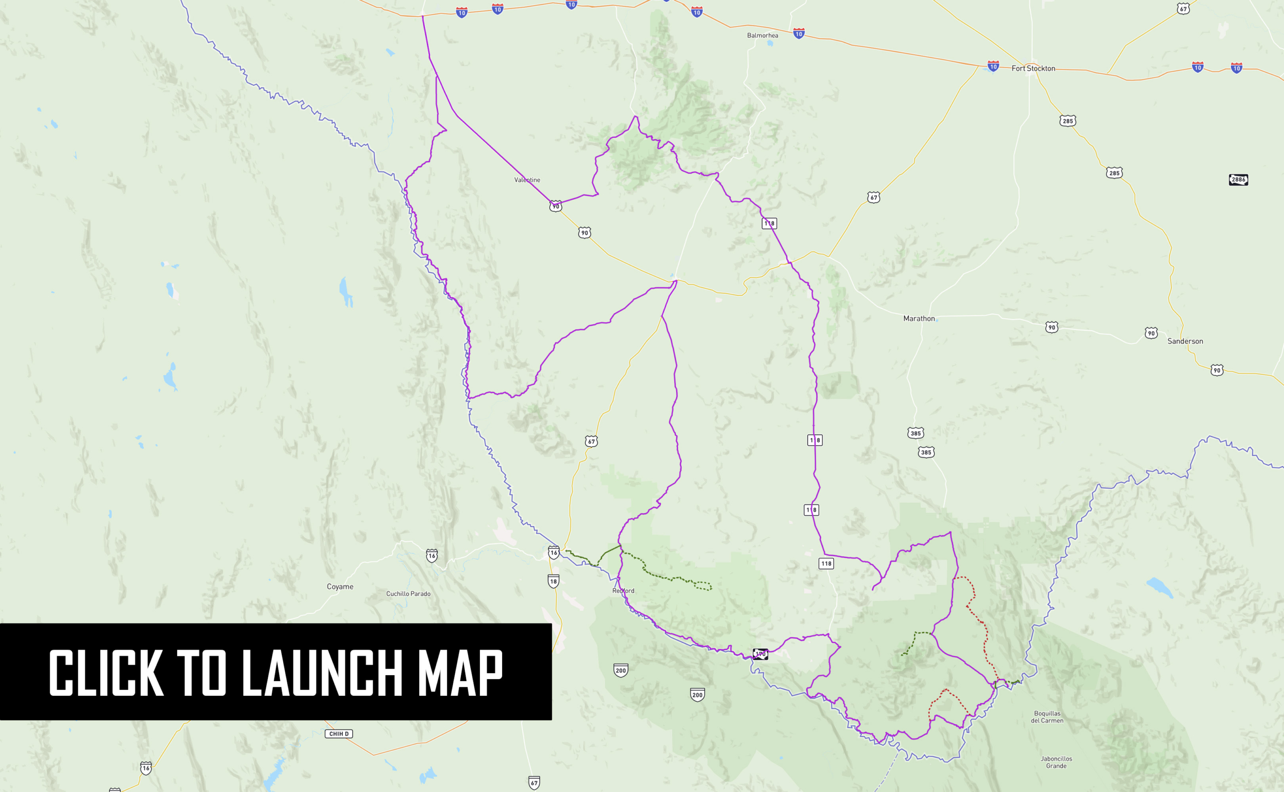
The Big Bend, Texas BDR-X is the latest addition to BDR’s lineup of X routes, which are “shorter BDR-style routes that loop”, tailored for dual-sport and adventure motorcycle travel. Set against the rugged landscape of west Texas in the largest protected portion of the Chihuahuan Desert in the United States, and within the unique backdrop of the Rio Grande river, this route stands out as a premier destination for adventurous riders seeking a remote and unforgettable journey.
Spanning 618 miles, this route weaves through the iconic terrain of Big Bend National Park, Big Bend Ranch State Park, and other remote wilderness, offering a unique off-pavement adventure. Riders can explore the untamed beauty of the Chisos Mountains, encounter hidden historical gems, experience vibrant artistic communities, and even venture into Mexico with an optional foot crossing.
This route is an immersive riding experience in the heart of Texas’ ‘Gift to the Nation,’ making it a must-visit destination for riders seeking an authentic and unforgettable desert adventure.
Important Route Update in Section 3 – Terlingua Ranch
We’ve recently learned that certain roads within Terlingua Ranch lack public easements. As a result, we have removed the Terlingua Ranch portion from Section 3 of the route. We’re exploring potential alternatives, but for now, please respect the private property in this area and avoid riding this segment to help maintain positive relationships with local residents and landowners.
The GPX tracks have been updated. Remember to download the latest route tracks before your trip. Download the latest tracks here.
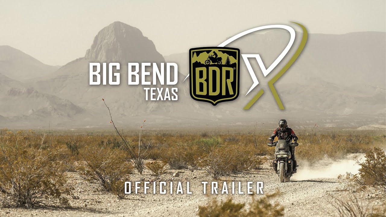
WATCH THE TRAILER
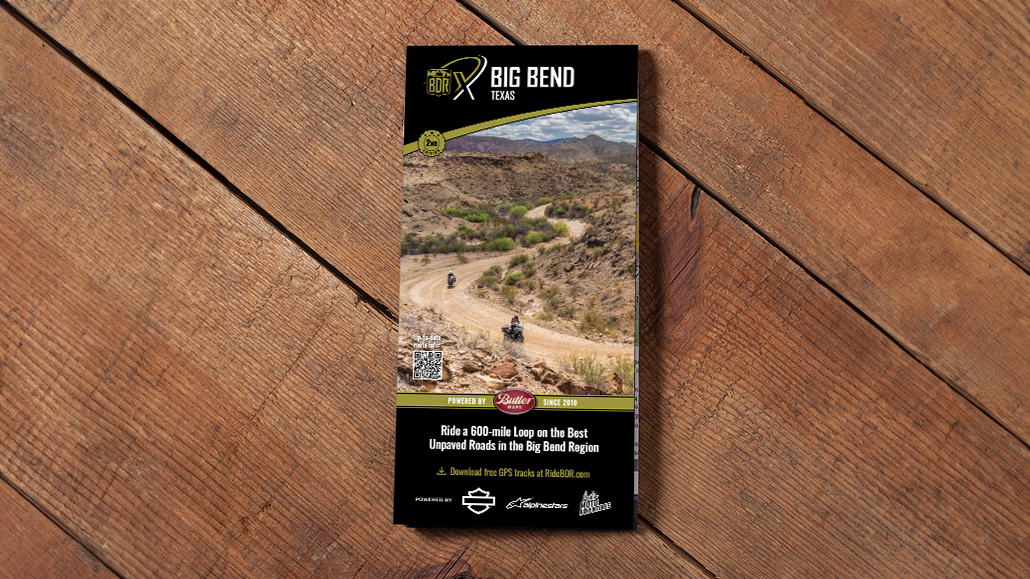
PURCHASE THE MAP
The latest version of the Big Bend BDR-X map is the First Edition, dated: October 2024
SECTION-BY-SECTION
TO RIO GRANDE VILLAGERIO GRANDE VILLAGE
TO STUDY BUTTESTUDY BUTTE
TO PRESIDIOPRESIDIO
TO VAN HORNVAN HORN
TO ALPINE
ALPINE TO RIO GRANDE VILLAGE – 143 miles
Your journey begins in Alpine, where you’ll find ample options for food, fuel, and lodging. Be sure to fuel up, and as you head south, keep an eye out for herds of Aoudad, the majestic Africa wild sheep transplanted here. Turning east, you’ll transition from paved to dirt roads. Reduce your speed and navigate carefully. A rest stop at Terlingua Ranch offers food, cold drinks, and accommodations.
Entering Big Bend National Park, you’ll encounter a brief but exciting stretch of primitive two-track, which may feature patches of deep sand. After reaching Highway 385, the route becomes paved and continues to the Fossil Bone Exhibit and Panther Junction, which has food, fuel and entrance passes.
For experienced riders, an optional harder route on Old Ore Road provides a challenging 29-mile experience through rugged desert terrain, including rocky climbs, off-camber turns, switchbacks, and sand. There are no bailouts on Old Ore Road, and while this section is not for the faint of heart, the challenge is worth the reward. Although this section is just 29 miles long, expect it to take some time as it’s fairly rugged all the way through.
Meeting the mighty Rio Grande, visit Boquillas Overlook for panoramic views and the optional excursion into Mexico at Boquillas Crossing. Don’t forget your passport!
Section 1 concludes at Rio Grande Village, where you can find fuel and supplies at the general store (available from 9 am to 5:30 pm). Be sure and pay your entrance fee at the visitor center if you haven’t already. There is no lodging here, but a campground is available. For additional lodging and camping, head to Chisos Basin, located high above the desert floor, or exit the park and stay in Study Butte or Terlingua. Reservations are required in advance for all park accommodations.
LODGING
The Maverick Inn, TX
- Address: 1200 E Holland Ave, Alpine, TX 79830
- Phone: (432) 837-0628
- Visit Website
The Holland Hotel
- Address: 209 W Holland Ave, Alpine, TX 79830
- Phone: (432) 837-2800
- Visit Website
Terlingua Ranch Lodge
Rustic lodging in a remote setting directly on the route.
- Address: 16000 Terlingua Ranch Rd, Terlingua, TX 79852
- Phone: (432) 371-3146
- Visit Website
Rio Grande Village Campground
- Address: Big Bend National Park, TX 79834
- Phone: (432) 477-2251
- Visit Website
Chisos Mountain Lodge & Campground (off route)
Hotel and campground with restaurant perched high above the valley floor.
- Address: 1 Basin Rural Station, 1 Basin Jct Station, Big Bend National Park, TX 79834
- Phone: (432) 477-2291
- Visit Website
FOOD
Terlingua Ranch Lodge
- Address: 16000 Terlingua Ranch Rd, Terlingua, TX 79852
- Phone: (432) 371-3146
- Visit Website
Panther Junction
Gas station with basic necessities.
- Address: Big Bend National Park, TX 79834
- Phone: (432) 477-2294
- Visit Website
Rio Grande Village Store
Convenience store with gas and food. Open 9am-5:30pm daily.
- Address: Big Bend National Park, TX 79834
- Phone: (432) 477-2293
- Visit Website
FUEL
Panther Junction
Gas station with basic necessities.
- Address: Big Bend National Park, TX 79834
- Phone: (432) 477-2294
- Visit Website
Rio Grande Village Store
Convenience store with gas and food. Open 9am-5:30pm daily. No pay at pump.
- Address: Big Bend National Park, TX 79834
- Phone: (432) 477-2293
- Visit Website
DISCOVERY POINTS
Museum of the Big Bend
Convenience store with gas and food. Open 9am-5:30pm daily.
- Address: 400 N Harrison St C-101, Alpine, TX 79832
- Phone: (432) 837-8730
- Visit Website
Fossil Discovery Exhibit
- Address: Fossil Bone Exhibit, Big Bend National Park, TX 79834
Boquillas Crossing Port of Entry
Crossing into Mexico. Open 9am-4pm Wed-Sun. CLOSED Mon and Tue with no re-entry.
- Address: Big Bend National Park, TX 79834
- Visit Website
RIO GRANDE VILLAGE TO STUDY BUTTE – 83.6 MILES
The River Road is a true gem, traversing miles of rugged desert terrain, showcasing the raw beauty of this expansive wilderness. Take a break at Boquillas Hot Springs, accessible via a short scenic hike past the remnants of an old hotel, pictographs, and natural hot springs along the Rio Grande.
Midway along River Road, advanced riders can take Black Gap Road. This highly-challenging route includes deep ruts, steep descents, rough ledges, rocky terrain, and the notorious Black Gap—a ramp of stacked rocks cutting through the rock formation. Near the junction of these roads, riders can visit Mariscal Mine to view the impressive remains of a decommissioned mercury mine.
After a short but sweet stretch of pavement, stop at Elena Canyon Overlook for breathtaking views. Continue on Maverick Road, the final stretch of gravel leading out of the National Park and into the small towns of Study Butte and Terlingua.
Study Butte and Terlingua offer various lodging options and excellent dining spots. When in Terlingua, be sure to visit the Starlight Theatre for a great meal and a chance to relax on “the porch.”
CAUTION: River Road is a 52-mile stretch of continuous primitive dirt with no bailouts and takes longer than expected. Carry sufficient food, fuel and water as you will be far from assistance in this remote area.
LODGING
La Posada Milagro Guesthouse
- Address: 101 Milagro Way, Terlingua, TX 79852
- Phone: (424) 645-8017
- Visit Website
Ocotillos Village
- Address: 23006 FM 170, Terlingua, TX 79852
- Phone: (432) 300-6695
- Visit Website
Big Bend Holiday Hotel
- Address:100 Ivey Rd, Terlingua, TX 79852
- Phone: (432) 203-6929
- Visit Website
Buzzard’s Roost
- Address:333 Goat Trak Trl, Terlingua, TX 79852
- Phone: (432) 955-6244
- Visit Website
FOOD
Castolon Visitor Center
Basic necessities in a small general store. No fuel available.
- Address: 600, Ross Maxwell Scenic Dr, Big Bend National Park, TX 79834
- Phone: (432) 477-2666
Espresso y Poco Mas
- Address: 45 Milagro Way, Terlingua, TX 79852
- Phone: (432) 371-3044
- Visit Website
Starlight Theatre
- Address: 631 Ivey Rd, Terlingua, TX 79852
- Phone: (432) 371-3400
- Visit Website
DB’s Rustic Iron BBQ
- Address:10 Terlingua Ghost Town, Terlingua, TX 79852
- Phone:(432) 371-3939
- Visit Website
FUEL
Alon Gas Study Butte
- Address: TX-118, Terlingua, TX 79852
- Phone: (432) 371-2218
- Visit Website
DISCOVERY POINTS
Boquillas Hot Springs
Short hike with old structures to lovely hot spring pool on the Rio Grande.
Mariscal Mine
Santa Elena Canyon Overlook
STUDY BUTTE TO PRESIDIO – 111 MILES
Heading north from Study Butte, you’ll traverse a mix of gravel roads and primitive two-track, navigating through desert terrain with occasional obstacles and patches of sand before passing back through Terlingua.
Westbound on FM170, stop in Lajitas for food and fuel, and don’t forget to pick up your Big Bend Ranch State Park entrance pass at the Barton Warnock Visitors Center. Riders coming from the west should visit Fort Leaton for permits.
Enjoy a blissful stretch of paved road as you cruise alongside the Rio Grande before embarking on an optional 47-mile detour into Big Bend Ranch State Park. This scenic out-and-back route ends at the Sauceda Bunkhouse, where you can replenish water or stay overnight, with a reservation.
Section 3 concludes in Presidio, where you’ll find ample food, fuel, lodging, and another entry point into Mexico.
LODGING
Lajitas Golf Resort
- Address: 21701 FM170, Lajitas, TX 79852
- Visit Website
Sauceda Bunkhouse
Rustic bunkhouse with beds and camping. Reservations required.
- Address: Redford, TX 79846
- Visit Website
Three Palms Inn
- Address: 1200 Erma Ave, Presidio, TX 79845
- Phone: (432) 229-3211
- Visit Website
Riata Inn Presidio
- Address: 99205 US-67, Presidio, TX 79845
- Phone: (432) 229-2528
- Visit Website
FOOD
Lajitas General Store
Large general store with sandwiches, supplies and fuel
- Address: 55 Main Street, Lajitas, TX 79852
- Phone: (432) 424-5040
- Visit Website
The Bean Cafe
- Address: 506 O Reilly St, Presidio, TX 79845
- Phone: (432) 229-3131
- Visit Website
FUEL
Lajitas General Store
Large general store with sandwiches, supplies and fuel
- Address: 55 Main Street, Lajitas, TX 79852
- Phone: (432) 424-5040
- Visit Website
Valero
Large general store with sandwiches, supplies and fuel
- Address: 104 O Reilly St, Presidio, TX 79845
- Phone: (210) 345-2000
DISCOVERY POINTS
“The Porch” at Starlight Theatre
Terlingua Historic District
Big Bend Ranch State Park
Lodging and camping. Permits Required for entry. Reservations required for camping and lodging.
PRESIDIO TO VAN HORN – 129 MILES
After a brief stretch of highway, as the pavement ends in the village of Candelaria, you’ll begin one of the best parts of this route as you navigate through remote two-track roads along the Rio Grande. A notable feature is Godzilla Hill, featuring a long, steep climb followed by a challenging descent, marked by a distinctive rock formation resembling Godzilla.
This hill is considered impassable when wet, so if weather conditions are poor, turn back and use the optional bypass track to Marfa. This entire stretch along the Rio Grande is remote with no bailouts, so ensure you have all necessary supplies.
Watch for ranch gates and make sure to leave them as you found them. After extensive desert riding, you’ll rejoin the pavement for a short ride into Van Horn, where you can find food, fuel, and lodging
LODGING
Chinati Hot Springs
Rustic hot springs resort with great cabins and community kitchen. Advanced reservations required, not open to public walk-ins.
- Address: 1 Hot Springs Rd, Presidio, TX 79845
- Phone: (432) 229-4165
- Visit Website
Hotel El Capitan
- Address: 100 E Broadway, Van Horn, TX 79855
- Phone: (432) 283-1220
- Visit Website
Desert Inn
- Address: 401 E Broadway, Van Horn, TX 79855
- Phone: (432) 284-1714
- Visit Website
Holiday Inn
- Address: 1805 Frontage Rd, Van Horn, TX 79855
- Phone: (432) 283-0009
- Visit Website
Hampton Inn Van Horn
- Address:1921 Frontage Rd, Van Horn, TX 79855
- Phone: (432) 283-0088
- Visit Website
FOOD
Gilbert’s
- Address: 313 E Broadway, Van Horn, TX 79855
- Phone: (432) 284-9153
Broadway Cafe
- Address: 404 W Broadway St, Van Horn, TX 79855
- Phone: (432) 283-5090
FUEL
Pilot Van Horn
- Address: 501 Van Horn Dr, Van Horn, TX 79855
- Phone: (432) 283-8067
Valero
- Address: 500 Van Horn Dr, Van Horn, TX 79855
- Phone: (432) 283-1447
DISCOVERY POINTS
Godzilla Hill
VAN HORN TO ALPINE – 151 MILES
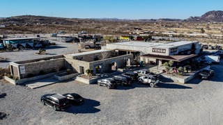
After several hundred miles of rugged dirt, Section 5 offers a rewarding stretch of smooth pavement. Departing Van Horn, make a stop at the Prada art installation before tackling some of the finest paved mountain roads in Texas. Highway 118 winds through dramatic terrain with continuous twists and turns. Consider a visit to the McDonald Observatory before descending into Fort Davis. This charming town provides food, fuel, lodging, and a historic fort to explore.
Continue south through Marfa, known for its eclectic vibe and artsy charm, before completing the final miles back to Alpine. Each of these towns — Alpine, Fort Davis, and Marfa — make an excellent starting or ending point for your adventure.
LODGING
Chinati Hot Springs
Rustic hot springs resort with great cabins and community kitchen. Advanced reservations required, not open to public walk-ins.
- Address: 1 Hot Springs Rd, Presidio, TX 79845
- Phone: (432) 229-4165
- Visit Website
Chinati Hot Springs
Rustic hot springs resort with great cabins and community kitchen. Advanced reservations required, not open to public walk-ins.
- Address: 1 Hot Springs Rd, Presidio, TX 79845
- Phone: (432) 229-4165
- Visit Website
FOOD
Blue Mountain Bar and Grill
- Address: 109 State St, Fort Davis, TX 79734
- Phone: (432)-426-3244
- Visit Website
Double Shot Coffee Lounge
- Address: Box 1207, 108 State St, Fort Davis, TX 79734
- Phone: (432) 426-3284
Para Llevar
- Address: 1203 E San Antonio St, Marfa, TX 79843
- Visit Website
Sazon Baja Mex
- Address: 901 E Holland Ave, Alpine, TX 79830
- Phone: (432) 538-7002
- Visit Website
Sentinel
- Address: 209 W El Paso St, Marfa, TX 79843
- Phone: (432) 729-7009
- Visit Website
FUEL
Quarles
- Address: 101 State St, Fort Davis, TX 79734
- Phone: (877) 444-3835
- Visit Website
Stripes
- Address: 109 E San Antonio St, Marfa, TX 79843
- Phone: (432)-729-3933
- Visit Website
DISCOVERY POINTS
Prada Store
Iconic art installation.
- Address: 14880 US-90, Valentine, TX 79854
McDonald Observatory
- Address: 3640 Dark Sky Dr, Fort Davis, TX 79734
- Phone: (432)-426-3640
- Visit Website
Fort Davis National Historic Site
- Address: 1504 State St, Fort Davis, TX 79734
- Phone: (432) 426-3224
- Visit Website
PLAN YOUR ADVENTURE
BIG BEND PACKING LIST
This packing list serves as an example and is not intended to be a complete list for your backcountry riding needs. Feel free to customize this list to work for you.
- Helmet
- Boots
- Goggles
- Gloves (2 sets)
- Protective gear (pressure suit, Leatt brace, knee braces)
- Jacket
- Pants
- Balaclava or neck gaitor
- Water bladder or bottle
- Hydration pack
- Ear plugs
BIG BEND MOTORCYCLE DEALERSHIPS
FREQUENTLY ASKED QUESTIONS
Below are answers to some Frequently Asked Questions about the Big Bend BDR-X.
What is the Big Bend BDR-X?
Set against the rugged landscape of west Texas in the largest protected portion of the Chihuahuan Desert in the United States, and within the unique backdrop of the Rio Grande river, the Big Bend, TX BDR-X stands out as a premier destination for adventurous riders seeking a remote and unforgettable journey.
Spanning 618 miles, this route weaves through the iconic terrain of Big Bend National Park, Big Bend Ranch State Park, and other remote wilderness, offering a unique off-pavement adventure. Riders can explore the untamed beauty of the Chisos Mountains, encounter hidden historical gems, experience vibrant artistic communities, and even venture into Mexico with an optional foot crossing.
This route is an immersive riding experience in the heart of Texas’ ‘Gift to the Nation,’ making it a must-visit destination for riders seeking an authentic and unforgettable desert adventure.
What time of year can I ride the Big Bend BDR-X?
The ideal times to ride the Big Bend area are in fall (October to November) and spring (March to April). During these months and most of winter, temperatures are mild and comfortable, ranging from the 60s to 80s°F (15 to 30°C), making for pleasant riding conditions. Be mindful, the desert can still get rain storms and very cold temperatures, and the daylight hours are much shorter in winter.
How difficult is the route?
As with all BDR’s, this route is designed for intermediate riders. Most of the composition is pavement, gravel and packed dirt, but there are stretches of tight, rugged and rocky two-track, rocky hills, potentially deep sand, and the Optional Harder routes on Old Ore Road and Black Gap Road. This route is one of the more difficult BDR-X routes given its rugged and remote desert landscape.
How remote is the route and how can I prepare?
This route is perhaps the most desolate and remote feeling of any BDR. Although parts of the route go through a National Park and several small towns, there are long stretches of very remote and primitive roads where you may not see anyone for hours, and be a long way from cell service or assistance. We strongly encourage riders to be fully self-sufficient and have skill in navigation, field repairs, first aid, and other emergency situations. Have the right tools for the job, bring an umbrella or tarp to provide shade if you’re stuck, have adequate water, food, and fuel, share your itinerary with others, and have a way to communicate in emergency situations with a satellite phone or SOS device.
What weather concerns should I have?
Early winter and early spring weather is generally predictable and mild, with nice warm temperatures during the day and cool evenings. There is the potential for rain in these times so plan accordingly.
Summer temperatures can be extreme and all riders should avoid this area during the summer heat. Heat related illness, injury, or death can be avoided with proper planning and common sense.
Can the Route be done counter-clockwise?
This route is designed to be ridden clockwise starting from Alpine, but you can access this loop from any location. Many riders may choose to start in Fort Davis or Marfa, or even basecamp out of Terlingua. Always be prepared for two-way traffic everywhere on this route and always remember to Ride Right to avoid head-on collisions, especially around blind corners.
How long does it take to run the Big Bend BDR-X?
This route is divided into five sections, and can generally be ridden in 4-6 days. The area is full of amazing opportunities for tourist activities, hiking, parks, rafting, crossing into Mexico, and many historical sites so plan to spend some extra time to really enjoy the area.
Do I need any permits or passes?
YES. A National Park Pass is required for entry and any activities within Big Bend National Park. Additionally, a permit is required to enter Big Bend Ranch State Park, which is an optional Extension track.
Big Bend National Park has various entrance stations and visitor centers. If you follow the route starting from Alpine, your first available fee station will be at the end of section 1 at the Rio Grande Visitor Center.
Permits for Big Bend Ranch State Park must be purchased from either Barton Warnock visitor center in Lajitas, or Fort Leaton in Presidio. Both locations are marked as waypoints in the GPS track file.
Click HERE for more info on Big Bend National Park passes.
Click HERE for more info on Big Bend Ranch State Park entrance passes.
Can I camp on this route, and where?
In addition to entrance fees being required for the National Park and State Park, almost all lodging and camping accommodations within the parks require reservations, and may be booked out months in advance. Plan your itinerary thoroughly to ensure you have secured your stays and services. Visit the official park websites for reservations and travel advisories.
There is no backcountry dispersed camping allowed within the National Park without a permit, which must be made in advance.
Click HERE for more info in Big Bend NP
Click HERE for more info in Big Bend Ranch State Park.
Can I build a campfire?
Follow all posted rules and regulations within this area. The National Park and State Park may have specific requirements and restrictions for campfires.
How far between gas stops?
The longest distance between available gas on the main route is the entire 129 miles of Section 4. On Section 1, riders will need a range of over 140 miles from Alpine to Rio Grande Village if taking the ALT Harder track via Old Ore Road. Some gas stations are small and have limited hours of operation. Even if your bike’s range is beyond the gas stop distances, we recommend always stopping to top off your gas and to carry extra fuel in these remote areas.
What about hotel accommodations along the route?
There are lodging options available throughout this route, however many require advanced reservations, especially within the park. Alpine, Marfa, and Fort Davis have ample options. Terlingua/Study Butte have many options and can be a good place to basecamp for a few days while you run the route. Lodging in Presidio and Lajitas is limited. Lodging in Van Horn is ample and provides quick interstate access.
This area is busy in prime season, so expect accommodations to book out ahead of time and always plan before you go.
Can I cross into Mexico?
Riders have the unique opportunity to cross into Mexico at the end of Section 1 at the Boquillas Crossing Port of Entry. Here, you can be shuttled across the river and ride burros into town for a memorable experience. Be advised, there are very strict times for entry and re-entry, and you will not be allowed back into the US without a passport or outside of normal operating hours.
Click HERE for more information.
Normal Operating Hours are as follows:
Winter Schedule
(November 2 – April 28)
5 days a week: Wednesdays through Sundays
9:00 am – 4:00 pm
Summer Schedule
(May 3 – November 1)
4 days a week: Fridays through Mondays
9:00 am – 4:00 pm
Additionally, riders can cross into Mexico in the town of Presidio and must follow all rules and regulations for entry and re-entry.
What navigation resources do I need to ride the Big Bend BDR-X?
This route cannot be ridden without the use of GPS tracks. Be prepared and bring a navigation device with the latest GPS tracks loaded. Free GPS tracks are available for download on this site and are updated regularly, so download just before you go. The route can also be navigated using a smartphone GPS navigation app like Gaia, OnX, Rever and others. The Big Bend BDR-X expedition documentary film is a great source of information about the route and is available on the RideBDR YouTube channel. The official map is available to purchase on the BDR Store HERE
What GPS should I use?
Any GPS unit capable of handling 15 track logs with a minimum of 1500 points each is suitable for use on this route. Garmin models that work best for this application are: Zumo XT, XT2, Zumo 590/595/395/396, Montana, and 276Cx. Many other GPS units are compatible with the GPX file format, check the owner’s manual of your device for more information. You can also import the tracks into a GPS navigation app, like Gaia GPS, but make sure you have the premium version of the app, so you can navigate via offline maps.
Is there cell phone service on this route?
Cell phone service can be limited in some areas on this route so a satellite communication or tracking device such as Zoleo, Spot, Garmin InReach or a satellite phone is strongly recommended for emergency situations.
What is the ideal bike to use?
Any bike that has a license plate, can run knobby tires, has adequate suspension, can carry the gear you will need, and has enough fuel range. Most adventure or dual-sport motorcycles will be suitable for this trip. Even very experienced riders on our team reported being challenged on larger bikes by some of the technical sections of the route during the filming expedition. Choose the bike that you are the most comfortable riding in challenging terrain and that you are able to pick up if you drop it.
What tires should I use for the Big Bend BDR-X?
DOT approved knobby tires are strongly recommended. Riding this route without at least a 60/40 tire (60% dirt, 40% road) is not recommended. This route features remote, rugged desert terrain with sharp rocks and cactus, so heavy-duty tires (and tubes, if relevant) are recommended. Always have tire repair supplies and knowledge before you go, you may be a long way from help on this route.
Can you do the route two-up?
Segments of this route can be ridden two-up for those experienced in riding off-highway with a passenger and luggage. However, we strongly advise against riding the technical sections of this route two-up. The pavement portions of this route are a fantastic way to explore with a partner on board, but most of this route would not be recommended with a passenger.
Can I explore off the route in any areas?
Please don’t go off the route anywhere where it’s gated or signed for seasonal or permanent closures, and don’t venture onto private property. Texas has many private areas, and riding off-route in the National or State Parks is a serious criminal offense.
What if I see a ‘Private Land Sign’?
The Big Bend BDR-X route may include a few instances where the track follows an easement road through private land. In many, but not all cases, the land owners have installed “private land” signs and it is important that riders acknowledge these signs and stay on the designated track. If you are unsure of the land ownership adjacent to the roads, it’s best to stay on the track to avoid trespassing. In all cases riders should not ride off the roads which creates new trails and damages vegetation. Please remember that riding off the designated roads can jeopardize our right to use these roads for recreation.
Are there any gates on the route?
There may be gates and/or seasonal closures along the route, please do not ride around closed gates. As a general reminder on BDR’s, if you encounter ranch gates, leave them as you found them. If they were open, leave them open and if they were closed, close them again after you pass through. If you pass by ranches, be courteous and Ride Respectfully.
Check the official website pages for Big Bend National Park and State Park for updates and closure alerts.
I’m following your tracks and see a Road Closed sign. Does it mean I cannot pass through?
Please abide by posted road closure signs. Ignoring these signs is a sure way of getting a road closed for good. That said, sometimes locals will post unofficial “road closed” signs on public roads for their own personal reasons. Additionally, land managers may not have removed a “closed” sign from a seasonal road – even though the sign right next to it clearly displays the open/closed dates. In these cases, use your best judgment – if in doubt navigate around the closed road and report it to BDR. And please remember never to engage in arguments with local land owners.
How do I get information on current road conditions?
We do our best to post the most up-to-date information about the route on ridebdr.com/.
We depend on the BDR community to inform us about route and road conditions, so if you encounter any road closures or severe conditions that are worth reporting, please contact us with the information. We also recommend riders join the official Facebook Group Page.
Additionally, riders can visit the official website pages for the National and State Park for updates and resources.
What about the Wild/Domestic Animals?
Texas is a habitat for many animals like deer, bighorn sheep, snakes, coyotes, and small critters — all of which make their way to the road at some point. Be alert everywhere you go as animals can and will cross your path along the route – especially at dusk.
Yield to all animals whether wild, domestic, or livestock by slowing down or stopping. Many locals in rural areas keep their dogs off-leash on their property and dogs love to chase motorcycles – be cautious and considerate.
Can I drive a 4x4 on this route?
All of the roads used on the BDR-X are public roads and as such, are open to vehicles. If you do decide to drive this route you will want a 4×4 with high clearance as the route has large rocks, ruts, sand, and steep, loose grades. Always stay to the right and go slow around blind corners to avoid head-on accidents with others using the roads. We recommend traveling the loop clockwise to minimize head-on traffic.
What do you mean by Riding Respectfully?
It is absolutely essential that you Ride Respectfully and follow the tips outlined in our Ride Respectfully campaign. Remember, it’s up to all of you to preserve our access – we can easily lose access to many of these roads if we don’t practice proper etiquette. Always represent BDR and the ADV community in the best light.