https://ridebdr.com/wp-content/uploads/2026/01/AllMotoTireLogoNew23.jpg
175
300
BDR
https://ridebdr.com/wp-content/uploads/2022/11/BDR-RIDEBDR_Logo.png
BDR2026-01-27 11:26:392026-01-27 11:26:39All Moto TirePROMOTION EXTENDED: Join the BDR Annual Supporter Program until Monday, May 4th at 5 pm pacific (Bronze, Silver, or Gold) for a chance to win a full set of 25 BDR maps. 2 additional winners will be selected on Monday.
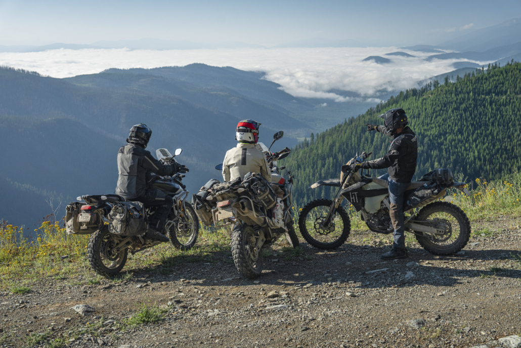
The MTBDR is BDR’s 23rd route and completes the final link in the Western BDR system, creating a continuous backcountry network across the western United States. The approximately 900-mile route begins in Island Park, Idaho, and travels north through Montana before ending near the U.S.–Canada border outside of Eureka.
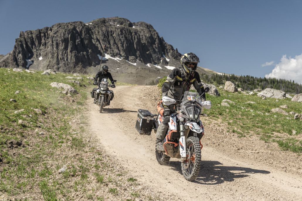
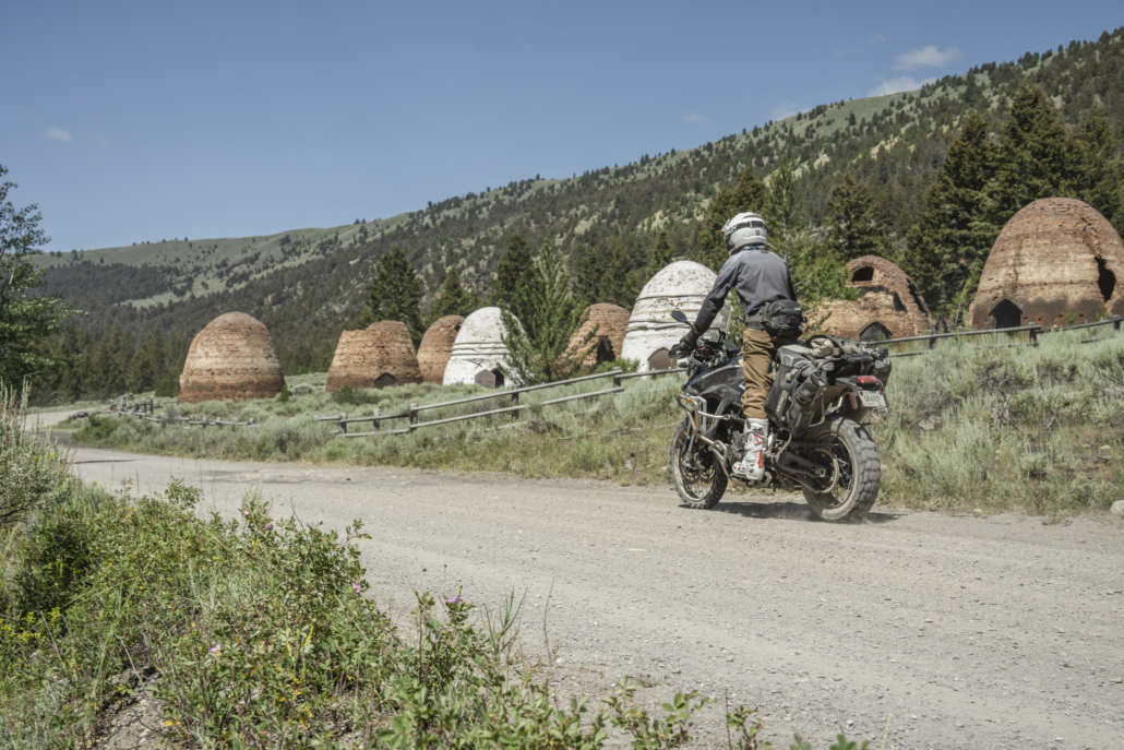
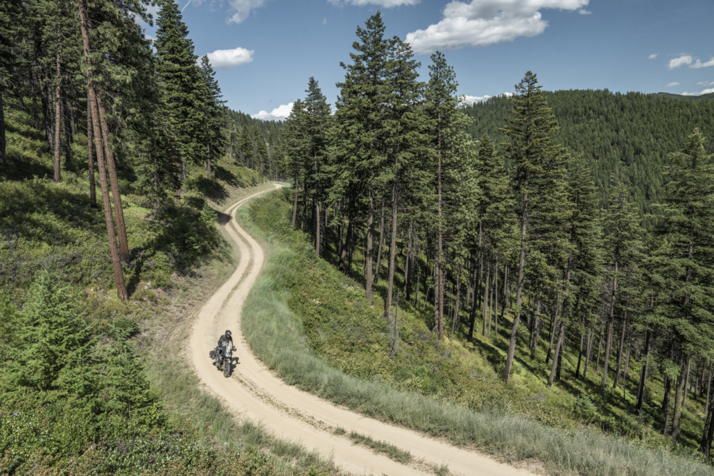
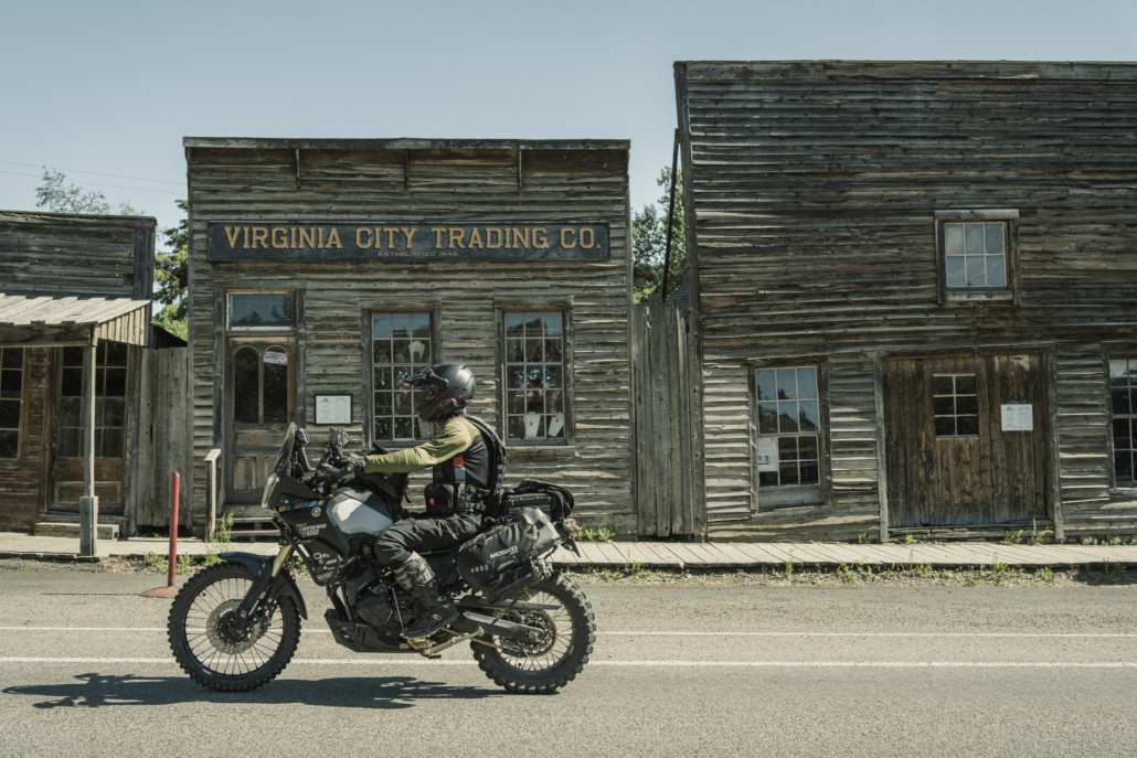
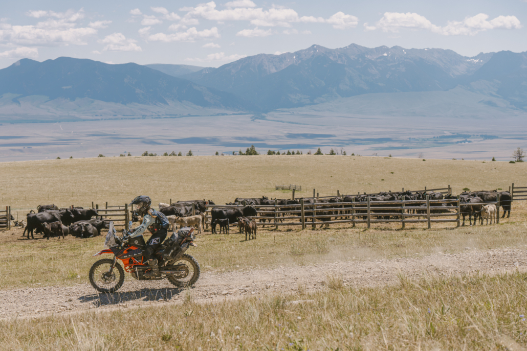
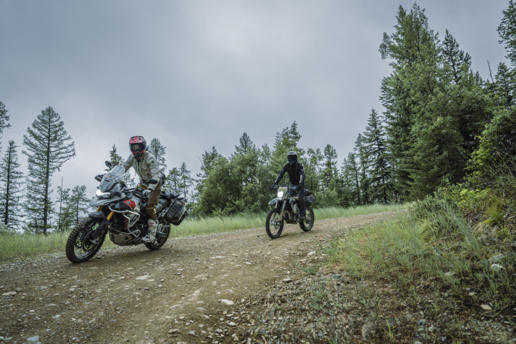
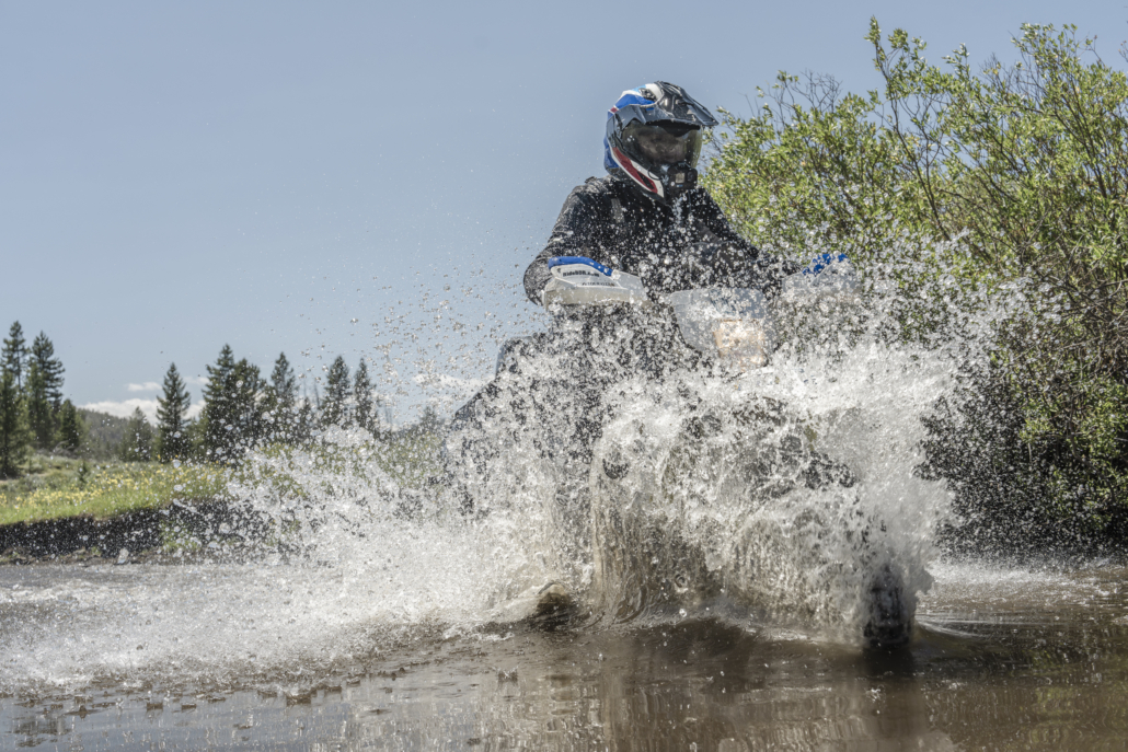
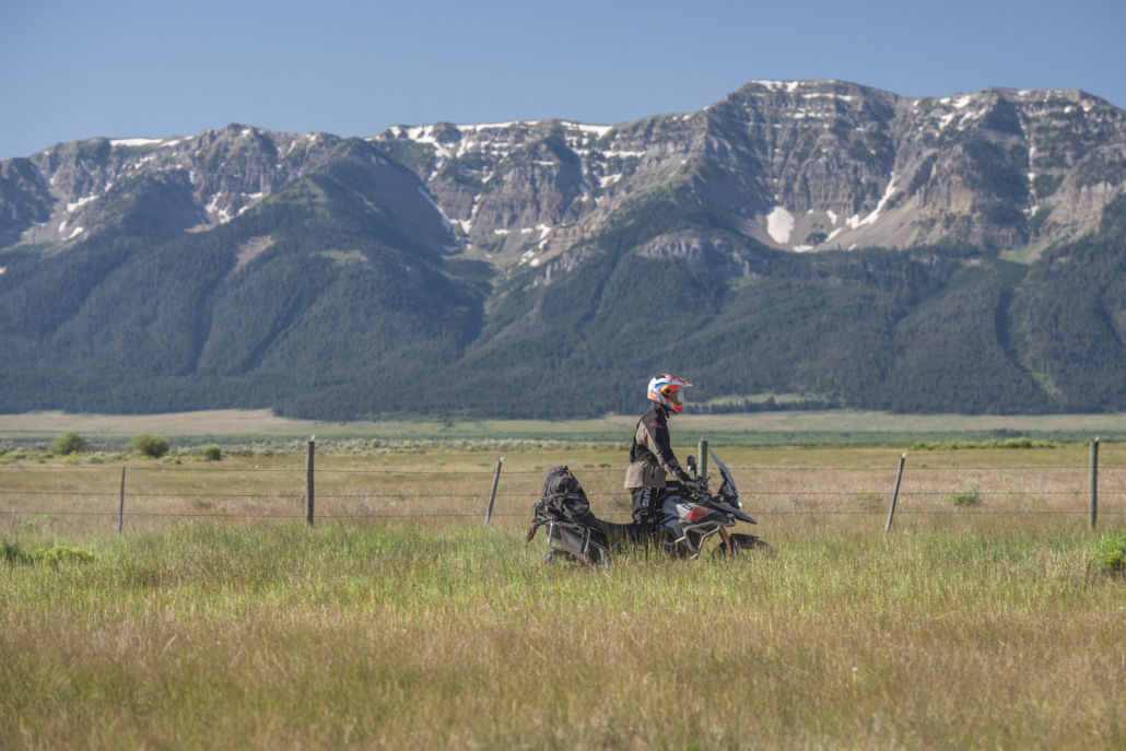
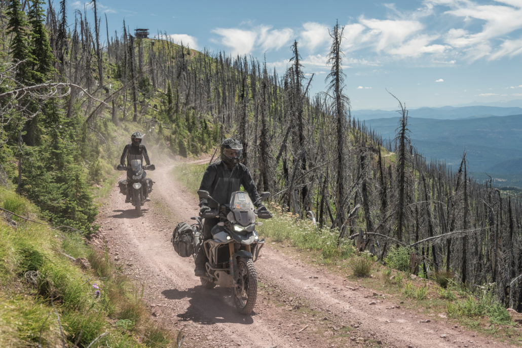
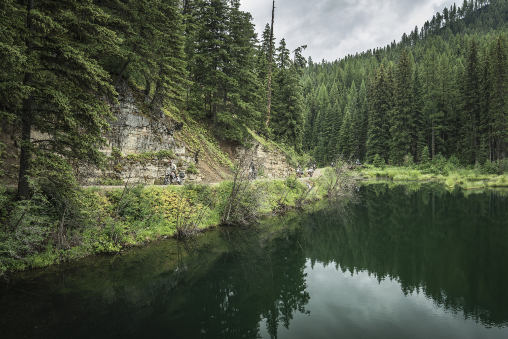
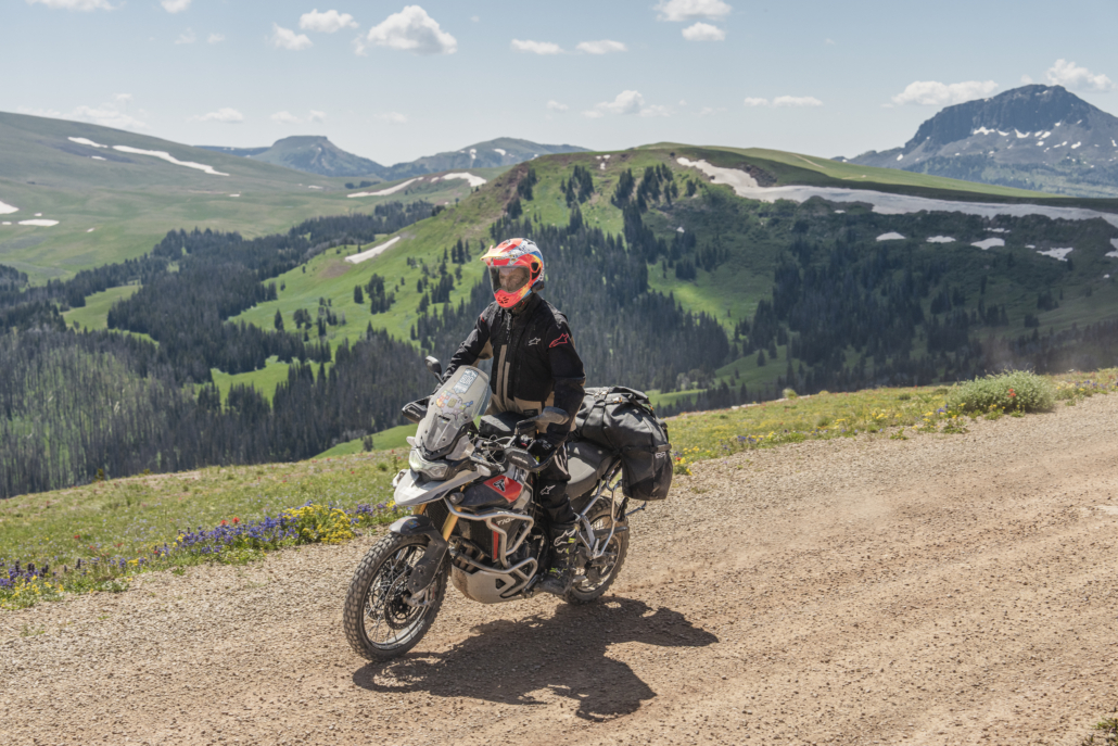
Crossing more than thirteen mountain ranges, the MTBDR takes riders deep into Big Sky Country, weaving together alpine ridgelines, remote valleys, dense pine forests, historic mining towns, wide-open ranchlands, and rugged two-track roads. Highlights include the Gravelly Range, Ruby River Valley, Virginia City, Butte, and the wild landscapes of the East Pioneer, Highland, and Cabinet Mountains.
Blending scenic gravel, flowing forest roads, and optional harder sections for more experienced riders, the MTBDR offers an ideal balance of accessibility and challenge. The route is best enjoyed between July and September, depending on snow levels and seasonal closures.
This route was made possible by the generous support of our Presenting Sponsors: Triumph Motorcycles, onX Offroad, Quad Lock and Edelweiss Bike Travel. BDR is also grateful for the continued support of our industry partners and the incredible riding community.
Join us for the online premiere of the Montana BDR film, streaming live on YouTube on April 30 at 5 PM Pacific.
After a nationwide tour of in-person screenings, this special broadcast brings the film directly to you—along with much more. Hosted by BDR Executive Director and Montana expedition team member Inna Thorn, alongside Route Creator and BDR Co-Founder Bryce Stevens, the evening goes beyond the film with live commentary, behind-the-scenes stories, and valuable route insights.
Even if you’ve already seen the film, this is a unique opportunity to hear directly from Bryce about what it took to build the Montana BDR, key highlights from the route, and what riders should know before tackling it themselves. The event will also include a live Q&A, giving viewers the chance to be part of the conversation.
Tune in, connect with the BDR community, and experience the Montana BDR like never before.
WATCH THE TRAILER
PURCHASE THE MAP
MTBDR Map: First Edition, dated: December 2025
SECTION-BY-SECTION
VIRGINIA CITYVIRGINIA CITY
TO BUTTEBUTTE
TO LINCOLNLINCOLN
TO SEELEY LAKESEELEY LAKE
TO ST. REGISST. REGIS
TO THOMPSON FALLSTHOMPSON FALLS
TO LIBBYLIBBY
TO CANADA BORDER
ISLAND PARK, ID TO VIRGINIA CITY – 105 MILES
The fun begins just outside of Island Park, Idaho with a mix of pavement and wide gravel roads near Henrys Lake. You’ll soon cross into Montana at Red Rock Pass (7,120 ft) and the Centennial Mountains come into view to the south before the route turns north around the Red Rock Lakes National Wildlife Refuge. The roads in this area are sandy and can be deep in places, so be prepared. The route continues north and follows a blissful 2-track road as you ascend into the Gravelly Range which opens on July 1st annually. Experience amazing views through the Gravellies as you ride above 8,000 ft for over 30 miles. Black Butte at 10,547 ft is impossible to miss near the crest of the range. The route descends into the Madison River Valley passing through a housing community, so please Ride Respectfully. After passing by Axolotl Lakes, cross a 7,200 ft pass and descend several miles to Virginia City on rugged 2-track that can be slick when wet.
LODGING
Drift Lodge & Fly Shop
Rustic cabins and a fly shop located near prime fishing waters, offering simple accommodations in a quiet, outdoors-focused setting.
- Address: 4771 US-20, Island Park, ID 83429
- Phone: (208) 558-0152
- Visit Website »
Island Park Lodge
Full-service lodge with cabins and hotel-style rooms, a restaurant, and bar, conveniently located near Island Park attractions.
- Address: 4149 N Big Springs Loop Rd, Island Park, ID 83429
- Phone: (208) 999-3388
- Visit Website »
Sawtelle Mountain Resort
Cabin-style lodging and motel rooms with on-site dining, popular with outdoor travelers exploring the Island Park area.
- Address: 4133 Quakie Ln, Island Park, ID 83429
- Phone: (208) 558-9366
- Visit Website »
Timbers at Island Park
Comfortable lodge-style accommodations offering easy access to fishing, riding, and nearby recreation areas.
- Address: 4153 N Big Springs Loop Rd, Island Park, ID 83429
- Phone: (208) 558-7502
- Visit Website »
Fairweather Inn
Historic inn located in downtown Virginia City, offering period-style rooms within walking distance of shops and attractions.
- Address: 305 Wallace St, Virginia City, MT 59755
- Phone: (406) 843-5377
- Visit Website »
The Bonanza Inn
Historic lodging in Virginia City featuring classic rooms close to local dining and historic sites.
- Address: 308 W Idaho St, Virginia City, MT 59755
- Phone: (406) 843-5333
- Visit Website »
Nevada City Hotel & Cabins
Historic hotel rooms and cabins located just outside Virginia City, offering a quieter stay with easy access to town.
- Address: 1578 MT-287, Virginia City, MT 59755
- Phone: (406) 843-5382
- Visit Website »
Just an Experience Cabins
Private cabins near Nevada City offering a secluded, rustic lodging option for travelers exploring the area.
- Address: 1570 MT-287 N, Virginia City, MT 59755
- Phone: (406) 843-5402
- Visit Website »
FOOD
Cafe Sabor
Casual restaurant serving Mexican-inspired dishes, with a convenient location for travelers passing through Island Park.
- Address: 4298 US-20, Island Park, ID 83429
- Phone: (208) 558-9300
- Visit Website »
The Parlor at Mack’s Inn
Casual pizza and ice cream spot in Island Park with wood-fired pizzas, salads, and sweet treats — perfect for a relaxed bite after a ride or outdoor adventure.
- Address: 4292 US-20, Island Park, ID 83429
- Phone: (208) 558-2450
- Visit Website »
The Lodgepole Grill & Bar
Relaxed grill and bar offering classic American fare and a comfortable stop for a meal in Island Park.
- Address: 3907 Phillips Loop Rd, Island Park, ID 83429
- Phone: (208) 558-9379
- Visit Website »
Bob’s Place
Laid-back local spot in Virginia City known for hearty meals and a welcoming, old-town atmosphere.
- Address: 304 W Wallace St, Virginia City, MT 59755
- Phone: (406) 843-5292
- Visit Website »
Virginia City Cafe
Classic small-town cafe serving breakfast and lunch favorites in the heart of historic Virginia City.
- Address: 212 Wallace St, Virginia City, MT 59755
- Phone: (406) 843-5311
- Visit Website »
FUEL
Island Park, ID
Virginia City, MT
DISCOVERY POINTS
Henrys Lake (Off Route)
Scenic lake offering fishing, boating, and camping opportunities, located off the BDR route.
Monument Ridge Viewpoint
High-elevation viewpoint in the Gravelly Range offering expansive views of the surrounding mountains and valleys.
Axolotl Lakes
Remote lake area managed by the BLM, popular for camping, fishing, and quiet recreation in a backcountry setting.
VIRGINIA CITY TO BUTTE – 139 miles
An optional harder route ascends Alder Gulch and descends Barton Gulch, featuring tight switchbacks and loose rocks. The main route then follows wide gravel roads through farm and ranch land in the Ruby River valley before reaching Highway 41. Wide dirt roads through the picturesque Big Hole River valley lead to paved roads into Melrose where you can get food and fuel. Beyond Melrose the track climbs into the East Pioneer Mountains. The historic Glendale smelter site and beehive-shaped charcoal kilns are a must see. After descending from the Pioneers, an optional harder section follows rugged roads in the Moose Creek (“Crick”) drainage and ascends into the Highland Mountains. This road is primitive, rocky and has a large water crossing that can be challenging during spring runoff. Finally, the route descends from the Highlands into Butte, the largest city on the route and one of the most historic. Consider visiting the Berkeley Pit viewing area or other sites near the Old Town.
LODGING
H Bar J Saloon Cafe & RV
Information, food, drinks, camping, and lodging for travelers in Wise River, Montana.
- Address: 64800 MT Hwy 43, PO Box 212, Wise River, MT 59762
- Phone: (406) 832-9292
- Visit Website »
Finlen Hotel and Motor Inn
Historic hotel with classic rooms and a central location in downtown Butte, close to restaurants, shops, and local attractions.
- Address: 100 E Broadway St, Butte, MT 59701
- Phone: (406) 723-5461
- Visit Website »
The Miners Hotel
Historic lodging with a long heritage in Butte, offering simple rooms and easy access to the heart of town.
- Address: 53 W Park St, Butte, MT 59701
- Phone: (406) 723-8928
- Visit Website »
Butte Lodging Options
In addition to the locations listed here, Butte offers a wide range of lodging options throughout the city.
Sportsman Lodge
Rustic lodge in Melrose, MT featuring comfortable rooms and a relaxed atmosphere — a good base for outdoor activities and scenic rides in the area.
- Address: 28 Main St, Melrose, MT 59058
- Phone: (406) 646-0948
- Visit Website »
FOOD
H Bar J Saloon Cafe & RV
Information, food, drinks, camping, and lodging for travelers in Wise River, Montana.
- Address: 64800 MT Hwy 43, PO Box 212, Wise River, MT 59762
- Phone: (406) 832-9292
- Visit Website »
Montana Axe Bar & Throwing Co
Bar and entertainment venue where guests can enjoy drinks and test their skills with axe throwing, a fun stop for riders looking for something different.
- Address: 37 W Park St, Butte, MT 59701
- Phone: (406) 299-2196
- Visit Website »
The Copper Plate
Upscale casual restaurant serving a mix of American and global dishes, known for its welcoming atmosphere in downtown Butte.
- Address: 22 W Galena St, Butte, MT 59701
- Phone: (406) 221-7424
- Visit Website »
Saffron
Restaurant and catering service offering a variety of flavorful dishes in a comfortable downtown Butte setting.
- Address: 217 W Park St, Butte, MT 59701
- Phone: (406) 299-2600
- Visit Website »
Butte Food Options
In addition to the food options listed here, Butte offers a wide range of food options throughout the city.
Melrose Bar & Station
Local bar and gathering spot in Melrose, MT — a relaxed place to grab a drink and rest during your travels.
- Address: 120 Main St, Melrose, MT 59743
- Phone: (406) 835-2711
FUEL
Nevada City
Alder
Sheridan (off route)
Twin Bridges (off route)
Melrose
Wise River (off route)
Butte
DISCOVERY POINTS
Ruby River Reservoir
Large reservoir managed by the BLM offering fishing, boating, and camping opportunities.
Big Hole River Access
Multiple public access points along the Big Hole River, popular for fishing, picnicking, and scenic stops.
Glendale Smelter Site
Historic mining site featuring the remains of a 19th-century smelter and townsite near the Big Hole River.
Canyon Creek Kilns
Historic charcoal kilns located near Canyon Creek, offering a glimpse into Montana’s mining-era history.
Moose Creek Water Crossing – (Alt Harder Track)
Notable creek crossing along the route that may vary in depth and difficulty depending on season and recent weather. Proceed with caution and assess conditions before crossing.
Highland City Site
Historic ghost town site marking the remains of a once-active mining community.
Blacktail Trestle
Historic railroad trestle offering a scenic and interesting stop along the route.
BUTTE TO LINCOLN – 146 miles
Leaving Butte, the route begins on pavement before transitioning to a mix of wide gravel and lesser-traveled dirt roads. After the Interstate 15 corridor the main route heads north from the tiny town of Basin on the scenic Basin Creek Road and the optional harder track follows I-15 east before turning north. The Occidental Plateau Alt Harder is long and much more difficult with varied challenges, including high elevation, steep hills, and very rocky terrain, but has rewards like the historic Comet Mine and several epic viewpoints.
After food and fuel in Elliston, the route climbs into the mountains past Empire Mine and an optional extension to the Granite Butte summit and lookout tower. Section 3 ends at the town of Lincoln where riders can visit the ‘Blackfoot Pathways: Sculpture in the Wild International Sculpture Park’ and a variety of lodging and dining options.
LODGING
Town of Boulder (Off Route)
Boulder is located off the BDR route and offers additional lodging, dining, and services for riders willing to detour.
Three Bears Motel
Simple, rider-friendly motel located in the center of Lincoln, offering convenient access to dining and local services.
- Address: 203 Main St, Lincoln, MT 59639
- Phone: (406) 362-4355
- Visit Website »
Lincoln Log Hotel
Historic log hotel featuring comfortable rooms and a classic Montana lodge atmosphere just outside downtown Lincoln.
- Address: 96 Sleepy Hollow Ln, Lincoln, MT 59639
- Phone: (406) 362-4822
Blue Sky Motel
Affordable roadside motel offering basic accommodations within walking distance of restaurants and shops in Lincoln.
- Address: 328 Main St, Lincoln, MT 59639
- Phone: (406) 362-4450
FOOD
Silver Saddle Bar & Cafe
Local bar and cafe offering food and drinks in a laid-back setting popular with riders and travelers.
- Address: 109 Basin St, Basin, MT 59631
- Phone: (406) 225-9995
- Visit Website »
Spotted Dog Saloon
Small-town saloon in Elliston, MT serving drinks and pub-style fare in a relaxed, rider-friendly environment.
- Address: 108 E Front St, Elliston, MT 59728
- Phone: (406) 492-8596
The Montanan Steakhouse
Classic steakhouse serving hearty meals in a casual, small-town setting in downtown Lincoln.
- Address: 520 Main St, Lincoln, MT 59639
- Phone: (406) 362-4244
- Visit Website »
Lambkins
Local restaurant offering homestyle meals and baked goods, popular with both locals and travelers passing through Lincoln.
- Address: 460 Main St, Lincoln, MT 59639
- Phone: (406) 362-4271
- Visit Website »
Scapegoat Eatery
Casual eatery featuring creative comfort food and a relaxed atmosphere in the heart of Lincoln.
- Address: 511 Main St, Lincoln, MT 59639
- Phone: (406) 362-4272
- Visit Website »
FUEL
Boulder (off route)
Elliston
Lincoln
DISCOVERY POINTS
Berkeley Pit Viewing Stand
Public viewing area overlooking the Berkeley Pit, one of the largest Superfund sites in the U.S.
Mine Memorial & Viewpoint (Off Route)
Memorial and viewpoint honoring Butte’s mining heritage, located off the main route with views of the surrounding area.
Butte Montana “M” Viewpoint
Hillside viewpoint featuring the iconic “M” overlooking Butte, offering panoramic views of the city.
Comet Mine – (Alt Harder Track)
Historic mining site and ghost town remains offering insight into Montana’s silver mining past.
Lookout Knoll – (Alt Harder Track)
Scenic overlook offering views of the surrounding landscape and a quiet place to take a break.
Occidental Plateau Viewpoint – (Alt Harder Track)
High-elevation viewpoint providing expansive views across the Occidental Plateau.
Park Lake – (Alt Harder Track)
Mountain lake offering camping, fishing, and scenic recreation opportunities.
Empire Mine
Historic mine site highlighting the area’s mining history and early industrial development.
Granite Butte Lookout
Historic fire lookout offering sweeping views of the surrounding forest and mountains.
Sculpture in the Wild Park
Outdoor sculpture park featuring large-scale art installations set along forest trails.
LINCOLN TO SEELEY LAKE – 72 miles
This section is just 72 miles but packed with fun riding. Start by ascending Huckleberry Pass before descending to the Blackfoot River valley. Coopers Lake and Browns Lake provide options for a swim to cool down or clean off the dust and sweat. Stop at the Ovando general store and historic sites or grab a meal at Trixi’s Saloon on Highway 200. The route climbs again before traversing the south end of the Swan Range. Although it’s a bit long at 8.4 miles each way, the ride up to Mt. Morrell Lookout is worth the time. If the summit gate is closed, it’s just a short walk to the tower, and there are views from the saddle at the gate. Seeley Lake features multiple restaurants and large campgrounds on the lake but has limited lodging options.
LODGING
The Lodges on Seeley Lake
Lodge-style accommodations offering cabins and rooms near Seeley Lake, with easy access to outdoor recreation and riding routes.
- Address: 2156 Boy Scout Rd, Seeley Lake, MT 59868
- Phone: (800) 900-9016
- Visit Website »
Tamaracks Resort
Resort offering motel rooms, cabins, and RV sites, conveniently located along Highway 83 near Seeley Lake.
- Address: 3481 MT-83 N, Seeley Lake, MT 59868
- Phone: (406) 677-2433
- Visit Website »
Campgrounds (Lolo National Forest)
Multiple campgrounds are available in the region, offering a range of options for tent and RV camping within Lolo National Forest.
FOOD
Seeley Chicken Coop & Lounge
Casual bar and restaurant serving comfort food and drinks in a relaxed, local atmosphere.
- Address: 645 Pine Dr, Seeley Lake, MT 59868
- Phone: (406) 677-2980
- Visit Website »
Lindey’s Prime Steakhouse
Steakhouse offering classic Montana-style steaks and hearty meals, popular for dinner in the Seeley Lake area.
- Address: 3129 MT-83, Seeley Lake, MT 59868
- Phone: (406) 677-9229
- Visit Website »
Pop’s
Laid-back local eatery known for burgers, pizza, and casual fare in Seeley Lake.
- Address: 116 Redwood Ln, Seeley Lake, MT 59868
- Visit Website »
Trixi’s Antler Saloon
Family-friendly saloon serving comfort food such as burgers and cocktails, plus dancing.
- Address: 4520 MT-200, Ovando, MT 59854
- Phone: (406) 793-
- Visit Website »
FUEL
Ovando
Seeley Lake
DISCOVERY POINTS
Cooper Lake & Big Nelson Campground (Off Route)
Remote lake and campground offering camping, fishing, and a quiet backcountry experience off the main route.
Browns Lake
Scenic lake popular for fishing, camping, and relaxing stops in a forested setting.
Mt. Morrell Lookout Tower
Historic fire lookout accessible by hike, offering panoramic views of the surrounding mountains and valleys.
Seeley Lake
Small mountain town and lake area offering lodging, dining, fuel, and recreation opportunities.
SEELEY LAKE TO ST. REGIS – 133 miles
Due west out of Seeley Lake, enter the Mission Mountains in Lolo National Forest. The route soon enters the Flathead Indian Reservation and follows a public thoroughfare, known as Jocko Canyon Road, to the small town of Arlee. While on the reservation, stay on the route and do not venture off to camp or for any other Reason. If you do want to camp on the Flathead Reservation, non-members need a CSKT Conservation Permit and a specific Flathead Reservation Camping Stamp, which are purchased together and allow access for activities like camping and hiking on tribal lands. Permits are available online through the Montana Fish, Wildlife & Parks (FWP) licensing portal (https://ols.fwp.mt.gov) or in person from various local vendors in towns like Polson, Ronan, and St. Ignatius.
Beyond Arlee, the route stays in the reservation before re-entering Lolo NF and heading up the Ninemile Creek Valley. Enjoy the ride on West Side Ninemile Road and the ascent onto Ninemile Divide before your final descent to St. Regis.
LODGING
Little River Motel
Quiet, locally owned motel offering comfortable rooms just outside downtown St. Regis, with easy access to I-90.
- Address: 424 Little River Ln, St Regis, MT 59866
- Phone: (406) 649-2713
- Visit Website »
Super 8 by Wyndham St. Regis
Standard chain motel offering basic accommodations with convenient access to I-90 and nearby services.
- Address: I-90, St Regis, MT 59866
- Phone: (406) 640-4423
- Visit Website »
FOOD
Winki’s Diner
Classic roadside diner serving breakfast and comfort-food favorites in St. Regis.
- Address: 8 Old U.S. 10, St Regis, MT 59866
- Phone: (406) 649-9753
Huck’s Grill
Casual grill located at the St. Regis Travel Center, offering burgers, sandwiches, and quick meals for travelers.
- Address: 55 Mullan Gulch Rd, St Regis, MT 59866
- Phone: (406) 649-2407
- Visit Website »
Jasper’s
Sit-down restaurant serving classic American fare, located near I-90 in St. Regis.
- Address: 13 Old U.S. 10, St Regis, MT 59866
- Phone: (406) 649-2473
- Visit Website »
Pigasus Bar
Local bar and restaurant in Arlee, MT offering food, drinks, and a relaxed stop along US-93.
- Address: 92637 US-93, Arlee, MT 59821
- Phone: (406) 726-7444
- Visit Website »
FUEL
Arlee
St Regis
DISCOVERY POINTS
Double Arrow Lookout (Off Route)
Historic fire lookout offering expansive views of the surrounding forest and mountains, accessible seasonally.
Historic Ninemile Remount Depot & Ranger Station
Historic Forest Service site showcasing early ranger operations, horse remount facilities, and preserved buildings.
ST. REGIS TO THOMPSON FALLS – 72 miles
The route leaves St. Regis on Highway 135 and then goes around the north side of Camels Hump Mountain before a series of switchbacks return you to the Interstate 90 corridor. From there, you’ll climb back into the Coeur d’Alene Mountains on tight, forested roads before eventually dropping into Thompson Falls. This town provides full services and offers a short walking excursion on footbridges to the Clark Fork of the Flathead River and the Thompson Falls Dam.
LODGING
Rimrock Lodge
Lodge-style accommodations offering rooms and cabins in a quiet setting just outside Thompson Falls.
- Address: 6 Rimrock Lane, 4946 MT-200, Thompson Falls, MT 59873
- Phone: (406) 827-3536
- Visit Website »
Riverfront Motel & Cabins
Motel rooms and cabins located along the Clark Fork River, offering a peaceful stay near Thompson Falls.
- Address: 4907 MT-200 W, Thompson Falls, MT 59873
- Phone: (406) 827-3460
- Visit Website »
FOOD
Minnie’s Montana Cafe
Classic hometown cafe serving breakfast, lunch, and comfort-food favorites in Thompson Falls.
- Address: 921 W Main St, Thompson Falls, MT 59873
- Phone: (406) 827-3747
- Visit Website »
Big Eddy’s
Local restaurant and bar offering American fare, drinks, and a relaxed atmosphere near downtown Thompson Falls.
- Address: 219 W Main St, Thompson Falls, MT 59873
- Phone: (406) 827-3300
- Visit Website »
Beagle’s Bakery & Espresso
Bakery and espresso stop offering baked goods and coffee — a quick and convenient stop for riders passing through town.
- Address: 4896 MT-200, Thompson Falls, MT 59873
- Phone: (406) 827-2579
FUEL
Thompson Falls
DISCOVERY POINTS
Camels Hump Lookout (Hike)
Historic fire lookout site accessed by a hike, offering panoramic views of the surrounding mountains and valleys.
THOMPSON FALLS TO LIBBY – 113 miles
After a short stretch of pavement from Thompson Falls the route turns to dirt and climbs to Vermilion Pass at over 6,000 ft in the Cabinet Mountains. Be sure to stop at impressive Graves Creek Falls on your way to the pass. On your descent, you’ll ride the shoreline of picturesque Fishtrap Lake followed by a series of fun, flowy dirt roads. After a stretch on Hwy 2, venture back into the foothills of the Cabinet Mountains through tight forested 2-track roads and consider the worthy side trip to Howard Lake before the last stretch of Highway 2 that leads to the town of Libby.
LODGING
Evergreen Motel
Locally owned motel offering comfortable rooms in a quiet setting, with convenient access to downtown Libby.
- Address: 808 Mineral Ave, Libby, MT 59923
- Phone: (406) 293-4178
- Visit Website »
Venture Inn & Restaurant
Hotel-style lodging with an on-site restaurant and lounge, offering a convenient overnight stop in Libby.
- Address: 1015 9th St, Libby, MT 59923
- Phone: (406) 293-7711
- Visit Website »
Country Inn
Simple, budget-friendly motel offering standard rooms near local dining and services in Libby.
- Address: 1020 9th St, Libby, MT 59923
- Phone: (406) 293-2092
- Visit Website »
FOOD
Fix Coffeehouse
Local coffee shop serving espresso drinks and light bites, a popular stop in downtown Libby.
- Address: 512 Mineral Ave, Libby, MT 59923
- Phone: (406) 293-8014
- Visit Website »
Rosita’s
Mexican restaurant offering classic dishes in a casual, family-friendly setting in Libby.
- Address: 350 E 9th St, Libby, MT 59923
- Phone: (406) 293-3902
- Visit Website »
Dorio’s
Local restaurant serving Italian-inspired dishes and comfort food favorites in downtown Libby.
- Address: 316 California Ave, Libby, MT 59923
- Phone: (406) 300-8629
- Visit Website »
Cabinet Mountain Brewing Co
Local brewery and taproom offering craft beer and pub fare, a relaxed spot to unwind in Libby.
- Address: 206 Mineral Ave, Libby, MT 59923
- Phone: (406) 293-2739
- Visit Website »
FUEL
Libby
DISCOVERY POINTS
Graves Creek Falls
Scenic waterfall accessible via a short hike, offering a peaceful stop in a forested setting.
Vermilion Pass
Mountain pass offering scenic riding and views along a high-elevation section of the route.
Fishtrap Lake
Forest Service campground and lake offering camping, fishing, and quiet recreation opportunities.
Howard Lake
Remote Forest Service campground offering camping and fishing in a quiet, forested area.
LIBBY TO CANADA BORDER – 125 miles
The final section of the MTBDR heads north out of Libby on beautiful scenic ridge roads and works its way up to a cabin and viewpoint on the upper reaches of Big Creek Baldy. After descending, the roads get more primitive and overgrown so use extra caution for branches, downfall, and vehicles heading in the opposite direction. As the route meanders along the next ridge, beautiful Lake Koocanusa comes into view, with the tallest bridge in Montana. Consider the short side trip up to Black Butte Lookout before reaching Eureka.
The final stretch passes by homes and farmland, then turns to rugged 2-track before officially ending at a remote parking spot. Here you can follow a walking path to the US/Canada border, clearly indicated by a clearcut alley of trees as far as you can see. NOTE: the border is electronically monitored and crossing the border will activate a response from Homeland Security. Ride Respectfully on this final out-and-back to preserve our right to visit this special place.
LODGING
The Suites at Indian Springs
Hotel-style suites located at Indian Springs, offering comfortable accommodations with access to on-site amenities near Eureka.
- Address: 86 Indian Springs Rd, Eureka, MT 59917
- Phone: (406) 889-6920
- Visit Website »
Tobacco River Ranch Glamping
Glamping accommodations offering a unique stay with furnished tents and cabins in a scenic setting near Eureka.
- Address: 359 Osloski Rd, Eureka, MT 59917
- Phone: (406) 297-7870
- Visit Website »
FOOD
The Gathering Place
Coffeehouse and cafe serving espresso drinks, breakfast, and light fare in a relaxed setting in Eureka.
- Address: 101 Julian Dr #1230, Eureka, MT 59917
- Phone: (406) 297-3001
- Visit Website »
Front Porch Dewey Burger & Fish Co.
Casual restaurant known for burgers, fish, and comfort food, popular with both locals and travelers.
- Address: 307 US-93, Eureka, MT 59917
- Phone: (406) 297-1234
- Visit Website »
Valley Pizza
Local pizza spot offering classic pies and casual dining along US-93 in Eureka.
- Address: 700 US-93, Eureka, MT 59917
- Phone: (406) 297-2709
Von’s Cafe
Classic small-town cafe serving breakfast and lunch favorites in downtown Eureka.
- Address: 607 3rd Ave E, Eureka, MT 59917
- Phone: (406) 297-2333
- Visit Website »
FUEL
Eureka
DISCOVERY POINTS
Loon Lake
Forest Service campground and lake offering camping, fishing, and scenic recreation in a quiet mountain setting.
Big Creek Baldy Cabin & Lookout
Historic fire lookout and cabin offering expansive views of the surrounding forest and mountains, accessible seasonally.
Lake Koocanusa Bridge
Scenic bridge crossing Lake Koocanusa, offering great views of the reservoir and surrounding landscape.
Black Butte Lookout
Historic fire lookout offering panoramic views of the surrounding area, accessible by hike or seasonal road access.
Remote U.S./Canada Border
Remote border area serving as the end (or start) of the route, featuring the rugged landscape near the international boundary.
PLAN YOUR ADVENTURE
MTBDR PACKING LIST
This packing list serves as an example and is not intended to be a complete list for your backcountry riding needs. Feel free to customize this list to work for you.
- Helmet
- Boots
- Goggles
- Gloves (2 sets)
- Protective gear (pressure suit, Leatt brace, knee braces)
- Jacket
- Pants
- Balaclava or neck gaitor
- Water bladder or bottle
- Hydration pack
- Ear plugs
MTBDR MOTORCYCLE DEALERSHIPS
FREQUENTLY ASKED QUESTIONS
Below are answers to some Frequently Asked Questions about the Montana Backcountry Discovery Route.
What is the MTBDR?
The Montana BDR (MTBDR) completes the final link in the western BDR system, a 900-mile journey through the rugged beauty, vast horizons, and quiet solitude that define Big Sky Country. Crossing more than thirteen mountain ranges from Island Park, Idaho, to the Canadian border, it offers riders an unforgettable exploration of Montana’s wild backcountry.
From alpine ridges and remote valleys to shimmering lakes, dense pine forests, historic mining towns, and wide-open ranchlands, the MTBDR captures everything that makes this state legendary. Riders climb into the Gravelly Range, trace the Ruby River Valley, explore Virginia City and Butte, and cross the wild hearts of the East Pioneer, Highland, and Cabinet Mountains, landscapes that invite you to slow down, breathe deep, and take it all in.
What time of year can I do the MTBDR?
The MTBDR is best enjoyed between July and September after the snow melts and before the first snowfall. Weather can change rapidly in the mountains, and seasonal closures may be in effect through late spring. Always check weather forecasts and local conditions before heading out. Note that the Gravelly Range is closed until July 1st each year.
How difficult is the route?
The main route is a moderate-level route appropriate for intermediate riders. Many portions of the main route feature tight switchbacks, dense forest, and primitive roads that can be prone to ruts, washouts, rocks, and mud. Beginners will face adversity, especially in poor weather conditions. This route features several optional ALT Harder tracks that are suitable only for experienced advanced riders.
What weather concerns should I have?
Montana features rugged landscapes in the mountains and can be prone to lingering snow in the spring and early snowfall with freezing temperatures in early fall. Given the elevation changes, riders should expect to face temperature swings and the possibility of rain at any time.
Can the route be done in either direction?
Yes. This route was designed to be ridden south to north, starting in Island Park, Idaho, but it can be ridden from north to south as well. Use caution in the many blind turns and Ride Right to avoid head-on collisions with other traffic.
How long does it take to run the MTBDR?
The time it takes to ride a BDR can vary based on many factors, including your fuel range, preparedness, riding skill, stamina, breakdowns, weather, and many other factors. This route is divided into 8 sections, which does not necessarily mean the number of days or how you should break up your trip. On average, this route will take riders 7-9 days to complete.
Do I need any permits or passes?
Street legal motorcycles with a license plate can ride this route. No other permits or passes are required.
Are there any advanced sections on the MTBDR?
The Montana BDR features three optional advanced sections, each presenting various levels of challenge suitable only for highly experienced riders. Cell service and EMS response are extremely limited throughout this region, and an emergency satellite communication device is highly recommended. These sections may feature very rocky, technical terrain, large river crossings, steep hills, and deep ruts. Review the section descriptions and documentary film for more detailed information on each optional ALT Harder.
Can I camp on this route, and where?
This route is largely within the National Forest, so you can “dispersed camp” within the National Forest boundary. There are dozens of established campgrounds indicated on the official map, GPS tracks, and interactive map. Dispersed camping is not permitted in the Flathead Reservation through Section 5. Always practice Leave No Trace principles when camping and exercise extreme caution with campfires and follow local regulations and restrictions. Grizzly bears are common in the Montana mountains, so be bear aware and consider carrying bear spray if you plan to camp.
Can I build a camp fire?
Always check with local ranger stations to determine if campfires are allowed before you build one. In most cases, campfires are only allowed in established fire rings. If you are dispersed camping, we don’t suggest building fires. Instead, bring a camp stove for cooking and boiling water to avoid the risk of wildfires. Be sure to fully extinguish fires so they are DEAD-OUT. Use water to ensure a fire is fully extinguished, and the ground is left cool and wet.
How far between gas stops?
The longest distance between available gas on the MTBDR is the entire span of Section 7 from Thompson Falls to Libby, at approximately 113 miles. Even if your bike’s range is well beyond the gas stop distances, we recommend always topping off your gas and carrying extra fuel.
What about hotel/motel accommodations along the route?
The MTBDR has many traditional lodging opportunities directly on the route, and adjacent towns feature additional options with a short detour. AirBnB or cabin rentals may be available in some areas, and all lodging should be booked in advance. In some cases, notably Seeley Lake, if you are looking for a traditional hotel, you may need to divert from the route and backtrack the next day to where you left off. Camping is plentiful in the region, and this is a great place to try it out!
What navigation resources do I need to ride the MTBDR?
This route cannot be ridden without the use of GPS tracks. Be prepared and bring the official BDR Map and your navigation device with the latest GPS tracks loaded. Free GPS tracks are available for download on the BDR website. The route can also be navigated using a smartphone GPS navigation app, such as onX Offroad, Gaia GPS, Rever, and others. The MTBDR expedition documentary film is a great source of information about the route and is available for free on YouTube.com/ridebdr.
What GPS should I use?
Any modern GPS unit capable of handling multiple tracks with a minimum of 1500 points each is suitable. Garmin models that work best for this application are: Zumo XT, XT2, Zumo 590/595/395/396, Montana, and 276Cx. Many other GPS units are compatible with the GPX file format. Check the owner’s manual of your device for more information. You can also import the tracks into a GPS navigation app, like onX Offroad or Gaia GPS, but we recommend you upgrade to the premium version of the app so you can download and navigate via offline maps.
Is there cell phone service on this route?
Cell phone service is very sparse on this route and non-existent in many areas. A satellite communicator, sat phone, or GPS tracking device, such as a Garmin InReach, is highly recommended for emergency situations so you can call for help or text without cell service (subscription required).
What is the ideal bike to use?
Any adventure or dual sport bike that has a license plate, can run knobby DOT tires, has adequate suspension, can carry the gear you will need, and has enough fuel range. Most adventure or dual-sport motorcycles will be suitable for the trip.
What tires should I use for the MTBDR?
DOT approved knobby tires are strongly recommended. Riding this route without at least a 50/50 tire (50% dirt, 50% road) would not be advisable.
Can you do the route two-up?
Segments of this route can be ridden two-up for those experienced in riding rugged, unpaved roads with a passenger and luggage.
Can I explore off the route in all areas?
Please don’t go off the route anywhere where it’s gated or signed for seasonal or permanent closures, and don’t ever venture onto private property.
What if I see a Private Land Sign?
This route may include a few instances where the track follows an easement road through private land. In many, but not all cases, the land owners have installed “private land” signs, and it is important that riders acknowledge these signs and stay on the designated track. If you are unsure of the land ownership adjacent to the roads, it’s best to stay on the track to avoid trespassing. In all cases, riders should never ride off the road, which damages vegetation. Please remember that riding off the designated roads can jeopardize our right to use these roads for recreation.
Are there any gates on the route?
This route may have seasonal gates in place at any time, but especially in the early riding season and late fall. There may be temporary closures when crews are repairing washouts, downed trees, and other road hazards. If roads are closed, please do not ride around the signs, as that can put you and work crews in danger and can get you a hefty fine. Check the BDR website for route updates before you go.
I’m following your tracks and see a Road Closed sign. Does it mean I cannot pass through?
Please abide by posted road closure signs. Ignoring these signs is a sure way of getting a road closed for good. That said, sometimes locals will post unofficial “road closed” or “dead end” signs on public roads for their own personal reasons. Additionally, land managers may not have removed a “closed” sign from a seasonal road – even though the sign right next to it clearly displays the open/closed dates. In these cases, use your best judgment – if in doubt, navigate around the closed road and report it to BDR. And please remember never to engage in arguments with local landowners.
Can I fish on the MTBDR?
How do I get information on current road conditions?
We do our best to post the most up-to-date information about the route on our website. We depend on the BDR community to inform us about route and road conditions, so if you encounter any road closures or severe conditions that are worth reporting, please contact us with the information.
There is also a dedicated Facebook group page. We recommend that you join the group prior to your trip to read trip reports and comments from other riders about their experience on the route. Search for: MTBDR Backcountry Discovery Route.
What about the Wild/Domestic Animals?
Montana is a habitat for many animals, like deer, as well as smaller animals — all of which make their way to the road at some point. Be alert everywhere you go as animals can and will cross your path along the route – especially in the morning and at dusk. Deer are a major concern throughout this route, and you can expect to see many of them, so ride with extra caution.
Slow down as soon as you see animals, as they like to cross in front of bikes. Appropriate food practices while camping are an absolute must for your safety and the animal’s safety.
Yield to all animals, whether wild, domestic, or livestock, by slowing down or stopping. Many locals in rural areas keep their dogs off-leash on their property, and dogs love to chase motorcycles – be cautious and considerate.
Can I drive a 4x4 on this route?
All of the roads used on the MTBDR are public and open to licensed vehicles. If you do decide to drive this route, you will need a reliable 4×4 with high clearance, and full recovery gear is highly encouraged. The optional ALT Harder tracks will require a dedicated 4WD rig and should not be attempted in a stock vehicle. Always stay to the right and go slowly around blind corners to avoid head-on accidents with others using the roads. We recommend traveling in the direction of the GPX tracks as this is intended to minimize head-on traffic.
What do you mean by Riding Respectfully?
It is absolutely essential that you Ride Respectfully and follow the tips outlined in our Ride Respectfully campaign. Remember, it’s up to all of you to preserve our access – we can easily lose access to many of these roads if we don’t practice proper etiquette. Always represent BDR and the ADV community in the best light.


