Chattahoochee BDR-X

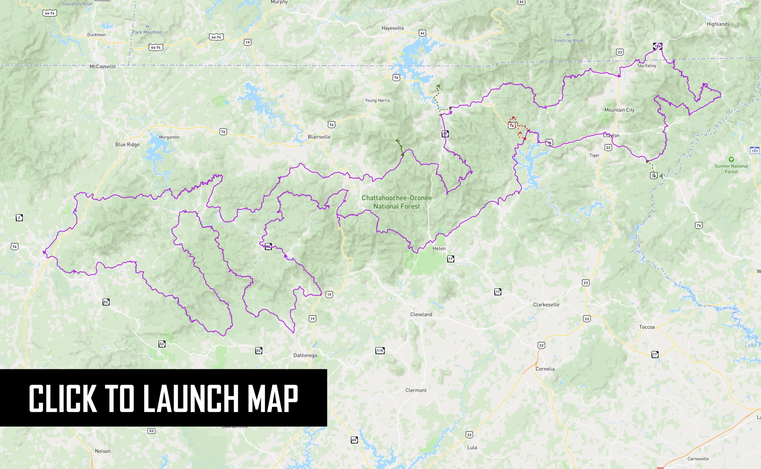
The Chattahoochee BDR-X is a 350-mile loop featuring the best dual-sport and adventure riding in the north Georgia mountains. This unforgettable route combines a collection of graded forest roads, primitive two-track, and scenic backcountry pavement under the dense canopy of the Chattahoochee National Forest.

Quaint mountain towns dot the track including Ellijay, Dahlonega, Suches, and Helen, with abundant lodging and camping opportunities throughout. Riders will criss-cross the Appalachian Trail, tackle rugged climbs, carve twisty pavement, and splash through numerous creek crossings. Unique to the south, the Chattahoochee BDR-X can be ridden most of the year and is best between March and December, weather and seasonal road closures permitting.

UPDATE: The tracks for Section 1 have been updated as of 12/9/24. Please be sure and download the latest track file HERE before you go.

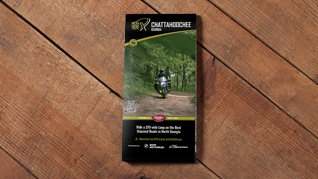
PURCHASE THE MAP

The latest version of the Chattahoochee map is the First Edition, dated: September 2024

SECTION-BY-SECTION

ELLIJAY TO SUCHES – 99 miles

Begin your journey in the picturesque north Georgia mountain town of Ellijay, known for mountain biking, hiking, whitewater kayaking, and its numerous apple orchards and wineries. The track meanders along paved and unpaved county roads through mountain farmland before intersecting with Old Bucktown Road. This rugged two-track road climbs steadily to Nimblewill Gap, where the Appalachian Trail (AT) Approach Trail connects Amicalola Falls to the southern terminus of the AT at Springer Mountain.

From Nimblewill Gap, the road smooths out as it descends the mountain, connecting with Winding Stair Gap Road and the picturesque Noontootla Creek. Stop for a break at Van Zandt’s Grill and Grocery in Dial, a local favorite. Continue on Old Rock Creek, a narrow two-track road, where you can access a 1/3 mile hike to cross the Toccoa River via the longest swinging bridge in the Eastern US.

Visit the US Army Ranger Camp Merrill, home of the Mountain Phase of Ranger training and “The Overhang” café. The route passes near Dahlonega, a quintessential mountain town with restaurants, shopping, and lodging. Connecting dirt roads lead to Highway 60 for a grand finale of spectacular pavement heading north into the charming community of Suches.

Best Western Mountain View Inn
Best Western Mountain View Inn offers a wide range of amenities and rooms.

  • Address: 94 Mountain View Dr, East Ellijay, GA 30540
  • Phone: (706)-515-1500
  • Visit Website

Comfort Inn and Suites
Conveniently located off I-95 and 3 miles away from the Chattahoochee Nat’l Forest – Plenty of amenities are offered and adjacent to numerous natural wonders and recreational spots in the north Georgia mountains.

  • Address: 234 Highland Pkwy, East Ellijay, GA 30540
  • Phone: (706)-514-0355
  • Visit Website

Mulberry Gap Adventure Basecamp
Located 12.4 miles west of Ellijay, Mulberry Gap Adventure Basecamp offers multiple cabin rentals in addition to wine tours, home style meals, and a variety of beverages. End your day with a hearty dinner and relaxing in a bubbling hot tub. The friendships forged fireside, the communion with nature, and the stargazing will have you coming back for more!

  • Address: 400 Mulberry Gap Rd, Ellijay, GA 30540
  • Phone: (706)-698-2865
  • Visit Website

North Georgia Mountain Vacation Cabins
Cabins offered on the beautiful banks of the Coosawattee River. Take a beautiful drive up river and drop your tubes in and have a relaxing 2 hour float down to the back yard!

  • Address: 81 Amy Ln Ellijay , Gilmer County, United States
  • Phone: (727)-251-8659
  • Visit Website

Two Wheels of Suches
Infamous lodge, cabin, camping and restaurant catering to motorcyclists

  • Address: 1915 GA-60, Suches, GA 30572
  • Phone: (706)-973-1671
  • Visit Website

Kennedy Creek Resort
Cabins, yurts, camping and restaurant with a small aircraft grass runway.

  • Address: 3001 High Valley Rd, Suches, GA 30572
  • Phone: (478)-484-7759
  • Visit Website

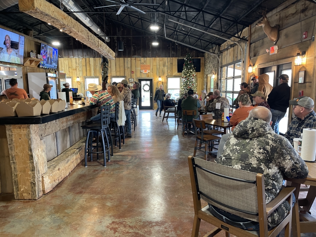
Van Zandt’s Grill & Grocery
Charming country store with full menu, basic groceries and supplies.

  • Address: ​103 Newport Rd, Blue Ridge, GA 30513
  • Phone: (706)-838-4158
  • Visit Website

The OverHang at Camp Frank Merril
Home of the Mountain Phase of Army Ranger training school with cafe open to public.

  • Address: 1 Camp Merrill Dr, Dahlonega, GA 30533
  • Phone: (706)-626-3951(706)-626-3951
  • Visit Website

Dahlonega
Small city in Northern Georgia with multiple services available.


Two Wheels of Suches
Infamous lodge, cabin, camping and restaurant catering to motorcyclists

  • Address: 1915 GA-60, Suches, GA 30572
  • Phone: (706)-973-1671
  • Visit Website

Kennedy Creek Resort
Cabins, yurts, camping and restaurant with a small aircraft grass runway.

  • Address: 3001 High Valley Rd, Suches, GA 30572
  • Phone: (478)-484-7759
  • Visit Website

Cooper’s Creek Store
Fuel is offered and ice cold beverages (no alcohol), ice cream, snacks and more.

  • Address: ​ 27880 Morganton Hwy, Suches, GA 30572
  • Phone: (706)-838-4514
  • Visit Website

Wolf Pen Gap Store
Located in Suches, GA. They have a hostel for AT hikers, and are on Wolf Pen Gap, a curvy road.

  • Address: ​ 41 Wolf Pen Gap Rd, Suches, GA 30572
  • Phone: ((706)-747-2271
  • Visit Website

Dahlonega
Small city in Northern Georgia with multiple services available.

Toccoa River Swinging Bridge On Benton MacKaye Trail

Short hiking trail to iconic Toccoa River swinging foot bridge, the longest east of the Mississippi.


Chattahoochee Forest National Fish Hatchery

Hatches and supplies trout to numerous North Georgia Streams.


The OverHang Cafe at Camp Frank D. Merrill

Take second entrance to a public access cafe and pub on the Army Ranger base.

SUCHES TO DILLARD – 136 miles

Depart Suches on a twisty paved section of Highway 60 before entering the Mulky Gap area of the National Forest. A series of forest service roads lead to Duncan Ridge, a fun rocky road that eventually intersects Highway 180. Stop at Sunrise Grocery, a local spot for boiled peanuts, local produce, snacks and ethanol-free gas!

Visit Helton Creek Falls for a short hike to this scenic waterfall before continuing on the track through a pair of stream crossings. The route passes near Helen, Georgia, a tourist town known for its Bavarian theme, summer swimming and rafting on the Chattahoochee River.

Ride through a mix of country dirt and paved roads with a short detour to the Chattooga River, a protected Wild and Scenic natural river featured in the 1970s movie “Deliverance”. If you hear banjo music, you might want to pick up the pace.

The route then meanders through tight, scenic forest roads at the point where Georgia, South Carolina, and North Carolina meet. Section 2 concludes with a picturesque, curvy paved descent into the town of Dillard, enjoying mountain views along the way.

The Dillard House
The Dillard House, in Dillard, Georgia, is located only 2 hours north of Atlanta, GA, 1 hour from Asheville, NC, and 1 ½ hours from Greenville, SC in the beautiful Northeast Georgia Mountains. Historic Lodge and family style restaurant.

  • Address: 768 Franklin Street, Dillard GA, 30537
  • Phone: (706) 746-5348
  • Visit Website

Black Rock Mountain State Park
Mountaintop cottages surround a small playground, while campsites are nestled under rhododendron and gnarled oaks. Tent campers will appreciate the walk-in and backcountry sites that allow extra privacy, and “bear boxes” are provided to protect food. The park’s small lake is popular with anglers and circled by an easy walking trail. At an altitude of 3,640 feet, Black Rock Mountain is often cooler than other Georgia parks and may close during icy weather. RVers should be comfortable driving on steep, winding roads.

  • Address: 3085 Black Rock Mountain Parkway, Mountain City, GA 30562
  • Phone: 706-746-2141
  • Visit Website

Vogel State Park Campground & Cottages
Cottages, campsites and primitive backpacking sites provide a range of overnight accommodations. The park’s 22 acre lake is open to non-motorized boats, and during summer, visitors can cool off at the mountain-view beach.

  • Address: 405 Vogel State Park Road, Blairsville, GA 30512
  • Phone: 706-745-2628
  • Visit Website

Unicoi State Park & Lodge
Just two miles northeast of Alpine Helen in the gorgeous North Georgia Mountains is the ultimate mountain retreat destination. Unicoi State Park & Lodge is centered around beautiful Lake Unicoi within the Chattahoochee National Forest. The park offers unparalleled hiking trails leading to Anna Ruby Falls and Helen. Smith Creek – a peaceful tributary of the Chattahoochee River – winds from the base of the Anna Ruby falls to Unicoi Lake and is a celebrated trout fishing spot.

  • Address: 1788 GA-356, Helen, GA 30545
  • Phone: 706-878-2201
  • Visit Website

Wildcat BBQ and Store
Breakfast, Lunch and Dinner. Local honey, ice, boiled peanuts, fire wood, jams, jellies and pickles.

  • Address: 7475 GA-60, Suches, GA 30572
  • Phone: (706)-747-3855
  • Visit Website

Sunrise Grocery
Charming roadside country store with gas and cabin rentals.

  • Address: 7568 Gainesville Hwy, Blairsville, GA 30512
  • Phone: (706)-745-5877
  • Visit Website

The Dillard House
The Dillard House, in Dillard, Georgia, is located only 2 hours north of Atlanta, GA, 1 hour from Asheville, NC, and 1 ½ hours from Greenville, SC in the beautiful Northeast Georgia Mountains. Historic Lodge and family style restaurant.

  • Address: 17267 Johns Creek Rd, New Castle, VA 24127
  • Phone: (706)746-5348
  • Visit Website

Helen, GA
Helen is a mountain town in northeast Georgia. Helen offers a little bit of everything to appeal to the outdoor adventurer in you, whether its tubing, eating, or shopping!


Clayton, GA
Clayton is a city in Rabun County, Georgia. This “Farm-to-Table Capital” of Georgia offers up award-winning chefs cooking dishes with buttery biscuits and tender, fresh-from-the-farm, local meats and vegetables.

Cooper’s Creek Store
Gas, gift shop and deli.

  • Address: 27880 Morganton Hwy, Suches, GA 30572
  • Phone:(706)-838-4514
  • Visit Website

Sunrise Grocery
Charming roadside country store with gas and cabin rentals.

  • Address: 7568 Gainesville Hwy, Blairsville, GA 30512
  • Phone: (706)-745-5877
  • Visit Website

Helen, GA
Helen is a mountain town in northeast Georgia. Helen offers a little bit of everything to appeal to the outdoor adventurer in you, whether its tubing, eating, or shopping!


Clayton, GA
Clayton is a city in Rabun County, Georgia. This “Farm-to-Table Capital” of Georgia offers up award-winning chefs cooking dishes with buttery biscuits and tender, fresh-from-the-farm, local meats and vegetables.


Dillard, GA
A town in Rabun County, Georgia. Multiple fuel options can be found.

Vogel State Park Campground & Cottages

One of Georgia’s oldest and most beloved state parks, Vogel is located at the base of Blood Mountain in the Chattahoochee National Forest.


Unicoi State Park

Just two miles northeast of Alpine Helen in the gorgeous North Georgia Mountains is the ultimate mountain retreat destination. Unicoi State Park & Lodge is centered around beautiful Lake Unicoi within the Chattahoochee National Forest.


Helton Creek Falls

Helton Creek Falls cascades in a set of two waterfalls, sliding down in tendrils through a beautiful, hemlock-filled creek valley. The trail to these gorgeous waterfalls isn’t a long hike – in fact, the trail’s extremely short distance qualifies it as more of a short walk in the woods.


Chattooga River

Flowing through three states and the Ellicott Rock Wilderness, the Chattooga is recognized as one of the Southeast’s premier whitewater rivers.

DILLARD TO ELLIJAY – 119 miles

Departing Dillard, Patterson Gap Road offers a scenic and winding dirt route through the gap, with an option to tackle the more challenging Popcorn Creek Forest Service Road. This rugged alternate section is often muddy, overgrown and rutted, eventually reconnecting with the main route at Tallulah River Road. Here, you’ll encounter the longest river crossing of the route at the Tallulah River, followed by a blissful stretch of dirt with multiple creek crossings and steep, rutted climbs that become more challenging in wet conditions.

Consider an extension to Brasstown Bald via excellent paved roads to visit Georgia’s highest point at 4,784 feet and a lookout tower with panoramic views. The journey continues with a series of enjoyable country paved roads and two back-to-back forest roads, offering numerous twists and turns, and some of the most fun riding yet. Follow the Toccoa River for several miles, crossing it on an old iron bridge near tubing rentals and a sandwich café. Section 3 concludes with a mix of pleasant paved and gravel roads, passing under a scenic railroad trestle and ending in the town of Ellijay.

Bell Creek Cabin Rentals
These beautiful new lakefront cabin rentals are located close to downtown Hiawassee in the northeast Georgia Mountains. One cabin sleeps 5 people and one cabin sleeps 6 people. They offer grills, kayaks, full kitchens and easy access.

  • Address: 1473 Upper Bell Road, Hiawassee GA 30546
  • Phone: (706) 897-1081
  • Visit Website

Lake Chatuge Lodge
Enjoy the North Georgia Mountains in a relaxed, comfortable lodge. Lake Chatuge Lodge is conveniently located close to the many amenities and attractions in the area, including Lake Chatuge and the cities of Hiawassee and Young Harris. The lodge is located right on Lake Chatuge and many of our rooms are lakefront views, All deluxe and lake view rooms also feature fridges and microwaves. All rooms have a private balcony or patio.

  • Address: 1653 U.S. Highway 76, Hiawassee, GA 30546
  • Phone: 706–896–5253
  • Visit Website

Sunrise Cabins & Cottages
Just a few miles south of Blairsville and three miles north of Vogel State Park, located in one of the most scenic spots in Georgia. The Owners and your hosts Jason and Jesica Clemmons are here to help you with any special requests during your stay just let them know and they are more than happy to help. 

  • Address: 7568 Gainesville Hwy Blairsville, GA 30512
  • Phone: 706.745.5877
  • Visit Website

Vogel State Park
One of Georgia’s oldest and most beloved state parks, Vogel is located at the base of Blood Mountain in the Chattahoochee National Forest. Cottages, campsites and primitive backpacking sites provide a range of overnight accommodations. The park’s 22-acre lake is open to non-motorized boats, and during summer, visitors can cool off at the mountain-view beach.

  • Address:  405 Vogel State Park Rd. Blairsville GA 30512
  • Phone:(706) 745-2628
  • Visit Website

Jim’s Smok’n Que
Exquisite, Award winning, low & slow Jim’s Smokin’ Que in North Georgia. Pickup available at the catering facility or food truck.

  • Address: 4971 Gainesville Hwy, Blairsville, GA. 30512 US
  • Phone: (706) 835-7427
  • Visit Website

Iron Bridge Cafe
Lots of great food and a large selection of your everyday needs. Everything from snacks and drinks, to gifts, T-shirts, hats and camping supplies, you can find it all here.

  • Address: 8436 Aska Rd., Blue Ridge, Georgia, 30513
  • Phone: 706-632-4700
  • Visit Website

The Roof
Southern rooftop kitchen and bar inspired by the culture of their hometown in Appalachia.

  • Address: 16 River Street, Ellijay, GA 30540
  • Phone: 706.635.ROOF (7663)
  • Visit Website

River Street Tavern
Salads, Wings, Burgers, Sandwiches and More! River Street Tavern has a large selection and variety of great food to choose from.

  • Address: The River Street Tavern, 40 River Street Suite B. Ellijay, GA 30540
  • Phone: 706-635-6166
  • Visit Website

Pasture Country Store
Carries Regular, Midgrade, Premium. Country store with great inventory.

  • Address: 3958 River Bank Run, Hiawassee, GA 30546
  • Phone: (706)-896-5232

Lost Creek Citgo
CITGO / Lost Creek in 29 Mulky Gap Rd road has been providing High quality Fuel and Services for its Customers. CITGO / Lost Creek at 29 Mulky Gap Rd lane is known for its friendly Customer Service and Cleanliness.

  • Address: 29 Mulky Gap Rd, Blairsville, GA 30512
  • Phone: (706)-745-7183
  • Visit Website

Alternate Harder Option – Popcorn Creek


Tallulah River Crossing


Brasstown Bald Visitor Center

Highest point in Georgia with shuttle ride to observation area. Fee required.

  • Address: 2941 GA-180 Spur, Hiawassee, GA 30546
  • Phone: (706)-896-2556
  • Visit Website

CHATTAHOOCHEE PACKING LIST

This packing list serves as an example and is not intended to be a complete list for your backcountry riding needs. Feel free to customize this list to work for you.

  • Helmet
  • Boots
  • Goggles
  • Gloves (2 sets)
  • Protective gear (pressure suit, Leatt brace, knee braces)
  • Jacket
  • Pants
  • Balaclava or neck gaitor
  • Water bladder or bottle
  • Hydration pack
  • Ear plugs

CHATTAHOOCHEE MOTORCYCLE DEALERSHIPS

FREQUENTLY ASKED QUESTIONS

Below are answers to some Frequently Asked Questions about the Chattahoochee BDR-X.

The Chattahoochee BDR-X is a 350-mile loop featuring the best dual-sport and adventure riding in the north Georgia mountains. This unforgettable route combines a collection of graded forest roads, primitive two-track, and scenic backcountry pavement under the dense canopy of the Chattahoochee National Forest.

Quaint mountain towns dot the track including Ellijay, Dahlonega, Suches, and Helen, with abundant lodging and camping opportunities throughout. Riders will criss-cross the Appalachian Trail, tackle rugged climbs, carve twisty pavement, and splash through numerous creek crossings.

Unique to the south, the Chattahoochee BDR-X can be ridden most of the year and is best between March and December, weather permitting.

As with all BDR’s, this route is designed for intermediate riders.  Most of the composition is pavement, gravel and packed dirt, but there are stretches of tight, rugged and rutted two-track, rocky hills, water crossings, and the Optional Harder route up Popcorn Creek.

May through October are generally predictable, but can see hot temperatures in the middle of summer, and cold mornings and evenings in the shoulder seasons with potential for snow or ice on the ground.  Rain storms can happen at any time but are more common in early summer.  June is typically the highest rain month.

This route is designed to be ridden counter-clockwise, starting from Ellijay, but you can access this loop from any location. Please be prepared for two-way traffic everywhere on this route and always remember to Ride Right to avoid head-on collisions around blind corners.

This route is designed to be ridden counter-clockwise, starting from Ellijay, but can be ridden clockwise and accessed from any location along the loop. Please be prepared for two-way traffic everywhere on this route and always remember to Ride Right to avoid head-on collisions around blind corners.

This route can be accomplished in three days, roughly one section per day. This area is full of amazing opportunities for tourist activities, hiking, memorials, monuments, parks, whitewater rafting and historical areas so plan to spend some extra time to really enjoy the area.

There are no permit requirements along this route. However if you choose to ride up to Brasstown Bald there is a fee required to enter the visitors area and take the shuttle to the top. Other State Parks or recreation sites may have specific fees.

There are many established campgrounds throughout the route, as well as fantastic free dispersed camping within the National Forest.

Campfires are generally allowed in the National Forest using already established campfire rings. Read specific rules and regulations before you go HERE

The longest gap between fuel stops is 94 miles on Section 1 on the route from Ellijay to Suches.  There is the option to take a detour to Dahlonega if needed. Fuel is readily available on the remainder of the route, but we always recommend riders stop at every opportunity and carry extra fuel if needed.

There are plenty of great lodging options available throughout this route, and the adjacent towns such as Dahlonega, Helen, and Hiawassee provide more opportunities just off the main route.

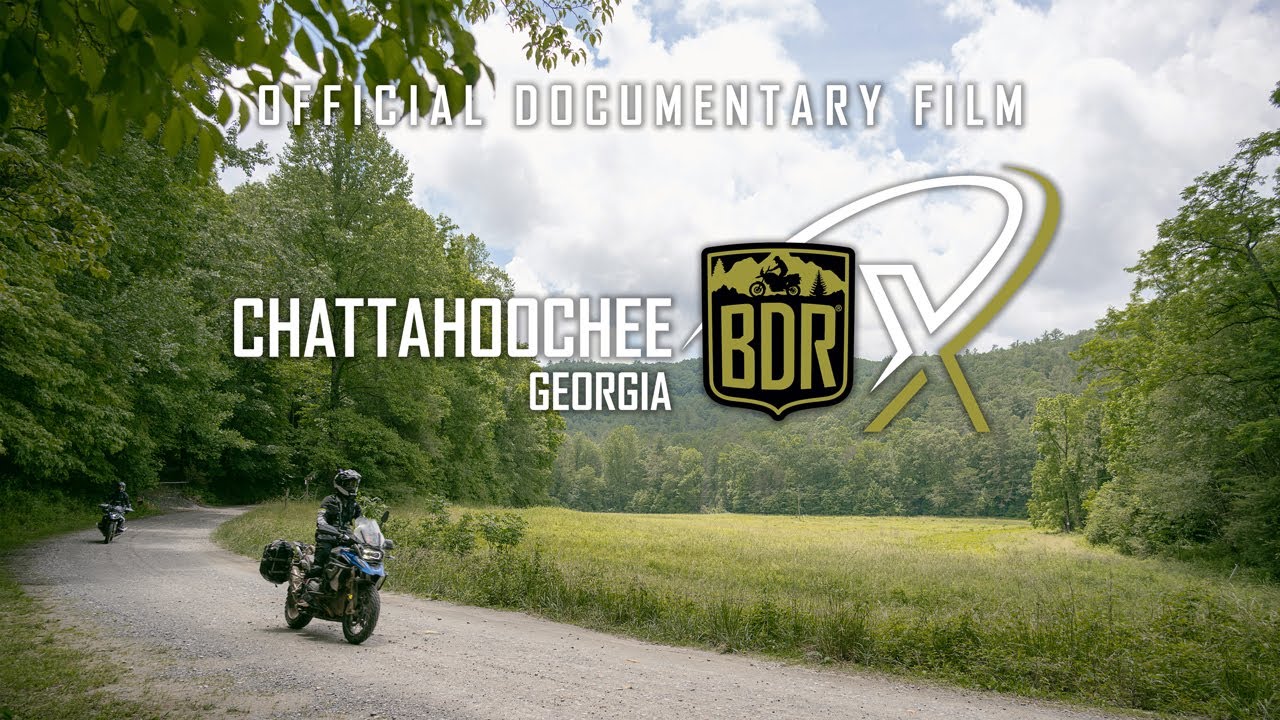
This route cannot be ridden without the use of GPS tracks. Be prepared and bring a navigation device with the latest GPS tracks loaded. Free GPS tracks are available for download on this site. The route can also be navigated using a smartphone GPS navigation app like Gaia, Rever and others. The Chattahoochee BDR-X expedition documentary film is a great source of information about the route and is available via on-demand video platforms like YouTube and Vimeo.

Any GPS unit capable of handling 15 track logs with a minimum of 1500 points each is suitable for use on this route. Garmin models that work best for this application are: Zumo XT, Zumo 590/595/395/396, Montana, and 276Cx. Many other GPS units are compatible with the GPX file format, check the owner’s manual of your device for more information.  You can also import the tracks into a GPS navigation app, like Gaia GPS, but make sure you have the premium version of the app, so you can navigate via offline maps.

Cell phone service can be limited in some areas on this route so a satellite communication or tracking device such as Zoleo, Spot, or Garmin InReach is strongly recommended for emergency situations.

Any bike that has a license plate, can run knobby tires, has adequate suspension, can carry the gear you will need, and has enough fuel range. Most adventure or dual-sport motorcycles will be suitable for this trip. Even very experienced riders on our team reported being challenged on larger bikes by some of the technical sections of the route during the filming expedition. Choose the bike that you are the most comfortable riding in challenging terrain and that you are able to pick up if you drop it.

DOT approved knobby tires are strongly recommended.  Riding this route without at least a 60/40 tire (60% dirt, 40% road) is not recommended.

Segments of this route can be ridden two-up for those experienced in riding off-highway with a passenger and luggage. However, we strongly advise against riding the technical sections of this route two-up. The pavement portions of this route are a fantastic way to explore with a partner on board.

Please don’t go off the route anywhere where it’s gated or signed for seasonal or permanent closures, and don’t venture onto private property.

The Chattahoochee BDR-X route may include a few instances where the track follows an easement road through private land. In many, but not all cases, the land owners have installed “private land” signs and it is important that riders acknowledge these signs and stay on the designated track. If you are unsure of the land ownership adjacent to the roads, such as outside of national forest lands, it’s best to stay on the track to avoid trespassing. In all cases riders should not ride off the roads which creates new trails and damages vegetation. Please remember that riding off the designated roads can jeopardize our right to use these roads for recreation.

There may be gates and/or seasonal closures along the route, please do not ride around closed gates. As a general reminder on BDR’s, if you encounter ranch gates, leave them as you found them. If they were open, leave them open and if they were closed, close them again after you pass through. If you pass by ranches, be courteous and ride respectfully.

In spring and early summer there may be temporary closures when crews are repairing washouts, downed trees, and other road hazards. If roads are closed due to wildfires, do not ride around the signs as that can put you or fire crews in danger and can get you a hefty fine. Check the BDR website for route updates before you go.

Please abide by posted road closure signs. Ignoring these signs is a sure way of getting a road closed for good. That said, sometimes locals will post unofficial “road closed” signs on public roads for their own personal reasons. Additionally, land managers may not have removed a “closed” sign from a seasonal road – even though the sign right next to it clearly displays the open/closed dates. In these cases, use your best judgment – if in doubt navigate around the closed road and report it to BDR. And please remember never to engage in arguments with local land owners.

Each state has its own recreational fishing requirements and restrictions. To learn about the required licenses and stamps for fishing (and hunting) in Georgia, visit: 

https://www.eregulations.com/georgia/fishing/general-regulations/

We do our best to post the most up-to-date information about the route on ridebdr.com/.

We depend on the BDR community to inform us about route and road conditions, so if you encounter any road closures or severe conditions that are worth reporting, please contact us with the information. We also recommend riders join the official Facebook Group Page HERE

Georgia is a habitat for many animals like deer, bear, and small critters — all of which make their way to the road at some point. Be alert everywhere you go as animals can and will cross your path along the route – especially at dusk.

Yield to all animals whether wild, domestic, or livestock by slowing down or stopping. Many locals in rural areas keep their dogs off-leash on their property and dogs love to chase motorcycles – be cautious and considerate.

All of the roads used on the BDR-X are public roads and as such, are open to vehicles. If you do decide to drive this route you will want a 4×4 with high clearance as the route has deep puddles, large rocks, ruts and steep, loose grades. Always stay to the right and go slow around blind corners to avoid head-on accidents with others using the roads. We recommend traveling the loop counter-clockwise to minimize head-on traffic.

It is absolutely essential that you Ride Respectfully and follow the tips outlined in our Ride Respectfully campaign.  Remember, it’s up to all of you to preserve our access – we can easily lose access to many of these roads if we don’t practice proper etiquette. Always represent BDR and the ADV community in the best light.

Rating the Routes by Difficulty

We are often asked if we rate BDRs by difficulty. We don’t officially rate the difficulty level of our routes as it varies daily due to current weather, road conditions, and other unpredictable factors. Difficulty also depends on individual skill and fitness level, bike and tire selection and load carried.

Some riders find sand to be most challenging, some find mountain passes difficult. Each rider’s perception is unique.

While we can’t provide a standardized rating like ski resorts, we can provide some basic guidance of difficulty level from most to least. This order does not include optional harder sections and implies favorable road and weather conditions:

BDR Routes: CABDR-South, ORBDR, AZBDR, WYBDR, UTBDR, COBDR, NVBDR, NEBDR, WABDR, NMBDR, CABDR-North, IDBDR, MABDR.

BDR-X Routes: Big Bend, TX; Red Desert, WY; Steens/Alvord, OR; Chattahoochee, GA; Black Hills, SD; PA Wilds, PA.

Review the FAQs for each route before your trip.

Backcountry Discovery Routes is a 501c(3) non-profit corporation. © 2025 Backcountry Discovery Routes, Inc. All rights reserved. Terms of Use.