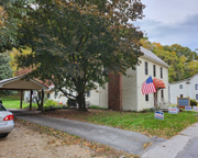
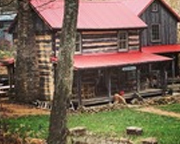
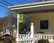
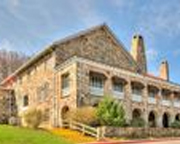
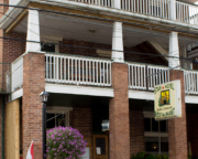
The Evergreen Inn, Covington, VA (Section 3) 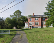
Evergreen Inn is a 1920’s home renovated in 2019 with all new furnishings & situated along the Jackson River Scenic Trail, a former railroad line that ran from Covington to Hot Springs and transported milk from the Evergreen Dairy (building is still across the street) to The Homestead Resort.
- Address: 1914 Dressler Drive, Covington, Virginia 24426
- Visit Website
Vine Cottage Inn, Hot Springs, VA (Section 3) 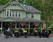
Riders are ALWAYS WELCOME at Vine Cottage Inn! We offer 10 beautiful, yet comfortable guest rooms, each with private bathroom for a hot shower after a day of riding through some of the most beautiful country along the MABDR! A full 3 course breakfast will fuel you up in the morning, getting you ready to start the next part of your ride. Kickstand pucks and wipe down towels are always available. We’d love to talk about our own adventures on the MABDR!
- Address: 7402 Sam Snead Hwy, Hot Springs, VA 24445
- Visit Website
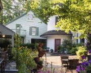
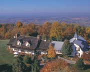
The Inn at Gristmill Square, Warm Springs, VA (Section 3) 
The Inn at Gristmill Square is Bath County’s premier boutique inn and restaurant located in the heart of the George Washington National Forest. Our 18 rooms and suites are comfortably appointed with a mix of beautifully selected antiques and modern furnishings to create unique spaces for which guests have long enjoyed.
- Address:O. Box 359 / 118 Old Germantown Road, Warm Springs, Virginia 24484
- Phone: (540) 839-2231
- Visit Website
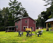
Wilderness Adventure at Eagle Landing (Section 3) 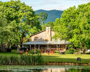
Situated on 500 acres of field, forest, mountains and streams in Virginia’s Blue Ridge, Wilderness Adventure at Eagle Landing is the perfect spot to spend the weekend, bring a group, or tie the knot. Craig’s Creek, a wide, shallow, and meandering body of water flows along nearly a half mile of the property making it perfect for tube floats, canoe paddles, or afternoon rinses on hot afternoons. The opportunities for relaxation and adventure are endless. You can move at your own pace, exploring your surroundings on foot, boat, or bike OR you can let us guide your adventures over multiple days. Let us be your basecamp for adventure!
- Address: 11176 Peaceful Valley Road, New Castle, VA 24127
- Phone: (540) 864-6792
- Visit Website
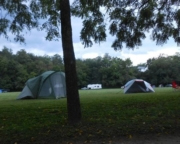
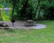
Brandywine Recreation Area, Brandywine, WV (Section 3) 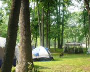
Swimming lake, bathrooms, showers, grills, tent sites = $16 (large enough for 2 tents), hiking trails.
Big Spring Bed & Breakfast, Williamsville, VA (Section 3) 
Ranch style house on 300-acre farm where the Cow pasture river runs through it. Nestled beside a Big Spring. Farm is bordered on the east by the George Washington National Forest. Short walking distance to the Shaw’s Ridge Trail. Short driving distance to Shenandoah Mountain and the Confederate breastworks. A few miles from historical McDowell and Monterey, Highland County, Virginia. Enjoy outdoor activities such as fishing hunting hiking biking kayaking in the area.
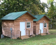
Loafers Glory B&B and Campground, Sugar Grove, WV (Section 3) 
One full apartment, two rustic camping cabins with 3-4 beds in each, and unlimited camping. Also, hot showers.
Thorn Spring Park, Franklin, WV (Section 3) 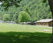
Thorn Spring Park, the county’s 4-H camp for two weeks of the year, is also open to the public with cabins for rent, full hookups for trailers and RVs, and campsites for tenters.
- Address: 42 All Star Dr, Franklin, WV 26807
- Phone: (304) 358-7737
- Visit Website
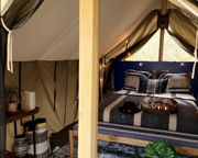
LTD Vacation Rental Cabins, Petersburg, WV (Section 3) 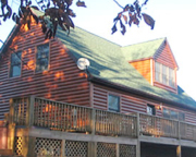
5 cozy cabins with fully equipped kitchens, outdoor hot tubs, satellite TV, and full privacy from each other.
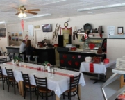
Star Hotel & Restaurant, Franklin, WV (Section 3) 
The Star Hotel & Restaurant is the choice place to stay & dine in the town of Franklin, West Virginia. Our restaurant offers casual & fine dining, with the best prime rib around! Guests love our cozy rooms with vintage character. We have everything you need for the perfect visit.
- Address: 210 S Main St, Franklin, WV 26807
- Phone: (304) 358-3580
- Visit Website
The Red Lantern Inn, Clifton Forge, VA (Section 3) 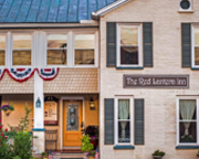
A 100-year-old building, completely renovated; casual overnight accommodations; 7 bedrooms, 4.5 baths, and common areas: living room, full kitchen, glassed-in porch and media room.
- Address: 314 Jefferson St., Clifton Forge, VA 24422
- Phone: (540) 797-5000
- Visit Website
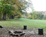
Douthat State Park Campground, Millboro, VA (Section 3) 
Cabins, campsites, conference facilities, picnic shelters, stocked lake, boat house, sandy beach, hiking/biking trails.
- Address: 14239 Douthat State Park Rd., Millboro
- Phone: (540) 862-8100 or 1-800-933-PARK
- Visit Website
Quality Inn, Covington, VA (Section 3) 
Located 1.5 miles from I-64. Free breakfast, exercise facility, business center, and guest laundry facilities.
- Address: 429 W. Main St., Covington, VA 24426
- Phone: (540) 960-2131
- Visit Website
Magnuson Hotel, Covington, VA (Section 3) 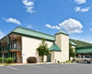
Cable TV, fridge, coffee maker
- Address: 820 E. Madison Ave. Exit 16, I-64, Covington, VA 24426
- Phone: (540) 962-4951
- Visit Website
Hampton Inn, Covington, VA (Section 3) 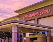
Free hot breakfast, indoor heated pool, microwave and refrigerator in every room, exercise facility, outdoor patio with fire pit; on site business center.
- Address: 701 Carlyle St., Covington, VA 24426
- Phone: (540) 962-1200
- Visit Website
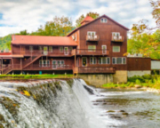
Hot Springs Omni Resort, Hot Springs, VA (Section 3) 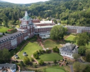
Experience the southern hospitality and elegant charm that have made this resort a premier destination for 23 U.S. presidents. Located across more than 2,000 acres of scenic Virginia landscape, this resort provides timeless comforts and access to an array of exciting activities no matter the season. From the full-service spa featuring the same mineral waters that President Thomas Jefferson experienced in 1818, to two of the best golf courses in Virginia, you’re sure to have an experience unlike any other.
- Address: 1766 Homestead Dr., Hot Springs, VA
- Phone: (540) 839-1766
- Visit Website
Morris Hill Campground, Covington, VA (Section 3) 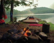
Rustic campground, showers, also primitive camping; stocked lake; water sports; bath house, sandy beaches, hiking and in season hunting.
- Address: Exits 10, 14, or 16, I-64 to Lake Moomaw and Gathright Dam, St. Rt. 605, Covington, VA
- Phone: (540) 962-2214 (info only) 1-877-444-6777 (reservations)
- Visit Website
Travelodge, Low Moor, VA (Section 3) 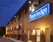
Adjacent to Penny’s Diner, open 24 hrs. Microwave and fridge, HBO. Near LewisGale Hospital Alleghany.
- Address: 123 Westvaco Rd., Exit 21, I-64, Low Moor, VA 24457
- Phone: (540) 929-0977
- Visit Website
Smoke Hole Caverns Log Cabin Resort, Cabins, VA (Section 3) 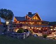
Tourist attraction located in the Seneca Rocks/Spruce Knob National Recreational Area. Cozy log cabins and Cavern pool tours.
- Address: 8290 N Fork Hwy Cabins, WV 26855
- Phone: (304) 257-4442
- Visit Website
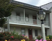
Warm Springs Inn, Warm Springs, VA (Section 3) 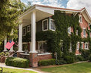
A landmark in Bath County since it was built in the late 1800’s, this historical inn was established in the same building as the first courthouse and jail in the county.
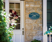
Penmerryl Farm, Greenville, VA (Section 3) 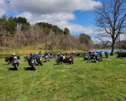
Found just a 30 – 40-minute detour off the MABDR section 3, and just 15 minutes from the Blue Ridge Parkway, Skyline Drive, Rt 11 and I-81/I-64, Penmerryl Farm is an ADV motorcycle centric resort offering primitive camping, overland vehicle and trailer parking, lodge rooms and cabin rentals. Training opportunities and trails on-site, as well as a motorcycle shop available for public use.
Allegheny MotoCamp, Monterey, VA (Section 3) 
Whether you are coming from the Mid-Atlantic Back Roads Discovery Route or otherwise exploring the beautiful mountain roads in our county, MotoCamp is here to provide safe and clean accommodations in a scenic setting, either in your own tent or in our Clubhouse. Stay for one night or longer, enjoy the pristine mountain air, and re-energize for another day of motorcycling. We will have information on places to eat and the best routes to travel. With advance notice, we can also provide a snack pack with healthy food and drink for your next day of travel or help you stock up on hygiene items, such as toothpaste and a toothbrush.
- Address: 5026 Jackson River Rd, Monterey, VA 24465
- Visit Website
Spacious Farmhouse, Highland County, VA (Section 3) 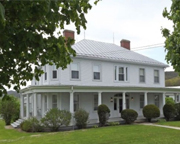
A new VRBO rental right in the heart of section 3 in Highland County VA. Accommodations are ideal for large groups. Just miles from the MABDR and additional riding options in every direction in VA and WV. Garage to park bikes. Convenient to several restaurants and gas stations.
- Address: Highland County, VA Detailed location provided after booking.
- Visit Website
Hill Crest Bed and Breakfast, Clifton Forge, VA (Section 3) 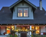
100-year-old Historic Greek Revival Home nestled on the top of the Alleghany Hills of Virginia. 7 Federal Style guest rooms, 6 private baths. Guests are spoiled and pampered with 3 to 7 Course Silver Service Candlelight breakfast, afternoon teatime, and turn down service in the evening.
- Address: 110 McCormick Blvd., Clifton Forge, VA 24422
- Phone: (540) 865-0359 or (385) 201-4106
- Visit Website
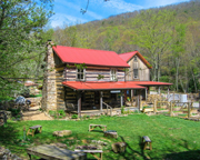
Fort Lewis Lodge & Farm, Millboro, VA (Section 3) 
Fort Lewis Lodge & Farm is a country inn set on a 3,300-acre mountain estate in Bath County, VA. The property offers 3-miles of private river access for fishing, swimming, and boating and trails for hiking and biking. Soak in our wood-fired sauna by day or sit fireside in our pavilion by night. Family-owned for over 30 years, Fort Lewis is also a working farm, where produce is grown, and the pastureland is used for grass-fed cattle. Your stay includes a seasonally inspired breakfast and dinner. All rooms offer private bathrooms, daily housekeeping, AC, and WIFI.
- Address: 603 Old Plantation Way, Millboro, VA 24460
- Visit Website
River Rest Farm B&B (Section 3) 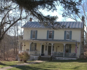
4 rooms. one with a king bed 1 with queen 1with 2 full 1 with twins also 3 shared baths. Call Rick for reservation (don’t forget to mention the BDR!)
- Address: 80 Cowpasture River Road S., VA 24442 (On 614 S., 100 ft. south of 250)
- Phone: (610) 570-6410
- Visit Website
North Fork Mountain Inn (Section 3) 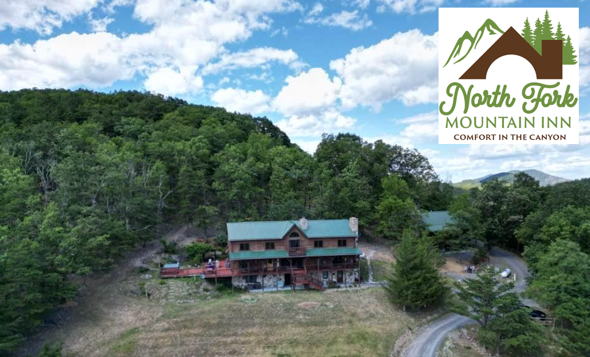
Conveniently located at 235 Canyon View Ln, Cabins, WV 26855. This is directly located off of Smoke Hole Road, which is on the Mid Atlantic Route. Riders get to start their day off with a delicious home cooked breakfast (included in the room rate).
- Address: 235 Canyon View Ln, Cabins, WV 26855
- Phone: (304) 257-1108
- Visit Website
Buttonwood Motel and Restaurant (Section 3)
They have a variety of room sizes ranging from 1 queen bed, 2 double beds, 2 double and 1 single. We also have a cabin with 2 double beds, kitchen, bath and a fire pit. Prices range from $79.92- $116.55 depending on bed sizes. Call to check availability 814-486-0522
- Address: 368 Sizerville Rd, Emporium Pa 15834
- Phone: 814-486-0522
- Visit Website
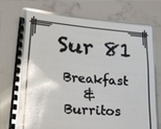
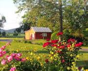
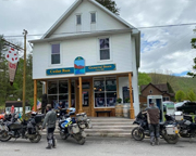
The Curly Maple (Section 3)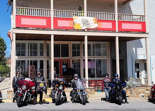
The Curly Maple is a mom and pop country store, restaurant, and lodging facility located in the beautiful town of Monterey, VA. It’s a great place to base camp and ride our scenic, empty, and open roads, then relax in one of our cozy, custom suites, which include full kitchens and living rooms.
- Address: 174 W. Main St, Monterey, VA 24465
- Phone: (540) 468-1250
- Visit Website


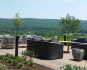
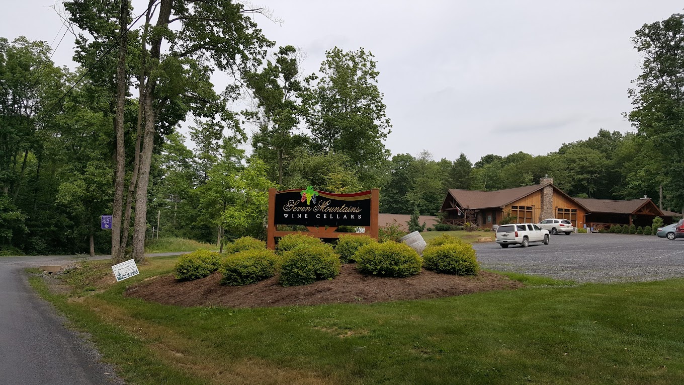 Seven Mountains Wine Cellar(Section 6)


