Join our Facebook Group for more route updates.

Visit the official WYBDR Facebook Group page for ride reports, photos, and discussions with other riders in your area HERE

Winter is Coming: Check snow levels with our interactive map

With winter upon us, weather and route conditions can change rapidly.  Before you go, be sure and use our Interactive Map to view estimated snow levels on each of our routes.

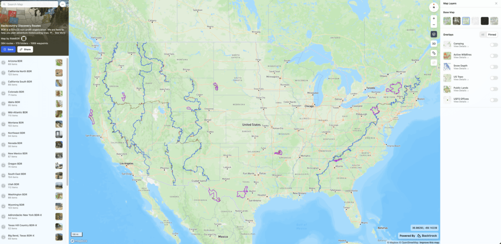
  • Click HERE to access the main interactive map page.
  • Click on the LAYERS icon in the top right of the window.
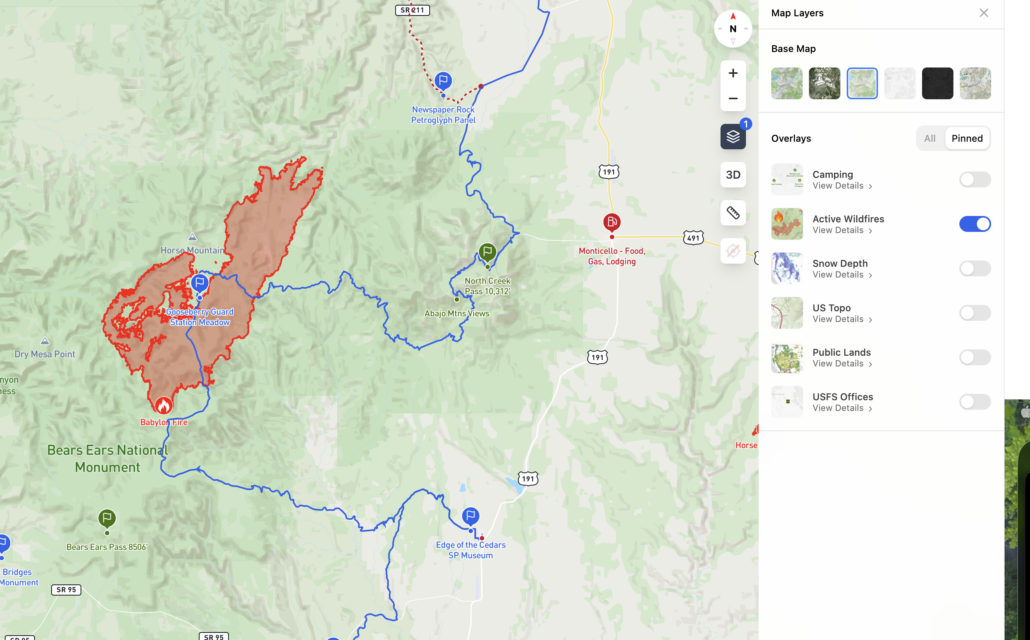
  • Select SNOW DEPTH to view estimated current snow levels.
  • Zoom into the area of your choosing to view the estimated snow depth.
  • Explore the other features of our interactive map to plan your next BDR experience.
  • See attached screenshots for reference.
September 3, 2025

New Tracks Available for Download

A new version of the WYBDR tracks is available labeled WYBDR-September2025

This update includes a few minor refinements and a few new updates:

SECTION 3:

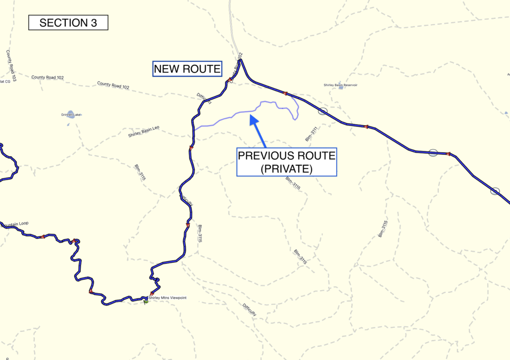
  • The track near Shirley Mtns has been revised to avoid a portion of private property. Please be courteous and avoid private roads.

SECTION 4:

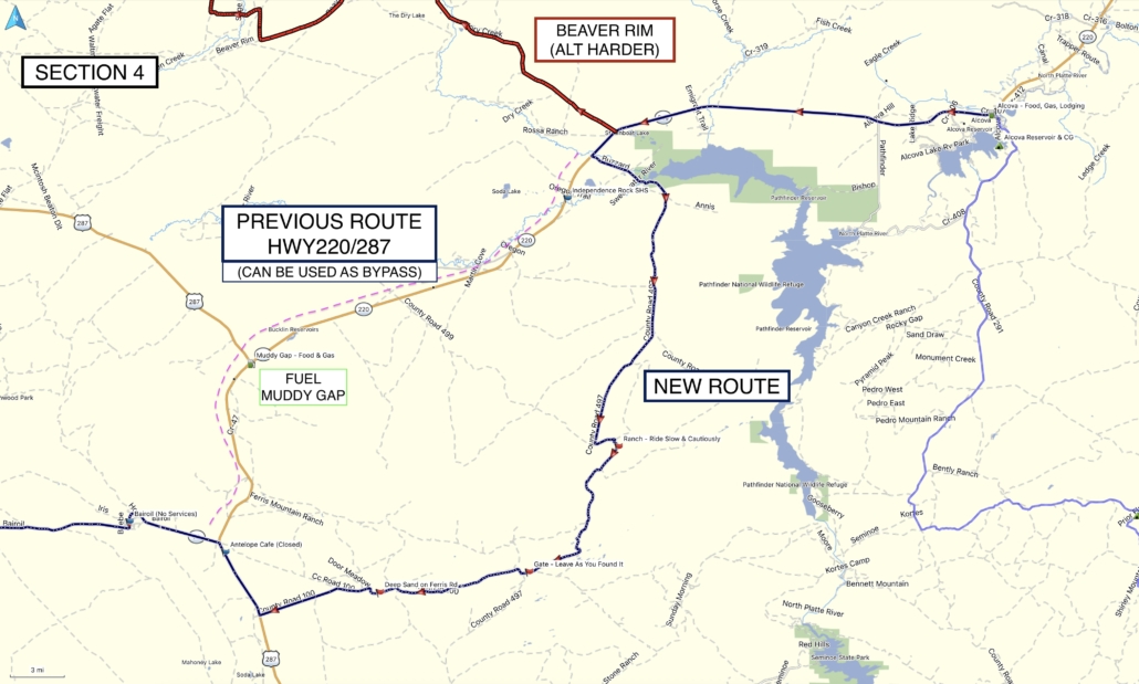
  • The main route out of Alcova has been revised to add more dirt.
  • This section is 163mi and no fuel is available. Riders can detour to Muddy Gap for fuel via Hwy287. Always carry extra fuel if you are concerned with your range.
  • Riders wishing to avoid this new portion of dirt or concerned about fuel range can remain on Hwy220/287

See attached screenshots for reference.

Purchase the official map for the WYBDR HERE

Always download the latest version of the GPS tracks just before you go HERE

June 12, 2024 (updated June 19th 2024)

Important WYBDR Reminder – Beaver Rim (Section 4 ALT Harder)

Please read this important update before heading out on the WYBDR:

  • Riders should not attempt the entire WYBDR before July 1st due to sensitive land areas and lingering snow and mud.
  • As a reminder, BLM representatives have notified us that the Beaver Rim section of the route will not be open until July 1st each year. This date coincides with seasonal closures in the national forests.
  • On the Beaver Rim this would allow the Greater Sage Grouse birds to hatch their chicks and it would minimize lasting impacts on them in addition to mitigating potential road damage due to muddy conditions and ruts. Avoid environmental damage and never travel off a main road.
  • The Beaver Rim (previous Section 4 main route) has now been changed to an optional ALT Harder track, with a new main section 4.

Download the latest version of the WYBDR tracks HERE

Check estimated snow levels using our interactive map HERE

November 27, 2022

WYBDR Route Update
 
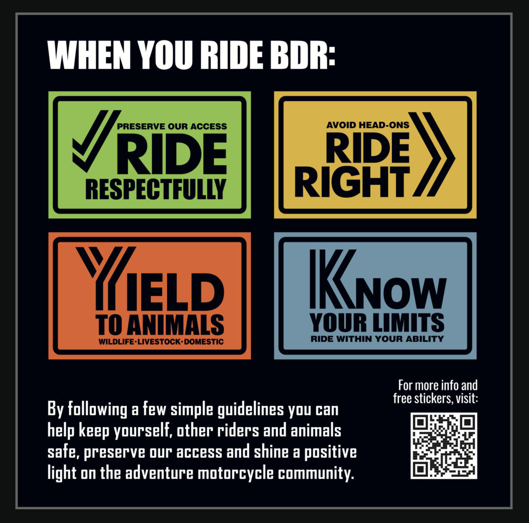
We have received complaints from the Wyoming Game & Fish Department and the Bighorn National Forest managers about unwanted behavior of riders on the WYBDR. Please review these guidelines before heading out on the WYBDR and Ride Respectfully to help preserve access to our public lands.

Can I fish on the WYBDR?
Each state has its own recreational fishing requirements and restrictions. To learn about the required licenses and stamps for fishing (and hunting) in Wyoming, visit https://wgfd.wyo.gov/apply-or-buy.
Please note, the Wyoming Game & Fish Department has reported a number of riders fishing without the proper licenses and conservation stamps, so please ensure that you have obtained the proper permits if you intend to go fishing during your WYBDR trip.

What if I see a ‘Private Land Sign’?
The WYBDR route includes a few instances where the the track follows an easement road through private land. In many, but not all cases, the land owners have installed “private land” signs and it is important that riders acknowledge these signs and stay on the designated track. If you are unsure of the land ownership adjacent to the roads, such as outside of national forest lands, it’s best to stay on the track to avoid trespassing. In all cases riders should not ride off the roads which creates new trails and damages vegetation. Please remember that riding off the designated roads can jeopardize our right to use these roads for recreation.

What if I encounter a gate along the route?
On most BDRs riders will encounter gates across roads and the WYBDR is no exception. These gates are important and are used by ranchers to control and separate herds. The rule of thumb is to leave the gate as you’ve found it. This means that if it was closed when you found it, close it after passing through. If it was open, leave it open. It is important for riders to follow this rule to prevent animal herds intermixing, and respect the rights and needs of private landowners and permittees.
Backcountry Discovery Routes is a 501c(3) non-profit corporation. © 2026 Backcountry Discovery Routes, Inc. All rights reserved. Terms of Use.