Wyoming Backcountry Discovery Route

The long awaited Wyoming BDR (WYBDR) is our eleventh route developed for dual-sport and adventure motorcycle travel.

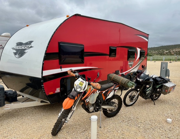
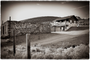
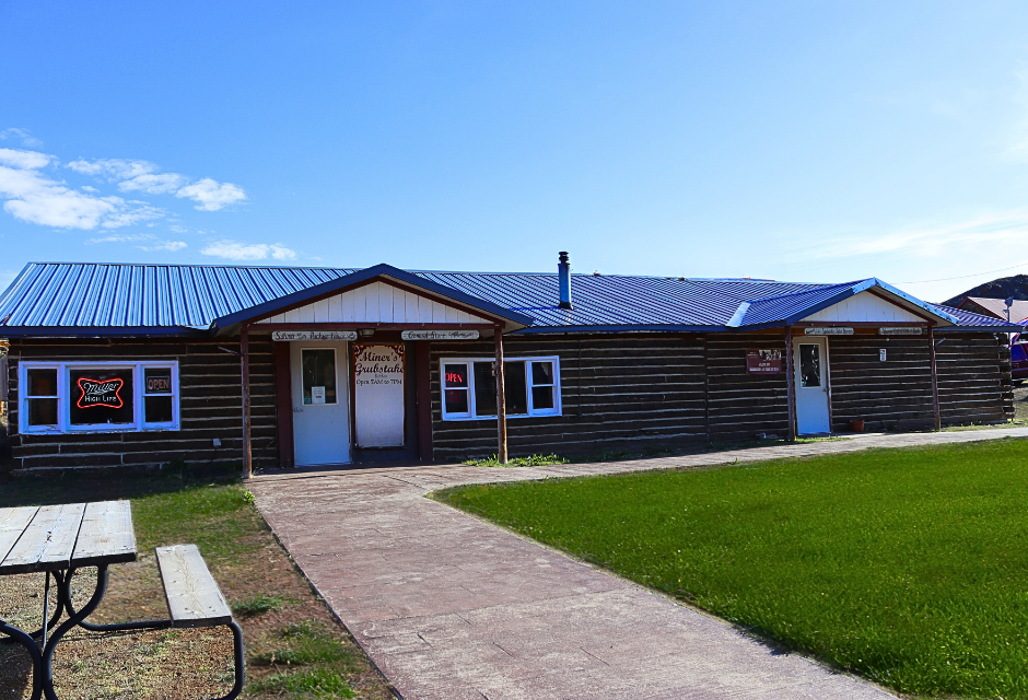
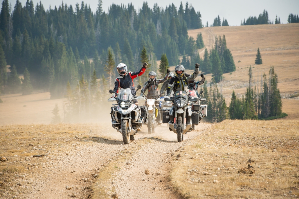
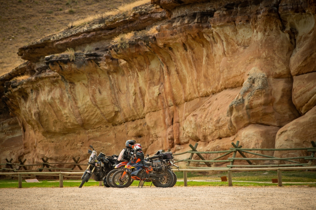
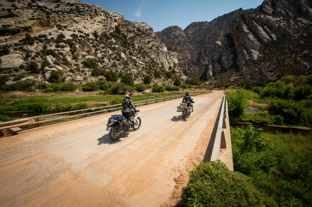
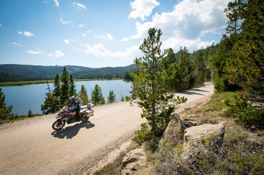
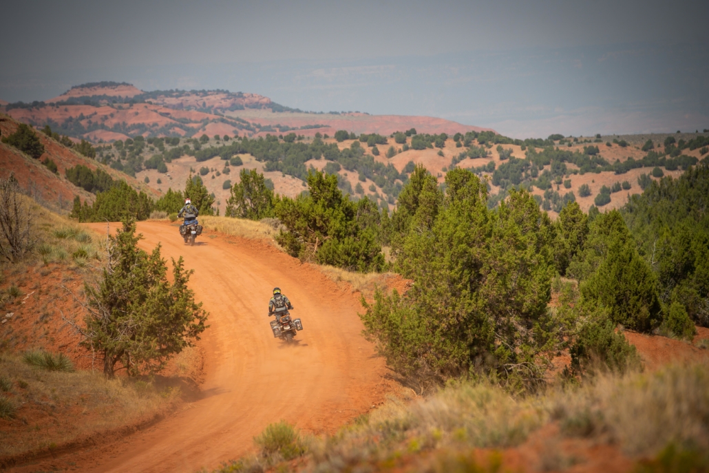
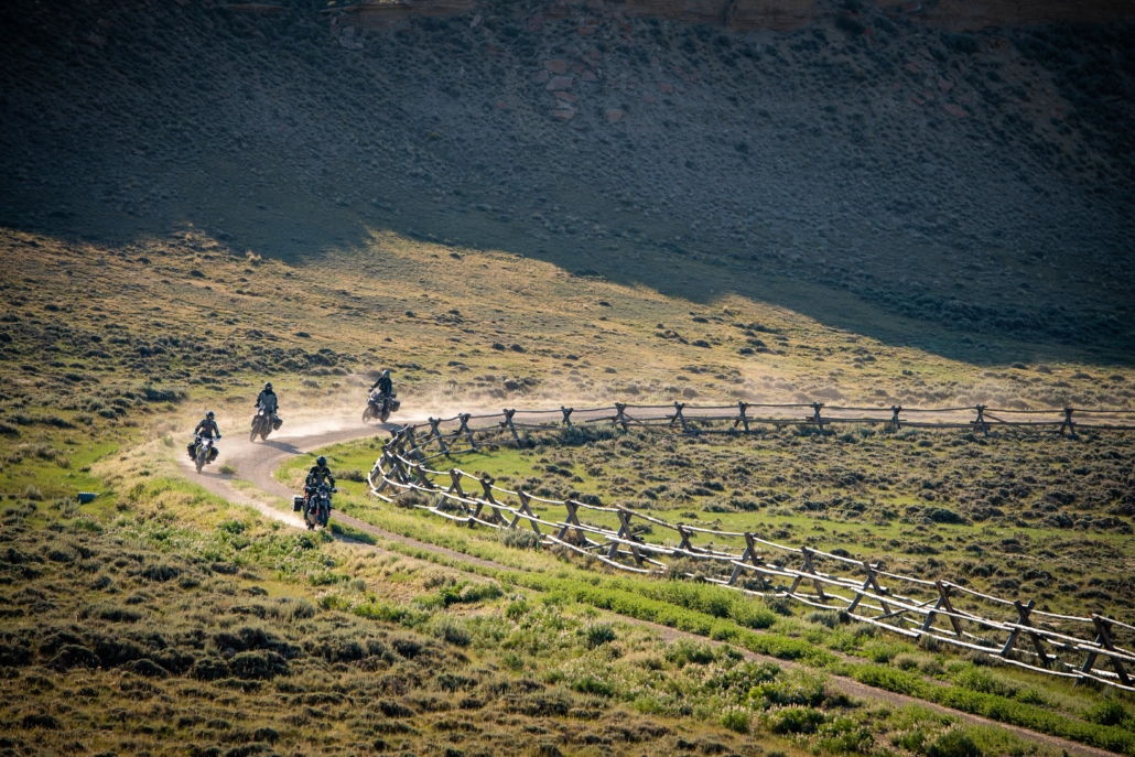
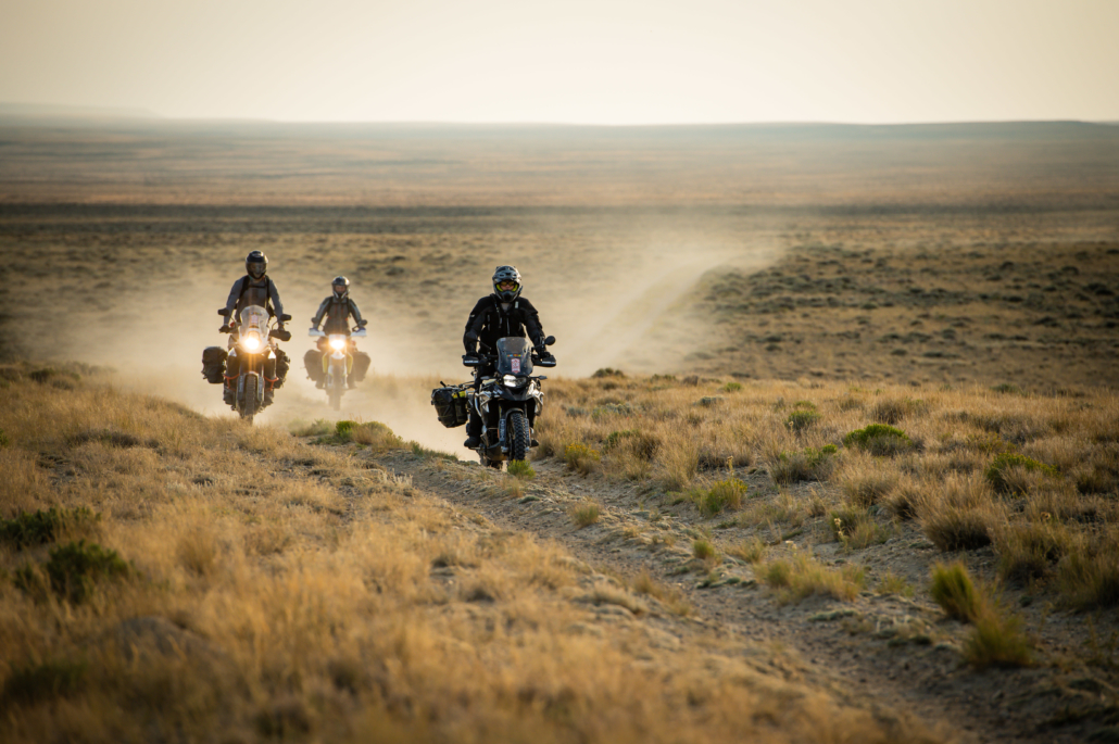
The Wyoming Backcountry Discovery Route is a multi-day off-pavement ride for dual-sport and adventure motorcycles through the most dramatic and rugged landscapes in Wyoming.  Beginning in Baggs, WY, the route traces the mountain ranges to the east through the Sierra Madre and Medicine Bow Ranges, crosses west to the Wind River Range, then goes back east and north through the Bighorn Mountains, eventually ending at a remote Wyoming-Montana border.  Almost every section includes some moderately technical riding, as the remote two-track flows through regions of vast high-desert, short-grass prairies, and alpine climates.  You will experience expansive views from the summit of two different 11,000-foot mountains, cross two major rim escarpments and pass through many other seldom visited areas and historic mining towns.  This is the most remote BDR, so plan ahead and be prepared to have a true backcountry adventure.

NOTE: Riders should not attempt the entire WYBDR before July 1st due to sensitive land areas and lingering snow and mud.
Click HERE for more information.

PURCHASE THE MAP

The latest version of the WYBDR map is the Second Edition, dated: July 2023

SECTION-BY-SECTION

BAGGS TO CENTENNIAL – 160 miles

The WYBDR begins in Baggs, Wyoming just 2.6 miles north of the Colorado border. This is a great place to get provisions for the trip as they have a grocery store. Lodging is available and convenient as you’ll probably be getting here from out of town (reserve rooms ahead if possible). The route officially begins with a short paved segment on Highway 789. Pay attention for a turn that comes up quickly on the right which leads you into the vast treeless region known as Wild Horse Basin. Enjoy the views and the firm dirt track which makes a nice introduction to Wyoming’s backcountry. This section ends when it descends into the Savery Creek Valley and passes by Boyer YL Ranch, another lodging option for the start of the WYBDR. A side trip to the historic town of Savery (pop. 25) is worthwhile.

Riders will then ascend out of the valley onto a blissful track with sagebrush and aspen trees called Savery Stock Drive which is impassible when wet as the mud will be too slippery and sticky to ride. This mud warning applies to all of the non-forested sections of the WYBDR. One more bit of pavement leads past the Battle Mountain Viewpoint before a northward turn begins a long segment through the Sierra Madre Range. Immediately riders will go through the unmistakable “Aspen Alley” where photographs are in order.
Then riders will pass through burned forests before stopping to make a decision. The first harder option on the WYBDR goes over the Continental Divide Trail and Bridger Peak (elev. 11,004 ft). This option is not doable early in the season and after the first snowfall in autumn. If you’re here in July and August and you are an advanced rider who enjoys steep rocky 4×4 trails, this is for you. Otherwise enjoy the scenic and bucolic option that bypasses this massive mountain. Both options end in the town of Encampment/Riverside (pop. 460 combined) where you should re-fuel.

The next section uses pavement and wide dirt roads heading eastward towards the next mountain range. The road ascends from the North Platte River Valley and passes through another burned forest before getting to Rob Roy Reservoir in the heart of Medicine Bow-Routt National Forest. Camping is available at Holmes Campground and Rob Roy Campground at the north end of the lake. For those staying at Rob Roy consider the side trip up to Spruce Mountain Lookout for superb views of the area. The BDR leaves Rob Roy going northward and the track gets a bit rougher. Watch for puddles and sharp rocks as the track continues and turns NE before leaving the Medicine Bow Mountains and descending to the historic town of Centennial (pop. 308).

The Dixon Motel and Club
Motel located east of Baggs offering a range of room sizes with private bathrooms, in-room amenities, on-site laundry, and trailer parking. Dinner is available by reservation at the Dixon Club across the street.

  • Address: 216 Cottonwood Street, Dixon, WY 82323
  • Phone: (307) 383-2300
  • Visit Website

Boyer Ranch
Ranch lodging near the start of the WYBDR offering unique accommodations including cabins, a historic barn loft, and a converted bus. Meals available upon request.

  • Address: 34 County Road 754, Savery, WY 82332
  • Phone: (307) 383-7778
  • Visit Website

The Cowboy Inn
Local motel offering basic accommodations in Baggs with easy access to dining and fuel.

  • Address: 210 Penland St #490, Baggs, WY 82321
  • Phone: (307) 383-2200
  • Visit Website

Cottonwood Cabins
Cabin-style accommodations in Riverside offering a quiet stay near the river and surrounding outdoor recreation.

  • Address: 411 1st St, Riverside, WY 82325
  • Phone: (307) 228-4773
  • Visit Website

Riverside Garage & Cabins
Cabins and lodging located in Riverside, offering a convenient base for exploring the surrounding area.

  • Address: 107 Riverside Ave, Riverside, WY 82325
  • Phone: (307) 327-5361
  • Visit Website

The Cabin at Riverside
Cabin accommodations offering a private and comfortable stay in the Riverside area.

  • Address: 205 Riverside Ave, Riverside, WY 82325
  • Phone: (307) 760-0017
  • Visit Website

Spirit West River Lodge
Riverfront lodge offering rooms and cabins along Highway 230 near Riverside.

  • Address: 10046 HWY 230, Riverside, WY 82325
  • Phone: (307) 327-5753
  • Visit Website

Riviera Motor Lodge
Riviera Motor Lodge is a renovated, 40-room property located along the North Platte River in Saratoga, Wyoming. The lodge offers oversized parking, pet-friendly accommodations, long-term stay options, and comfortable lodging for travelers exploring the outdoors.

Guests can enjoy a riverfront lawn complete with a fire pit, outdoor seating, and grills. The on-site Gear Garage provides complimentary access to bikes and snowshoes. Riviera Motor Lodge is also just a short walk from downtown Saratoga and the popular Hobo Hot Springs.

  • Address: 303 N 1st St, Saratoga, Wyoming 82331
  • Phone: (307) 326-5651
  • Visit Website

The Dixon Motel and Club
Motel located east of Baggs offering a range of room sizes with private bathrooms, in-room amenities, on-site laundry, and trailer parking. Dinner is available by reservation at the Dixon Club across the street.

  • Address: 216 Cottonwood Street, Dixon, WY 82323
  • Phone: (307) 383-2300
  • Visit Website

Bear Trap Cafe & Bar

  • Address: 120 Riverside Ave, Riverside, WY 82325
  • Phone: (307) 327-5277
  • Visit Website »

The Divide Restaurant & Lounge

  • Address: 520 McCaffrey Ave, Encampment, WY 82325
  • Phone: (307) 327-5064
  • Visit Website »

Baggs

Encampment

Little Snake River Museum, Savery (pop. 25) (Off Route)
Small museum showcasing local history, pioneer artifacts, and wildlife in the remote Savery area (population 25).


Battle Mountain Viewpoint
Scenic overlook with panoramic views along the route at 41.1047° N, 107.1788° W.


Aspen Alley
Beautiful stretch of aspen groves perfect for photos at 41.1265° N, 107.1700° W.


Bridger Peak Summit 11,004′
High-elevation summit (11,004 ft) offering expansive mountain vistas.


Rob Roy Reservoir & Campground
Reservoir with fishing, boating, and primitive camping facilities.


Spruce Mountain Lookout Tower (Off Route)
Fire lookout tower with 360° views, 4 miles off route at 41.2025° N, 106.2163° W.

CENTENNIAL TO ELK MOUNTAIN – 68 miles

After leaving Centennial, riders will begin ascending into the Snowy Mountains area of Medicine Bow – Routt National Forest. The first part follows paved twisties on Barber Lake Road through Libby Creek Recreation Area before returning to the highway.

After a couple miles of pavement on Highway 130, watch for a right turn which soon becomes Towner Lake Road, a rugged scenic track below the Snowy Mountains. Look for moose which frequent the small lakes along this road. You’ll find campgrounds galore in this area north of the highway. The brief dirt thoroughfare connects back to pavement and heads westward on Highway 130. You should stop at one of the two signed viewpoints along this section to photograph the mountains.

As Highway 130 descends you’ll have to decide again whether to take an harder section. This one involves a deep water crossing and rugged roads for eight miles. Early in the riding season this creek crossing might be too deep and fast flowing to attempt. If so, just take the main route. Soon a 6.5 mile long side trip leads up to the summit of Kennaday Peak (elev. 10,810 ft). Early in the year snow will linger and after the first snows of fall appear this summit might not be attainable. At other times, it’s worth the extra time as the riding is top notch and the views at the summit are rewarding.

The rest of this section heads north through typical forest roads before the skies open again to treeless farmlands and wide fast roads leading to the town of Elk Mountain (pop. 194). We recommend filling up at the gas station where the track crosses Interstate 80 as it has high octane fuel and the one in Medicine Bow does not.

Friendly Store & Motel
Convenient roadside motel and general store offering basic lodging and supplies along WY-130 in Centennial.

  • Address: 2758 WY-130, Centennial, WY 82055
  • Phone: (307) 742-6033
  • Visit Website

Mountain Meadow Cabins
Cabin-style lodging offering a quiet stay with easy access to outdoor recreation near Centennial.

  • Address: 3519 WY-130, Centennial, WY 82055
  • Phone: (307) 742-6042
  • Visit Website

Mountain View Hotel
Historic hotel offering comfortable rooms and dining in the heart of Centennial.

  • Address: 2747 WY-130, Centennial, WY 82055
  • Phone: (307) 742-3588
  • Visit Website

Old Corral Hotel & Steakhouse
Historic hotel and steakhouse offering lodging and hearty meals, a popular stop for travelers and riders.

  • Address: 2750 WY-130, Centennial, WY 82055
  • Phone: (307) 745-5918
  • Visit Website

Medicine Bow Lodge
Lodge-style accommodations offering rooms, dining, and access to outdoor recreation near Saratoga.

  • Address: 5556 Hwy 130 HC 63 Box #8A, Saratoga, WY 82331
  • Phone: (800) 409-5439
  • Visit Website

Bear Bottom Bar & Grill

  • Address: 2768 WY-130, Centennial, WY 82055
  • Phone: (307) 742-2410
  • Visit Website »

Friendly Store & Motel

  • Address: 2758 WY-130, Centennial, WY 82055
  • Phone: (307) 742-6033
  • Visit Website »

The Mountain View Cafe

  • Address: 2747 WY-130, Centennial, WY 82055
  • Phone: (307) 223-6007
  • Visit Website »

Centennial

St. Alban’s Open Air Chapel
Unique outdoor chapel with stone altar and cross amid alpine scenery.


Brooklyn Lake & Campground (Off Route)
Scenic lake with fishing and primitive camping, 1 mile off the route.


Lewis Lake, Libby Lake & Campground (Off Route)
Twin lakes with hiking trails and backcountry camping, 1 mile detour.


Snowy Range Observation Tower
Fire tower offering 360° panoramic views of the Snowy Range mountains.


Snowy Range Viewpoint
High alpine pullout with sweeping vistas of rocky peaks and meadows.


Deep Creek Crossing
Scenic creek ford and crossing point along the route at 41.3345° N, 106.4490° W.


Kennaday Peak Lookout Tower (Off Route)
Historic fire lookout with mountain views, 6.5 miles off route.

ELK MOUNTAIN TO ALCOVA – 122 miles

After crossing the interstate, look for a road on the right and follow the track as it heads north on seldom traveled County Rd 115. This bit of two-track heaven meanders through sage hills and shallow valleys as it connects I-80 to Highway 30. Along the way you’ll need to open and close a few gates in barbed wire fences. Near the north end look for old rock walls that still stand from the abandoned mining town of Carbon (circa 1881). The town’s substantial cemetery can be found on the west side of the road too. After the dirt ends you have roughly nine miles of tarmac before reaching the town of Medicine Bow (pop. 284).

The WYBDR turns north onto a long paved segment on Highways 487 and 77 and passes the countless wind turbines of Dunlap Wind Farm. The track then ascends into the Shirleys on moderate-level roads with loose rocks, occasional ruts and sandy patches. You’ll soon descend more fun roads and the trees will open up to sage covered high desert again. The roads north of the Shirley Mountains are wide and fast. They seem to go on forever, but eventually they pass by Alcova Reservoir, descend a red rock canyon and end at the town of Alcova (pop. 86).

Elk Mountain Cabins
Cabin-style lodging offering a quiet and comfortable stay in the small town of Elk Mountain.

  • Address: 107 Main St, Elk Mountain, WY 82324
  • Phone: (307) 348-7778
  • Visit Website

The Historic Elk Mountain Hotel
Historic hotel offering traditional rooms and a classic small-town atmosphere in downtown Elk Mountain.

  • Address: 102 E Main St, Elk Mountain, WY 82324
  • Phone: (307) 348-7774
  • Visit Website

Virginian Hotel

Lay your helmet where the Old West still rides.

The Historic Virginian Hotel is a living slice of cowboy Americana—part restored boutique hotel, part living museum, and a legendary stop for the road-worn and free-spirited.

Downstairs, swap miles for music and cold pints at the Shiloh Saloon—Wyoming’s finest bar—where pool cues click, stories flow, and the road crew feels right at home. Upstairs, crash in a cozy historic or renovated room in the Cowboy Corner. Rustic charm, modern comforts. No saddle required.

Roll in. Rack a game. Raise a glass. Ride out rested.

  • Address: 404 Lincoln Hwy, Medicine Bow, WY 82329
  • Phone: (307) 331-2288
  • Visit Website

J B’s Stop-N-Shop

  • Address: 604 Old Casper Medicine Bow Hwy, Medicine Bow, WY 82329
  • Phone: (307) 379-2547
  • Visit Website »

Elk Mountain

Medicine Bow

Carbon Ghost Town
Abandoned coal mining townsite with historic ruins and foundations at 41.8495° N, 106.3758° W.


Carbon Cemetery
Historic pioneer cemetery adjacent to the ghost town, preserving early settler graves.


Shirley Mountains & Camping
Remote mountain range with dispersed BLM camping and off-road trails.


Alcova Reservoir & Camping
Large reservoir offering boating, fishing, and lakeside camping facilities.

ALCOVA TO ATLANTIC CITY – 140 miles

Top off your fuel tank in Alcova and stock up on food and drinks as the next stretch is 140 miles long and remote to say the least. Leaving Alcova you’ll ride 19 miles of Highway 220 before heading off-pavement for the remainder of that day. This is the beginning of the Beaver Rim section and it starts with easy riding on Dry Creek Road but don’t let that fool you. Follow the tracks and look for a BLM marker signaling the start of Beaver Rim Road #2401 (signage after that is unreliable). Thus begins the many miles of doubletrack that can be loose sand, round rocks, deep ruts, slippery puddles and everything in between. It’s a scenic and spectacularly fun riding challenge you’ll never forget. It is important to pay close attention to the track on this section as there are many private landowner parcels that the route skirts–stay on public land!

Save your energy as this will be a long day and you’ll need to stay focused on the track. There are many places to stop for photos when you reach the rim itself and continue along its rolling roads. If the daylight dwindles or your internal reserves run low there are a couple roads to bail on that will get you south to Highway 287. The main optional bail point is Ore Road which is near the center of Beaver Rim and takes you to Jeffrey City and a gas station which is occasionally open, but don’t count on it. Those who are desperate and find the station closed, can limp another 24 miles on highway 789 south to Muddy Gap.

After Ore Road you are pretty committed to completing this entire section. The going finally gets easier as you start heading southeast on wider roads. At the end of this grueling section you’ll be in historic Atlantic City (pop. 39). Stop into Miner’s Grubstake for a meal and drinks and stay at Miner’s Delight BnB. The owner, Bill, sells fuel here as well. Fuel is also available in nearby Lander.

The Reef Fly Shop, Cottages and RV
Our four on-site vacation rentals, The Reef Cottages, feature big windows and big views overlooking Grey Reef. Each of our cottages have a single bedroom that houses two plush queen beds with an extra long twin bunk over one of the queen beds. A fourth guest sleeps on the futon in the living space. A tiled shower, full kitchen, a large patio with a grill and outside dining furniture as well as a flat screen TV culminate in a great vacation rental at the best possible location. Cottage guests are not required to fish at all, but we’d highly recommend it! If you prefer to grill your own steak and arrange your own logistics it doesn’t get any better than the cottages.

  • Address: 22222 Grey Reef Road, Alcova, WY 82620
  • Phone: (307) 232-9128
  • Visit Website

Windy Waters RV Parks
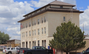
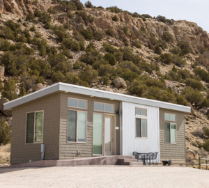
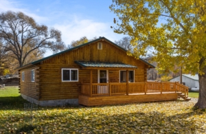
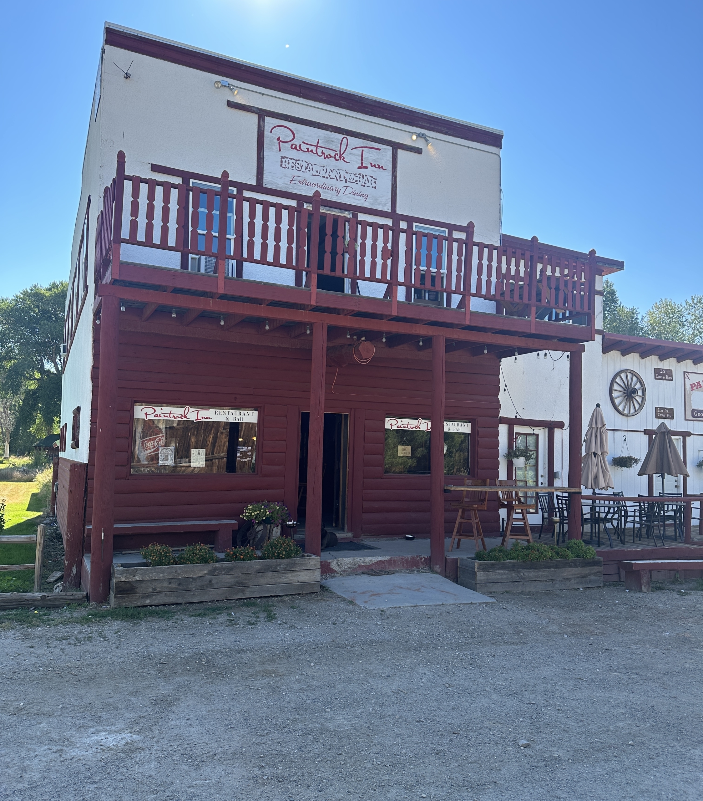
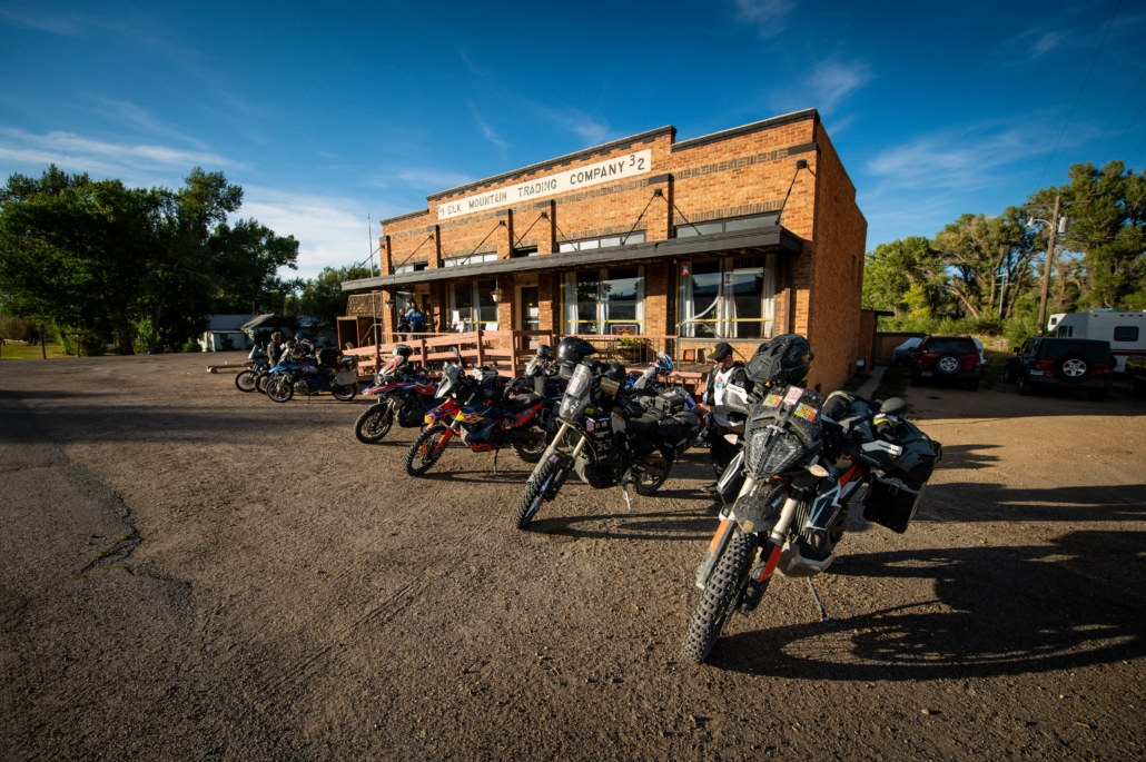
Windy Waters RV Parks, located in Alcova, WY across the street from Sloane’s General Store, is the perfect mid-point of the WYBDR. Whether you chose to make them home base between the North and South routes, or just a stopover along the way, they have a spot for you. No camper? No problem they have (2) RV rentals set-up ready and waiting for you.
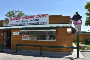
  • Address: 21500 Kortes Road – Alcova Park | 21600 Kortes Road – Eagle Creek Park
  • Phone: (307) 377-7878
  • Visit Website

Sloane’s General Store and the Inn at Alcova
General store and inn offering lodging, food, and basic supplies, making it a convenient stop for riders passing through Alcova.

  • Address: 21405 Kortes Rd, Alcova, WY 82620
  • Phone: (307) 234-2066
  • Visit Website

Sloane’s General Store and the Inn

  • Address: 21405 Kortes Rd, Alcova, WY 82620
  • Phone: (307) 234-2066
  • Visit Website »

Alcova

Muddy Gap

Jeffrey City

ATLANTIC CITY TO SHOSHONI – 130 miles

Soon after leaving Atlantic City you’ll pass by the remains of Carissa Mine (circa 1867). The gold found in this mine led to a surging population in the area and the founding of South Pass City (pop. 57). This restored historic town is worth a stop as the buildings are often open for viewing and there’s a museum and gift shop as well.

The route becomes undulating doubletrack after crossing Highway 28. It’s short but sweet riding and soon connects to a wide road crossing the south end of the Wind River Range. This section on Forest Road 300 is one of the highest trafficked sections of the WYBDR so go slow and watch for vehicles on every corner, and Ride Right. You’ll pass by several lakes including Louis Lake, Fiddlers Lake and Frye Lake along this section and several campgrounds run by Shoshone National Forest.

Eventually, the dirt ends and the pavement begins, but don’t fret, this is a wonderful bit of tarmac. Eight sweeping switchbacks take you down from the Wind Rivers to the Middle Popo Agie River Valley below. After the switchbacks end, look for signs for Sinks Canyon State Park. This park has two parking lots, one for where the river disappears underground and another 1 1/2 miles down the road where it “rises” in a calm pool full of hungry trout (you can feed them for a quarter).

In a few miles you’ll reach Lander, the largest city on this BDR and home to NOLS. Lander has all the services you’ll need so fuel up the body and the bike. A few miles of pavement riding gets you to the town of Hudson and the start of a long section of dirt roads through wide open spaces dotted with mining and extraction sites. It’s not the most exciting section of the WYBDR but it goes around the Wind River Indian Reservation. You will pass by unique and colorful sandstone formations on this section and go right through a gas plant on a public road. There are Poison Gas Warning signs in the area and it feels strange but ride on through (if the lights aren’t flashing). This section ends at Shoshoni (pop. 515) where you must fuel up again.

Miner’s Delight Inn Bed & Breakfast

  • Address: 290 S Pass Rd, Atlantic City, WY 82520
  • Phone: (307) 332-0248
  • Visit Website »

The Hyde Out Guest Cabin
The Hyde Out is a small guest cabin located just off of Main Street in Atlantic City, Wyoming. Constructed in 2013, there are 2 extra-long twin beds, a full bath (tub/shower combo), complete kitchen and small living/dining area. A covered porch has great views of the historic town and is a fine place to enjoy a cold beer, a morning cup of coffee, or look at the night sky. WiFi and a smart tv are provided, along with a bag of Epsom salts for those travel weary muscles. The space has a private parking and entry area on the uphill side of the building. The owner works in the pottery studio beneath the rental, and can stock the apartment with most requested items if given a week’s notice. The Hyde Out is listed on AirBnB, or you can book direct.

  • Address: 15 North Dexter Ave., Atlantic City, WY 82520
  • Phone: 307-330-7933
  • Visit Website »

Miners Grubstake
A friendly stop with hearty meals inspired by the spirit of the Gold Rush. Enjoy breakfast, lunch, and dinner at the restaurant and bar, stock up at the general store, or stay the night in the rental cabin (call to book). Located near the Continental Divide with plenty of free parking.

  • Address: 150 East Main Street, Atlantic City, WY 82520
  • Phone: (307) 332-0915
  • Visit Website »

Noble Hotel

  • Address: 288 Main St, Lander, WY 82520
  • Phone: (307) 349-3066
  • Visit Website »

Rodeway Inn Pronghorn Lodge

  • Address: 150 E Main St, Lander, WY 82520
  • Phone: (307) 332-3940
  • Visit Website »

Atlantic City Mercantile

  • Address: 100 E Main St, Atlantic City, WY 82520
  • Phone: (307) 332-5143
  • Visit Website »

Miners Grubstake
A friendly stop with hearty meals inspired by the spirit of the Gold Rush. Enjoy breakfast, lunch, and dinner at the restaurant and bar, stock up at the general store, or stay the night in the rental cabin (call to book). Located near the Continental Divide with plenty of free parking.

  • Address: 150 East Main Street, Atlantic City, WY 82520
  • Phone: (307) 332-0915
  • Visit Website »

Svilar’s Bar & Steakhouse

  • Address: 173 S Main St, Hudson, WY 82515
  • Phone: (307) 332-4516
  • Visit Website »

The Kai Espresso & Gifts

  • Address: 109 S Main St, Hudson, WY 82515
  • Phone: (307) 332-2211
  • Visit Website »

Cowfish

  • Address: 148 Main St, Lander, WY 82520
  • Phone: (307) 332-8227
  • Visit Website »

Gannett Grill

  • Address: 126 Main St, Lander, WY 82520
  • Phone: (307) 332-8228
  • Visit Website »

Mulino Italian Bistro

  • Address: 129 Main St, Lander, WY 82520
  • Phone: (307) 438-4016
  • Visit Website »

The Middle Fork

  • Address: 351 Main St, Lander, WY 82520
  • Phone: (307) 335-5035
  • Visit Website »

Whitebark Cafe & Bakery
Whitebark Cafe is open 7 days a week, 7 am–3 pm. Serving coffee, espresso drinks, and amazing pastries.

  • Address: 135 N. Second St, Lander, Wyoming 82520
  • Phone: (617) 335-4912
  • Visit Website »

Barnard, VT

Hancock, VT

Warren, VT

Chelsea, VT

Washington, VT

South Pass Historic Site
Well-preserved gold rush ghost town with 30+ original buildings, mining exhibits, and trails.


Louis Lake, Lodge & Campground
Alpine lake with rustic lodge cabins, boat rentals, fishing, and dispersed camping.


Fiddlers Lake & Campground
Scenic high-elevation lake with 9 primitive campsites, fishing, and hiking trails.


Frye Lake
Remote alpine reservoir ideal for fishing and quiet backcountry solitude.


Louis Lake Switchbacks
Dramatic steep switchbacks climbing through aspen groves beside Louis Lake.


Sinks Canyon State Park & Campground
Geological wonder where Popo Agie River vanishes underground; features camping, trails, and wildlife viewing.


Rise of the Popo Agie & Trout Pool
Spectacular where the “vanishing” river reemerges as crystal trout pools at 42.7523° N, 108.8057° W.


Rainbow Cliffs Area
Colorful banded cliffs and rock formations perfect for photography at 42.7571° N, 108.4061° W.


Boysen State Park & Campground
Large reservoir state park with boating, fishing, marinas, and extensive camping on 33,000 acres.

SHOSHONI TO TEN SLEEP – 104 miles

Leaving Shoshoni and continuing northward the WYBDR follows the wide dirt Badwater Road past more mining and extraction areas. It’s fast fun riding and after passing a couple small mining support towns (Lysite and Lost Cabin) the route ascends towards Cottonwood Pass (elev. 6,727). This barely noticeable pass marks the beginning of a memorable section that descends the Nowood Road towards Ten Sleep. This farm-filled valley is surrounded by rock walls to create a high contrast of greens and reds. It’s picturesque to say the least. Riders will pass through a narrow gap where Nowood River has carved its way through a ridge on Mahogany Butte.

After a few more miles on Upper Nowood Road through bucolic settings, the route branches off onto County Road 58 where the track gets a little rougher and definitely integrates more red hues into its surface. Eventually CR 58 connects back to the main road which leads to a thriving town of Ten Sleep (pop. 214) where you can find food, gas, lodging, camping and beer (at Ten Sleep Brewing Co.)!

Desert Inn & RV Park

  • Address: 505 W 2 St, Shoshoni, WY 82649
  • Phone: (198) 988-49876
  • Visit Website »

Hot Stuff Pizza

  • Address: 110 W 2 St, Shoshoni, WY 82649
  • Phone: (307) 876-2787

Shoshoni

Lost Cabin Townsite (no services)
Abandoned oil boom ghost town with weathered buildings and no amenities.


Cottonwood Pass 6727′
Scenic mountain pass at 6,727 ft elevation through rolling foothills.


Nowood River Canyon
Dramatic river canyon carved through red rock formations and timbered slopes.


Red Gulch
Scenic valley featuring colorful badlands and dinosaur tracksite nearby.


Ten Sleep Brewing & Campground
Craft brewery with food trucks, taproom, and adjacent campground for riders.

TEN SLEEP TO BURGESS JUNCTION – 116 miles

Fuel up for a long section, then ride east into Ten Sleep Canyon as it ascends into the Bighorn Mountains. The route leaves the pavement near the pass and enters Bighorn National Forest. These roads are rugged and will throw all sorts of obstacles at you. Pay attention to the tracks as they turn off Hyattville Road into Renner Wildlife Habitat Management Area (no fires, no camping). This route through state land can have deep sand and deep ruts, so take your time. You’ll also have to watch the GPX tracks as it’s easy to miss turns before getting back to Hyattville Rd.

After passing through Hyattville (pop. 97 and no services), we recommend doing the side trip to Medicine Lodge Archaeological Site to see the petroglyphs. Then begins another long ascent into the Bighorns. This twisty forest road leads to Medicine Lodge Lakes where you’ll find a couple campgrounds and Paintrock Lodge. The road quality improves after the lakes and you’ll ride roads that alternate between groves and prairies then open up to high elevation alpine hillsides.

After crossing Shell Creek you’ll come to another harder option. This one is 22 miles long and follows tough roads over remote Woodchuck Pass (elev. 9,636 ft). The first part of this harder segment tests riders skills immediately. If the roads in this area are wet, they’ll be slippery and could be impassible. The alternative option is mostly paved en route to Highway 14. Section 7 ends at Bear Lodge Resort near Burgess Junction where you can get food, fuel and a room for the night.

Wildlife Habitat Management Area Campground
The camping limit is 14 days. The upper (east) portion of this area is closed each year from January 1 through May 31. The lower (west) portion is open all year.


Circle J Ranch Camp

  • Address: 3338 Hwy 16 E, Ten Sleep, WY 82442
  • Phone: (307) 366-2541
  • Visit Website »

Deer Haven Lodge

  • Address: 4301 US-16, Ten Sleep, WY 82442
  • Phone: (307) 366-2424
  • Visit Website »

Meadowlark Lake Lodge

  • Address: 4700 US-16, Ten Sleep, WY 82442
  • Phone: (307) 366-2459
  • Visit Website »

Ten Sleep Rock Ranch

  • Address: 3278 US-16, Ten Sleep, WY 82442
  • Phone: 307-366-2096
  • Visit Website »

Ten Sleep RV Park

  • Address: 98 2nd St, Ten Sleep, WY 82442
  • Phone: (307) 366-2250
  • Visit Website »

The Carter Inn

  • Address: 414 2nd St, Ten Sleep, WY 82442
  • Phone: (307) 366-9911
  • Visit Website »

Base Camp Cabin
The “Base Camp Cabin on Main” offers a great location to access the western slope of the Bighorn Mountains. At the junction of all three BLM and Forest Service access roads (Alkali Road, Cold Springs Road & the Hyattville Logging Road) leading into the Bighorn Mountains, the cabin offers a superb central point to begin or end miles and miles of “two-track” mountain roads. Approximately 17 miles north of Tensleep, Wyoming, on a gravel road, you will find the cabin. Situated on Main Street, it is a short walk to the local watering hole to quench a dusty thirst after a day on the trail. Please take a look at the listing, Base Camp Cabin on Main, Hyattville, WY, on Airbnb or VRBO.

  • Address: 315 Main Street, Hyattville, WY 82428
  • Phone: 307-272-7139
  • Visit Website »

Paintrock Inn
Paintrock Inn is the first and only business as you enter Hyattville, WY. The restaurant features delicious eats focused around locally raised beef from Hyattville, including tacos, burgers, steaks, and salads made from scratch with local produce. Riders can also grab quick refuel items like Gatorade and Clif Bars before heading back out. A few rooms are available for lodging, along with hot showers and a wide selection of beers.

Enjoy the full bar or relax with a slice of homemade cake after tackling the challenging first half of Section 7. As the only true lodging option with beds, showers, food, and a full bar between Ten Sleep and Burgess Junction, Paintrock Inn has been a favorite gathering place since its founding in 1903.

  • Address: 319 Main St, Hyattville, WY 82428
  • Phone: 1(307)469-2335
  • Visit Website »

Ten Sleep Brewing Company
Brewpub offering craft beers and rotating food trucks (e.g., tacos, pizza); family-friendly taproom with live music in a historic barn setting.

  • Address: 2549 US-16 / Highway 16, Ten Sleep, WY 82442
  • Phone: (307) 366-2074
  • Visit Website »

Sleepy Coyote Cafe & Bar
Casual American spot with sandwiches, ribeye, tenders, salads, and drinks; suitable for lunch/dinner.

  • Address: 125 2nd St, Ten Sleep, WY 82442
  • Phone: (307) 366-2171

Ten Sleep Saloon
Local bar serving meals and takeout; family-friendly with drinks and basic eats.

  • Address: 211 2nd St, Ten Sleep, WY 82442
  • Phone: (307) 366-2237
  • Visit Website »

The Daily Bread Cafe
Breakfast-focused (7 AM–2 PM) with lunch specials; known for fresh food, large portions, and friendly service.

  • Address: 408 2nd St, Ten Sleep, WY 82442
  • Phone: (307) 366-2144
  • Visit Website »

Dirty Sally’s General Store
Grocery/convenience with coffee, ice cream, gifts, souvenirs, and takeout; free grocery delivery available.

  • Address: 124 2nd St, Ten Sleep, WY 82442
  • Phone: (307) 366-2500

Ten Sleep

Meadowlark Lake & Lakeview Campground (Off Route)
Scenic alpine lake with 20-site campground, fishing, and boating, 2.5 miles off route.


South Bighorn Viewpoint (Off Route)
Panoramic overlook of the southern Bighorn Mountains, 0.25 miles detour.


Renner Wildlife Area (No Camping or Fires)
15,590-acre wildlife habitat with big game winter range for deer and elk; day use only.


Medicine Lodge Archaeological Site & Petroglyphs (Off Route)
Ancient Native American petroglyphs and pictographs dating back 10,000 years, 2 miles off route.


Bighorns Viewpoint
Sweeping vistas of the Bighorn Mountain range and surrounding valleys.


Medicine Lodge Lake Campground
Primitive lakeside camping with fishing access in the Bighorn National Forest.


Shell Falls Viewing Area (Off Route)
120-foot waterfall viewing platforms and interpretive trails, 4.6 miles off route.


Woodchuck Pass 9612′
High mountain pass at 9,612 ft with expansive alpine meadow views.

BURGESS JUNCTION TO MONTANA BORDER – 43.2 miles

Get fuel at Bear Lodge and begin the last section which uses wide dirt roads north of Highway 14A. The first 15 miles follows Freeze Out Road (NF-15) as it meanders in and out of trees in Bighorn National Forest. Then you turn onto road 143 and begin five miles of doubletrack bliss that descends back to the highway.

After a few miles of pavement the track turns due north on an out-and-back adventure to a remote fence at the Wyoming-Montana border marking the end of the WYBDR. This high elevation 17-mile long road passes by Sheep and Duncum Mountains (both approx 9800 ft) and has grand views most of the way. Celebrate your accomplishment then ride back to Highway 14A the same way you rode in.

Elk View Inn

  • Address: 4622 US-14, Dayton, WY 82836
  • Phone: (307) 461-4168
  • Visit Website »

Arrowhead Lodge

  • Address: 6002 US-14, Dayton, WY 82836
  • Phone: (307) 683-0111
  • Visit Website »

Bear Lodge Resort

  • Address: 5600 US-14 ALT, Dayton, WY 82836
  • Phone: (307) 752-2444
  • Visit Website »

Bear Lodge

Duncum Mountain 9831′
Prominent Bighorn Mountains ridge peak at 9,831 ft with hiking trails and expansive views.

Sheep Mountain Viewpoint (Off Route)
Scenic overlook of Sheep Mountain, 0.5 miles off route with panoramic Bighorn vistas.

Sheep Mountain 9813′
High peak at 9,813 ft featuring historic fire lookout tower with 360° mountain views.

WYBDR PACKING LIST

This packing list serves as an example and is not intended to be a complete list for your backcountry riding needs. Feel free to customize this list to work for you.

  • Helmet
  • Boots
  • Goggles
  • Gloves (2 sets)
  • Protective gear (pressure suit, Leatt brace, knee braces)
  • Jacket
  • Pants
  • Balaclava or neck gaitor
  • Water bladder or bottle
  • Hydration pack
  • Ear plugs

WYBDR MOTORCYCLE DEALERSHIPS

FREQUENTLY ASKED QUESTIONS

Below are answers to some of the Frequently Asked Questions about the Wyoming Backcountry Discovery Route.

The Wyoming Backcountry Discovery Route is the eleventh route developed by the BDR organization for dual-sport and adventure motorcycle travel. Riders will test their endurance and skills on this epic 950-mile backcountry tour of Wyoming from Colorado to Montana. The tracks wind through five mountain ranges and explore vast high desert regions on dirt roads and epic double-track. Expect scenic views, endless forest roads under a canopy of trees, blissful double-track, rocky expert-only sections, and elevations that sometimes range between 9,000 and 11,000 feet. This route will throw many challenges at you so don’t try this route if you are new to adventure motorcycling.

The route consists of 8 sections and can be ridden in 7-8 days.

The best time to ride the WYBDR is mid-July to mid-September. We do not recommend riding the route before July 1st due to seasonal road closures in the national forest, and the impassible roads at higher elevations prior to July.
The WYBDR uses forest roads and backroads that typically open sometime in July depending on the size of the lingering snowpack. Depending on the autumn snowfall, the route can become unrideable sometime in September. The highest points are at the top of Bridger Peak and Kennaday Peak (both optional) which are around 11,000 feet tall and can only be reachable in the middle part of the riding season (e.g. August and a little before and after). The Snowy Range can also hold snow well into summer, but Highway 130 is typically cleared so you can get through.
Absolutely no riding the Beaver Rim section until after July 1st in order to allow the Greater Sage Grouse birds to hatch their chicks and minimize lasting impacts on them. Riders doing the WYBDR before July 1st will omit the Beaver Rim by riding the highway the whole way. That means connecting Alcova and Atlantic City using Highways 220 and 287 (riding Hudson-Atlantic City road is ok).

BDRs are generally designed for the average adventure rider on a fully-loaded adventure or dual-sport motorcycle. The WYBDR is suitable for riders with intermediate and above skill level.  You can expect to cover sections with deep ruts, loose rocks, sand, rocky hill climbs/descents and other challenges. There are some roads on the main route that are tough even for average riders especially on the Beaver Rim, in the Red Desert, and in the Bighorns.  Road conditions change from day to day in the Rocky Mountains, and Wyoming is no exception. If there has been an afternoon rainstorm, the roads in high desert regions will be impassible. The clay roads become slippery and the clay clings to tires creating dangerous conditions. Don’t “press on” if it starts raining. Turn back to better roads or stay put until the roads dry out. Always carry gear to wait out inclement weather should you be riding when the storms hit.  There also may be some deep puddles and water-crossings especially early in the season.

The expert sections on the WYBDR are quite difficult so do not attempt them if you are not a very experienced and competent rider. 

The Rocky Mountains are notorious for severe thunderstorms that seem to appear out of nowhere. Watch weather forecasts and even monitor weather radar maps, when possible, to see where rain might occur. If the high desert roads get wet, the clay surfaces will become unrideable. They become very slippery and will gum up your tires so bad that they will not roll. Do not attempt wet roads as your chances of getting stranded are high. Always carry a satellite tracking & communication device as cell phone reception is poor throughout the Wyoming backcountry. Be sure to check the interactive map at the top of this page for current conditions and use a reliable weather app on your phone during your ride. 

Yes. As with all the BDR routes, the WYBDR was designed for riding South to North, but it can absolutely be done North to South. The route ends at a remote place on the Montana border which is done as an out-and-back. Please be prepared for two-way traffic everywhere on this route and always remember to Ride Right to avoid head-on collisions around blind corners.

Most riders average 150 miles a day on a backcountry motorcycle trip. Give yourself 6-7 days to complete the entire route depending on your personal riding style. Keep in mind that you will face challenges along a route of this length – so work in at least one bumper day or even a rest day. Allow time to get back to your starting point after completing the route at the remote Montana state border.

There are no special permits or passes needed for normal groups of riders. On BLM lands like the Beaver Rim, permits are required for commercial activities like paid tours and for organized groups larger than 25 people. In the state-operated Renner Wildlife Management Area you can ride through without a pass, but camping and fires are not permitted. A small fee is charged to enter the historic part of South Pass City (which we highly recommend).

Designated public campgrounds can be found in the national forests and other places along this route. A few of the public campgrounds are identified on the WYBDR map as a small tent icon and are listed on the www.RideBDR.com/WYBDR page. Dispersed camping is also available throughout the route but be aware that each forest and land manager has their own guidelines so it’s advisable to check their websites. Camping is not allowed on state trust lands, including Renner Wildlife Area in section 7, except where there’s a designated campground. See our map above to see the brown shaded areas where the state doesn’t allow camping or fires or off-route vehicular travel.

In the national forest campgrounds campfires are allowed, but check with local Ranger Stations to determine if campfires are allowed before you build one. In most cases, campfires are only allowed in fire rings. State trust lands near Hyattville do not allow fires or dispersed camping. See our map above to see where the many state trust lands are located (brown shaded areas). If you are dispersed camping, we don’t suggest building fires. Instead, bring a camp stove for cooking and boiling water to avoid the risk of fires in Wyoming’s arid landscapes. Be sure to fully extinguish fires so they are DEAD-OUT. Use water to ensure a fire is fully extinguished and the ground is left cool and wet.

On Wyoming state trust lands (see the brown areas on our map above) there is no camping, no open fires, and no vehicular travel off-established routes and roads. Note that the state can issue fines of up to $750 for travelers who break these rules. A good example of state trust lands would be some of the areas surrounding and in the vicinity of Renner WMA. In general, it’s safest for dispersed camping inside National Forests (consult their websites for limitations). Wyoming has so many state land properties along the WYBDR and it’s difficult to know when you are on them, on BLM land, or on private land. So outside of national forests we suggest only camping in designated campgrounds to avoid accidentally camping on state land. This page on the Wyoming state website has the rules & regulations, recreational use restrictions, and even a map viewer to find the state properties you’ll be passing through.

Never pass fuel. It’s one of the golden rules of adventure riding. The longest distance between gas stops on the WYBDR is between Alcova and Atlantic City (ask Wild Bill at Miner’s Delight for a gallon to get you to Lander if necessary). Wyoming is a vast remote state and the towns are very spaced out so top off the tank every time you can. Even if your bike’s range is way beyond the fuel stop distances, we recommend carrying extra fuel. 

The WYBDR is one of the most remote states in the union. Because of this fact, lodging opportunities are slim but there are some along the way. The WYBDR page lists many of the hotels, motels and lodges that you’ll pass by. We highly recommend that you plan properly and make reservations when possible. Carrying a minimum of “emergency” camping gear is important in Wyoming as lodging can be unavailable and you can also get stuck at any time due to wet backroads from afternoon rain squalls.

We highly recommend that to plan your adventure on the WYBDR, you use online lodging/travel aggregators in addition to the listing of lodging options on the WYBDR page and the WYBDR Butler Map.

This route cannot be ridden without the use of GPS tracks.  Be prepared and bring the WYBDR Butler Map AND your navigation device with the latest WYBDR GPS tracks loaded. Free GPS tracks are available for download on this site. The route can also be navigated using a smartphone GPS navigational app like Gaia, Rever and others. The WYBDR expedition documentary film is a great source of information about the route and is available via on-demand video platforms like Vimeo. 

Any GPS unit capable of handling 15 track logs with a minimum of 1500 points each is suitable for use on the WYBDR. Garmin models that work best for this application are: Zumo 590/595/395/396, Montana, and 276Cx. Many other GPS units are compatible with the GPX file format, check the owner’s manual of your device for more information.  You can also import the tracks into a GPS navigational app, like Gaia GPS, but make sure you have the premium version of the app, so you can navigate via offline maps.

Cell phone service is very limited on this route so a satellite communication or tracking device is recommended for emergency situations. 

Any bike that has a license plate, can run knobby tires, has adequate suspension, can carry the gear you will need, and has enough fuel range. Most adventure or dual-sport motorcycles will be suitable for the trip.  However, if you are planning on doing the Expert sections, we recommend a mid-sized bike for this route unless you are very comfortable on a big bore bike in rough technical terrain.  Even very experienced riders on our team reported being challenged on larger bikes by some of the technical sections of the route during the filming expedition. Choose the bike that you are the most comfortable riding in challenging terrain and that you are not afraid to drop a few times.

DOT approved knobby tires are strongly recommended.  Riding this route without a least a 60/40 tire (60% dirt, 40% road) could be dangerous.

Segments of this route can be ridden two-up for those experienced in riding off-highway with a passenger and luggage. However, we strongly advise against riding the technical sections of this route two-up.

Please don’t go off the route anywhere where its gated or signed for seasonal or permanent closures, don’t venture onto private property, and don’t veer off the Beaver Rim track (in section 4) except right at the rim to see the views.

The WYBDR route includes a few instances where the the track follows an easement road through private land. In many, but not all cases, the land owners have installed “private land” signs and it is important that riders acknowledge these signs and stay on the designated track. If you are unsure of the land ownership adjacent to the roads, such as outside of national forest lands, it’s best to stay on the track to avoid trespassing. In all cases riders should not ride off the roads which creates new trails and damages vegetation. Please remember that riding off the designated roads can jeopardize our right to use these roads for recreation.

Yes. There may be gates and/or barricades along the route. When you encounter gates, leave them as you found them. If they were open, leave them open and if they were closed, close them again after you pass through. If you pass by ranches, be courteous and ride respectfully. In spring and early summer there may be temporary closures when crews are repairing washouts, downed trees, and other road hazards. If roads are closed due to wildfires, do not ride around the signs as that can put you or fire crews in danger and can get you a hefty fine. Check the BDR website for route updates before you go.

On most BDRs riders will encounter gates across roads and the WYBDR is no exception. These gates are important and are used by ranchers to control and separate herds. The rule of thumb is to leave the gate as you’ve found it. This means that if it was closed when you found it, close it after passing through. If it was open, leave it open. It is important for riders to follow this rule to prevent animal herds intermixing, and respect the rights and needs of private landowners and permittees.

Please abide by posted road closure signs. Ignoring these signs is a sure-fire way of getting a road closed for good. That said, sometimes locals will post unofficial “road closed” signs on public roads for their own personal reasons. Additionally, land managers may not have removed a “closed” sign from a seasonal road – even though the sign right next to it clearly displays the open/closed dates. In these cases, use your best judgment – if in doubt navigate around the closed road and report it to BDR. And please remember never to engage in arguments with local land owners.

Each state has its own recreational fishing requirements and restrictions. To learn about the required licenses and stamps for fishing (and hunting) in Wyoming, visit https://wgfd.wyo.gov/apply-or-buy.
Please note, the Wyoming Game & Fish Department has reported a number of riders fishing without the proper licenses and conservation stamps, so please ensure that you have obtained the proper permits if you intend to go fishing during your WYBDR trip.

We do our best to post the most up-to-date information about the route on ridebdr.com/WYBDR.  We depend on the BDR community to inform us about route and road conditions, so if you encounter any road closures or sever conditions that are worth reporting, please contact us with the information.

There is also a dedicated WYBDR Facebook group page.  We recommend that you join the group prior to your trip to read trip reports and comments from other riders about their experience on the route. Search for: Wyoming Backcountry Discover Route (WYBDR).

Wyoming is a habitat for many animals like deer, antelope, moose and bear as well as smaller animals like coyote, porcupines, and snakes — all of which make their way to the road at some point. Be alert everywhere you go as animals can and will cross your path along the route – especially at dusk.

Antelope are known for wanting to race motorcycles, but don’t encourage them. Slow down as soon as you see animals as, for some reason, they like to cross in front of bikes instead of running away from them. Look out for wild horses when you are in open range land.  Appropriate food practices while camping is an absolute must for your safety and the animal’s safety. 

Yield to all animals whether wild, domestic, or livestock by slowing down or stopping. Many locals in rural areas keep their dogs off-leash on their property and dogs love to chase motorcycles – be cautious and considerate.

All of the roads used on the WYBDR are open to vehicles. If you do decide to drive this route you will want a 4×4 with high clearance as the route has deep puddles, large rocks, huge ruts and steep loose grades. Always stay to the right and go slow around blind corners to avoid head-on accidents with others using the roads. We recommend traveling south to north to minimize head-on traffic.

When we filmed the WYBDR documentary our support vehicle remained on major roads as much as possible. 

It is absolutely essential that you Ride Respectfully and follow the tips outlined in our Ride Respectfully campaign.  Remember, it’s up to all of you to preserve our access – we can easily lose access to many of these roads if we don’t practice proper etiquette. Always represent BDR and the ADV community in the best light.

Rating the Routes by Difficulty

We are often asked if we rate BDRs by difficulty. We don’t officially rate the difficulty level of our routes as it varies daily due to current weather, road conditions, and other unpredictable factors. Difficulty also depends on individual skill and fitness level, bike and tire selection and load carried.

Some riders find sand to be most challenging, some find mountain passes difficult. Each rider’s perception is unique.

While we can’t provide a standardized rating like ski resorts, we can provide some basic guidance on difficulty level. These groupings do not include optional harder sections and imply favorable road and weather conditions:

BDR ROUTES:

Moderate: Idaho, Mid-Atlantic, Southeast

Challenging: California North, Colorado, Montana, Nevada, New Mexico, Northeast, Oregon, Wyoming

Difficult: Arizona, California South, Utah, Washington

BDR-X ROUTES:

Moderate: PA Wilds, Texas Hill Country

Challenging: Black Hills, Chattahoochee, Lost Coast

Difficult: Big Bend, Ozarks, Red Desert, Steens-Alvord

Review the FAQs for each route before your trip.

Backcountry Discovery Routes is a 501c(3) non-profit corporation. © 2026 Backcountry Discovery Routes, Inc. All rights reserved. Terms of Use.